Gliders 101
 By Leslie M. Smith, PhD. Science Communicator, Ocean Observatories Initiative
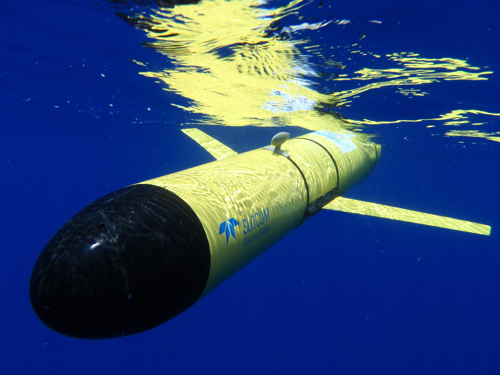
Rising and falling though the water column, tracing a saw-tooth path, gliders travel the ocean collecting data day and night, in fair seas and foul weather. The “Slocum” glider, a great workhorse and an exceptional addition to the Ocean Observatories Initiative (OOI) tool belt, will transform the way we view the ocean.
Twenty-two years ago, using a fleet of gliders to explore the oceans was only discussed in works of science fiction. In 1989, the late Dr. Henry Stommel published a science fiction article in Oceanography describing a futuristic world where an army of gliders, deployed in strategic arrays, swarmed the ocean to collect data at a resolution not previously believed possible. These gliders were named “Slocum floats” after Joshua Slocum, the Yankee skipper who first sailed around the world singlehandedly in a small sailing vessel. Since the time of Dr. Stommel’s publication, the use of gliders has moved from the arena of science fiction to science practice, as researchers are able to use fleets of gliders to obtain high resolution data from the ocean.
March 2011 marked the award of the contract to Teledyne Webb Research for the design, testing, and production of “Slocum” gliders for the OOI program. The “Slocum” gliders will play a key role in the Coastal Global Scale Network (CGSN) component of the OOI, as they will enable continuous monitoring in near real time from remote locations.
Gliders are very unique instruments. They are able to operate independently from ships for a very long time (months) and cover an expansive area (hundreds of miles) with only an internal battery pack for power. This high efficiency comes from the innovative mechanics within the glider. Rather than relying on an engine with a propeller, gliders appear to maneuver effortlessly up and down the water column by changing their buoyancy.
As they sink, or float, their wings produce lift, much like in an airplane, moving them forward through the water. As a result, gliders follow a saw-tooth path, moving diagonally up and down, through the water column. When they breach the surface, gliders acquire position information using a GPS antenna, transmit data, and receive commands via satellite allowing them to communicate to scientists on the shore. When the glider is underwater, the GPS antenna also acts as a rudder, allowing the vehicle to steer.
As gliders are able to move vertically and horizontally through the water column, their deployment in the CGSN will fill in gaps of information spatially between the non-moving, fixed platforms, penetrating down to depths of 1000 meters, a little over half of a mile. Gliders will gather data on physical, biological, and chemical properties of the water column such as temperature, salinity, chlorophyll (an estimate of phytoplankton biomass), and dissolved oxygen. Additionally, gliders will provide an avenue for communicating with subsurface instruments, collecting and relaying their data to shore. Because gliders can communicate by satellite when they are on the surface, scientists are able to alter the vehicle’s mission instructions such that sampling can be conducted in a directed and targeted manner, with the ability to change the sampling plan in response to immediate events in the ocean. At OOI, we are very excited about the addition of the Slocum glider. For more information please see the Contract News Release.
