
Regional Cabled Array
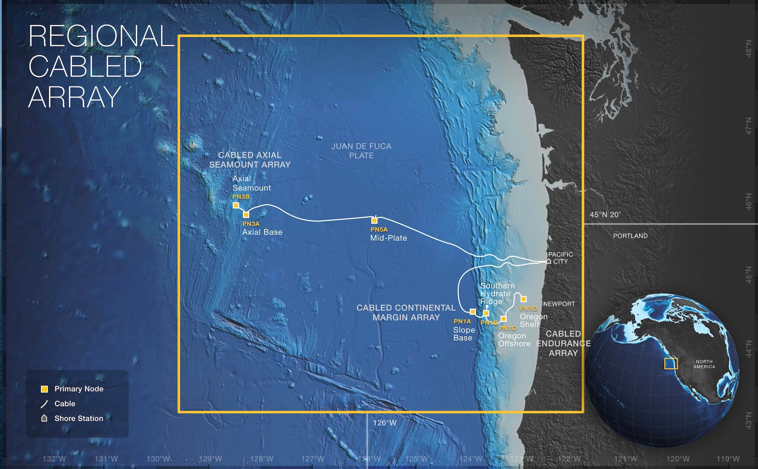
Nine-hundred kilometers of cable serves seven Primary Nodes: PN1A (Slope Base), PN1B (Southern Hydrate Ridge), PN3A (Axial Base), PN3B (Axial Summit), PN5A (Mid-Plate), PN1C (Oregon Offshore), and PN1D (Oregon Shelf). Credit: Center for Environmental Visualization, University of Washington
The first U.S. ocean observatory to span a tectonic plate, the Regional Cabled Array (RCA) provides a constant stream of real time data from the seafloor and through the water column across the Juan de Fuca plate. A network of 900 kilometers of electro-optical cables supplies unprecedented power (10 kilovolts, 8 kilowatt), bandwidth (10 Gigabit Ethernet (GbE), and two-way communication to scientific sensors on the seafloor and throughout the water column.
More than 140 instruments are connected to the RCA, which has significant expansion capabilities. The data gathered are sent through a variety of telecommunications sub-sea cables, made from fiber-optics and copper. The cables provide a two-way communication system between RCA’s seven nodes and the shore station in Pacific City, Oregon.
The Regional Cable Array powers three arrays conducting different scientific investigations: The Cabled Continental Margin Array, the Cabled Axial Seamount Array, and the Cabled Endurance Array.
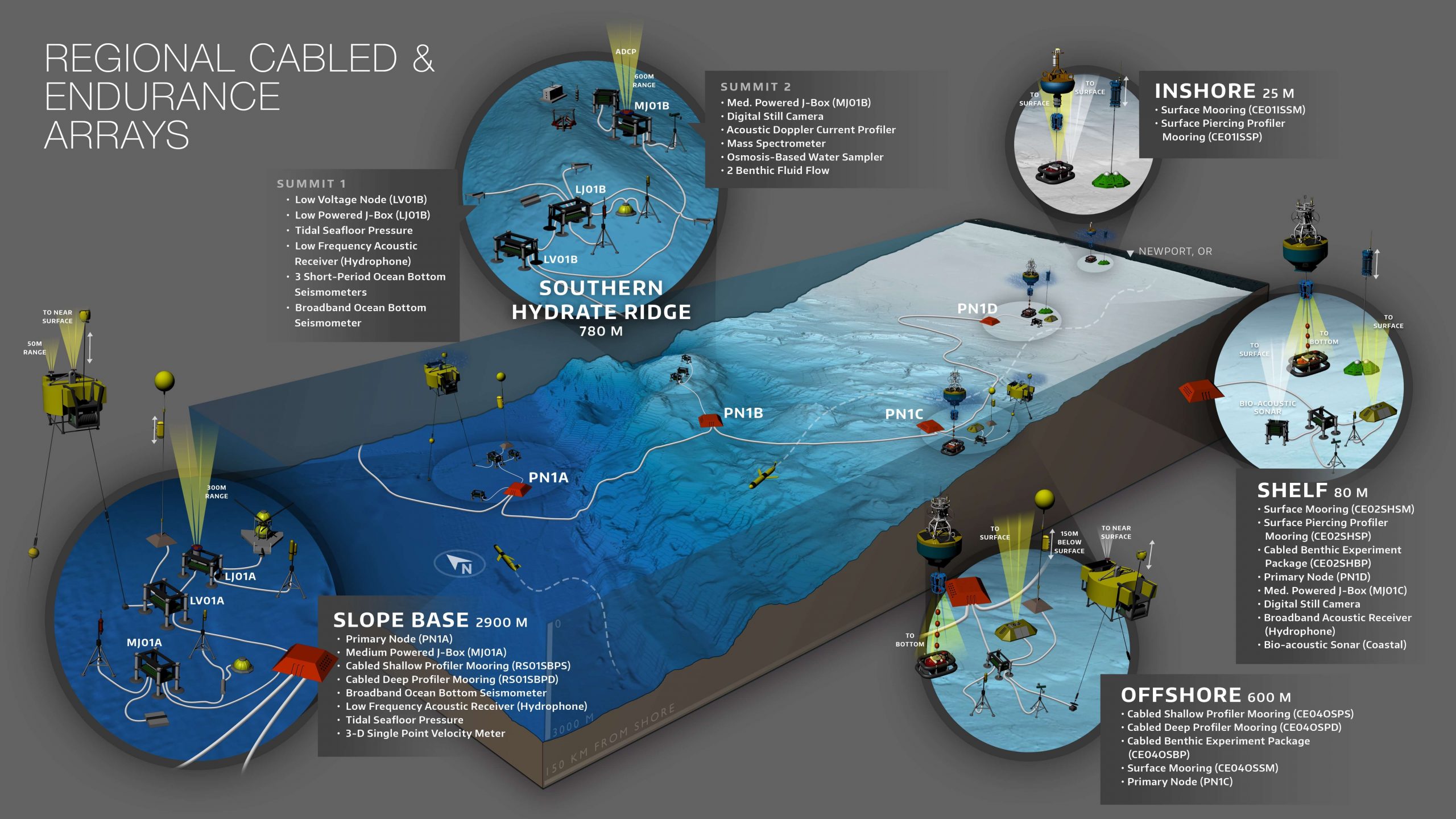
Credit: Center for Environmental Visualization, University of Washington
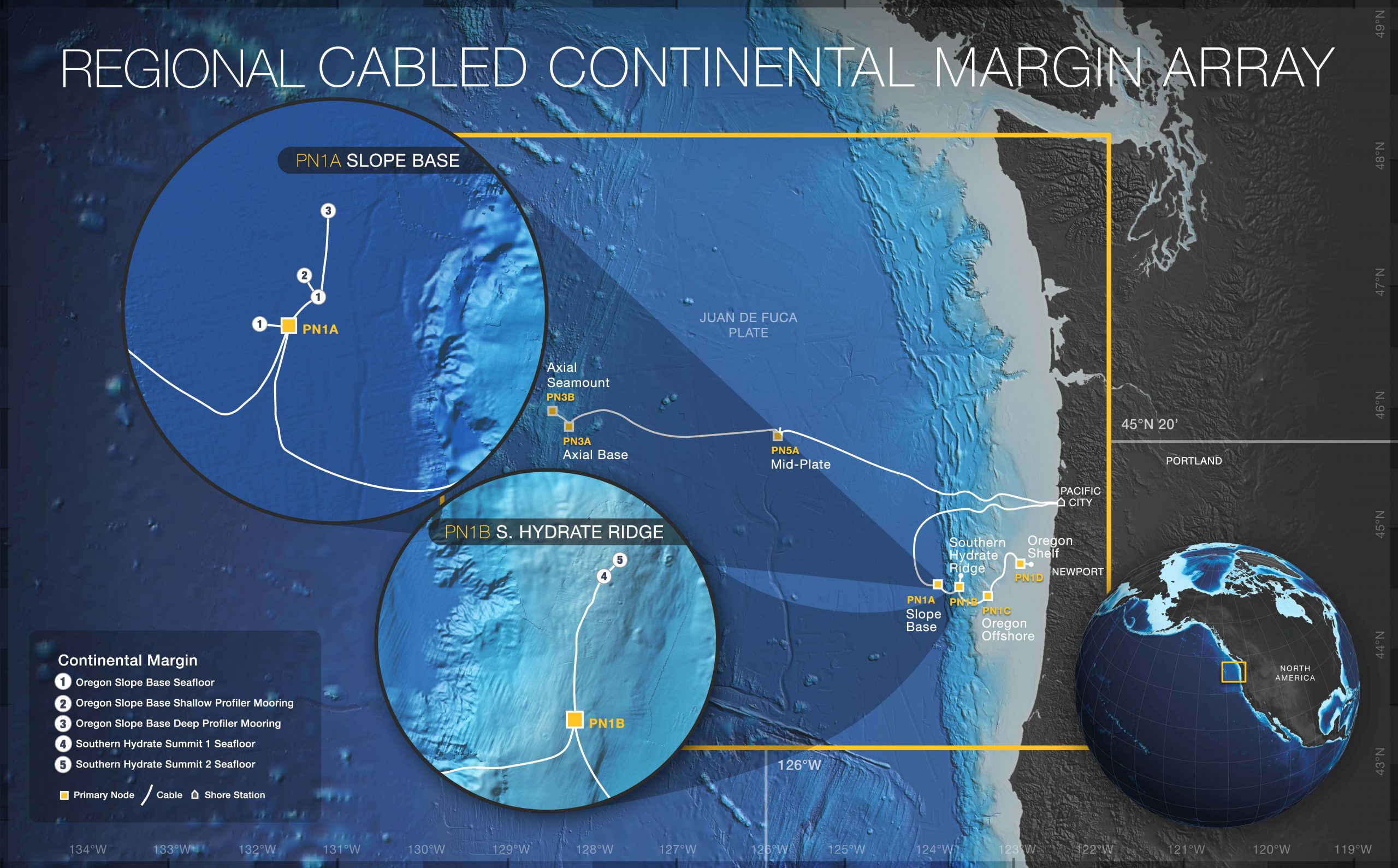
Credit: Center for Environmental Visualization, University of Washington
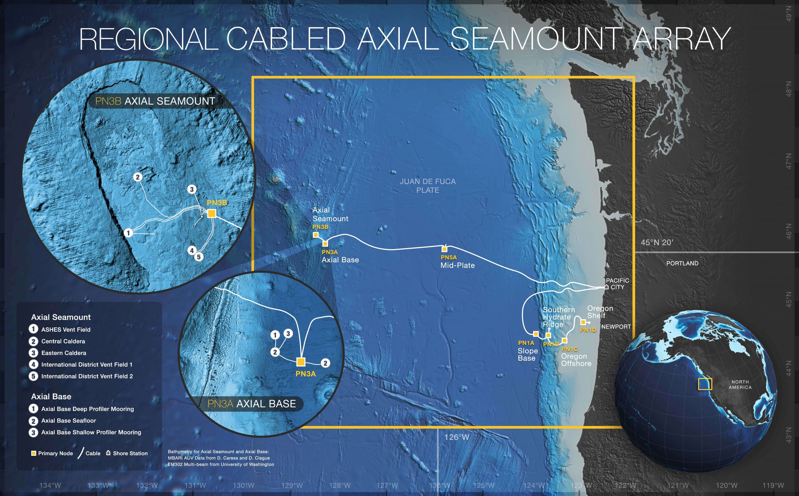
Credit: Center for Environmental Visualization, University of Washington