
First Deployment of the Pioneer Array in the MAB
At 0900 Eastern on Monday April 1, 2024, the R/V Neil Armstrong will back out of the dock at Woods Hole, MA to begin the transit to the new location of the U.S. National Science Foundation (NSF) Ocean Observatories Initiative (OOI) Coastal Pioneer in the Mid-Atlantic Bight (MAB). This promises to be a momentous trip for it will be the first deployment of the Pioneer in the MAB, a location decided upon after a series of NSF-sponsored meetings with community users of OOI data. The expedition also will mark the 20th Pioneer deployment undertaken by the Coastal and Global Scale Nodes (CGSN) team at Woods Hole Oceanographic Institution (WHOI).
“The array is design to provide data to help scientists better understand the dynamics of the region, the role of biogeochemical cycling and transport, and the impact of extreme events like hurricanes and freshwater outflows,” said Albert Plueddemann, chief scientist for this first deployment and lead scientist of the CGSN group. “There’s already considerable community interest in obtaining data from the OOI infrastructure and leveraging the array installation for research and testing. Once the array is in place, we anticipate even more interest, and look forward to engaging with researchers in the region.”
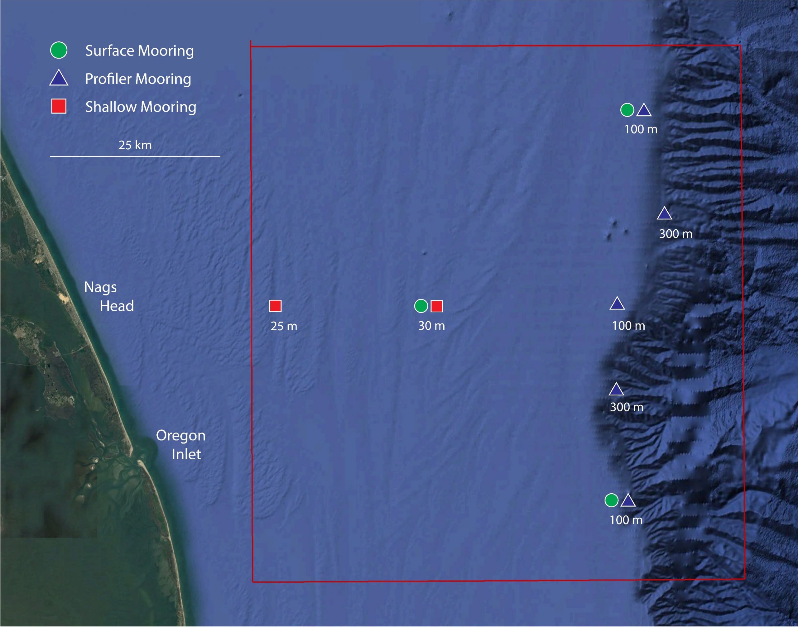
The Pioneer MAB is a T-shaped array with moorings, located offshore of Nags Head, North Carolina, at depths of 30-300 meters and nominal spacing of15-25 kilometers. The array will consist of ten platforms at seven different sites – two platforms will be deployed as adjacent pairs at three sites. The platforms include three surface moorings, five profiler moorings, and two shallow-water moorings. The Pioneer MAB will also have mobile assets—four coastal gliders and two autonomous underwater vehicles (AUVs). These mobile assets will traverse the water column along different track lines to give a fuller, more robust picture of water column properties.
After a ~36-hour transit to the site, the team of 15 scientists and engineers will get to work to deploy the new array. Because of the large size of the moorings, the expedition will be conducted in two legs and be completed on April 22nd. In addition to the mooring and mobile asset deployments, the team will be conducting CTD (to measure conductivity, temperature, and depth) casts with water sampling at the deployment sites. In addition, they will be making ship vs meteorological comparisons at the surface mooring sites to ensure the rigor and accuracy of meteorological measurements. They also will be conducting some shipboard underway surveys, as well as a bathymetric survey to gain a complete picture of the new location.
Continuing the tradition of the Coastal Pioneer Array off the New England Shelf, this first deployment expedition will be a collaborative one. A marine mammal observer from the National Oceanic and Atmospheric Administration will be onboard to count marine mammals in the region. A representative from the Northeast U.S. Shelf Long-Term Ecological Research (NES-LTER) will be onboard to conduct sampling from CTD casts and flow cytometers, which can analyze the characteristics of cells found in water as the ship is underway. This will be a continuation of an ongoing collaboration for the past seven years. And a Department of Energy representative will also be onboard as tests are conducted to determine the viability of placing a wave energy conversion device on the array.
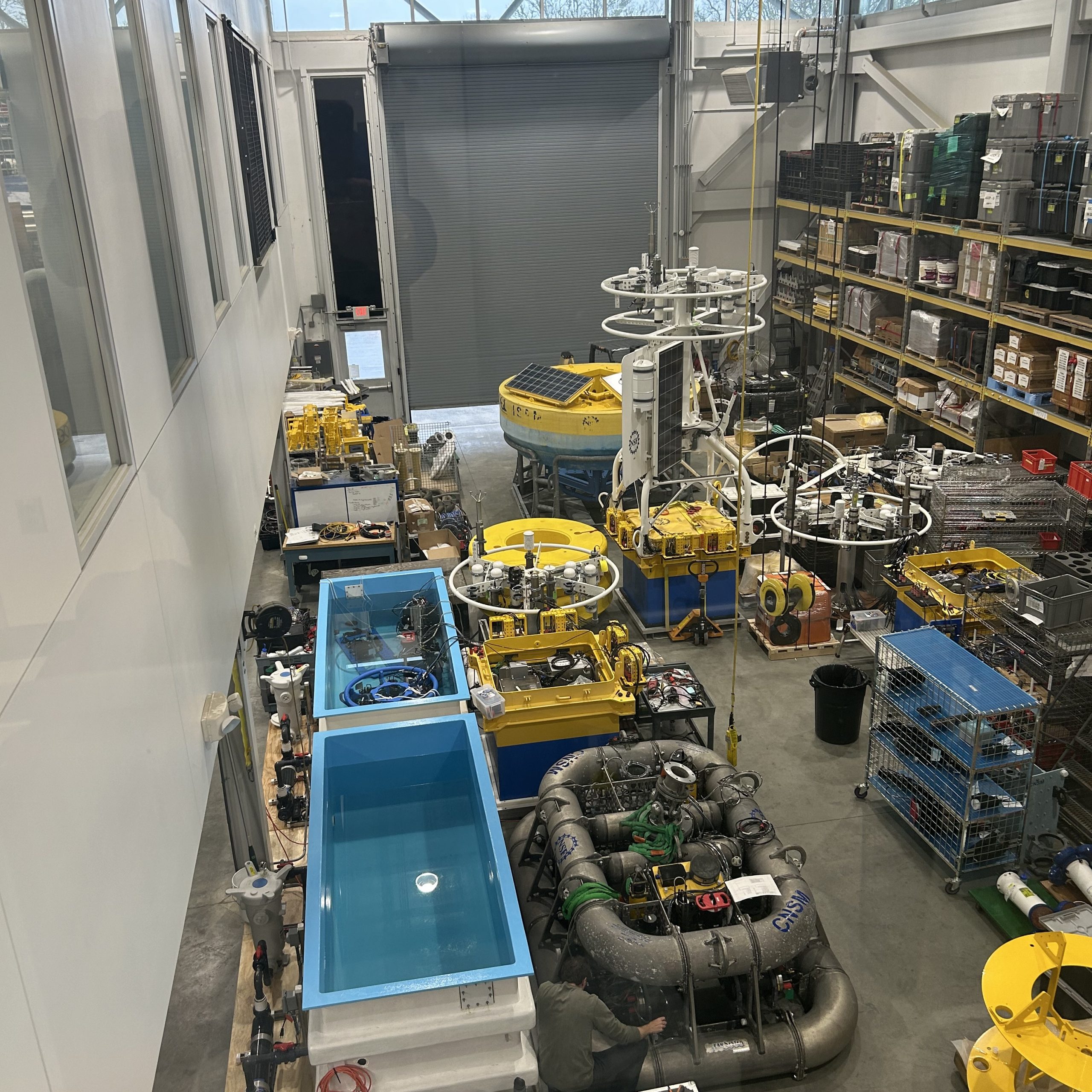
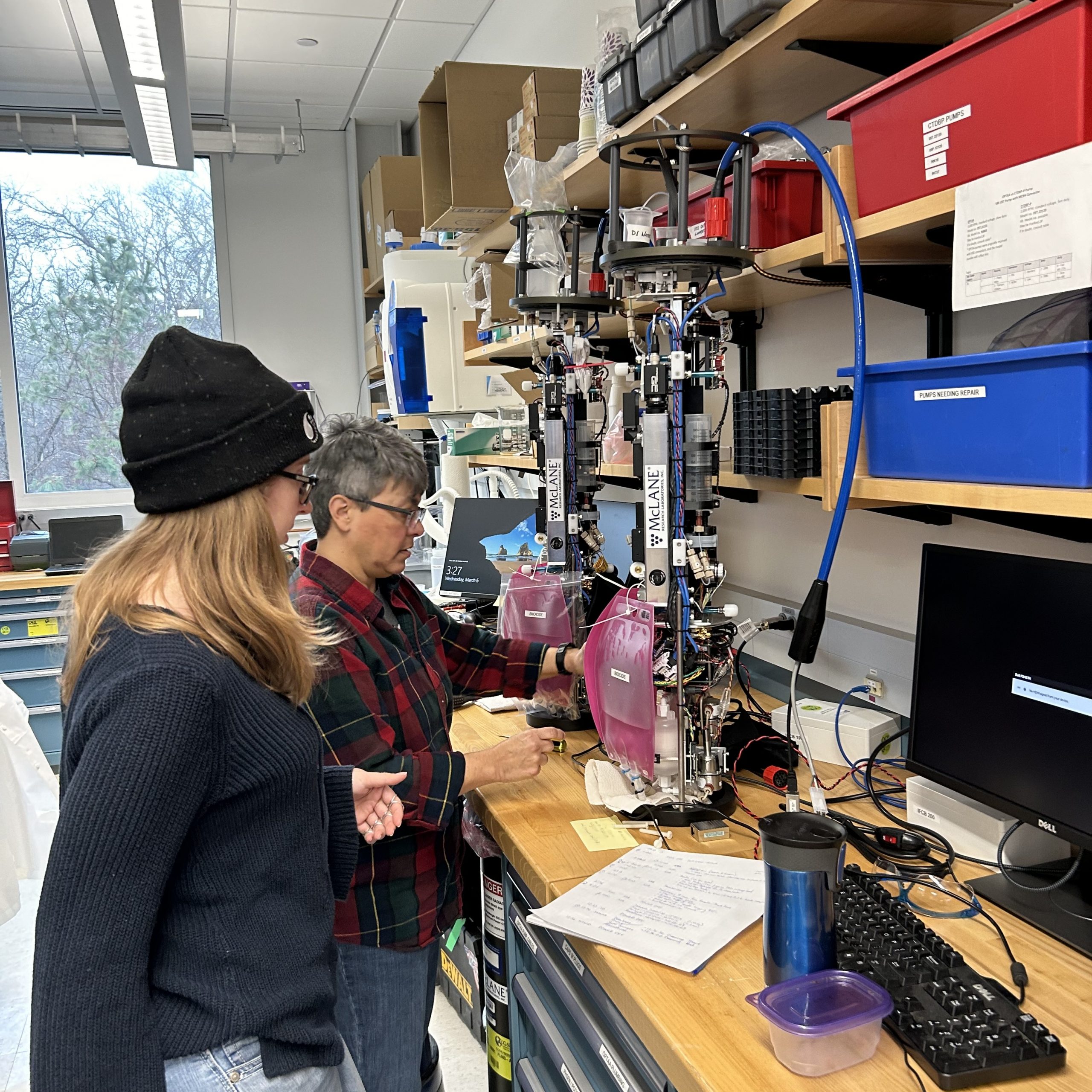
Along with being the first deployment in the Southern Mid-Atlantic Bight, the Pioneer MAB Array will also include new instrumentation on the three Surface Moorings. The new instrumentation includes plankton imaging sensors (the McLane IFCB), instruments that measure particle size distribution (the Sequoia LISST-200X), short-range velocity profile instruments for the upper water column (the Nortek Aquadopp Profiler-S1VP), turbidity sensors (the Sea-BIrd ECO), and new seafloor pressure sensors (the RBR Quartz3QPlus). These were among the measurements recommended during the National Science Foundation OOI Facility Board community workshops in 2021 to select a new location for the Pioneer Array.
Bookmark this page and follow along on the progress of this new addition to the ocean observing network in the important Mid-Atlantic region.