
MARUM CTD-DO Instrument
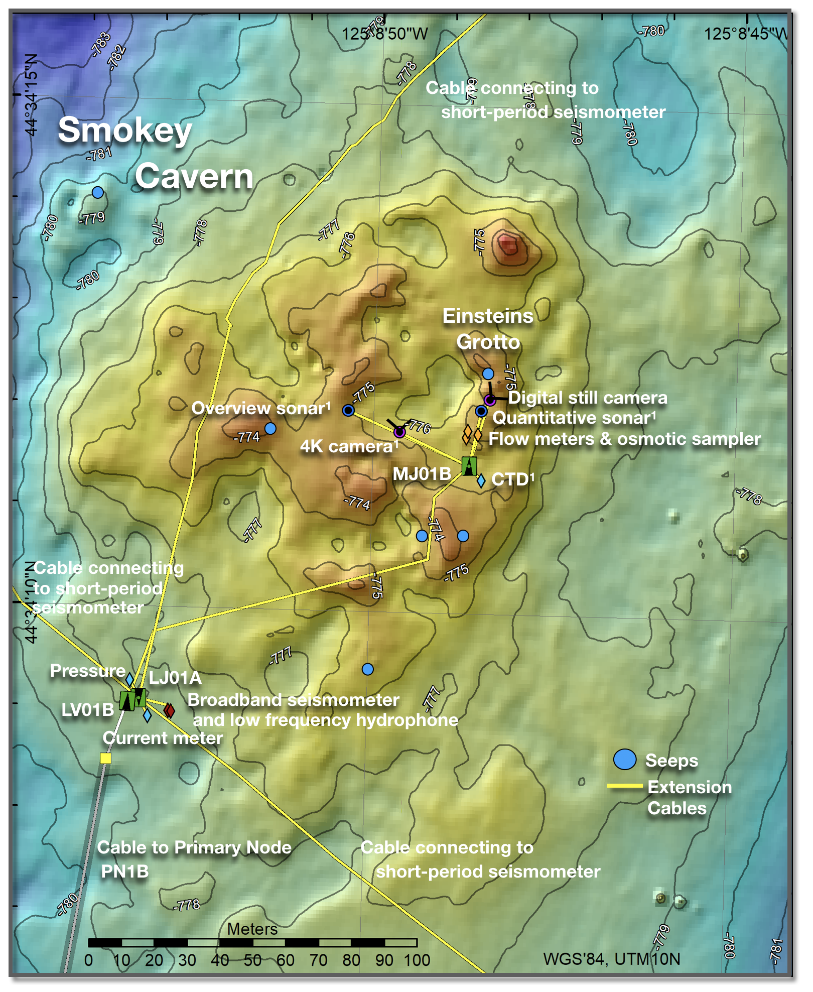
This map shows Regional Cabled Array infrastructure at the summit of Southern Hydrate Ridge and the location of MARUM instruments, denoted by a 1 superscript. Credit: University of Washington.
The MARUM CTD-DO instrument was provided by the MARUM Center for Marine Environmental Sciences and the Department of Geosciences, University of Bremen, Germany. The probe was by funded by the German Federal Ministry of Education and Research (BMBF) within the scope of the “M³: Monitoring Marine Methane” projects (grants 03F0765A and 03F0854A). The MARUM CTD-DO instrument measures the pressure near the seafloor, temperature, conductivity and dissolved oxygen every minute at the summit of Southern Hydrate Ridge. Contacts: Dr. Yann Marcon and Professor Gerhard Bohrmann.
Access CTDPFA110 DataInstrument Models & Deployed Locations
The MARUM CTD-DO Probe was installed on the Southern Hydrate Ridge summit near the medium-powered junction box MJ01B to which it is connected (Figure 1). It consists of a CTD probe (Sea-Bird Electronics SBE16plusV2 SeaCAT) with a dissolved oxygen optode.| Series | Make | Model |
|---|---|---|
| CTDPFA | Sea-Bird | SBE 16plusV2 |
Reference Information
Data FormatThe data products of the MARUM CTD-DO Probe consist of: Raw sensor data output (.dat files): raw data in engineering units recorded in one file for each day. Raw data lines are formatted as follow: Temperature (°C, ITS-90) = ttt.tttt ConductInstrument
CTDPFA110Investigator(s)
Dr. Yann Marcon and Professor Gerhard BohrmannAffiliation(s)
MARUM Center for Marine Environmental Sciences and the Department of Geosciences, University of Bremen, GermanyPrimary Science Discipline
Marine GeophysicsNode
Medium-Power Junction Box (MJ01B)Depth (m)
780 minimumAward
M³: Monitoring Marine MethaneFunding Agency
German Federal Ministry of Education and ResearchImages
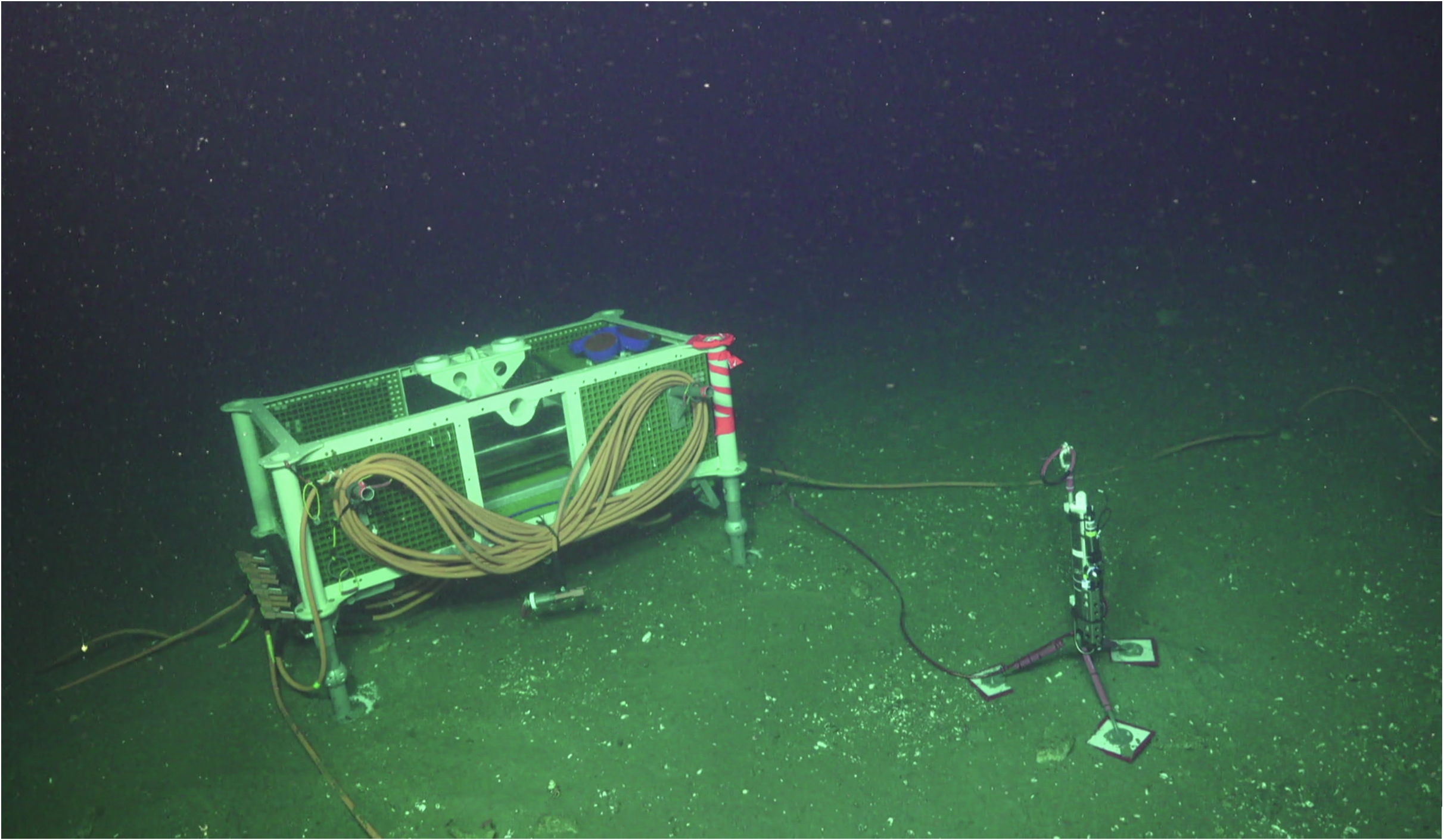
Figure 1. The MARUM CTD-DO instrument was deployed within few meters of the medium-power junction box MJ01B to measure environmental parameters of bottom waters at the summit of Southern Hydrate Ridge. Credit: UW/NSF-OOI/WHOI; V18.