Edson Encourages Federal Agencies to Use OOI Data
The U.S. National Science Foundation Ocean Observatories Initiative (OOI) Program Management Office Principal Investigator Jim Edson was invited to Pasadena, CA in April to present to a group of 160+ of experts who use satellite data to study the planetary boundary layer (PBL) over land, sea, and ice. These experts use observations and modeling to determine the PBL and represented an alphabet soup of federal agencies – NASA, NOAA, CLIVAR, DOE, ONR and NCAR. Edson took the opportunity to introduce them to OOI.
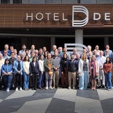
The attendees came together for NASA’s Decadal Survey Planetary Boundary Layer Incubation Community Meeting. Edson gave a presentation about observing the marine PBL using OOI and its partnership with the National Data Buoy Center and OceanSITES as examples of how to build an ocean network of observations.
“This presentation was one of my ongoing efforts to share knowledge about OOI and the data it can deliver,” said Edson. “By focusing on how valuable and rich the available data are, I hoped to re-enforce to our colleagues at these various agencies and institutions that OOI data are an important source for satellite calibration and validation activities over the open ocean. This represents only one of multiple ways that OOI can be used to clarify our understanding of what is going on in the rapidly changing marine environment.”

