
Bottom Pressure and Tilt
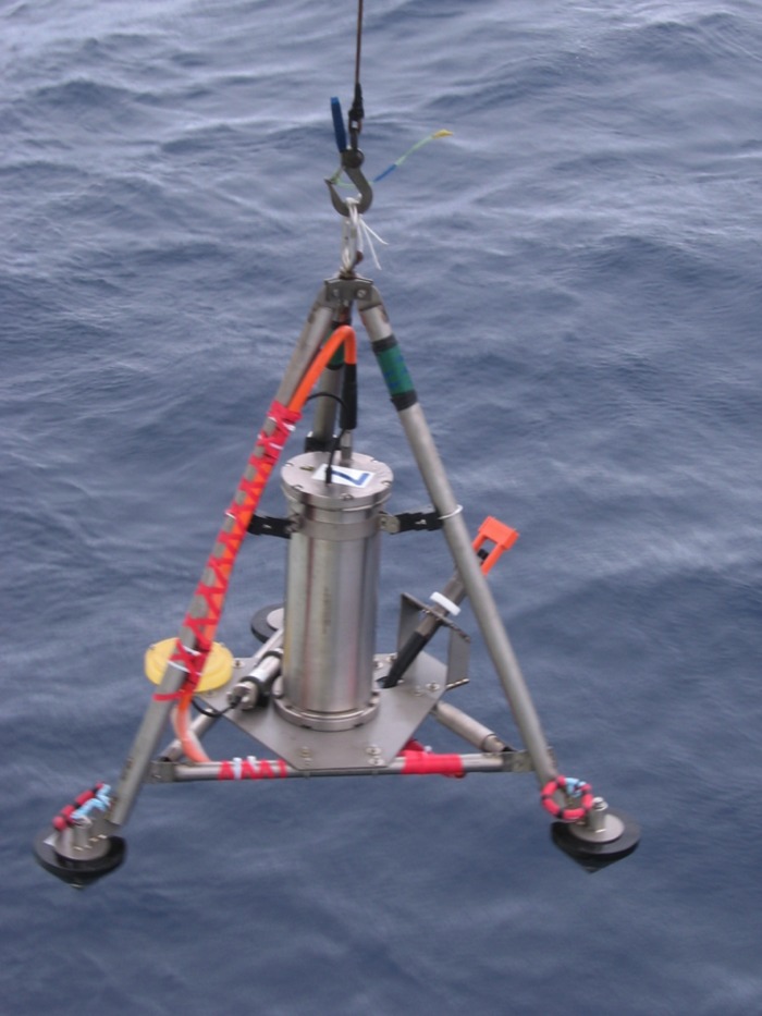
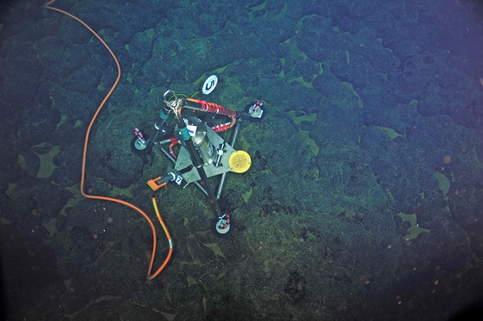
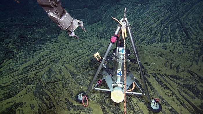
The Bottom Pressure and Tilt Meter (BOTPT) is a custom instrument developed by Bill Chadwick of NOAA PMEL. The BOTPT (aka Bottom Pressure Recorder or BPR) is designed to measure the inflation and deflation of the seafloor at the summit of Axial Volcano using a precision pressure sensor that enables detection of the seafloor’s rise and fall (“breathing”) as molten rock moves in and out of the underlying magma chamber. A very precise tilt meter that measures in micro-radians will record the tilting of the seafloor as it deforms in response to melt migration. Similar measurements are routinely made at terrestrial volcanoes, but these will be the first to be made in real-time at an active underwater volcano. Chadwick’s work has shown that the seafloor fell 2.4 m (7.9 feet) at the time of the eruption in April 2011. Three of these instruments are now installed at the summit of Axial Seamount at the Central Caldera (MJ03F), International District 2 (MJ03D), and Eastern Caldera (MJ03E) sites. They are connected to junction boxes that are now connected to Primary Node PN3B. All three instruments are now streaming data to shore. The pressure sensor is a Paroscientific Digiquartz pressure transducer, and the tilt meter is supplied by Applied Geomechanics (LILY).
(text and images courtesy of Interactive Oceans)
Data Products
This instrument measures the following data products. Select a data product's name to learn more.
| Data Product | Code | DPS |
|---|---|---|
| Nano-resolution Bottom Pressure | BOTPRES | DPS |
| Seafloor Uplift and Deflation | BOTSFLU | |
| Seafloor High-Resolution Tilt | BOTTILT | DPS |
The algorithm code used to generate data products for this instrument is also available in the ion-functions GitHub repository.
Instrument Models & Deployed Locations
The OOI includes the following instrument makes and models for this instrument type. Follow the links below to find out where in the OOI this instrument has been deployed. You'll also find quick links for each instrument to Data Explorer, where you can plot and access data.
| Class-Series | Make | Model |
|---|---|---|
| BOTPTA | PMEL/Chadwick | PMELcabled BPR/Tilt |

Reference Information
- BOTPT Locations (txt)
- BOTPT Tilt Relevel Times (txt)
- BOTPT Outgoing Data Formats v12 (pdf)
- BOTPT LILY Compass Information (txt) – corrected CCMP values added 3/5/18
- BOTPT Tilt Computations (pdf)
Associated Streams
When accessing the Data Portal, “streams” are the data packages that contain all parameters produced by a given sensor or instrument. The BOTPT contains multiple sensors, each of which produces a separate data stream:
- Streamed Science HEAT Sensor Data Products (botpt_heat_sample)
- Streamed Science IRIS Sensor Data Products (botpt_iris_sample)
- Streamed Calibration Data (botpt_lily_leveling)
- Streamed Science LILY Sensor Data Products (botpt_lily_sample)
- Streamed Science NANO Sensor Data Products (botpt_nano_sample)
- Streamed Engineering Data (botpt_status)
Primary Science Discipline
Geological