MARUM Camera System
The MARUM Camera System was developed by Dr. Yann Marcon, Professor Gerhard Bohrmann, and a team of engineers at the MARUM Center for Marine Environmental Sciences and the Department of Geosciences, University of Bremen, Germany. It was funded by the German Federal Ministry of Education and Research (BMBF) within the scope of the “M³: Monitoring Marine Methane” projects (grants 03F0765A and 03F0854A). The MARUM Camera System focuses on the Summit-A vent site at the summit of Southern Hydrate Ridge. It monitors the short-term variability of methane bubble plumes and changes in the seafloor morphology related to the venting activity.
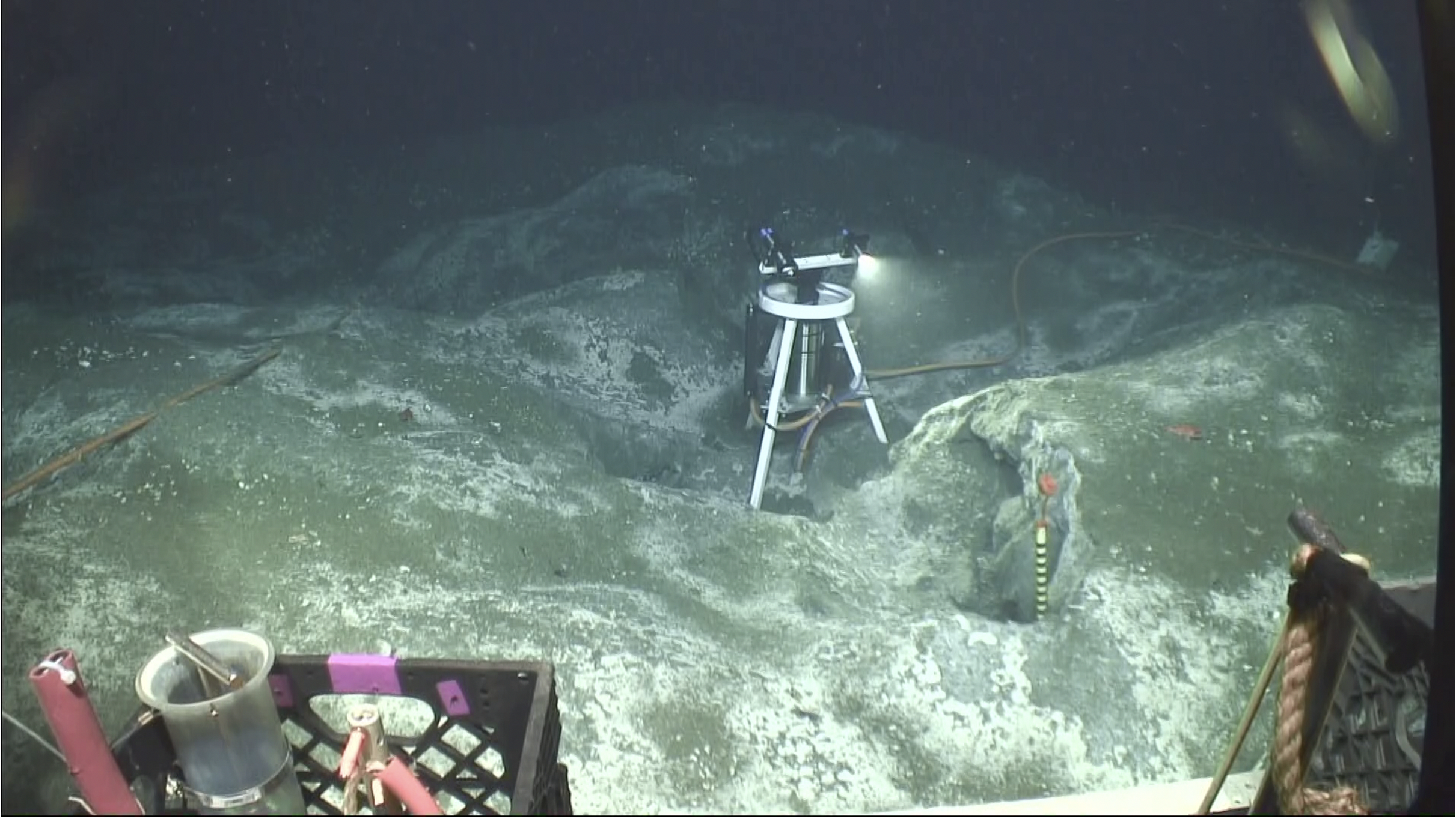
The MARUM Camera System is a 4K camera with a LED lamp mounted on a pan-tilt unit on a 1.3 m-high tripod (Figure 1). The camera can record 4K videos and 21 MP photographs.
The MARUM Camera System was set to record 30-second 4K videos bi-hourly and three consecutive stills every 30 minutes.
Access CAMPIA101 DataInstrument Models & Deployed Locations
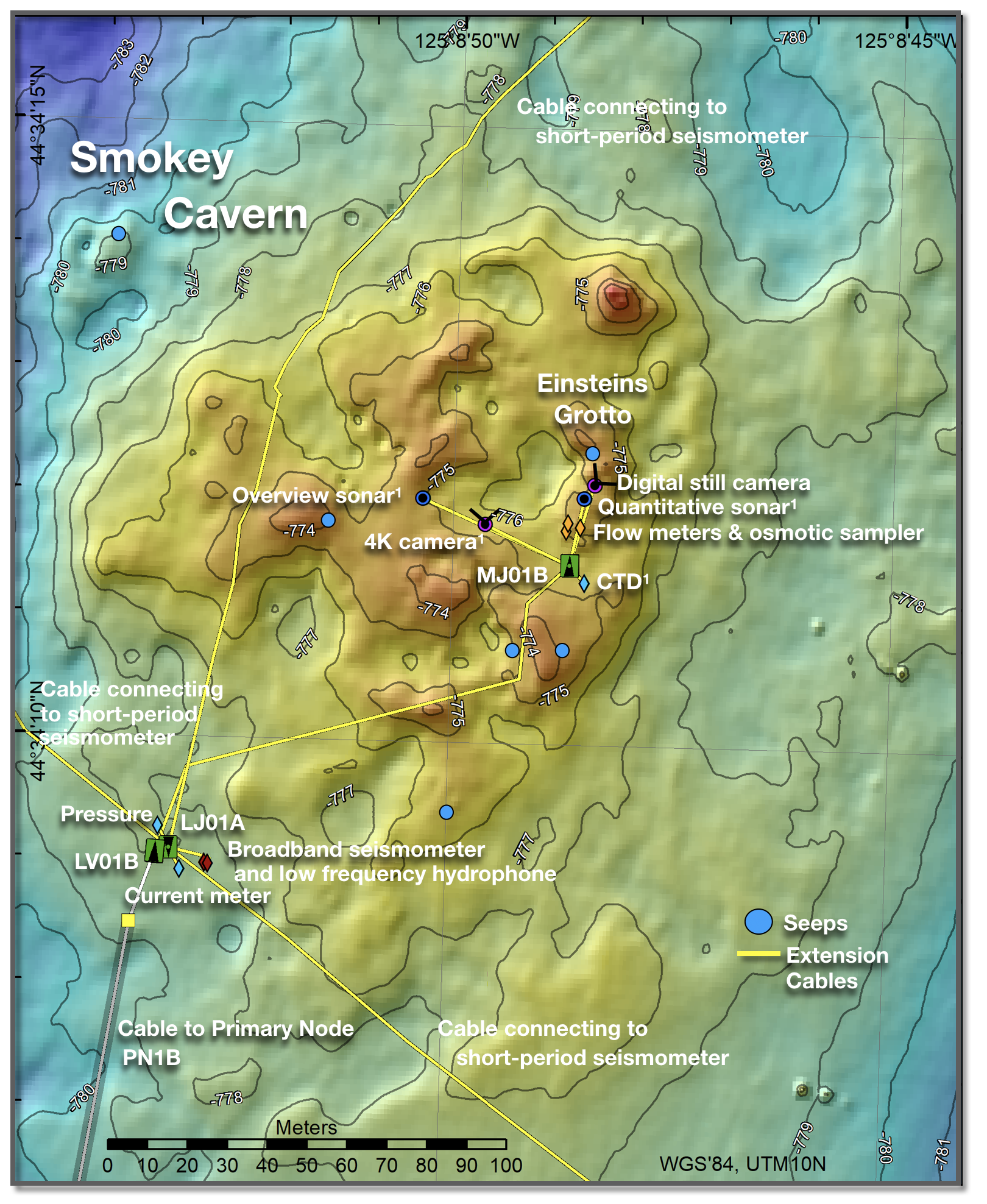
The MARUM Camera System was installed at the Summit-A vent site at the summit of Southern Hydrate Ridge at a water depth of 780 m. The instrument is connected to the medium-powered junction box MJ01B. It consists of a Rayfin Camera (SubC-Imaging), a AquorReference Information
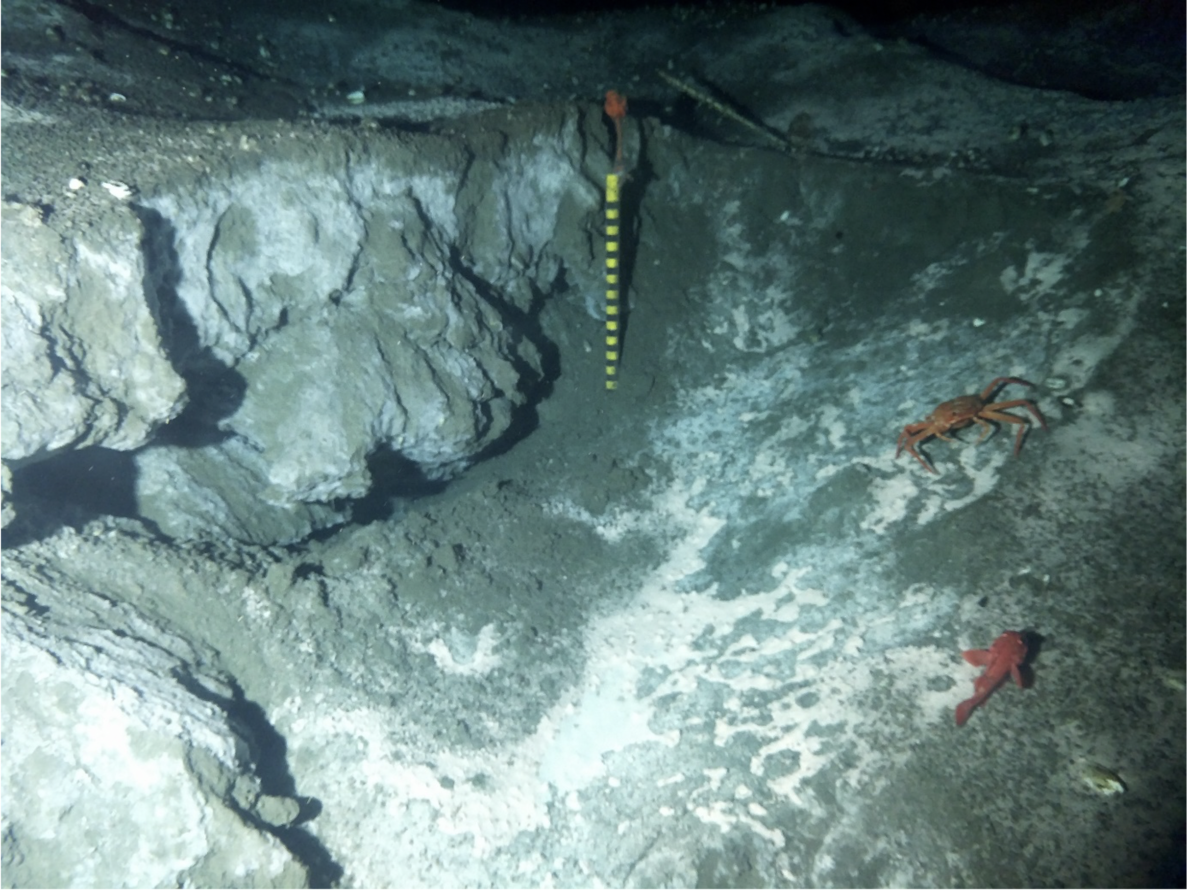
Data FormatThe data products of the MARUM Camera System consist of: Video files: 30-second video sequences recorded every two hours. Still images: bursts of three consecutive images (jpg) acquired every 30 minutes (Figure 2).Data AccessVideo and photo dInstrument
CAMPIA101Investigator(s)
Dr. Yann Marcon and Professor Gerhard BohrmannAffiliation(s)
MARUM Center for Marine Environmental Sciences and the Department of Geosciences, University of Bremen, GermanyPrimary Science Discipline
Marine GeophysicsSite
Southern Hydrate Summit 2 Seafloor (RS01SUM2)Node
Medium-Power Junction Box (MJ01B)Depth (m)
780 minimumAward
M³: Monitoring Marine MethaneFunding Agency
German Federal Ministry of Education and ResearchImages