MARUM Quantification Sonar Southern Hydrate Ridge
The Quantification Scanning Sonar (QSS) was developed in 2017 by Dr. Yann Marcon, Professor Gerhard Bohrmann, and a team of engineers at the MARUM Center for Marine Environmental Sciences and the Department of Geosciences, University of Bremen, Germany. It was funded by the German Federal Ministry of Education and Research (BMBF) within the scope of the “M³: Monitoring Marine Methane” projects (grants 03F0765A and 03F0854A). The QSS focuses on selected vent sites at the summit of Southern Hydrate Ridge. It monitors the short-term variability of methane bubble plumes and changes in the seafloor morphology related to venting activity.
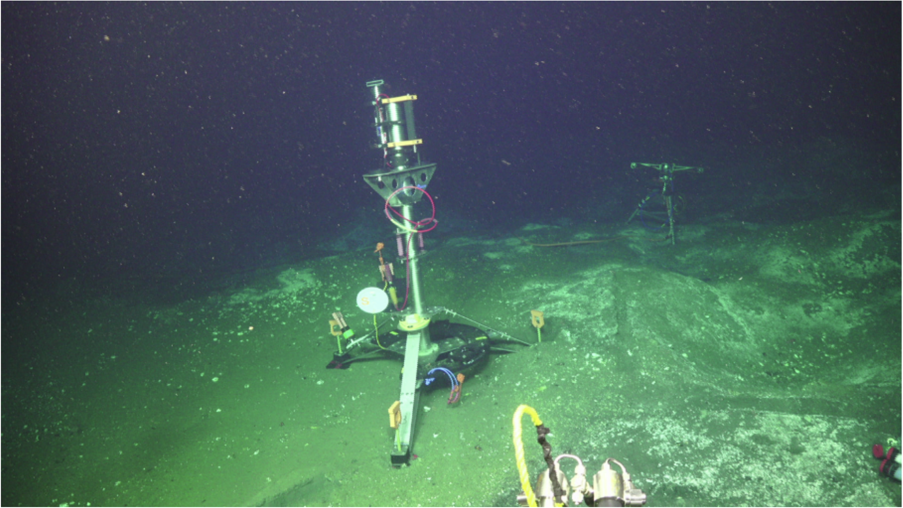
The QSS is a single-beam scanning sonar with an internal compass and a 360° scanning sector. The sonar is mounted on a 2.8 m high tripod (Figure 1). The QSS can operate at frequencies ranging from 500 kHz to 1.2 MHz. The beam width, which decreases with increasing operating frequencies, ranges from 45°x1.0° to 28°x0.6° (wide fan) and from 26°x1.2° to 20°x0.7° (narrow fan).
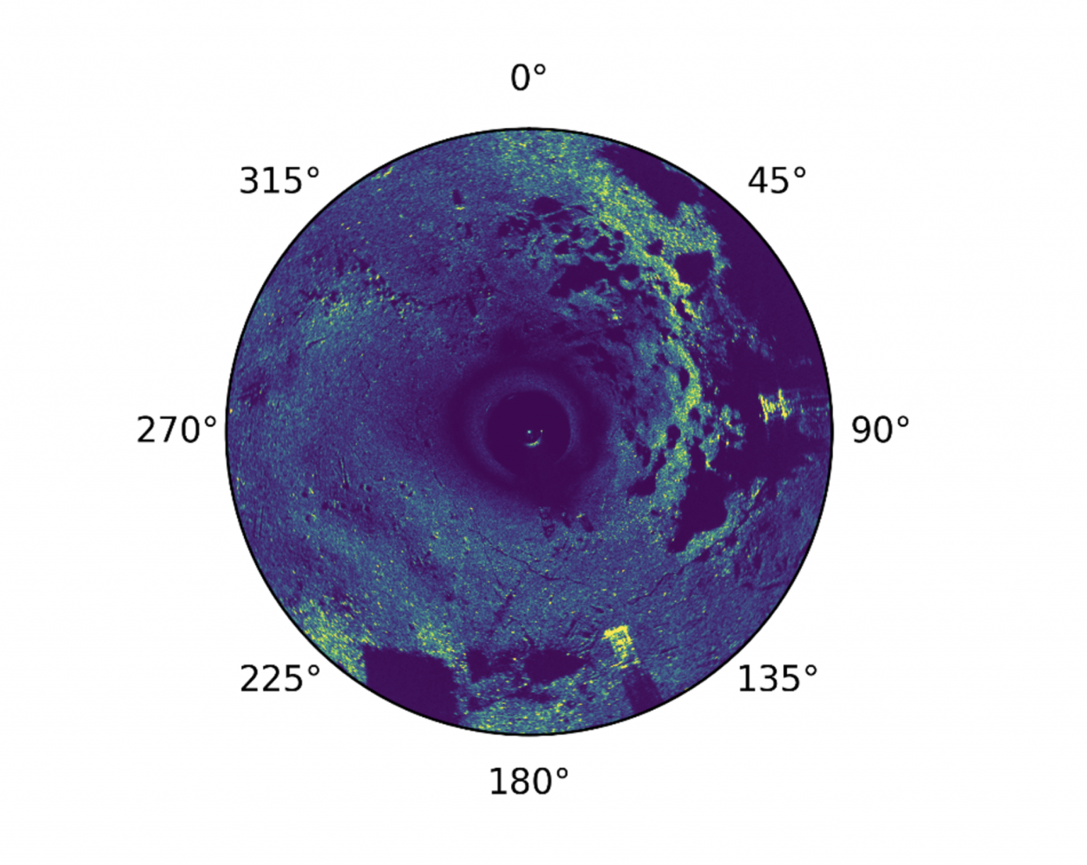
For most of its operating time, the QSS was set to operate at a frequency of 1000 kHz, a range of 20 m, a rotation angle of 360° and the minimum step size available (0.225°/step). The schedule consisted of one 15-minute long scanning sequence per hour. With these settings, a 15-minute scanning sequence recorded at least three consecutive 360° scans of the water column. However, the operation schedule of the QSS has changed a few times since the deployment of the instrument depending on the needs. The exact schedule can be inferred from the timestamp of the data files, while the operating settings can be retrieved from the data files.
Access QNTSRA101 DataInstrument Models & Deployed Locations
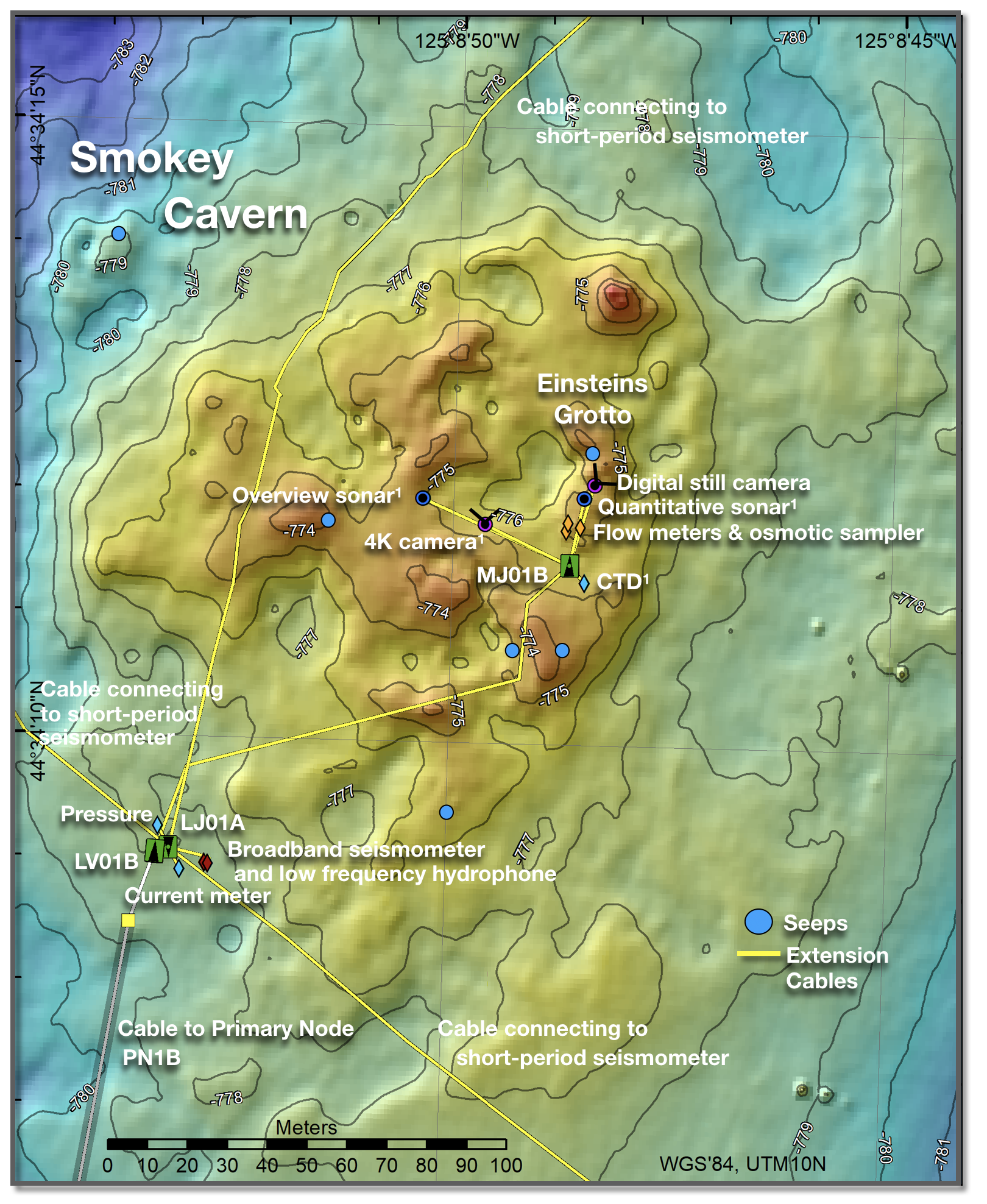
The QSS was installed on the summit of Southern Hydrate Ridge, west of the "Einstein's Grotto" vent area at a water depth of 780 m (Figure 1). The instrument is connected to the medium-power junction box MJ01B. It consists of a single-beam scanning sonarReference Information
Data FormatThe data products of each scanning sequence consist of: Raw data: one single file containing the data and metadata of the scanning sequence. The file name contains the starting time of the scanning sequence. The data are stored in the SMB formInstrument
QNTSRA101Investigator(s)
Dr. Yann Marcon and Professor Gerhard BohrmannAffiliation(s)
MARUM Center for Marine Environmental Sciences and the Department of Geosciences, University of Bremen, GermanyPrimary Science Discipline
Marine GeophysicsSite
Southern Hydrate Summit 2 Seafloor (RS01SUM2)Node
Medium-Power Junction Box (MJ01B)Depth (m)
780 minimumAward
M³: Monitoring Marine MethaneFunding Agency
German Federal Ministry of Education and Research (BMBF)Images