OOI Team Helps Capture Historic Shipwrecks in 3D
Almost any oceanographic expedition includes a group who disappear soon after departure to become “night stalkers.” These are the people who reverse their circadian rhythm, miss regular meals, and divorce themselves from the daytime pulse of activity to staff the night shift. They often develop a unique culture full of shorthand that only they fully understand.
On the Heroic Age Expedition to map and explore the wrecks of ships connected to Ernest Shackleton and Robert FalconScott, that role fell primarily to a three-person team from the U.S. National Science Foundation (NSF) Ocean Observatories Initiative (OOI). They were operating an OOI-provided, NSF-funded Falcon remotely operated vehicle (ROV) outfitted with a Voyis photogrammetric stereo camera system, as well as an ultra-high definition video camera, forward-looking sonar, and acoustic tracking beacons. The stereo camera allowed the OOI team to meet one of the major objectives of the expedition: fully documenting the shipwrecks and surrounding seafloor in three dimensions.
The Falcon ROV is typically used to inspect, maintain, and recover OOI seafloor observatory infrastructure, making this expedition a unique opportunity to demonstrate how OOI’s advanced capabilities can also support underwater archeological exploration and other scientific discoveries beyond routine observatory operations.
For much of the expedition, which was organized by Woods Hole Oceanographic Institution (WHOI) and the Royal Canadian Geographical Society (RCGS), while most of the science party slept, the OOI team of Andy Robinson, James Kuo, and Sam Dahlberg went to work. Their shift began after the human-occupied submersible Alvin had been safely stowed for the night. From a control station in the Hydro Lab aboard the Office of Naval Research’s R/V Atlantis packed with monitors, they guided the compact ROV through painstaking survey patterns, often just a few feet from the wrecks and the life that flourished on and around them.
“The lack of prior knowledge of the wrecks, especially Quest, where we only had a single sidescan sonar image, was a challenge,” said Robinson, chief pilot of the ROV. “We had to always be mindful of our exits. It was very different from our usual missions inspecting and recovering seafloor instrumentation.”
The targets that the Royal Canadian Geographical Society picked were two iconic vessels from the Heroic Age of Antarctic exploration. The first was Quest, the ship used by Shackleton on his final expedition and the vessel on which he died in 1922. The second was Terra Nova, which carried Robert Falcon Scott to Antarctica on his ill-fated South Pole expedition.
During each dive, the Voyis system captured hundreds of thousands of overlapping stereo photographs. Those images will be stitched together using a photogrammetric processing technique known as simultaneous localization and mapping (SLAM) to produce highly detailed digital reconstructions of the wrecks and surrounding seafloor. Every deck beam, broken spar, and scattered artifact will become part of a virtual model that researchers will be able examine long after the expedition.
“The imagery and data we collected from the wrecks in such a relatively short period is staggering,” said shipwreck expert and co-chief scientist of the expedition David Mearns. “A major question for me in the planning was whether we’d be able to get total coverage of both wrecks, documenting every surface of their exteriors and exposed interiors, knowing that the key to understanding a badly damaged shipwreck would be to have a single coherent, photogrammetrically accurate image as a final product. That question has been answered without reservation, and I can’t wait for the day the RCGS reveals what we have uncovered.”
The contribution of the OOI team extended well beyond operating the vehicle. They served as deckhands, deploying and recovering the ROV and the other half of the two-body vehicle system—a towcam provided by the NSF-funded WHOI Multidisciplinary Instrumentation in Support of Oceanography (MISO) Facility. They also acted as navigators, vehicle mechanics, camera technicians, and, along with imaging specialist Zoe Daheron, data managers and quality-control experts, continuously reviewing imagery and adjusting survey plans to ensure complete coverage.
By the time the ship returned to port, the night stalkers had accomplished something remarkable. Through the combined capabilities of the vehicle and camera systems, Quest and Terra Nova have been documented, transforming two historic wrecks from distant archaeological sites into immersive digital records that scientists, historians, and the public will be able to explore.
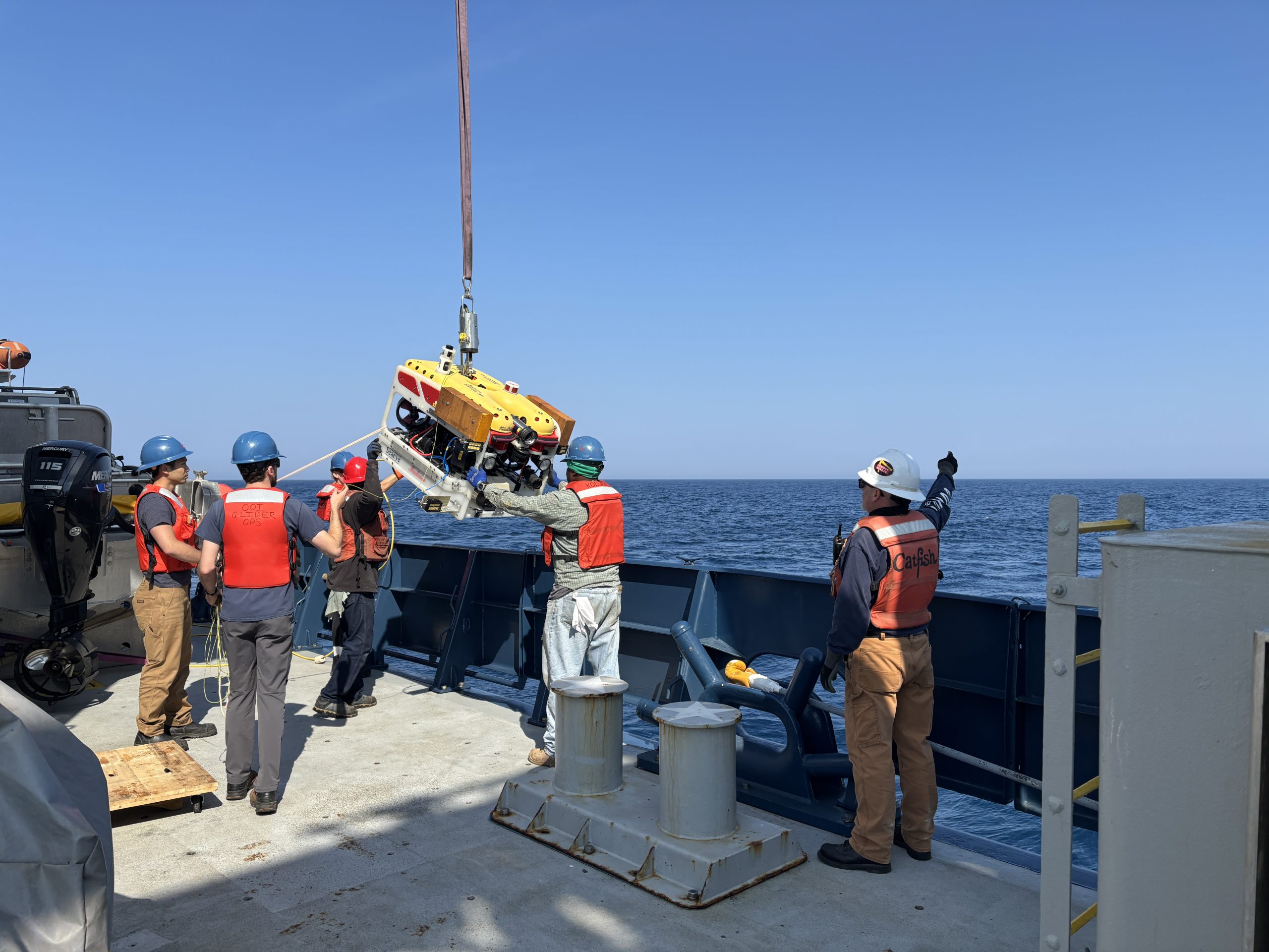
The OOI team and R/V Atlantis crew deploy the OOI Falcon ROV. Credit: Ken Kostel, © Woods Hole Oceanographic Institution.
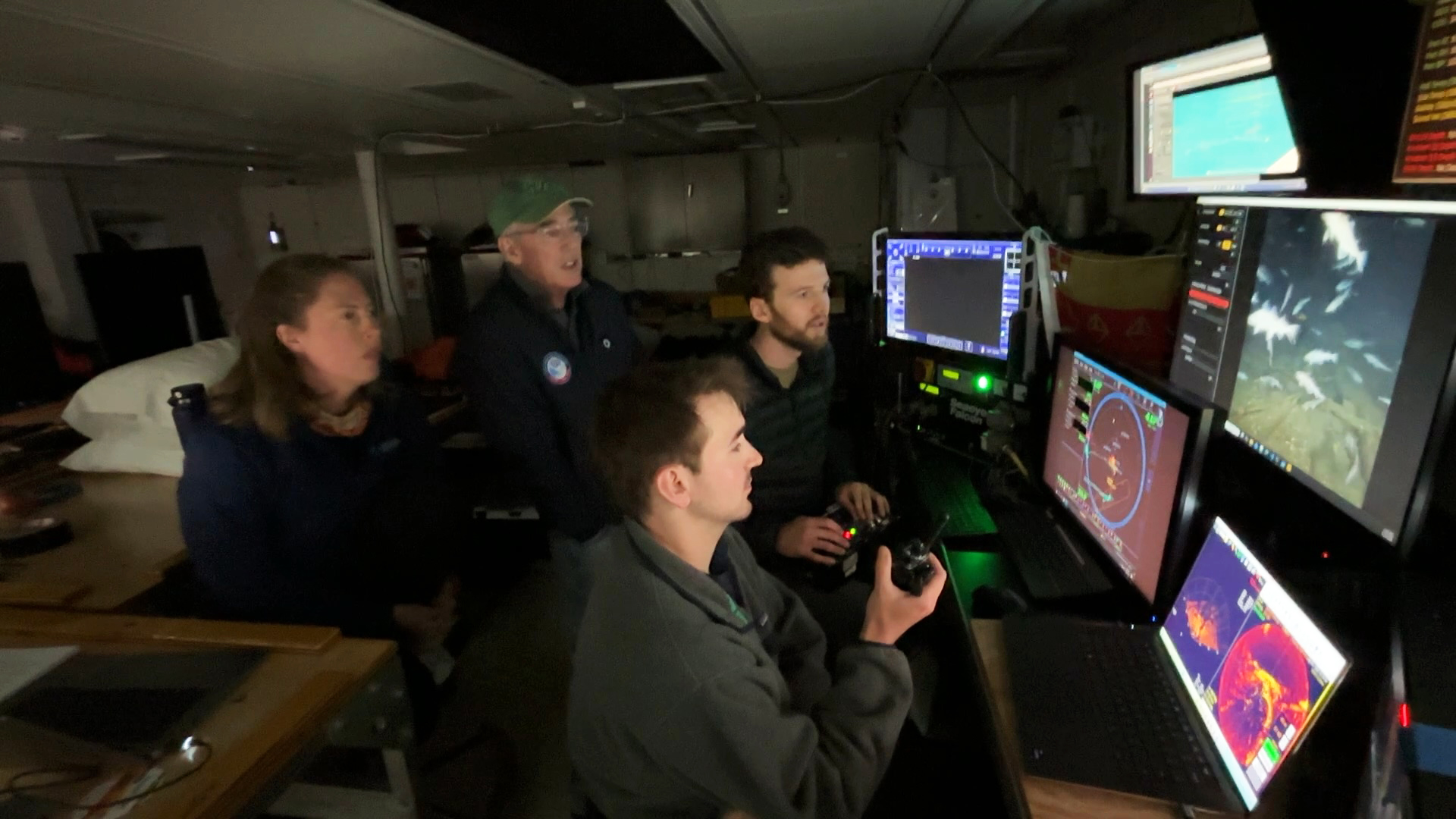
Sam Dahlberg (foreground) provides navigational support and situational awareness while Andy Robinson pilots the ROV and WHOI biologist Kirstin Meyer-Kaiser and co-chief scientist David Mearns watch the survey of Quest. Credit: Ken Kostel, © Woods Hole Oceanographic Institution.
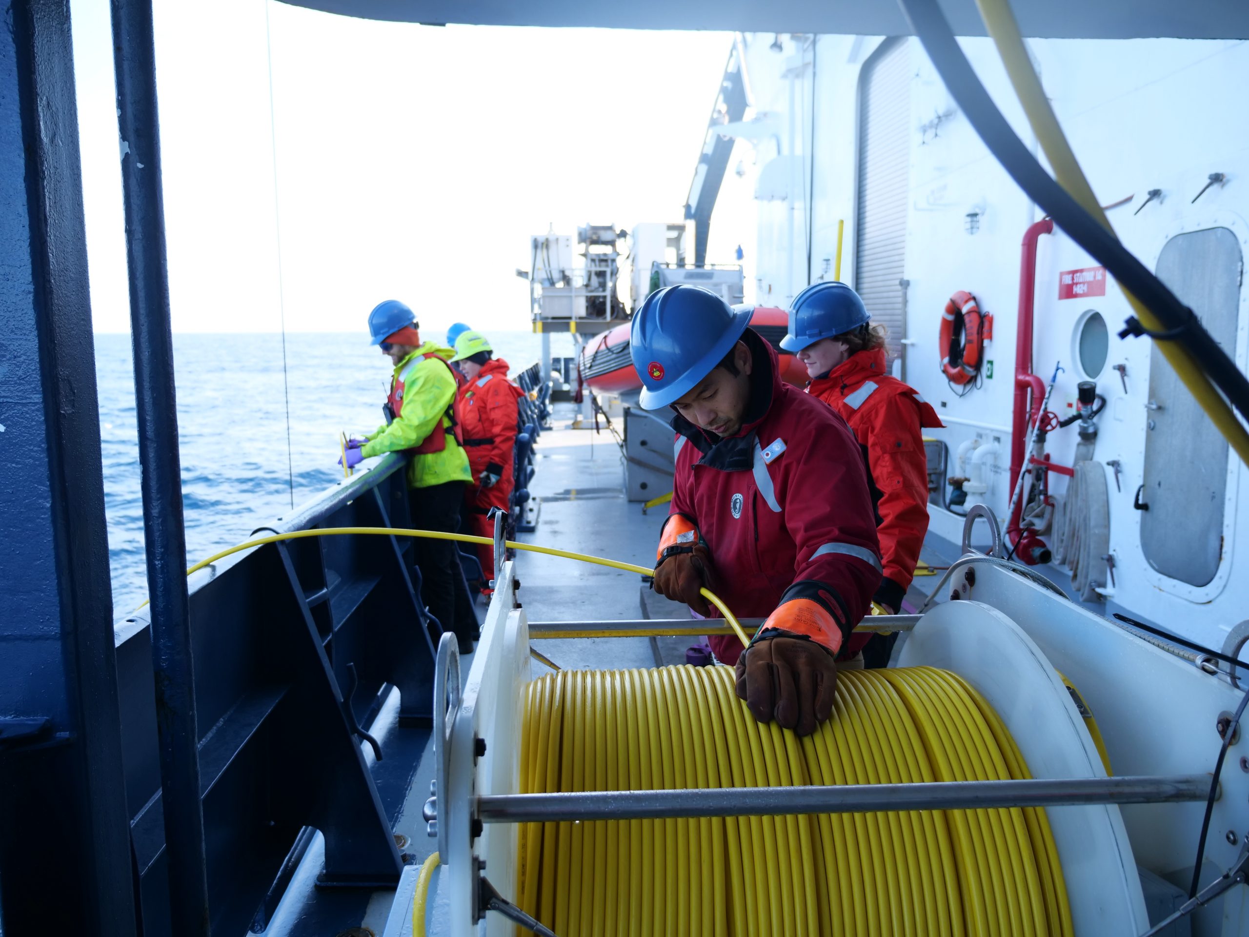
James Kuo (foreground) and Andy Robinson help recover the ROV after an overnight dive on the wreck of Terra Nova. Credit: Ken Kostel, © Woods Hole Oceanographic Institution.