
New Measurements Capture Variability at the Edge of the Gulf Stream
The Ocean Observatories Initiative (OOI) Pioneer Array plays an important role in advancing our understanding of the Mid-Atlantic Bight and its dynamic interactions with the Gulf Stream. The Gulf Stream separates from the continental shelf northeast of Cape Hatteras and is found just offshore of the Pioneer MAB Array at its new location east of Nags Head, North Carolina. The Pioneer MAB science drivers include investigation of shelf-slope exchange that may result from Gulf Stream eddies and meanders. In order to capture variability offshore of the shelf, the Pioneer moored array extends offshore, but only to water depths of 300 m to avoid direct interaction with the Gulf Stream.
To supplement the Pioneer Array observations while enabling investigation of mesoscale variability, identifying western excursions of the Gulf Stream north wall, and detecting the upper portion of the Deep Western Boundary Current (DWBC), specialized instruments were deployed in deeper water. PI Magdalena Andres (WHOI), supported by an NSF Rapid Response Research (RAPID) grant, deployed two current- and pressure-sensor-equipped inverted echo sounders (CPIES; Fig. 1) on the 1000 m isobath. The two CPIES are about 40-km apart and are positioned to allow comparison with a glider which is running a north/south line (nominally) along the 1000 m isobath.
The CPIESs were deployed in June 2024 and will remain on site for four years. They are equipped with Popup Data Shuttles (PDSs) that return batches of data via satellite at regular intervals throughout the deployment. The CPIES measure round-trip vertical acoustic travel time with bursts of 16 pings every 10 minutes, along with near-bottom pressure and current measurements every 30 minutes. Travel time provides information about vertical density structure. Bottom pressure helps to diagnose large-scale barotropic circulation and sea level changes. Near-bottom currents give local flow conditions and help resolve ambiguities between baroclinic and barotropic contributions.
The first round of PDS data has been processed and is available to the community. Hourly processed data and lowpass filtered data from the two deployments sites can be accessed from a listing on the Community Data Sets page of the OOI website, or directly from the CPIES Data Set landing page. The new CPIES observations are complementary to the Pioneer Array measurements, extend the Array footprint offshore, and provide unique data for exploring mesoscale variability associated with the Gulf Stream and DWBC.
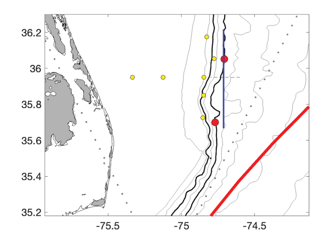
Figure 1. Map showing CPIES locations (red dots, site C1 to the north, C2 to the south) relative to the Pioneer MAB moorings (yellow dots) and the Pioneer Offshore Flux glider line (blue). The red line is the time-averaged position of the Gulf Stream core and the dotted lines are Jason satellite altimetry tracks. Heavy contours are the 200 and 1000 m isobaths.
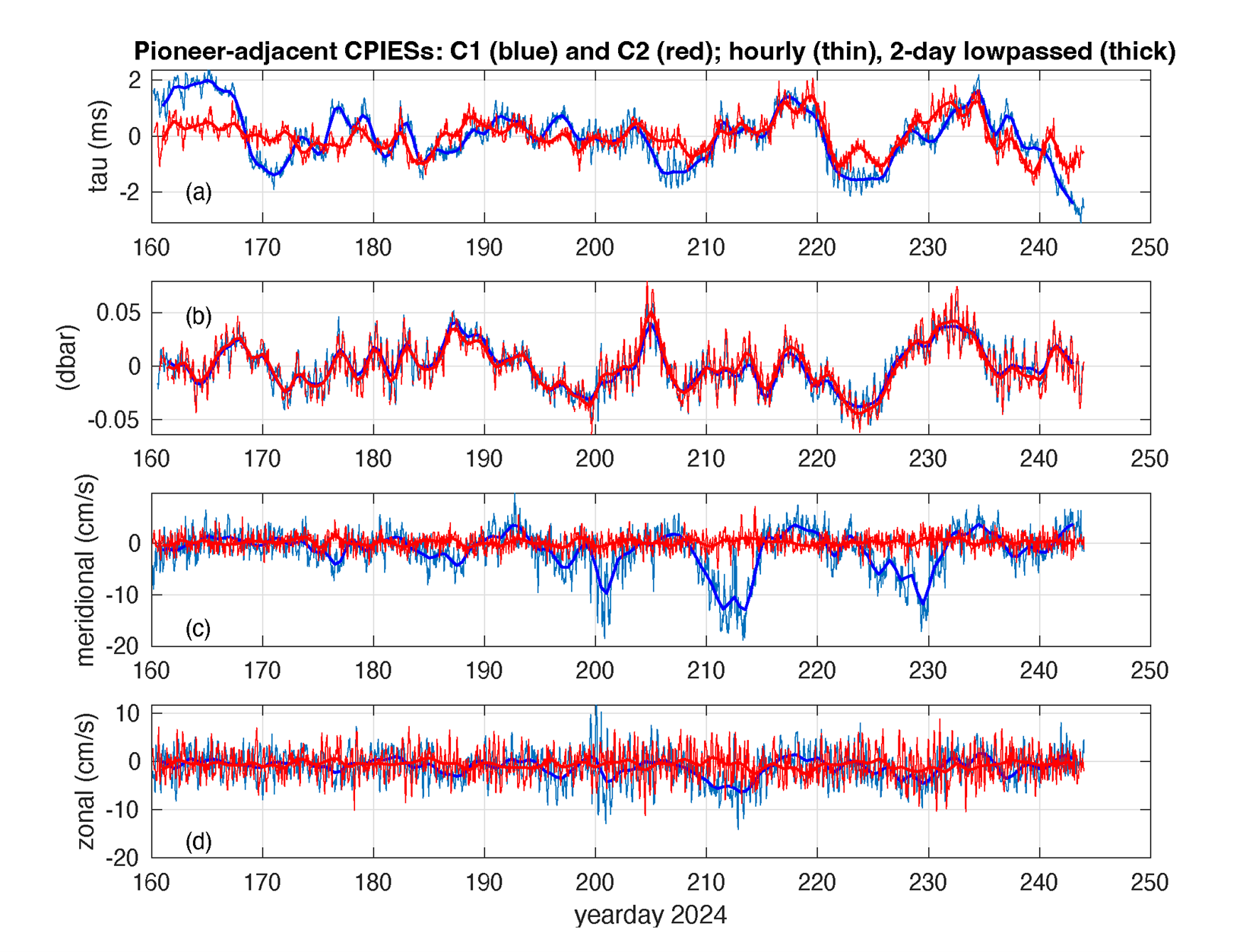
Figure 2. Data returned via satellite from the first two Popup Data Shuttles from CPIES at site C1(blue) and C2 (red). Hourly and two-day lowpass filtered records are shown for (a) round-trip acoustic travel time, (b) bottom pressure, (c,d) near-bottom meridional and zonal currents.