Cabled Continental Margin Array
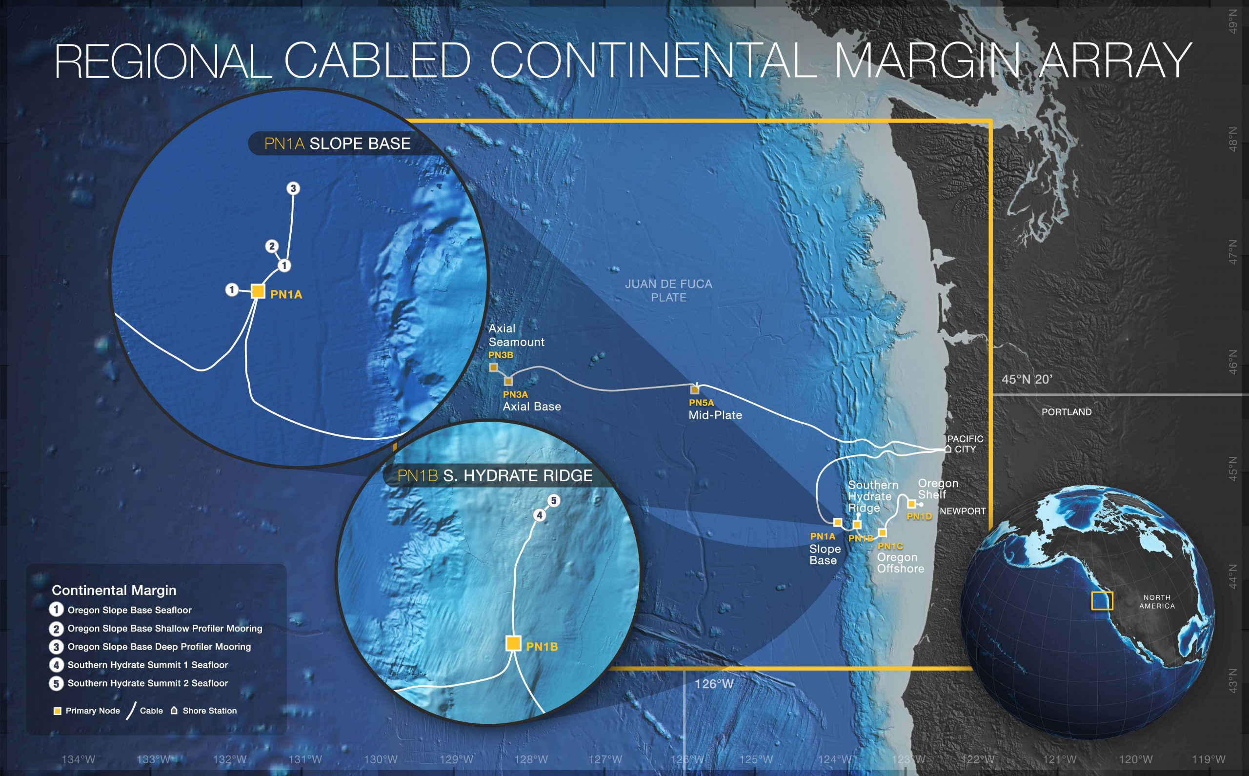
The Cabled Continental Margin Array portion of the Regional Cabled Array spans coastal to blue-water environments and includes electro-optical submarine cables that provide high power, bandwidth, and two-way real-time communication to seafloor and water column instrumentation. Within the Continental Margin Array, infrastructure is located just off the continental slope near the Cascadia subduction zone, on the continental slope at Southern Hydrate Ridge (an area with methane hydrates), and then connects further up the slope to the Endurance Array Oregon Line at the Offshore, and Shelf sites.
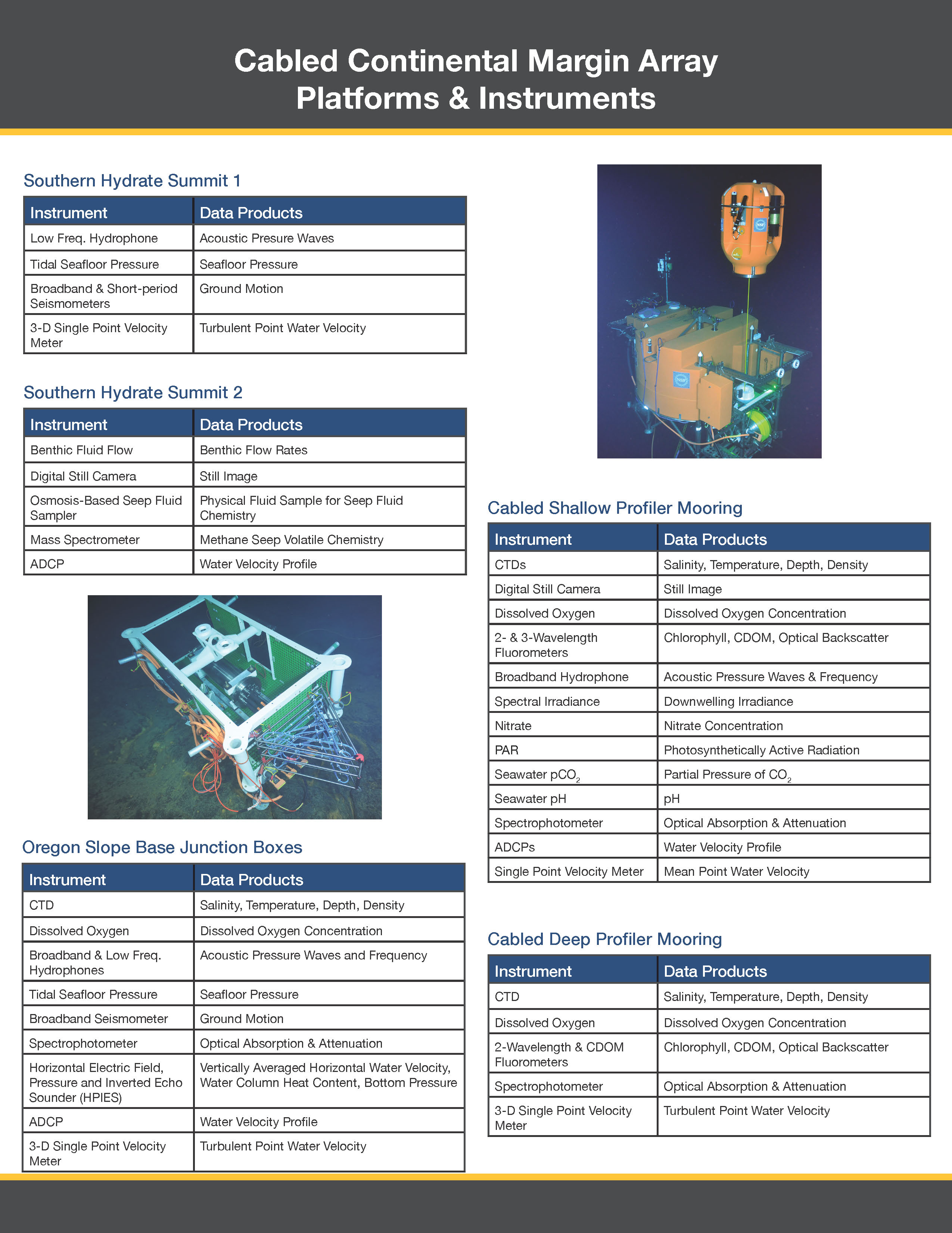
Three Junction Boxes located at the Southern Hydrate Ridge site contain geophysical instruments (seismometers and hydrophones), as well as sensors to image and measure the rising plumes, the flow of fluid into and out of the seafloor, and fluid chemistry. At the Slope Base, observations are made from the seafloor to near the sea surface using Junction Boxes hosting geophysical instruments and those focused on water column processes. These are paired with a Cabled Deep Profiler Mooring and a Cabled Shallow Profiler Mooring. All instrumentation and infrastructure are connected to the cable for power and communication, ultimately making possible real-time data flow.
For more information, check out the Regional Cabled Array related news stories.
Sites/Platforms
This array includes following research sites and platforms.
| Key | Site/Platform Name | Water Depth | DOI |
|---|---|---|---|
| 1 | Oregon Slope Base Seafloor (RS01SLBS) | 2901 meters | 10.58046/OOI-RS01SLBS |
| 2 | Oregon Slope Base Shallow Profiler Mooring (RS01SBPS) | 2906 meters | 10.58046/OOI-RS01SBPS |
| 3 | Oregon Slope Base Deep Profiler Mooring (RS01SBPD) | 2893 meters | 10.58046/OOI-RS01SBPD |
| 4 | Southern Hydrate Summit 1 Seafloor (RS01SUM1) | 775 meters | 10.58046/OOI-RS01SUM1 |
| 5 | Southern Hydrate Summit 2 Seafloor (RS01SUM2) | 772 meters | 10.58046/OOI-RS01SUM2 |
| PN01A | Oregon Slope Base Primary Node (PN01A) | 2905 meters | |
| PN01B | Hydrate Ridge Primary Node (PN01B) | 1241 meters |
Research Themes
Cabled Continental Margin Array

Approximate Water Depth
770-2, 900 metersResearch Setting
North Pacific coastal to blue water, continental shelf and slopeInstrument Table