Global Southern Ocean Array
The Global Southern Ocean Array, southwest of Chile was in place from February 2015-January 2020, when it was removed. Data from this array remain available for research at OOI’s data portal.
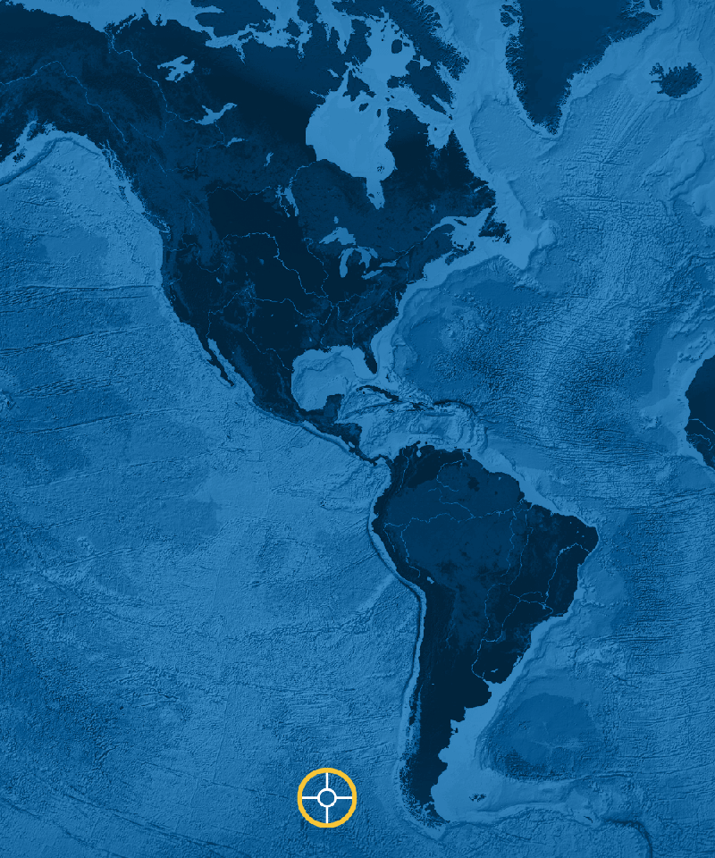
The Southern Ocean Array was located in the high-latitude South Pacific, west of the southern tip of Chile in an area of large scale thermohaline circulation, intermediate water formation, and CO2 sequestration. It permitted examination of linkages between the Southern Ocean and the Antarctic, including strengthening westerly winds and upwelling. The array sampled the data-sparse, cold, dry Southern Hemisphere, providing critical information to calibrate remote sensing and air-sea flux products.
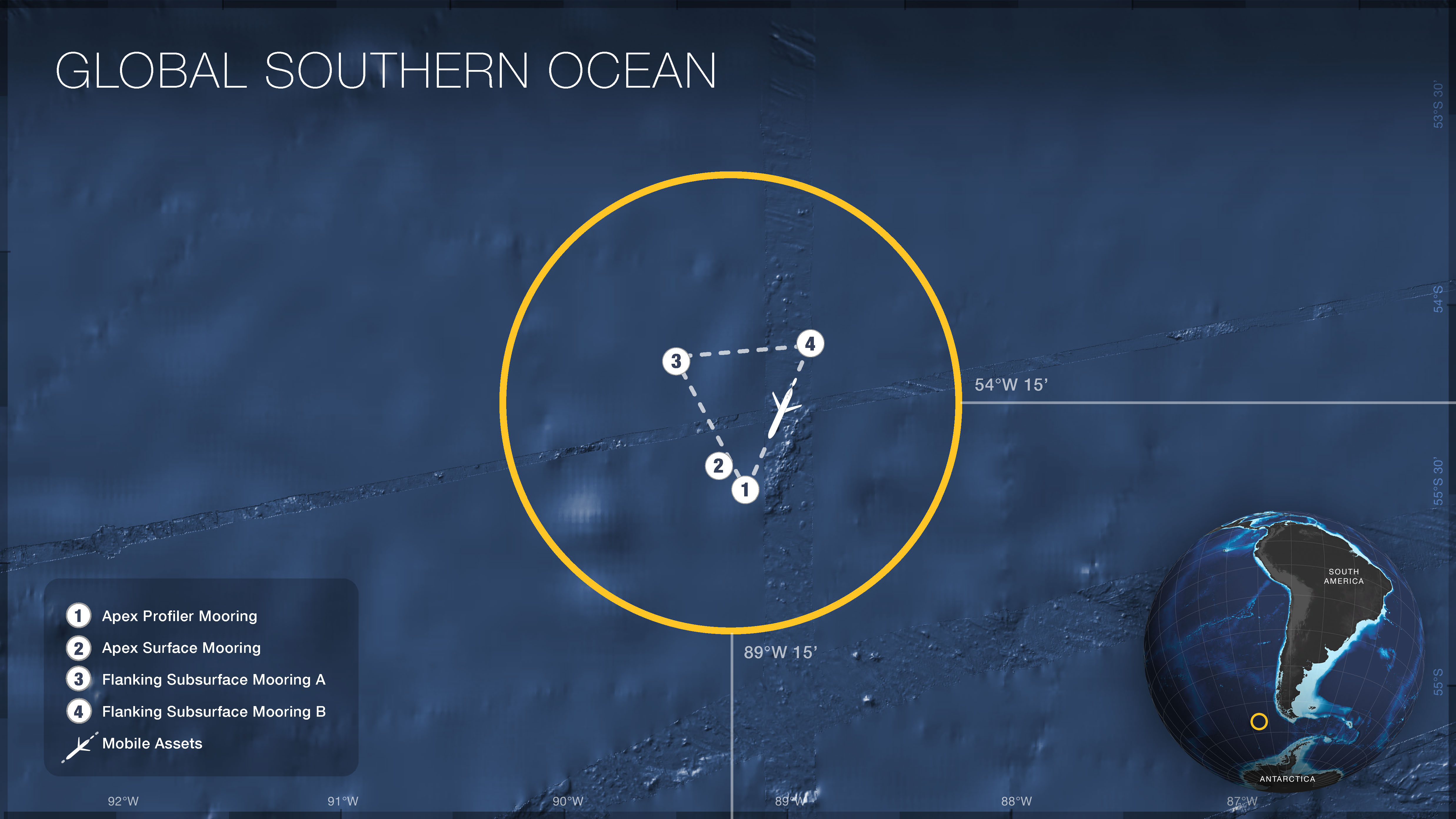
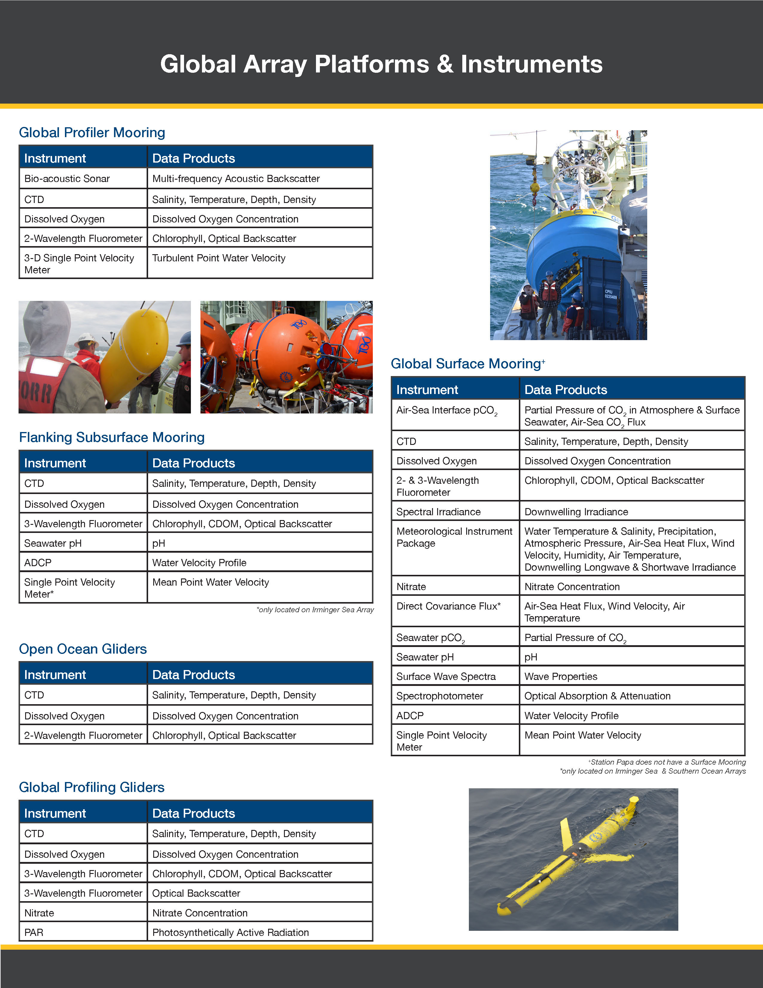
The Global Southern Ocean Array consisted of a triangular set of moorings (white circles), with the sides of the triangle having a length roughly 10 times the water depth to capture mesoscale variability in each region. The global array consisted of a combination of three mooring types: the paired Global Surface (2) and subsurface Global Profiler (1) Moorings are at one corner of the triangle, with the other two corners occupied by Flanking Subsurface Moorings (3,4). Two types of gliders were deployed within the array: open-ocean gliders (dashed lines) sampled spatial variability within and around the moored array, and vertically profiling gliders sampled the waters above the subsurface Global Profiler Mooring (1).
For more information, check out the Southern Ocean Array related news stories.
Sites/Platforms
This array includes following research sites and platforms.
| Key | Site/Platform Name | Water Depth | DOI |
|---|---|---|---|
|
Mobile Assets (GS05MOAS)
Suspended on: 01/15/2020 |
10.58046/OOI-GS05MOAS | ||
| 1 |
Apex Profiler Mooring (GS02HYPM)
Suspended on: 01/15/2020 |
4800 meters | 10.58046/OOI-GS02HYPM |
| 2 |
Apex Surface Mooring (GS01SUMO)
Suspended on: 01/15/2020 |
4800 meters | 10.58046/OOI-GS01SUMO |
| 3 |
Flanking Subsurface Mooring A (GS03FLMA)
Suspended on: 01/15/2020 |
4800 meters | 10.58046/OOI-GS03FLMA |
| 4 |
Flanking Subsurface Mooring B (GS03FLMB)
Suspended on: 01/15/2020 |
4800 meters | 10.58046/OOI-GS03FLMB |


