Cabled Array
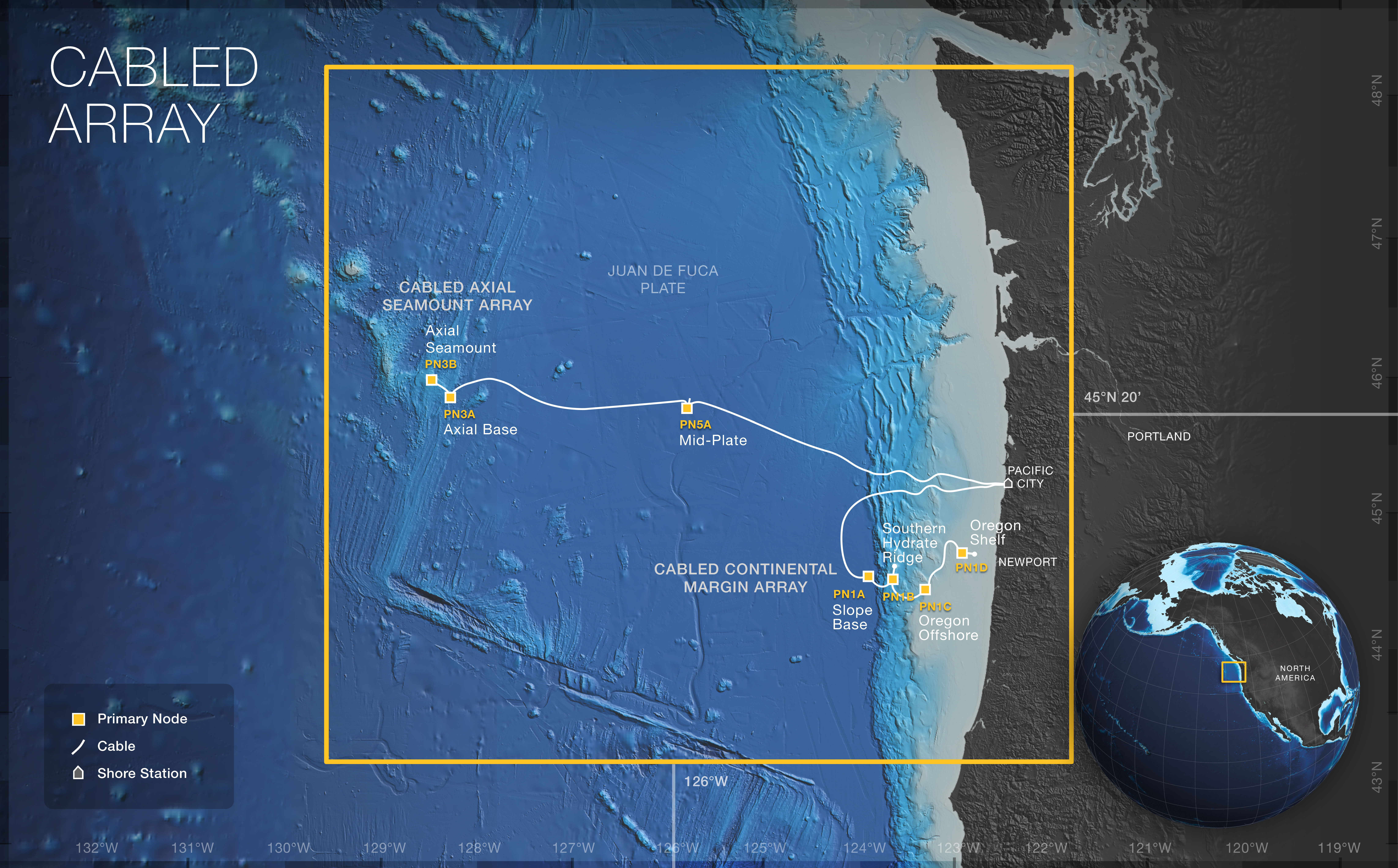
The Cabled Array provides unprecedented power (10 kV, 8 kW) and bandwidth (10 GbE), and two-way communication to scientific sensor arrays on the seafloor and throughout the water column. A shore station in Pacific City, Oregon includes two cable landings serving key sites on the Cabled Array: 1) Slope Base, Southern Hydrate Ridge, and the Endurance Array Oregon Line; and 2) Axial Seamount, and Axial Base. The ~ 900 km of modified telecommunications cable (installed in 2012) provides high power and bandwidth to seven Primary Nodes: PN1A (Slope Base), PN1B (Southern Hydrate Ridge), PN3A (Axial Base), PN3B (Axial Summit), PN5A (Mid-Plate), PN1C (Oregon Offshore), and PN1D (Oregon Shelf).
The Cabled Array is make up of two sub-Arrays. Select one of these sub-Arrays below for more information about their associated sites and instrumentation:
Cabled Continental Margin Array
Cabled Axial Seamount Array
As the first U.S. ocean observatory to span a tectonic plate, the OOI Cabled Array provides a constant stream of near-real time data from the seafloor and through the water column across the Juan de Fuca plate. The network of three instrumented cabled mooring sites (Axial Base, Slope Base, and Oregon Offshore) with complementary sensors on the Cabled Array and shared Endurance Array enable interdisciplinary observations of water-column processes that span >300 miles offshore of the continental margin to across the shelf. The water column sensors are deployed on 1) moorings with instrumented wire-following profilers, and 2) two-legged moorings that provide 3 kW power and 1 GB communication to 200-m deep instrumented platforms, and instrumented winched profilers. These provide key insights into a region that is strongly forced by air-sea interaction, shelf-slope interactions with the deep sea, and coupled atmospheric/oceanic phenomena acting to produce variations in North Pacific circulation over gyre scales.
Two other sites within the Cabled Array house cable seafloor instruments exclusively: Southern Hydrate Ridge and Axial Summit. Infrastructure on the Southern Hydrate Ridge provides important insight into actively venting methane hydrate systems, including: defining the temporal evolution of methane hydrate systems in response to seismic events; determining chemical fluxes from the seafloor and impacts on overlying ocean chemistry; and understanding biogeochemical coupling associated with gas-hydrate formation and dissolution. Axial Summit is the most advanced underwater volcanic observatory in the worlds oceans. This site is the most magmatically robust volcano on the Juan de Fuca Ridge, having erupted in 1998, April 2011, and again in April 2015 (link to story). It hosts numerous active hydrothermal fields (e.g., ASHES and the International District) and abundant sites of diffuse flow. A diverse array of geophysical chemical, and biological sensors, as well as an HD camera and digital still camera provide real-time information on linkages between seismic activity, fluid flow.
For more information, check out the Cabled Array related news stories.
Sites
This array includes following research sites and platforms.

