• Skip to main content
  • Skip to Navigation
Skip to content
Help Data Portal NSF Logo
Ocean Observatories Initiative
  • About OOI
    • The Vision
    • Leadership
    • For Mariners
    • Glossary
    • Subscribe
    • Contact
  • The Observatory
    • Arrays
      • Global Argentine Basin Array
      • Global Irminger Sea Array
      • Global Southern Ocean Array
      • Global Station Papa Array
      • Coastal Endurance Array
      • Coastal Pioneer Array
      • Regional Cabled Array Overview
      • Cabled Continental Margin Array
      • Cabled Axial Seamount Array
      • Cabled Endurance Array
    • Infrastructure
      • Cabled Infrastructure
      • Moorings
      • Profilers
      • AUVs
      • Gliders
      • Cyberinfrastructure
    • Instruments
    • Sites
    • Data Products
      • Complete List
  • Data Access
    • How to Access Data
      • Data Explorer
      • Data Portal
      • Analytical Data Archive
      • Axial Seamount Live Video
      • CAM HD
      • Cruise Data
      • ERDDAP
      • M2M
      • PI-Added Instruments
      • Raw Data Archive
      • Python, Jupyter Notebooks
      • Data Status
    • Observation and Sampling Approaches
    • Ensuring Quality
      • Data Status
      • Quality Control
    • Partner Data Sites
    • How to Use and Cite Data
  • Data Tools
    • Community Tools and Datasets
    • Need Help?
      • Tutorials
      • Resources
      • Webinars
      • FAQs (Knowledge Base)
  • How to Participate
    • Adding Instruments or Platforms
    • Propose Modifications to Sampling
    • Deploying in OOI Areas
    • Cruise Participation
    • Loaning of OOI Equipment
    • Proposals
  • Science
    • Science Highlights
    • Science Questions
    • Projects and Related Research
    • Publications
  • What’s New
    • Expeditions & Program Updates
    • OOI In The News
    • Newsletter
    • Upcoming Events
    • Webinars
    • Workshops/Conferences
  • For Educators
  • Gallery
    • Image Gallery
    • Video Gallery
Home::Data Access::How to Access Data::Raw Data Archive

Raw Data Archive

OOI raw data are received in instrument-specific format and are accessible through the Raw Data Archive, which you can visit here:

Raw Data Archive
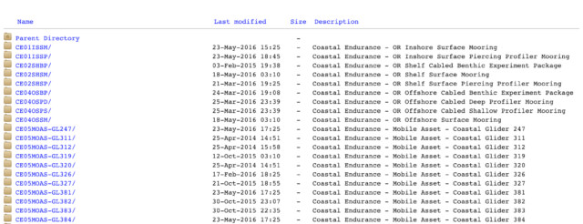
Raw Data Files

How to Use the Raw Data Archive

For more information about how to access and use data from the Raw Data Archive, please check out the following articles.

Show the articles

How do I download an entire raw data directory?

How do I use raw formatted data?

How do I know what data in the raw data archive are from a valid time range, not including test data or bad data?

Where is the metadata in the raw data archive?

What do the terms used in the raw data archive mean?

How do I find a specific instrument or platform in the raw data archive?

How is the raw data archive organized?

What is NOT in the raw data archive, and how do I get any data I can’t find there?

What is stored in the raw data archive?

How is “raw” data defined in OOI?

What is the raw data archive, and what is it for?

  • About OOI
    • The Vision
    • Leadership
    • For Mariners
    • Glossary
    • Subscribe
    • Contact
  • The Observatory
    • Arrays
      • Global Argentine Basin Array
      • Global Irminger Sea Array
      • Global Southern Ocean Array
      • Global Station Papa Array
      • Coastal Endurance Array
      • Coastal Pioneer Array
      • Regional Cabled Array Overview
      • Cabled Continental Margin Array
      • Cabled Axial Seamount Array
      • Cabled Endurance Array
    • Infrastructure
      • Cabled Infrastructure
      • Moorings
      • Profilers
      • AUVs
      • Gliders
      • Cyberinfrastructure
    • Instruments
    • Sites
    • Data Products
      • Complete List
  • Data Access
    • How to Access Data
      • Data Explorer
      • Data Portal
      • Analytical Data Archive
      • Axial Seamount Live Video
      • CAM HD
      • Cruise Data
      • ERDDAP
      • M2M
      • PI-Added Instruments
      • Raw Data Archive
      • Python, Jupyter Notebooks
      • Data Status
    • Observation and Sampling Approaches
    • Ensuring Quality
      • Data Status
      • Quality Control
    • Partner Data Sites
    • How to Use and Cite Data
  • Data Tools
    • Community Tools and Datasets
    • Need Help?
      • Tutorials
      • Resources
      • Webinars
      • FAQs (Knowledge Base)
  • How to Participate
    • Adding Instruments or Platforms
    • Propose Modifications to Sampling
    • Deploying in OOI Areas
    • Cruise Participation
    • Loaning of OOI Equipment
    • Proposals
  • Science
    • Science Highlights
    • Science Questions
    • Projects and Related Research
    • Publications
  • What’s New
    • Expeditions & Program Updates
    • OOI In The News
    • Newsletter
    • Upcoming Events
    • Webinars
    • Workshops/Conferences
  • For Educators
  • Gallery
    • Image Gallery
    • Video Gallery

NSF Logo

OOI Logo

Sign up for our newsletter to get the latest news from Ocean Observatories Initiative

Subscribe now

© 2020 Ocean Observatories Initiative. All Rights Reserved.

Funding for the Ocean Observatories Initiative is provided by the National Science Foundation through a Cooperative Agreement with Woods Hole Oceanographic Institution. Any opinions, findings, and conclusions or recommendations expressed in this material are those of the author(s) and do not necessarily reflect the views of the National Science Foundation. Internal | PMO/MIO Log in