Posts by ooistaff
Tracking Fish with Acoustics
New RAFOS Ocean Acoustic Monitoring (ROAM) tags have recently been designed to allow geolocation of underwater assets, including pelagic fishes, over large areas in the ocean and even deep into the ocean’s twilight zone.
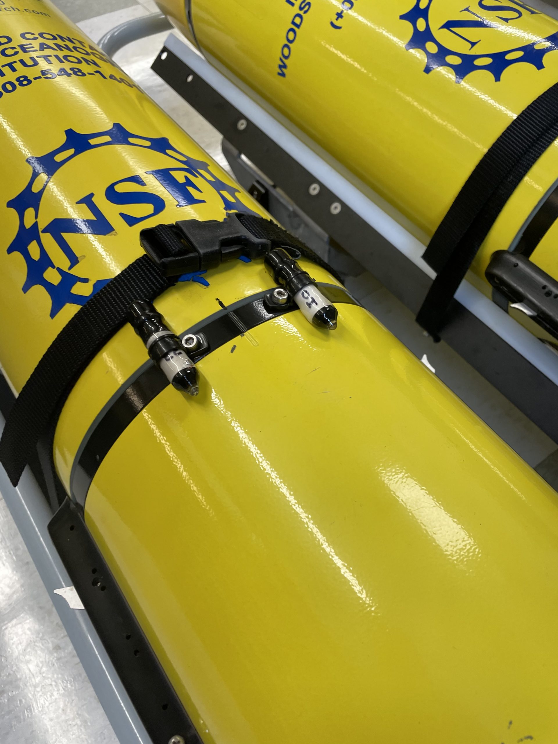
[caption id="attachment_22879" align="alignleft" width="350"]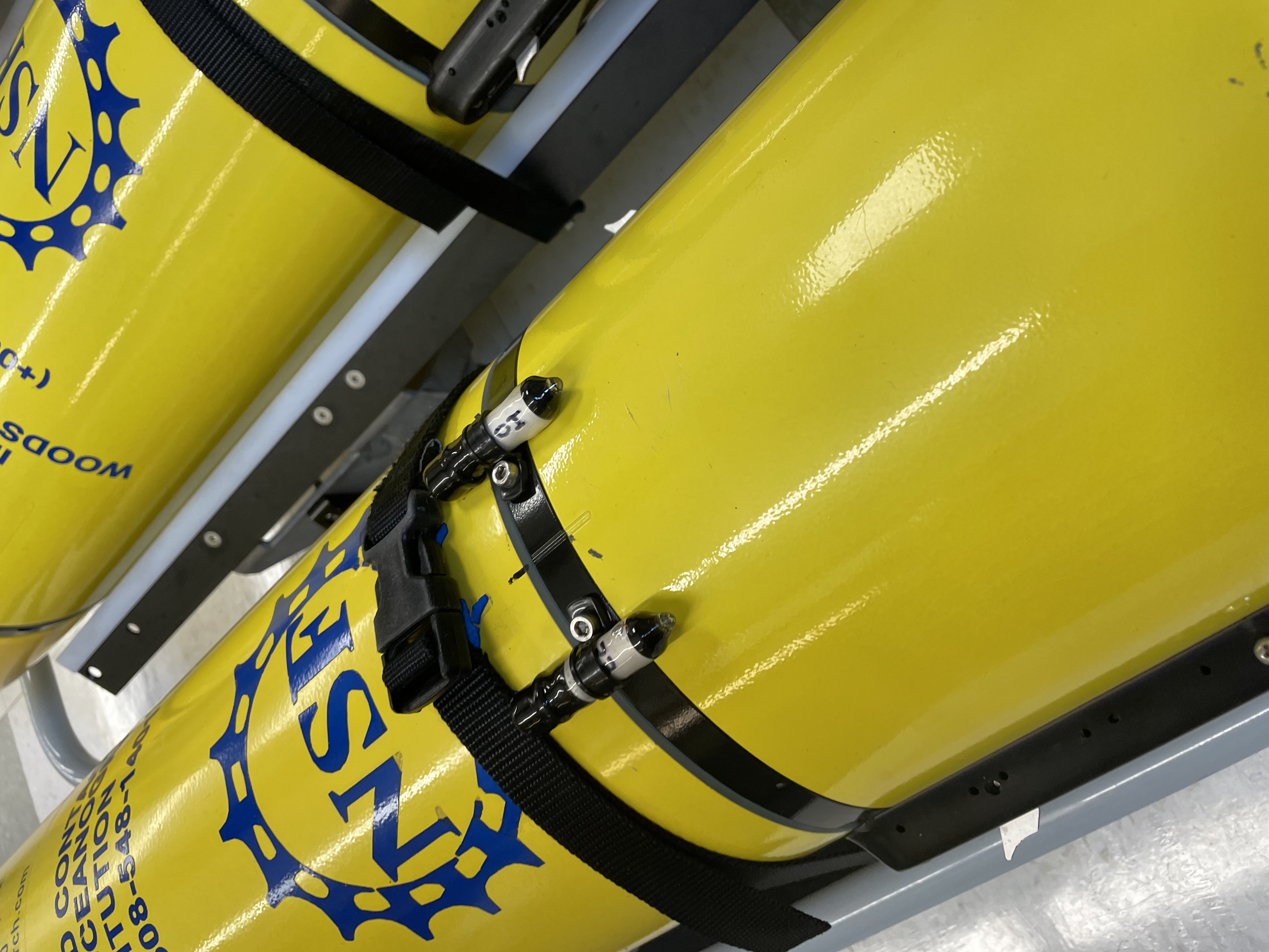 The ROAM tag is small (30 mm x 10 mm) and light enough (8 gm in water) to be attached to an ocean glider with no adverse impacts on performance. Here are two ROAM tags attached to OOI test glider 363 before deployment from the R/V Armstrong during the Pioneer 17 cruise. Credit: ©WHOI, Diana Wickman.[/caption]
An opportunity to test the new ROAM tags arose in conjunction with the October 2021 Pioneer Array mooring service cruise. “We had recently deployed moored sound sources in deep water between Cape Cod and Bermuda,” said Simon Thorrold who, with University of Rhode Island colleagues Melissa Omand and Godi Fischer, is leading the ROAM fish tag development. “One of our goals was to determine whether tagged fish near the continental slope south of New England could be detected using these distant sources.” Thorrold reached out to the OOI team to see if there was potential for a short-term test at the Pioneer Array site, located 75 nautical miles south of Martha’s Vineyard at the shelf-slope interface.
OOI Project Scientist Al Plueddemann and the OOI glider team determined that a glider test planned during the mooring service cruise in late October would be happening at the right place and the right time to be useful for testing the acoustic tags. “This technology is something we would like to consider for OOI, and in particular for the Pioneer Array in its new southern Mid- Atlantic Bight location,” said Plueddemann, “so the potential for a test was of interest to us.”
The glider team determined that the small (30×10 mm), light (8 gm in water) tags would have no measurable impact on glider performance and could be safely accommodated on the test glider. The tags were mounted to the glider by fitting the tags into plastic loop clamps and then securing the loop clamps to existing threaded holes in the glider hull. During the three-day test deployment, the glider made one dive to 50m, one dive to 200m, three dives to 500m, and approximately 76 dives to 200m.
The glider data and acoustic tag data are being evaluated, and will provide information about fish tag performance and the potential for future use within the OOI arrays.
This article was written by Woods Hole Oceanographic Institution colleagues: Senior Scientist Simon Thorrold and Senior Engineering Assistant II Diana Wickman.
Read MoreFunding Opportunity for OOI Education, Workshops, Training Proposals
To encourage wider use of OOI data by researchers and educators, the Ocean Sciences Division (OCE) of the National Science Foundation is seeking proposals for projects that use OOI data. Funding is available to support workshops, conferences or other training events that introduce researchers and educators to the type of data available through OOI and community tools that have been developed to use that data.
A Dear Colleague Letter (NSF20-047) issued in early 2020 remains in effect.
“We are seeking to support efforts that teach researchers or educators how to use OOI data and tools, that develop additional tools or instructional materials using OOI data or that serve to create communities of practice to use OOI data for multi-investigator, community-driven research, “ said Elizabeth Rom, an OCE Program Director who oversees a number of NSF educational initiatives.
At a recent town hall of the Ocean Observatories Initiative Facility Board at the AGU Fall Meeting, Rom presented a progress report on proposals funded since May 2020. These include:
- Two Ocean Hack weeks held at the University of Washington and Bigelow Laboratory for Ocean Sciences. In 2020, the workshop was virtual, in 2021 the workshop was a hybrid.
- OOI Biogeochemical Data Workshop, which consisted of an online meeting in July 2021 and plans for an in-person meeting for June 2022 at Woods Hole Oceanographic Institution.
- K12 OOI Workshop Series that involves the South Kitsap School District in Washington state and Deb Kelley at the University of Washington. The goals of the workshop series are to develop teacher cohort and lesson plans using OOI data in classrooms. The series launched in early December with virtual and in-person sessions planned throughout 2022.
She also reported on progress in course development, including support of a second cohort of faculty to develop version 2 of the Ocean Data Lab’s online manual, microbial monitoring using OOI RCA remote samplers at Axial Seamount, and development of instructional materials and piloting assessment instruments to explore undergraduate scientific literacy. NSF programs GeoPaths (Pathways into the Earth, Ocean, Polar and Atmospheric and Geospace Sciences) and Research Experiences for Undergraduates (REU) sites also provided opportunities for using OOI data. An initiative to broaden the scope and increase the efficacy of the SERC Discovery System was supported, as were multiple REU student projects in 2020 and 2021.
“While COVID served to discourage in-person meetings and workshops, we were pleased that so many innovative approaches were proposed,” added Rom. “Hopefully in 2022, we will have opportunities to for virtual, hybrid and in-person workshops, and certainly the innovation of this community will shine through.”
Two- and four-year U.S. institutions of higher education and U.S. non-profit non-academic organizations are eligible to submit proposals. Proposals may be submitted at any time, but Principal Investigators are encouraged to submit at least six months prior to the planned event. Submission details are available here. While the DCL refers to Fiscal Year 2020, it continues to be in effect until canceled.
Read MoreCall for Lightning Talks at OOIFB Town Hall
The Ocean Observatories Initiative Facilities Board (OOIFB) will host a Town Hall at the 2022 Ocean Sciences Meeting (OSM) on Friday, February 25th from 12:00 pm to 1:00 pm Eastern Time. The meeting will be fully virtual. The community will have the opportunity to hear the latest information about the OOI facility, Pioneer Array relocation plans, early career scientists’ activities, and education updates.
The Town Hall also will include a series of lightning presentations where scientists are invited to present one slide in one minute explaining how they have used (or plan to use) freely available observatory data in their respective research. OOIFB invites all to consider presenting a slide in the lightning session.
Time during the Town Hall is limited and about six lightning talks will be scheduled during the Town Hall. However, all submitted lightning talks will have the opportunity to be presented during the Ocean Sciences Meeting. The OOIFB has teamed with the OOI’s virtual booth team to offer a time slot during the meeting to highlight all of the lightning talks.
Sign-up Now to Present a Lightning Talk – If you are using observatory data and wish to present a lightning talk during the Town Hall, please apply using the: LIGHTNING TALK FORM by February 9th. From the applications submitted, OOIFB will select six lightning talks for the Town Hall that can highlight the exciting research that is being done across the entire OOI Facility.
Funding Available for OSM Registration Fee – Please note, all participants and presenters during the OOIFB Town Hall must be registered for the 2022 Ocean Sciences Meeting. Funding is available to offset the registration fee for students and early career scientists (ECS) who are presenting a lightning talk. Funding is limited and the first 20 student/ECS applications will be considered for reimbursement. The Lightning Talk application form includes space for requesting OSM registration reimbursement.
The workshop is aimed at researchers who are using or are considering using OOI data and/or adding instrumentation to OOI infrastructure and educators at all levels interested in using data from the OOI’s Arrays. Hope to see you at the OOIFB Town Hall!
Event: OOI Facility Board Town Hall
When: Friday, February 25th from 12:00 pm to 1:00 pm Eastern Time
Lightning Talks: Apply online. The form will be open until February 9th.
Where: Participation will be virtual and available to individuals registered for the Ocean Sciences Meeting.
The Town Hall agenda and additional details are available here.
OOI Data System User Survey: Opportunity to Provide Feedback
The OOIFB Data Systems Committee needs your help in evaluating new Ocean Observatories Initiative (OOI) data systems. In 2019 the OOI Facility Board’s Data Systems Committee (DSC) conducted a survey to learn how the OOI could better serve data to users. In response to the feedback received, the OOI program developed the Data Explorer, a refined and more capable interface for finding and accessing data. Now, the DSC is interested to hear your thoughts on this new data system, as well as the other available systems, and to uncover potential ways of improving data access for users.
OOI’s Contributions to Understanding the Changing Ocean Cited in Boston Globe
Woods Hole Oceanographic Institution Research Scientist Glen Gawarkiewicz cites how he uses OOI data to figure out what is happening in the changing ocean in an article on that appeared on the front page of the Boston Globe on December 28, 2021.
In a record-breaking year of weather, signs of a changed world.
[caption id="attachment_22801" align="alignnone" width="1610"]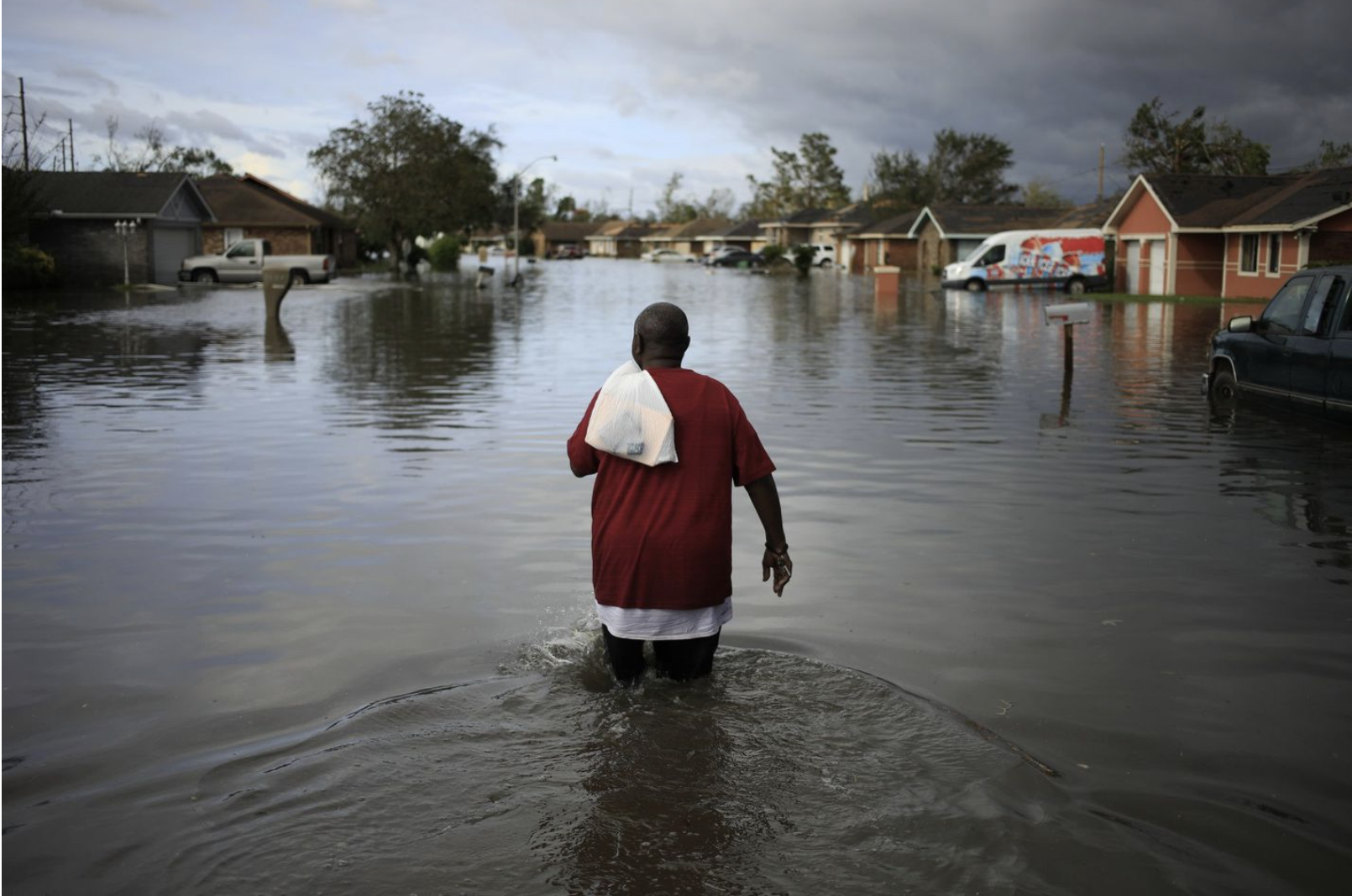 A resident walked through floodwaters left by Hurricane Ida in La Place Louisiana on August 30, 2921. Credit: Luke Sharrett/Bloomberg via the Boston Globe.[/caption]
Read More
 Gulf Stream Species in Cold North Waters Spur Scientific Discovery
In early 2017, something strange was going on in the waters off the coast of Rhode Island. Fishers were pulling up a very unusual bycatch of Gulf Stream flounder and juvenile Black Sea bass. The Gulf Stream flounder are typically found in warmer waters, and while black sea bass are a very common fish, they are typically not present in cold water in the middle of winter, particularly not their juveniles. The fish coming up in their nets were so unusual for this time of the year, that a member of the Commercial Fisheries Research Foundation (CFRF) sent a photograph to Woods Hole Oceanographic Institution (WHOI) scientist Glen Gawarkiewicz asking what he thought might be causing these tropical fish to end up in cold New England waters in the dead of winter.
[media-caption path="/wp-content/uploads/2021/12/Flounder-1.jpeg" link="#"]Anna Mercer from CFRF sent this photo of Gulf Stream flounder and juvenile Black Sea Bass to Glen Gawarkiewicz, launching an investigation that resulted in three research papers.[/media-caption]
“One fun thing about my relationship with the fishing community now is if they see unusual things, they send them to me. And then I’ll usually go right to the Pioneer Array website, look at the data and see if there’s some kind of a story, I can tell about the oceanographic conditions that might have given rise to unusual features, or unusual fish,” said Gawarkiewicz.
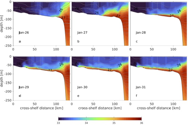
This query about an unusual catch prompted a scientific investigation whose results were recently published in the Journal of Geophysical Research: Oceans. The authors, WHOI colleagues Ke Chen, Glen Gawarkiewicz, and Jiayan Yang, identified for the first time the cause and multi-faceted dynamics at play in a subsurface marine heat wave (a high temperature anomaly event), expanding views of contributing factors to such ocean-altering events. They pinpointed the interplay between smaller scale cyclonic eddies and warm water intrusions that created an anomalous marine heat wave.
The research team started with the traditional hypothesis that warm core rings at the shelf break were pushing warm and salty water onto the shelf towards shore, generating a marine heat wave. But after analyzing the fishing data and oceanographic data from the Pioneer Array, the team was not able to pinpoint the exact process causing the marine heat wave. Chen took up the challenge and created a numerical model simulating ocean conditions during November 2016-February 2017.
The model, which was at an exceptionally fine scale of 1 kilometer resolution, captured what the team saw from the data. The model revealed warm core rings were not solely responsible for the increase in temperature of water moving into shore, but rather the heated, salty water was being moved by a combination of previously overlooked smaller scale cyclone-like eddies (circular currents of water) in the periphery of the warm core ring. The model also revealed a very persistent wind blowing from west to east in late January 2017 that worked jointly with the cyclonic eddies that had already changed the outer shelf conditions.
The winds brought the warm and salty water from the shelf break to around 50 meters depth for a distance larger than 100 kilometers over five-six days. The intrusion was localized. It moved along the slope, climbed up the shelf, and moved onshore.
“So this remarkable intrusion was really different from what has been known of the dynamics contributing to onshore intrusions for this region, “explained Chen. “It is a very new and exciting finding that such intrusions can be a combination of smaller scale eddies and wind causing warm water intrusions at a particular location.” The model shows the complexity of such intrusions that may result from multiple sources and conditions. “It provides a more complete picture of conditions and how they might ultimately impact what fish are caught and where they are caught,” added Chen.
Gawarkiewicz concluded, “The Pioneer Array has just worked wonders for our relationship with the fishing industry and has also allowed us to see ongoing changes in this ocean region that keep accelerating. The Pioneer Array just brilliantly combines both the cutting-edge research, like the modeling Ke is doing, with the real dire societal need of identifying and ultimately understanding changing ocean conditions. I only wish that we could have a Pioneer Array, basically in every region of the country.”
____________________________________________
See Boston Globe article on December 28, 2021 for other ways OOI data are contributing to scientific understanding of the changing ocean.
Read More
2022 COBRA Early Career Fellowship and Deep-Sea Expedition Planning Master Class
The Crustal Ocean Biosphere Research Accelerator (COBRA) is pleased to announce a paid training opportunity in the Spring of 2022 that is open to international early career participants. Participants in the COBRA Early Career Deep-Sea Expedition “Master Class” will receive training in deep-sea expedition planning from start to finish. This course will equip participants with the skills and tools to successfully design, propose, and execute deep-sea oceanographic field research, with a collaborative, just, equitable, diverse, and inclusive approach. Example topics to be covered in the Master Class include: Assets for conducting deep-sea research and exploration; Funding and proposal writing tips; Developing concepts through respectful and reciprocal engagement with others; Cruise preparation how-to; At-sea operations overview; Telepresence-enabled exploration and research; Permits and Reports; Data Management.
The COBRA Fellowship program is intended to help to create a larger, more diverse pool of talent engaged in leading deep-sea research that addresses societal needs. COBRA has a goal of having a balanced representation of US-based and international participants across the early career spectrum that bring diverse experiences and perspectives to the class. Previous experience with deep-sea research or policy is not required. COBRA defines “early career” as senior graduate students, postdoctoral scientists, junior faculty less than 10 years from their terminal degree, and other junior professionals, such as an early career employee of a government, NGO, or industry. Fellows are eligible to receive a $2,000 USD stipend to support their participation in the fellowship and virtual Master Class, which is offered free of charge.
The application period is open through January 15. More details and the online application form can be found here. Questions are welcome via email to cobra@bigelow.org.
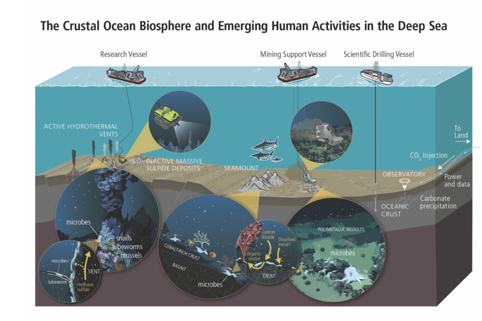
COBRA is an international research coordination network funded by the US National Science Foundation. COBRA’s mission is to accelerate research on the structure, function, resilience, and ecosystem services of the crustal ocean biosphere to generate new knowledge and inform decision-making, particularly related to deep-sea mining and subseafloor carbon sequestration. If you’d like to learn more, COBRA Directors will be providing an overview on Friday January 7 12:30PM EST (GMT-5) as part of the C-DEBI monthly seminar series. These seminars are open to anyone to participate by registering here.
Videos of OOI’s Virtual Booth Sessions at AGU
In case you missed any sessions at OOI’s Virtual Booth at the AGU Fall 2021 meeting, you can watch them here at your leisure:
[embed]https://vimeo.com/657572792[/embed] [embed]https://vimeo.com/657554340[/embed] [embed]https://vimeo.com/657568018[/embed] [embed]https://vimeo.com/657540648[/embed] [embed]https://vimeo.com/657477409[/embed] [embed]https://vimeo.com/657874176[/embed] [embed]https://vimeo.com/657995699[/embed] Read MoreOOI’S AGU Virtual Booth Schedule
OOI is hosting a virtual booth at AGU this year. All events are free and open to those wanting to attend, including those not attending AGU. Register for each event by clicking on the link in the event’s title. We hope to see you virtually at AGU this year! For those attending in person, do check out these OOI-related presentations.
OOI’s Virtual Booth Schedule |
||||
| DATE | TIME | EVENT | DESCRIPTION | PRESENTERS |
| Monday 13-Dec | 3-4 pm CT/4-5 pm ET | MOVING THE PIONEER ARRAY TO THE SOUTHERN MID-ATLANTIC BIGHT | Status of plans, permitting, and projected timeline for relocating the Pioneer Array | Lisa Clough (NSF) Moderator, Al Plueddemann (WHOI), Derek Buffitt (WHOI) |
| Tuesday 14-Dec | 1-2 pm CT/2-3 pm ET | INTRODUCING OOI’S NEW DATA CENTER: CREATIVE WAYS TO USE DATA | How cutting edge techniques to analyze and visualize data are being integrated into research and education | Anthony Koppers (OSU) Moderator, OOI’s New Data Center, Don Setiawan (UW) Interactive Oceans, Wu-Jung Lee (UW) EchoPype, Chris Wingard (OSU) Jupyter Notebooks |
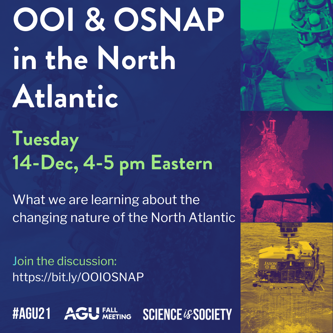
| Tuesday 14-Dec | 3-4 pm CT/4-5 pm ET | OOI AND OSNAP IN THE NORTH ATLANTIC | What we are learning about the changing nature of the North Atlantic | Al Plueddemann (WHOI) Moderator, Nora Fried (NIOZ), Nick Foukal (WHOI), Yao Fu (Georgia Tech), Isabela Le Bras (WHOI) |
| Wednesday 15-Dec | 1-3 pm CT/2-4 pm ET | OOIFB’s DATA SYSTEMS COMMITTEE: USING OOI DATA IN THE CLOUD WITH PANGEO | Be prepared to do science in real time during this hands-on interactive session in the cloud. Participants will need a GitHub account to fully participate. If you don’t have one, it’s a simple process. Once you have a GitHub account, you can experience using real data to resolve a real science question during this workshop. | Tim Crone (LDEO) |
| Wednesday 15-Dec | 3-4 pm CT/4-5 pm ET | WHAT’S NEW IN THE UNDERSEA WORLD OF EARTHQUAKES AND VOLCANOES? | Lead authors of high-impact papers present their findings on Axial Seamount using OOI and other data (i.e. 3D seismics) for an integrated view into this highly active volcano, what their next steps are, how OOI data will play a role, and ideally what tools they would like to have answer their questions. | Deb Kelley (UW) Moderator, Suzanne Carbotte (LDEO), William Chadwick (OSU), William Wilcock (UW) |
| Thursday 16-Dec | 3-4 pm CT/4-5 pm ET | OOIFB LIGHTNING TALKS REDUX | For those who miss the lightning talk presentations during OOIFB’s Town Hall, this is another opportunity to see, hear, and question Lightning Talk presenters | Ed Dever (OSU) Moderator, Lightning talk presenters |
| Friday 17-Dec | 11 am-noon CT/noon-1 pm ET | WHAT’S NEW WITH DATA EXPLORER? | A demonstration of how Data Explorer 1.2 can be used to address science questions using different data types | Jeff Glatstein (WHOI) Moderator, Stacey Buckelew (Axiom), Wendi Ruef, Mike Vardaro (UW), Andrew Reed (WHOI) |
OOI at AGU 2021
[media-caption path="/wp-content/uploads/2020/10/agufront2-scaled-e1603490292321.jpeg" link="#"]The AGU 2021 Fall Meeting is a combination of virtual and in person events. OOI will have a virtual booth with daily activities to join. [/media-caption]
AGU Fall Meeting 2021
The following is a compilation of OOI-related presentations at this year’s fall meeting. If we’ve missed any OOI-related sessions, please contact dtrewcrist@whoi.edu and we will be happy to add them. OOI will have a virtual booth at AGU this year. Interesting programming is being finalized and will be added to this listing once confirmed. Share your AGU news at #AGU2021.
Monday, 13 December 2021
09:07-09:12, Convention Center, Room 223 (Note: all times are in Central time)
OS11A-02 – Overflow Water Pathways in the North Atlantic: New Observations from the OSNAP Program
Susan Lozier, Georgia Institute of Technology, Amy S Bower and Heather H Furey, Woods Hole Oceanographic Institution, Kimberley Drouin, Duke University, Xiaobiao X, Florida State University, and Sijia Zou, Woods Hole Oceanographic Institution.
Tuesday, 14 December 2021
11:15-12:15, Convention Center, Room 395-396
Ocean Observatories Initiative Facilities Board Town Hall
17:00-1900
Posters, Convention Center Poster Hall D-F
B25E-1522 – Synergistic Data Source Approach to Studying Keystone Marine Predators.Elizabeth Ferguson, Ocean Science Analytics. See the poster live.
G25A-0340 – Drift Corrected Pressure Time Series at Axial Seamount, July 2018 to November 2021 – A Progress Report
Glenn S Sasagawa, University of California San Diego and Mark A Zumberge, University of California San Diego.
PP25C-0927 – OOI infrastructure and Experimental Deployments: Preliminary insights from SEA3s deployed from 6 months to 1 year in the North Pacific
Ashley M Burkett, Oklahoma State University and Sarah Keenan, South Dakota School of Mines and Technology.
Wednesday, 15 December 2021
17:00-1900
Posters, Convention Center Poster Hall D-F
V35A – Focused Observations of Ridge Near-Axis Remote and in Situ Investigations: Magmatic, Volcanic, Hydrothermal, and Biological Processes V Poster
Michael R Perfit, Timothy M Shank, Woods Hole Oceanographic Institution, Jeffrey Karson, Syracuse University, Deborah Kelly, University of Washington, and Kenneth Howard Rubin, University of Hawaii.
Thursday, 16 December 2021
13:45-15:00, Convention Center, el.Lightning Theater VII
V43B – Focused Observations of Ridge Near-Axis Remote and in Situ Investigations: Magmatic, Volcanic, Hydrothermal, and Biological Processes IV eLightning
Michael R Perfit, University of Florida, Timothy M Shank, Woods Hole Oceanographic Institution, Jeffrey Karson, Syracuse University, Deborah Kelly, University of Washington, and Darin M Schwartz, Boise State University.
14:18-14:21, Convention Center, el.Lightning Theater VII
V43B-07 – Spatial distribution of diffuse discharge at ASHES vent field, Axial Seamount, captured by acoustic imaging
Guangyu Xu, University of Washington, Karen G Bemis, Rutgers, The State University of New Jersey, Darrell Jackson, University of Washington, and Anatoliy N. Ivakin, University of Washington.
V43B-08 – Systematic Shift in Plume Bending Direction at Grotto Vent, Main Endeavour Field, Juan de Fuca Implies Systematic Change in Venting Output along the Endeavour Segment
Karen G Bemis, Rutgers, The State University of New Jersey
17:00-1900
Posters, Convention Center Poster Hall D-F
V45B-0137 – Monitoring at Axial Seamount since its 2015 eruption reveals tightly linked rates of deformation and seismicity
William W. Chadwick Jr, Oregon State University, Scott L Nooner, University of North Carolina at Wilmington, William S D Wilcock, University of Washington, and Jeff W Beeson, Oregon State University.
V45B-0138 – Deformation Models for the 2015-Eruption and Post-Eruption Inflation at Axial Seamount from Repeat AUV Bathymetry
William Hefner, University of North Carolina at Chapel Hill, Scott L Nooner, University of North Carolina at Wilmington, William W. Chadwick Jr., Oregon State University, David W Caress and Jennifer Brophy Paduan, Monterey Bay Aquarium Research Institute, and Delwayne R Bohnenstiehl, North Carolina State University.
V45B-0139 – Annual and long-term seismic velocity variations at Axial Seamount observed with seismic ambient noise
Michelle Lee, Columbia University, Yen Joe Tan, Chinese University of Hong Kong, Maya Tolstoy, Lamont-Doherty Earth Observatory of Columbia University, Felix Waldhauser, Lamont-Doherty Earth Observatory of Columbia University, and William S D Wilcock, Lamont-Doherty Earth Observatory of Columbia University.
Read More

