
Expeditions
Life at Sea: Student Reflections from the VISIONS’24 (Leg 1) Expedition
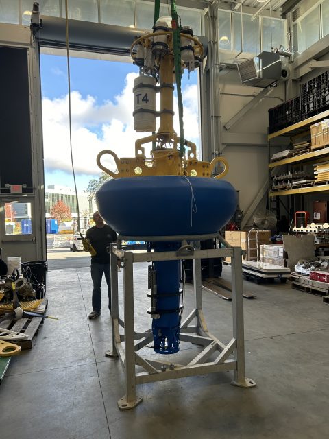
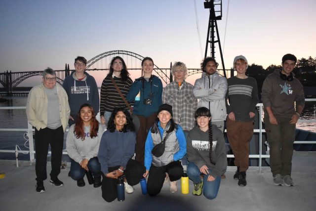
As part of the Regional Cabled Array operations and maintenance 2024 cruise, a cohort of 24 undergraduates spanning different countries of origin, states, and socio-economic backgrounds, participated in the expedition as part of the UW at-sea experiential learning program called VISIONS. This program has allowed over 200 undergraduate students, studying myriad disciplines, the opportunity to spend 8-45 days at sea on NSF-funded global class research ships utilizing state-of-the art remotely operated vehicles (ROV). Onboard, they stand 4-hr on, 8-hr off watches in the ROV control room working alongside the pilots, and RCA engineers and scientists. They see first-hand life forms rarely seen thriving in some of the most biologically productive waters in the ocean along the Cascadia Margin, the abyss at 2900 m water depth, and on 350°C underwater hot springs at the summit of Axial Seamount – the most active underwater volcano off the Oregon coast. The interviews below provide a glimpse of VISIONS’24 student impressions of life at sea and their experiences onboard. For many, their lives are forever changed.
Among the cohort was Nichole Sams, a PhD student in the Human-Centered Design and Engineering department, who brought a unique perspective to the program. Working alongside scientists and engineers, she embraced the opportunity to merge her expertise in mental health research with hands-on ocean exploration. Below, Nichole shares how her time aboard the R/V Atlantis shaped her academic journey, expanded her skill set, and inspired new approaches to collaborative research.
What motivated you to join the VISIONS program?
I am a Phd Student in the Human-Centered Design and Engineering department and I study designing and measuring mental health in the wild. When I first heard about VISIONS, I was so excited as I had always had a love for marine biology, but never got a chance to explore. My role and perspective on Visions was a little different, given my field being so far from everyone else on the boat.
What skills did you develop or strengthen during your time at sea that you feel will be valuable in your future career?
I went on Visions to practice research through design techniques, and I built a very beautiful research project around my time on Visions, and I am currently submitting to a large conference, Designing Interactive Systems. Visions gave me an exciting and wonderous play ground to explore my science and start to connect my PhD dissertation pieces together.
How do you see the skills and experiences gained from this program contributing to your role in the future workforce, particularly in science and engineering fields?
I’d like to think that my project aboard VISIONS will serve as a blueprint in how I operate with science teams. I designed a specific method to use on the boat that was very successful, and I plan to use similar methods when working with research teams to design mental health and wellness for their specific contexts.
What advice would you give to other students considering applying for experiential learning programs like VISIONS?
The combination of excitement and nerves can be a lot more impactful than people think when they aren’t going home to their own beds every night. Do preparation to keep yourself mentally strong while adventuring.
What was the most surprising thing you experienced during your time at sea?
Deb and Katie kept telling me that you just have to be on the boat to understand what the boat is like, and that’s so true, it’s an experience unlike any other, and I will carry it with me forever. I think the three things that were most surprising for me were:
- On the bow of the Atlantis, looking up at the galaxies, I found peace with in myself. As neurodivergent person, my mind is never really a quiet place. But on the bow of the Atlantis, I learned how to sit quiet in my mind and find joy in that calmness. I have now learned that this is called the “Blue Mind” which is that humans often receive meditative benefits from enjoying the sea.
- The Beyond-Human Connection. My first dive down I was hooked and mesmerized by the “Big Charismatic Megafauna” as Co-Chief Katie likes to say. I took a photo of a muso octopus and that will stick with me for the rest of my life.
- My science worked! I was engaging in a new, less physically based science methodology, speculative design, and it really worked!
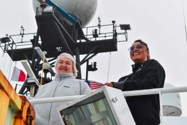
Deb and Nichole during departure. (c): M. Elend, University of Washington; V24[/caption]
[caption id="attachment_35618" align="alignnone" width="640"]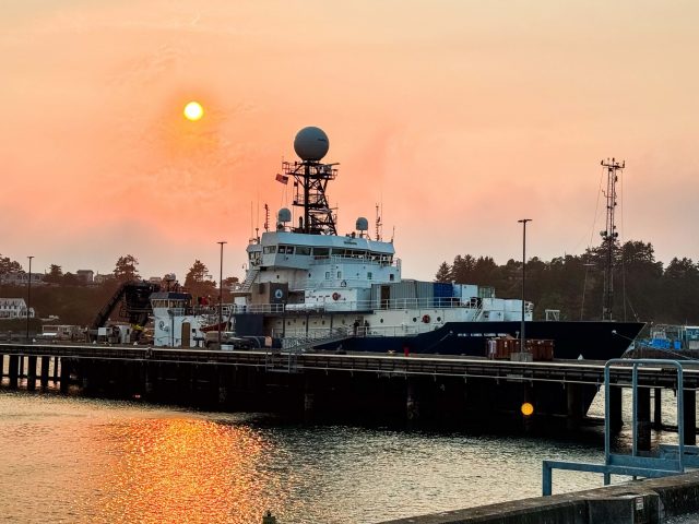 The R/V Atlantis docked in Newport, Oregon at Sunset (c): Nichole Sams, University of Washington; V24[/caption]
Read More
The R/V Atlantis docked in Newport, Oregon at Sunset (c): Nichole Sams, University of Washington; V24[/caption]
Read More Pioneer 21 Cruise Cancellation
Due to unforeseen circumstances requiring shipyard repairs to the R/V Armstrong, it was not possible to conduct the fall service cruise for the Pioneer MAB Array, originally scheduled for December 2024. All array infrastructure remains in place and data are available via telemetry. The moorings will be refreshed during the spring 2025 cruise, currently scheduled for March 2025. Glider and AUV missions will continue to operate as normal.
Read MoreOff We Go – Will Axial Seamount Surprise Us?
– Deborah Kelley, School of Oceanography Director at UW & Principal Investigator, OOI
The UW Regional Cabled Array team from the School of Oceanography and the Applied Physics Laboratory will once again have an exciting summer in the NE Pacific maintaining the National Science Foundations’ Regional Cabled Array (RCA) underwater observatory. This summer’s 37-day expedition (August 6-September 11) is especially exciting because we will be spending significant time directly viewing the highly active submarine volcano off our coast ‘Axial Seamount’, which erupted in 2015 and is poised to erupt anytime between now and sometime in 2025 (see Dr. Bill Chadwick’s blog).
The volcano, >300 miles offshore Oregon and Washington and nearly 1 mile beneath the ocean’s surface, has woken up over the past three months. Over 1000 earthquakes occurred in a single day in April and this week daily numbers are spiking at several hundred events each day (e.g >600 July 23)(see Dr. William Wilcock’s earthquake catalogue). Over this same period, the summit of the volcano began inflating at a more rapid rate as melt migrates into the shallow magma reservoir beneath the volcano. The summit of the volcano has already reached the depth it was at when it erupted in 1998 and 2011 and is approaching that of the 2015 eruption. That eruption resulted in a >400 ft thick lava flow (equivalent to ~ 2/3 up the height of Seattle’s Space Needle) and detection of over 30,000 explosions as the lava issued onto the seafloor. Temperatures in the underwater hot springs we will be visiting during the cruise are also rising — all pointing towards an immanent eruption.
The cruise will use the remotely operated vehicle (ROV) Jason and the global class research ship the R/V Atlantis operated by Woods Hole Oceanographic Institution. Excitement is building as our equipment is fully tested, safely packed away, and next week on its way via numerous 48 ft-long trucks to Newport, Oregon where we will begin mobilizing the ship starting August 6th. We are very much looking forward to working with 26 US and international students who are joining us on the expedition, working side-by-side scientists, engineers, and the ship and ROV teams.
This cruise is highly complex including berthing for 72 RCA folks during the three Legs of the cruise. A diverse array of >100 instruments, seafloor substations (junction boxes), and instrumented pods on the Shallow Profiler Moorings will be recovered and reinstalled, and tested. The cruise will also include turning instrumented vehicles on Deep Profiler Moorings. The vehicles make daily trips spanning up to ~18,000 ft as they traverse from the near seafloor environment to ~ 300 ft beneath the ocean’s surface.
The ship will be “packed to the gills” on each of the three legs that make up this expedition, carrying everything from state-of-the-art mooring components to sharpies. In addition to the core Ocean Observatories Initiative (OOI) work, seven days of the cruise will be dedicated to special programs funded by NSF to research scientists that involve turning of specialized instruments on the cable, recovery instruments and sampling of methane seeps at Southern Hydrate Ridge, and sampling of hydrothermal fluids for shore-based investigation of microbes and viruses in the extreme environments at Axial Seamount.
You will be able to watch our underwater operations live through streaming video as the ROV Jason works 1) 5000 ft down at the summit of Axial Seamount where we will see astounding seascapes of lava and numerous deep-sea active hot spring deposits that are home to some of the most bizarre creatures on Earth; 2) offshore Newport, Oregon to depths of ~250 ft to 10,000 ft in some of the most biologically productive waters in the oceans; and 3) sedimented sites on the Cascadia margin where methane-rich plumes jet from the seafloor. Here, methane seeps support dense bacterial mats and giant clams that thrive in the absence of sunlight on gases migrating through the seafloor.
An enhanced, high-bandwidth satellite connection from the R/V Atlantis will allow you to experience in real-time our deep-sea operations through live video streams to shore and onto this website.
The satellite feeds will allow scientists onboard to see data as new instruments are connected to the seafloor submarine fiber optic cables that bring the Internet into the ocean. During the cruise, engineers from the Applied Physics Lab will utilize the RCA operations center in the School of Oceanography where they will communicate directly with the instruments as they are installed, turn power on and off, and command and control instruments from hundreds of miles away and far offshore (including a resident cabled high definition camera that streams video live of an underwater hot spring at the summit of from Axial Seamount throughout the year). All total, the system hosts 150 instruments that stream data at the speed of light in real-time to shore 24/7, where they are stored and visualized through the OOI Cyberinfrastructure system at Oregon State University.
As always, it will be great to be away from the dock, smell the salt air again, and work beneath the waves on some of the most advanced technology in the oceans. For many students, these expeditions have changed their lives.
Read MoreTwo OOI Expeditions in Two Oceans
11th Recovery and Deployment of Global Station Papa and Irminger Sea Arrays
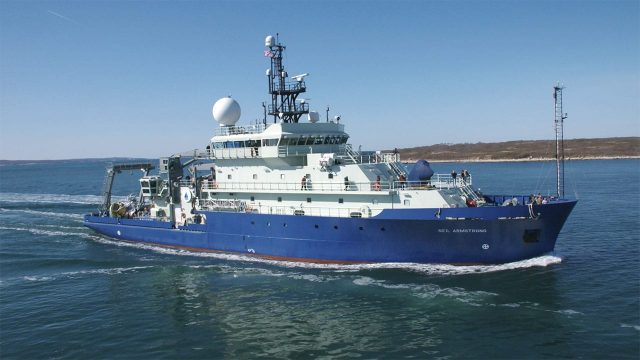
Two OOI Global Scale and Nodes (CGSN) teams are working simultaneously, but in different waters on opposite sides of the United States during June. The first CGSN team left Seward, Alaska aboard the R/V Sikuliaq on May 29 for a 17-day expedition to recover and re-deploy the Global Station Papa Array in the Gulf of Alaska. On June 2, a second CGSN team will depart from Woods Hole, MA to travel to the Irminger Sea Array aboard the R/V Neil Armstrong for a month-long expedition to recover and re-deploy this array.
The expeditions share similarities and differences. Both arrays are in remote locations. The Station Papa team has a 2.5-day transit to the array site in the Gulf of Alaska, while the Irminger Sea team has a longer transit of eight days to the array site. Once onsite, the teams will get to work quickly to deploy the replacement moorings to allow for overlapping measurements before recovering the moorings currently in place. This is the 11th time that each array has been turned – that is, existing ocean observing equipment at the sites will be recovered and replacement equipment will be deployed in their place. Such “turns” are needed to address biofouling of sensors, depletion of batteries, and wear and tear on equipment that has been battered by wind, waves, and weather for a year.
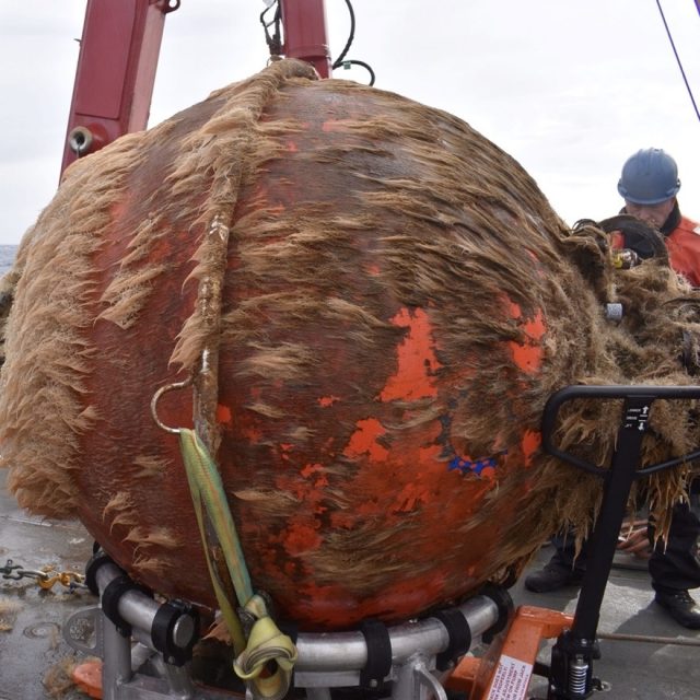
[media-caption path="https://oceanobservatories.org/wp-content/uploads/2024/05/Biofouling.jpg" link="#"]This is what one year in the ocean looks like: a Global Station Papa flanking mooring 64” sphere with 12 months of marine growth. Marine growth can inhibit the operation of the mooring and instruments and is one of the reasons we need to recover and refurbish the OOI infrastructure on a regular basis. Credit: Rebecca Travis © WHOI.[/media-caption]The Global Station Papa Array is located in the Gulf of Alaska, about 620 nautical miles offshore in a critical region of the northeast Pacific with a productive fishery subject to ocean acidification, low eddy variability, and impacted by the Pacific Decadal Oscillation. The Global Irminger Sea Array in the North Atlantic is located in a region with high wind and large surface waves, strong atmosphere-ocean exchanges of energy and gases, carbon dioxide sequestration, high biological productivity, and an important fishery. It is one of the few places on Earth with deep-water formation that feeds the large-scale thermohaline circulation.
“Because of their remote locations, both Station Papa and the Irminger arrays provide critical ocean data that scientists are using to better understand ocean circulation patterns and help identify changes in ocean conditions,” said Sheri N. White, Chief Scientist for the Irminger 11 expedition. “These arrays are hard to get to and to maintain but the data they provide are invaluable.”
Expedition Activities
A team of 11 scientists and engineers aboard the R/V Sikuliaq departed from Seward on May 29 for a 17-day expedition. During their time at sea, they will recover and deploy three OOI subsurface moorings and two open ocean gliders. They also will recover and deploy a Waverider mooring for the University of Washington. A POGO Fellowship awardee will be onboard to gain shipboard experience as part of OOI’s collaborative efforts to provide early career scientists opportunities to help increase their knowledge and advance careers. Other onboard activities will include water sampling at the deployment sites and collection of shipboard underway data.
[media-caption path="https://oceanobservatories.org/wp-content/uploads/2024/05/Irminger-gliders.jpeg" link="#"]The OOI CGSN science team will start operations at the Irminger Array by deploying two gliders. This allows the gliders to be monitored by the pilots onshore and ensure all systems are operational while the vessel is still onsite performing mooring operations. These gliders will operate autonomously at Irminger for ~12 months. Credit: John Lund © WHOI.[/media-caption]On the east coast, a second team of 15 scientists and engineers aboard the R/V Neil Armstrong will leave Woods Hole, Massachusetts on June 2 to begin their eight-day transit to the Irminger Sea. Once onsite, the team will recover and deploy four OOI moorings, deploy two gliders, recover a third, and conduct water sampling at the deployment sites. Underway shipboard data will also be collected throughout the voyage. Four additional subsurface moorings will be “turned” for the Overturning in the Subpolar North Atlantic Project (OSNAP). Water and biogeochemical sampling will be conducted in support of both OSNAP and researchers from Boston College. A marine mammal observer from NOAA will be onboard as a continuing collaboration between NOAA and OOI.
Added White, “When planning these expeditions, we do our best to maximize use of ship time by providing berths to researchers who could benefit from direct observation and data collection in these remote locations. During the expedition to Irminger, for example, we will be joined by a graduate student and two undergraduate students from Boston College who will collect biogeochemical data, and experience what it is like to do science at sea.”
A bird’s eye view of a previous Irminger Sea Array expedition:
[embed]https://www.youtube.com/watch?v=LF6Zhmlmd0A[/embed]Daily reports will be filed from both expeditions. Bookmark this site to follow along.
Read More
First Deployment of the Pioneer Array in the MAB
At 0900 Eastern on Monday April 1, 2024, the R/V Neil Armstrong will back out of the dock at Woods Hole, MA to begin the transit to the new location of the U.S. National Science Foundation (NSF) Ocean Observatories Initiative (OOI) Coastal Pioneer in the Mid-Atlantic Bight (MAB). This promises to be a momentous trip for it will be the first deployment of the Pioneer in the MAB, a location decided upon after a series of NSF-sponsored meetings with community users of OOI data. The expedition also will mark the 20th Pioneer deployment undertaken by the Coastal and Global Scale Nodes (CGSN) team at Woods Hole Oceanographic Institution (WHOI).
“The array is design to provide data to help scientists better understand the dynamics of the region, the role of biogeochemical cycling and transport, and the impact of extreme events like hurricanes and freshwater outflows,” said Albert Plueddemann, chief scientist for this first deployment and lead scientist of the CGSN group. “There’s already considerable community interest in obtaining data from the OOI infrastructure and leveraging the array installation for research and testing. Once the array is in place, we anticipate even more interest, and look forward to engaging with researchers in the region.”
The Pioneer MAB is a T-shaped array with moorings, located offshore of Nags Head, North Carolina, at depths of 30-300 meters and nominal spacing of15-25 kilometers. The array will consist of ten platforms at seven different sites – two platforms will be deployed as adjacent pairs at three sites. The platforms include three surface moorings, five profiler moorings, and two shallow-water moorings. The Pioneer MAB will also have mobile assets—four coastal gliders and two autonomous underwater vehicles (AUVs). These mobile assets will traverse the water column along different track lines to give a fuller, more robust picture of water column properties.
[media-caption path="https://oceanobservatories.org/wp-content/uploads/2024/03/MAB-Array-map-3-scaled.jpg" link="#"]Figure 1: Location of moorings of the Coastal Pioneer Array in its new location in the Mid-Atlantic Bight.[/media-caption]After a ~36-hour transit to the site, the team of 15 scientists and engineers will get to work to deploy the new array. Because of the large size of the moorings, the expedition will be conducted in two legs and be completed on April 22nd. In addition to the mooring and mobile asset deployments, the team will be conducting CTD (to measure conductivity, temperature, and depth) casts with water sampling at the deployment sites. In addition, they will be making ship vs meteorological comparisons at the surface mooring sites to ensure the rigor and accuracy of meteorological measurements. They also will be conducting some shipboard underway surveys, as well as a bathymetric survey to gain a complete picture of the new location.
[media-caption path="https://oceanobservatories.org/wp-content/uploads/2024/03/IMG_0550-2-scaled.jpg" link="#"]A lot of equipment is at the ready! Northern and Southern Coastal Surface Moorings, along with seabed multi-function nodes and near-surface instrument frames, as they were being assembled. The team integrates the science instrumentation with the mechanical/power/telemetry/data systems, then tests the system before loading on the vessel. Credit: Derek Buffitt © WHOI.[/media-caption]Continuing the tradition of the Coastal Pioneer Array off the New England Shelf, this first deployment expedition will be a collaborative one. A marine mammal observer from the National Oceanic and Atmospheric Administration will be onboard to count marine mammals in the region. A representative from the Northeast U.S. Shelf Long-Term Ecological Research (NES-LTER) will be onboard to conduct sampling from CTD casts and flow cytometers, which can analyze the characteristics of cells found in water as the ship is underway. This will be a continuation of an ongoing collaboration for the past seven years. And a Department of Energy representative will also be onboard as tests are conducted to determine the viability of placing a wave energy conversion device on the array.
Along with being the first deployment in the Southern Mid-Atlantic Bight, the Pioneer MAB Array will also include new instrumentation on the three Surface Moorings. The new instrumentation includes plankton imaging sensors (the McLane IFCB), instruments that measure particle size distribution (the Sequoia LISST-200X), short-range velocity profile instruments for the upper water column (the Nortek Aquadopp Profiler-S1VP), turbidity sensors (the Sea-BIrd ECO), and new seafloor pressure sensors (the RBR Quartz3QPlus). These were among the measurements recommended during the National Science Foundation OOI Facility Board community workshops in 2021 to select a new location for the Pioneer Array.
[media-caption path="https://oceanobservatories.org/wp-content/uploads/2024/03/IMG_0554-2-scaled.jpg" link="#"]Sheri White and Nikki Arm prepare and bench test the new Imaging Flow CytoBot, also known as a Plankton Imaging System (PLIMS), that will be deployed on the Central Surface Mooring of the new Pioneer MAB array. The PLIMS generates images of the particles in the local aquatic environment. Credit: Derek Buffitt © WHOI.[/media-caption]
Read More
Endurance Array Reaches 20th Deployment
Since 2014 when the U.S. National Science Foundation Ocean Observatories Initiative Coastal Endurance Array was first deployed in the waters off the coasts of Oregon and Washington, the array has been turned – that is moorings were recovered and replaced with new – 19 times. The upcoming expedition on March 28th, with 15 scientists and engineers aboard the R/V Sikuliaq will be the 19th time that the array has been pulled out of the water and replaced, and the 20th time the array has been deployed.
Over the past nine years, the turns have happened every six months, except for in 2020 when COVID restrictions caused the Endurance team to space two consecutive turn cruises 9 months apart. Regular recovery and deployments are needed to ensure the observing equipment stays operational.
“The EA team has really gotten proficient at turning the arrays,” said Jonathan Fram, the Endurance Array’s Project Manager, who will serve as the Chief Scientist for this expedition, his 10th time leading the effort. “We’ve made many technical improvements over the years to combat the powerful and ever-changing conditions of the Northeast Pacific Ocean so that we can continue to collect and report continuous ocean data from this important region.”
The 20th expedition will begin and end at the Oregon State University’s newly renovated pier in Newport, Oregon. The arrays and associated equipment will be transported to Newport from Corvallis in six tractor trailer trucks. Because of the large size of these components, the expedition will be conducted in two legs. The first leg will head to the Washington site, with a transit time of 2/3’s of a day. The second leg will be to the Oregon site. In total, the team will recover and deploy six surface moorings (two battery powered buoys and four large buoys powered by wind and solar energy), one offshore and three surface piercing profiler moorings, and four gliders. One glider experiencing navigation issues will be recovered. CTD casts (to measure conductivity, temperature, and depth) and water sampling will be conducted along with each mooring operation.
This 20th trip includes several technical improvements. The line used on the Heavy Lift Winch has been increased in size to improve load strength and safety. Each buoy will include a covered wagon style guard against sea lions, who regularly use the buoys as rest stops. All batteries have been replaced or upgraded. Additional improvements have been made that will result in better real-time wind data, and underwater camera operations. The Endurance 20 team also will be deploying new test instruments to see if they might improve data gathering for wind, pH, and partial pressure of carbon dioxide.
[media-caption path="https://oceanobservatories.org/wp-content/uploads/2024/03/Screenshot-2024-03-21-at-11.54.35-AM.png" link="#"]To dissuade sea lions that regularly stop and rest on Endurance Array buoys, OOI engineers have ingeniously devised a steel cover to protect the solar panels that provide power to the mooring. Credit: Jonathan Fram, OSU.[/media-caption]“The order of operations will in part depend on conditions,” added Fram, who joked, “but we expect this trip to be easier than last spring’s, which was three weeks earlier, when we were preparing for the cruise in the snow.”
In addition to regular operations, the Endurance Team will be joined by scientific partners. University of South Carolina (USC) researcher Eric Tappa and Oregon State University (OSU) student Faith Schell will be onboard to help turn a sediment trap adjacent to OOI’s Oregon Slope Base site. This is part of an ongoing research effort of OSU Associate Professor Jennifer Fehrenbacher and USC Professor Claudia Benitez-Nelson, who study the geochemistry, biomineralization, and marine biology of the sediments. Additionally, the team will be deploying fish tag readers for OSU Assistant Professor Taylor Chapple to support his work studying sharks and other large marine predators.
The expedition’s progress will be reported daily. Bookmark this page and follow along as the work unfolds.
Read More
Another Round of Pioneer MAB At-Sea Tests Completed
A team of OOI Coastal and Global Scale Nodes (CGSN) scientists and engineers returned to Woods Hole, MA aboard the R/V Neil Armstrong on November 4, having successfully completed another round of tests of mooring equipment and site location surveys for the proposed relocation of the Coastal Pioneer Array to the Mid-Atlantic Bight (MAB), off the coast of Cape Hatteras, NC.
[media-caption path="https://oceanobservatories.org/wp-content/uploads/2023/11/IMG_6640-2048x2048-2.jpg" link="#"]The OOI-CGSN team surveyed the seabed to better understand the environment for the proposed moorings sites. The RV Neil Armstrong operated hull-mounted acoustic equipment to collect bathymetry (depth contours; shown left ), backscatter imagery (seabed characterization), and sub bottom data (seabed profile and geophysical layering). Chris Basque and Irene Duran (shown right) also piloted the ROV over the mooring locations to collect still images, video, and high-resolution sonar of the seabed. Photos: Sheri N. White © WHOI.[/media-caption] [media-caption path="https://oceanobservatories.org/wp-content/uploads/2023/11/IMG_6643-1536x1536-1.jpg" link="#"]Closeup of multi-beam survey.[/media-caption]Having accomplished all of the primary cruise objectives under un-seasonally warm and calm conditions, the weather picked up at the MAB as they were finishing up the last two CTD (Conductivity, Temperature, and Depth) surveys along the proposed location of the main mooring lines.
The team then headed north to conduct a final ROV survey of the Shallow Water test mooring they had put in place the week before in 32 meters of water southwest of Martha’s Vineyard. This ROV inspection was the second conducted at this mooring location. A first inspection was done shortly after the mooring’s deployment, when all components were found to be in place and operational. The second confirmed the earlier findings.
In addition to deployment of the Shallow Water test mooring off Martha’s Vineyard, the CGSN team conducted recovery operations onsite at MAB. They recovered the Coastal Profiler Mooring anchor, deployed in the spring of 2023. The mooring itself had been recovered in August of this year. The team also recovered the Coastal Surface Mooring after ~8 months operating at the proposed Pioneer MAB location. The mooring was deployed in a water depth of 30 m and survived storms with max wave heights of 7.5-10 m and continued to send data to shore!
[media-caption path="https://oceanobservatories.org/wp-content/uploads/2023/11/IMG_6642-1536x1536-1.jpg" link="#"]The Coastal Surface Mooring is safely on deck after ~8 months operating at the proposed Pioneer Mid-Atlantic Bight location. Credit: Sheri N. White © WHOI.[/media-caption]Other activities conducted during the 11-day expedition included a site surveys (utilizing multi-beam, sub-bottom, and ROV) of alternate mooring locations, and cross-shelf and along-shelf CTD surveys to better understand the oceanographic conditions in the Mid-Atlantic Bight.
“Conducting at-sea tests of our infrastructure and detailed environmental surveys of the environment are important to ensure the success of new OOI Array,” said Sheri N. White, Chief Scientist for the recovery cruise. “We were lucky to have excellent weather for our deployment and recovery cruises. But also pleased that our test moorings experienced challenging weather during the deployment. This gives us the confidence that the moorings can operate successfully in the new environment and collect data year-round.” The plan is to deploy the Coastal Pioneer Array in its new location in spring 2024.
More details about and images from the expedition can be found here.
Read MorePioneer Mid-Atlantic Bight At-Sea Tests Continue
On Monday October 23, 2023, a team of scientists and engineers from Woods Hole Oceanographic Institution (WHOI) left Woods Hole, MA aboard the R/V Neil Armstrong to conduct a variety of at-sea tests to continue preparations for the anticipated move of the Coastal Pioneer Array to the Mid-Atlantic Bight (MAB), off Cape Hatteras, NC. The science team first traveled to a site off the coast of Martha’s Vineyard to deploy a newly designed shallow water mooring (SWM). This test deployment site was chosen because it offers suitable conditions to test the moorings performance in a shallow water environment, with easy access from Woods Hole, simplifying monitoring and recovery.
The mooring will be deployed for a few months to test the seabed multifunction node, buoyant stretch hose, riser cable, and Prawler profiling vehicle. Engineering data will be collected and assessed prior to the SWM’s deployment at the proposed Pioneer Mid-Atlantic Bight in Spring 2024.
[media-caption path="https://oceanobservatories.org/wp-content/uploads/2023/10/Pioneer-MAB-schematic.png" link="#"]Schematic drawing of the proposed Pioneer MAB moored array to be deployed off the coast of Nags Head, North Carolina. The full array, proposed to be deployed in the spring of 2024, would consist of ten moorings at seven different sites (three sites contain mooring pairs). For the test deployment, one Coastal Surface Mooring was deployed at the Central site and one Coastal Profiler Mooring was deployed at the Northeast site.[/media-caption]From there, the team will head to the Mid-Atlantic Bight to recover a mooring and two anchors that have been in place since spring 2023. Other activities will include a multibeam and sub-bottom site survey and ROV inspection of alternate sites. Water and CTD sampling will be conducted at various depths at the proposed mooring locations. Ancillary science activities will be conducted as time allows. The public comment period on the environmental assessment of the new location is open until October 30, 2023.
“The goal of our test cruises is to evaluate our mooring designs and instrument sampling strategies, and collect environmental data at the new location. This will help to ensure a successful first deployment in the spring of 2004,” said Sheri N. White, Chief Scientist for this expedition and a senior engineer at WHOI. “Understanding the seafloor and water column conditions in the Mid-Atlantic Bight will help us to confirm the optimum locations for the moorings and paths for the gliders and AUVs.”
“This new location in the MAB offers many opportunities for scientists to obtain data to further their research and will provide better insight into conditions in the area for a variety of stakeholders, “said Al Plueddemann, Project Scientist for OOI’s Coastal and Global Scale Nodes group at WHOI, which is responsible for operation of the Pioneer Array. “We welcome researchers, educators, and industry members to reach out to us to explore ways we might work together to maximize the usefulness of the data.”
The new MAB site offers opportunities to collect data on a variety of cross-disciplinary science topics, including cross-shelf exchange and Gulf Stream influences, land-sea interactions associated with large estuarine systems, a highly productive ecosystem with major fisheries, processes driving biogeochemical cycling and transport, and fresh-water outflows during extreme rain events.
The test mooring data will be evaluated during the deployment and after recovery to determine whether any modifications are needed to the mooring designs. The full array will be deployed at the new Mid-Atlantic Bight location in the spring 2024. The At-Sea Test expedition team is expected to return to Woods Hole in early November.
Read More
RCA’s Ninth Expedition: Best Laid Plans
Written by Deborah Kelley, PI of the Regional Cabled Array, September 17, 2023
The Regional Cabled Array, spanning the Cascadia Margin and Juan de Fuca tectonic plate and water depths of ~260 ft to 9500 ft, is an engineering marvel. It is the most advanced underwater observatory in the oceans comprised of >900 km of high power- and -bandwidth submarine fiber optic cables, a highly diverse suite of >150 instruments, and state-of-the-art moorings with instrumented profilers, which since 2014 have traversed >50 million meters of ocean water! The underwater substations and instruments are installed in some of the most extreme environments on Earth, including the most active submarine volcano off the Oregon-Washington coast ‘Axial Seamount’. Here, extension cables traverse glass covered lava flows and instruments are inserted into underwater, acidic hot springs, hot enough to rapidly dissolve aluminum and melt lead. Profiling science pods on moorings that traverse ocean depths from ~650 ft to 16 ft nine times a day, must be ‘smart’ enough to keep “their heads down” when storms, common in the waters of the NE Pacific Ocean, create waves reaching 30 feet in height or more. Yet, it is within these environments that the cabled observatory has thrived, largely due to its design, rigorous testing, and the hard work of the RCA Team, and Jason and Thompson crews during the annual operations and maintenance expeditions, such as the one nearing its end now: VISIONS’23.
[media-caption path="https://oceanobservatories.org/wp-content/uploads/2023/09/Katie_Studenst_sm-20230908_200403_startL4_ME-copy-scaled-1.jpg" link="#"]First time RCA Chief Scientist Katie Bigham (top row, second from left) with Co-Chief Scientist J. Nelson (far left), RCA technician Andrew Paley (top row, far right) and Leg 4 VISIONS students. Katie was a VISIONS’14 student. Credit: M. Elend, University Washington, V23.[/media-caption]Planning for the RCA 2023 cruise began over a year ago as there is a high demand for NSF’s global class ships that operate throughout the worlds’ oceans. Scheduling is a complex process with lots of moving parts involving minimization of transit lengths, awareness of optimum weather windows, and researchers’ schedules. As soon as lasts year’s cruise ended, RCA instruments recovered in the Fall of 2022, were sent back to vendors for calibration and refurbishment, parts and cables were ordered, and the RCA teams’ eyes were already looking to this year. By late Spring, most of the refurbishment and integration testing of platforms and instruments was complete, the four Legs were planned out in detail, and the nearly 144 berthing assignments were finished. The careful layout of equipment on the aft deck of the Thompson was of critical importance, with nearly 200,000 lbs of gear on the fantail and the need for deck space free of gear to allow for mooring cables to be recovered and redeployed.
So that brings us to now, nearing the end of Leg 4, which will end on September 18 when the Thompson arrives back to Newport, Oregon. Working at sea is just tough, no way around it, and best laid plans are often adjusted before even leaving port (such as happened at the start of Legs 1 and 3) as the weather gods do not care about our schedule. The prior three Legs experienced numerous perturbations due to the loss of a week of operational days when the ROV Jason could not dive due to bad weather and additional loss of time due to ROV issues. Plans were adjusted on the ‘fly’ over and over again to best accomplish all of our goals, including the recovery and re-installation of >100 instruments. Because of this, some work was pushed out into Leg 4, an already complicated Leg because it was especially dependent on having good sea state conditions due to the planned installation and recovery of two deep profiler moorings, the largest of which rises >8000 ft above the seafloor at the base of Axial Seamount.
[media-caption path="https://oceanobservatories.org/wp-content/uploads/2023/09/Float.jpg" link="#"]The float for the Deep Profiler mooring at the Oregon Offshore site being brought onboard the Thompson. Credit: M. Elend, University of Washington; V23.[/media-caption]Almost immediately, Leg 4 plans were adjusted following the first operation – the recovery and reinstallation of the Deep Profiler Mooring at the Oregon Offshore site. The communications and power ‘dock’ at the base of the mooring would not respond after plugging in the seafloor extension cable that connects it to a small substation (junction box) on the seafloor. While the engineers tested various aspects of the cable, and puzzled over the cause, the RCA team continued their work at the Slope Base site. There, the Deep Profiler mooring cable was cleaned, and the instrumented profiling vehicle deployed in 2022 was replaced. Following this operation, the Thompson transited ~ 18 hrs to the base of Axial Seamount, where, instead of turning the mooring, it was decided to just swap out the vehicle, similar to Slope Base.
[media-caption path="https://oceanobservatories.org/wp-content/uploads/2023/09/getting-ready-to-bring-in-the-cable.sm_.PD01B_20230909_132549_recovery_ME-copy-scaled-1.jpg" link="#"]RCA engineers and ship crew getting ready to spool cable onboard from the Offshore Deep Profiler Mooring. Credit: M. Elend, University of Washington, V23.[/media-caption]With this work complete, a series of dives was planned to support researchers’ projects funded by the National Science Foundation outside of the Ocean Observatories Initiative. These dives were to include sampling of hydrothermal vent fluids to investigate viruses and microbes in these extreme environments, the recovery and installation of cabled CTD instruments to test the hypothesis that highly saline fluids are flushed from beneath the seafloor shortly following an eruption, and the recovery of a cabled multibeam sonar (COVIS) focused on making unique fluid flux measurements in the ASHES hydrothermal field. Time allowing, equipment on the Thompson would be used to “talk” to an acoustic array (FETCH) installed in the volcanoes’ caldera for investigation of deformation within this highly active volcano.
There was, however, a small window to complete this work. After investigation of the Deep Profiler Mooring at the Oregon Offshore site, it was determined that the Thompson would need to transit nearly 300 miles back to this area, to install a new extension cable, and/or recover and redeploy the mooring with the one just recovered at the beginning of Leg 4 – an exercise that could take 2-3 days. Indeed, Jason had other ideas because while working at the summit of Axial, there was an issue with the specialized hydrothermal vent sampler on the vehicle, followed by a failure of the power system, preventing more dives. The Jason team worked very hard overnight to fix the power supply, but with ever decreasing time to get the Deep Profiler work done back on the margin, it was decided to abandon remaining work at Axial (a very tough decision as this would impact researchers work over the entire next year) and head to the Offshore site. This also allowed optimal use of the transit time to thoroughly test the repaired power system for Jason. It also provided time for the APL engineers to ready a new extension cable for the Deep Profiler mooring, hoping that this simple fix would solve the problem, and to catch up on much needed sleep. With huge relief, the replacement of the extension cable did the trick on the first dive at the Offshore site. The docking station powered up and the vehicle completed its test profiling run — opening up a three-day window for additional work.
[media-caption path="https://oceanobservatories.org/wp-content/uploads/2023/09/ratail-sulis_20230916210321_rattail_probe_closeup.jpeg" link="#"]A rattail fish came to investigate the UFO fluid sampler as it obtained fluids for Dr. Rika Anderson at Marker 113, a diffuse flow site in Axial Caldera. Credit: UW/NSF-OOI/WHOI, Dive J2-1559, V23.[/media-caption]With a sigh of relief and desperately wanting to support the external researchers work, Chief Scientist, Katie Bigham, asked Captain Eric to turn the ship around and head back out to Axial Seamount. So away they went, following the same track line they had completed less than 24 hrs before. During the next 34 hrs, Jason pounded out the dives and completed all but the FETCH work, before it was time to once again head back to Slope Base to complete two final tasks.
The above description is only part of what goes on during the various legs of these RCA expeditions. It is hard to convey what it is like to be a Chief Scientist on an RCA cruise. As with this cruise, decisions must be made rapidly, but also strategically, with an eye towards the end of a leg and cruise – “Will this decision prevent other work from happening? What is the weather going to be like in 2-3 days? What is the status of equipment? How are the students doing and how are their projects going? Do they need help? Is the team getting enough sleep? Should we transit to another site to help with this? On and on it goes…Awareness of these questions and outcomes are always in a Chief Scientists’ thoughts and are combined with the everyday tasks of writing plans for the next day and operational reports.
This was Katie’s first time being a Chief Scientist. She has done an exceptional job making adjustments to our “best laid plans” on a cruise that has been one for the books in the near decade of RCA operations and maintenance expeditions.
For more information on the RCA’s ninth operations and maintenance expedition, visit here.
Read More
Tenth Refresh of the Irminger Sea Array
On August 27th, a team of 13 scientists and engineers boarded the R/V Neil Armstrong in Reykjavik, Iceland to head to the Irminger Sea Array. Most of the array’s infrastructure and instrumentation was shipped from Woods Hole Oceanographic Institution (WHOI) in mid-July to Iceland, where it arrived in mid-August. Part of the scientific party traveled to Reykjavik in mid-August to reassemble the moorings and conduct a “burn-in,” a test period for the power, data, telemetry, and instrument systems to ensure everything is operational prior to loading the vessel.
The Irminger Sea Array is in a region with high wind and large surface waves in the North Atlantic and is one of the few places on Earth with deep-water formation that feeds the large-scale thermohaline circulation. Data collected by the Irminger Sea Array are providing critical insights into circulation patterns, ocean processes, and possible climate-induced changes occurring in this important oceanic area.
After an ~ two-day transit (550 nautical miles) to the array site off the tip of Greenland, the team will recover and deploy four moorings and three gliders over the next two and a half weeks. They will conduct CTD (conductivity, temperature, and depth) casts at the deployment/recovery sites and carry out shipboard sampling for field validation of the platforms and sensors that will remain in the water for the next year.
In addition to the recovery and deployment operations, the team will be conducting some CTD calibration casts in support of OSNAP-GDWBC (Overturning in the Subpolar North Atlantic Program-Greenland Deep Western Boundary Current). A participant from the National Oceanic and Atmospheric Administration will also be on board using “Big Eye” binoculars mounted on a forward deck to make observations of marine mammals during the transit and in the Irminger Sea.
[media-caption path="https://oceanobservatories.org/wp-content/uploads/2023/08/Big-eyes.jpg" link="#"]Large, deck-mounted binoculars known as “big eyes” are used for marine mammal observations. NOAA Research Wildlife Biologist Peter Duley will be aboard the R/V Neil Armstrong watching for marine life in the Irminger Sea. Credit: Al Plueddemann ©WHOI.[/media-caption]The Irminger Team will also be testing out some equipment modifications on this deployment. One change is an updated satellite telemetry system. This system would provide higher bandwidth allowing better and quicker data transmission from the global surface mooring potentially saving power, and better remote command and control of the mooring systems. Another change is a revised mounting scheme for the glider optode, which measures dissolved oxygen concentrations in the water column. The new mount may provide better in-air measurements during glider surfacing. The in-air measurements allow scientists to characterize the changing accuracy of the instrument over time.
“It’s always a challenge to get ready for this month-long expedition to this remote, but critical region, but we are ready and eager to get there,” said John Lund, Chief Scientist for Irminger 10. “We are pleased to play a part in collecting data that scientists are using to better understand changes occurring in this region, with implications for both weather and climate.”
The team will reporting regular updates from the field. Bookmark this page so you can follow along on their progress.
Read More