Posts Tagged ‘Oregon State University’
Spring 2025 OOIFB and DSC Meetings
The OOI Facility Board (OOIFB) and Data Systems Committee (DSC) will hold their 2025 Spring Meetings on Tuesday, May 6, and Wednesday, May 7, 2025. A site visit day with other activities (and/or, discussion carry-over if need be) is planned for Thursday, May 8, 2025 (“Field Trip Thursday”). The meetings will be held in person, but virtual participation will also be available. As always, these in-person meetings are open to the public (except during closed-door sessions as indicated on the agenda); space is limited, however, and a RSVP is required to attend.
The meetings will be held at the Oregon State University campus in Corvallis, Oregon. The planned schedule is as follows:
- Tuesday, May 6th- DSC meeting
- Wednesday, May 7th – OOIFB and DSC joint session
- Thursday, May 8th – cont’d discussion (if needed); OSU-OOI site visits and field activities (all are encouraged to stay for this day)
Cyber Resiliency Summit: Craig Risien
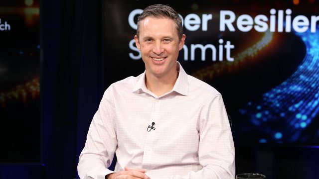
The Ocean Observatories Initiative (OOI) is at the forefront of data-driven discovery, leveraging advanced storage solutions, strategic planning, and innovative partnerships to protect and share critical oceanic research data for decades to come.
Hear from Oregon State University’s Craig Risien, CI Systems Project Manager, as he discusses OOI’s cyber resilience strategy with theCUBE at the Cyber Resiliency Summit 2025.
Read the full article by Victor Dabrinze on SiliconANGLE.
Read MoreExploring OSU’s Ocean Observatories Initiative Through Virtual Reality
Students and faculty at the Oregon Institute of Marine Biology (OIMB) had the opportunity to participate in a 360-degree virtual reality (VR) tour of Oregon State University’s (OSU) U.S. National Science Foundation’s Ocean Observatories Initiative (OOI) Ocean Observing Center in Corvallis. Led by Dr. Jonathan Fram, co-PI and project manager for the OOI Endurance Array, the tour provided an in-depth look at the advanced instruments and systems used to study the ocean’s physical, chemical, geological, and biological processes.
Hosted remotely, the tour allowed participants at OIMB to engage with the facility through live-streamed video, filmed using cutting-edge VR technology by Darryl Lai from OSU Productions. This immersive format enabled attendees to explore the facility virtually and ask real-time questions, making it an accessible and informative experience.
The event was complemented by guest lectures from visiting oceanographers Dr. Léo Mahieu and Dr. Mareike Körner, postdoctoral researchers from OSU’s College of Earth, Ocean, and Atmospheric Sciences (CEOAS). They shared insights about their research and career trajectories, offering inspiration and guidance to students interested in oceanography.
This unique event showcased the innovative tools and collaborative efforts that the OOI is using to advance modern ocean research. Check out the recording of the OSU/OOI tour here.
Read MoreNational Science Foundation Renews OOI for Another Five Years
The National Science Foundation (NSF) announced that it has awarded a coalition of academic and oceanographic research organizations a second, five-year contract to operate and maintain the Ocean Observatories Initiative (OOI). The coalition, led by the Woods Hole Oceanographic Institution (WHOI), and including the University of Washington (UW) and Oregon State University (OSU), will continue operations of the OOI, a science-driven ocean observing network that delivers real-time data to address critical science questions regarding the world’s oceans.
WHOI has led the operations and management aspects of the OOI since 2018 and will continue to serve as the home for the next five years of the OOI Project Management Office, led by Principal Investigator James B. Edson and Sr. Program Manager Paul Matthias.
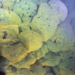
The OOI collects and serves measurements from more than 900 autonomous instruments on the seafloor and on moored and free-swimming platforms that are serviced during regular, ship-based expeditions to the array sites. Data from each instrument are transmitted to shore and are freely available to users worldwide, including scientists, policy experts, decision-makers, educators, and the public.
Under this new $220 M investment, each institution will continue to operate and maintain the portion of OOI assets for which it is currently responsible: WHOI will operate the Pioneer Array in the mid-Atlantic Bight off the North Carolina coast, subject to environmental permitting, and the Global Arrays in the Irminger Sea off the southern tip of Greenland and at Station Papa in the Gulf of Alaska; UW will operate the Regional Cabled Array that extends across the Juan de Fuca tectonic plate and through the overlying ocean; and OSU will operate the Endurance Array off the coast of Washington and Oregon. OSU also houses and operates OOI’s Data Center that ingests and delivers all OOI data.
“OOI has proven to be an exceedingly valuable source of information about the ocean,” said NSF Program Officer for OOI George Voulgaris. “Its freely available data are contributing to better understanding of ocean processes and how the ocean is changing. Scientists are using OOI data as the source of cutting-edge scientific discoveries—everything from getting close to predicting underwater volcanic eruptions to changing ocean circulation patterns that have real life implications for weather and fishing patterns. OOI data also are serving as inspiration for students in the classroom, who are excited about learning about the ocean with access to real-time ocean data. We at NSF are proud of our continued investment in making these data available.”
“WHOI is honored to have been selected to continue the mission of the OOI, which is providing valuable ocean data at a time when it is critically needed,” said Peter de Menocal, President and Director of the Woods Hole Oceanographic Institution. “The continued extreme weather events reinforce the importance of this ocean monitoring program to provide science-based data that is accessible to researchers, modelers, agencies, and the public, and we look forward to being part of the continued scientific advancements from this transformational program in the years ahead.”
The Project Management Office at WHOI collaborates with NSF to provide high-level oversight and financial management of the project. In addition, the office coordinates with partner institutions to establish annual priorities for each of the arrays individually and for the network. “The WHOI team and our partners at UW and OSU have learned a great deal over the past five years and are grateful that our efforts to perfect OOI and its data delivery system have been recognized,” said WHOI Senior Scientist Jim Edson, lead principal investigator on the OOI. “We look forward to the next five years where we can continue to perfect our collection and serving of data, while encouraging its increased use and collaboration among ocean scientists funded by NSF and other agencies.”
——————————————
About the Ocean Observatories Initiative
The Ocean Observatories Initiative is a science-driven ocean observing network that delivers real-time data from more than 900 instruments to address critical science questions regarding the world’s oceans. The National Science Foundation has funded the OOI, under Cooperative Agreement No. 1743430, to encourage scientific investigation. OOI data are freely available online to anyone with an Internet connection.
The U.S. National Science Foundation is an independent federal agency that supports science and engineering in all 50 states and U.S. territories.
Any opinions, findings, and conclusions or recommendations expressed in this material are those of the author(s) and do not necessarily reflect the views of the National Science Foundation.
Read More
OSU Assumes Cyberinfrastructure Responsibility for OOI
![]()
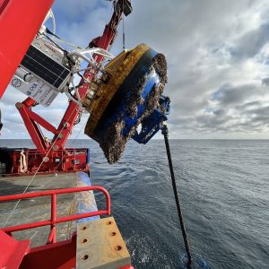
Woods Hole Oceanographic Institution (WHOI) and Oregon State University (OSU) jointly announced that OSU will assume responsibilities for the systems management of the cyberinfrastructure that makes data transmission for the Ocean Observatories Initiative (OOI) possible through September of 2023. OSU was awarded this role after a systematic and thorough selection process. Rutgers, the State University of New Jersey, has provided OOI’s Cyberinfrastructure systems management since 2014, and will leave the OOI Program in 2021 following a transition period with OSU. The OOI consists of five instrumented observatories in the Atlantic and Pacific Oceans outfitted with more than 900 instruments that continually collect and deliver data to shore via a cyberinfrastructure, which makes the data available to anyone with an Internet connection. The demands on the cyberinfrastructure are great, as it stores 73 billion rows of data, and has provided 36 terabytes of data in response to 189 million user requests since 2014. With the data requests and delivery demands increasing each year, the OOI has the capability to provide data that allows inquiries into episodic ecosystem events in real-time, as well as investigations using long-term time series data. The OOI is made possible through a funded five-year cooperative agreement to WHOI from the National Science Foundation. The OSU award is for $6 million over a three-year period.
“We are delighted that OSU has the capabilities and expertise to take on this hugely important task,” says John Trowbridge, Principal Investigator of the Program Management Office of the OOI at WHOI. “The OOI has become a dependable source of real-time ocean data, helping scientists answer pressing questions about the changing ocean. Educators use real-time ocean data to teach students about the fundamentals of oceanography, the global carbon cycle, climate variability, and other important topics. The team at OSU will help advance this work and ensure that OOI data are served reliably to an ever-growing audience.
“We are also extremely grateful to the Rutgers team for the excellent foundation they established over the past six years that will allow a seamless transition to the OSU cyberinfrastructure team. Rutgers was an important partner that helped establish OOI as a reliable data provider,” adds Trowbridge.
“OSU brings the perfect mix of hardware, software, and ocean data experts to ensure that we are able to store and serve up this gargantuan amount of important ocean data,” adds Anthony Koppers, Principal Investigator for the OSU Cyberinfrastructure Systems Team. “We have the key personnel and systems in place that will allow us to seamlessly take on the challenge of storing and serving OOI data, strategically planning for future data demands and implementing cybersecurity. We also will be working hand-in-hand with the OOI’s Data Management Team to ensure the data meets the highest quality standards.”
OSU’s cyberinfrastructure will handle telemetered, recovered, and streaming data. Telemetered data are delivered to the cyberinfrastructure from moorings and gliders using remote access such as satellites. Recovered data are complete datasets that are retrieved and uploaded to the cyberinfrastructure once an ocean observing platform is recovered from the field. Streaming data are delivered in real time directly from instruments in the field.
Read More
Easy-to-use MATLAB Data Tools
OOI data team members have developed a new toolbox for downloading data from the Machine-to-Machine (M2M) interface using MATLAB, making data access as easy as 1, 2, 3. The work expands on the existing tools available on OOI. This new toolbox covers data from moorings, gliders, and profilers in the OOI Coastal Arrays and can easily be extended to other research platforms. A video tutorial on how to use this new tool is provided above. (A pdf of the tutorial is provided below).
In three short steps – define the mooring, node, and instrument – users can easily and quickly access relevant OOI data. “This new approach eliminates some steps and makes it easy for anyone to find and access data they are looking for, “said Jonathan Fram, OOI Endurance Array Project Manager at Oregon State University (OSU). “We found this new approach really streamlined data access using the M2M interface and we are certain other OOI data users will find it similarly helpful.”
Developed by OOI OSU team members, Craig Risien and Russ Desiderio, these new tools are part of our ongoing effort to simplify access to OOI data to encourage its broader integration into scientific research and classroom content. A tutorial showing how to use MATLAB to access OOI data can be viewed here.
Other members of the OOI OSU team, Chris Wingard and Ian Black, are testing Python and R tools to explore OOI data, as well. Once the tools have been tested and vetted, they will be available along with other community-generated tools here.
This new tutorial adds to others that have been developed to help users integrate OOI data into their science.
Read More