
Posts Tagged ‘Pioneer Array MAB’
Hot Wash: Pioneer-Adjacent PIES Deployments

RAPID: A Cost-Effective Approach for Characterizing Variability at High Temporal Resolution for Long Duration on the Continental Slope of the Southern Mid-Atlantic Bight
Two popeye data shuttle-enabled current and pressure sensor equipped inverted echo sounders (PDS-PIESs, Figure 1) were successfully deployed on the continental slope east of the U.S. National Science Foundation Ocean Observatories Initiative (OOI) Pioneer Array in the southern Mid-Atlantic Bight in June 2024. Data collected during the 4-year deployments will be shared broadly when PDS pods ascend annually to the sea surface and return data batches via a satellite link.
[media-caption path="https://oceanobservatories.org/wp-content/uploads/2024/06/IMG_8421-scaled.jpg" link="#"]Figure 1. Massachusetts Institute of Technology/Woods Hole Oceanographic Institution (MIT/WHOI) Joint Program students, Ysabel Wang (right, Physical Oceanography) and Will Harris (left, Applied Ocean Science and Engineering) and WHOI technician Brian Hogue (background) preparing a PDS-PIES for deployment. The instrument will measure round trip vertical acoustic travel time with bursts of 16 pings every 10 minutes and near-bottom pressure and current measurements every 30 minutes. The PDSs (orange) are scheduled to rise to the sea surface to return data batches remotely on September 1 in 2024 and yearly thereafter until 2027 with recovery of the PIES (white) planned for 2028.[/media-caption]The scientific motivation is to (1) capture mesoscale variability offshore of the Pioneer Array, (2) capture western excursions of the Gulf Stream North Wall that may influence ocean-shelf exchange, and (3) observe the upper portion of the equatorward-flowing Deep Western Boundary Current where it squeezes under the poleward flowing Gulf Stream. The PDS-PIESs were deployed on the 1000 m isobath 40-km apart to extend the Pioneer Array mooring footprint offshore and to allow comparison with a glider which is running a line (nominally) along the 1000 m isobath (Figure 2).
[media-caption path="https://oceanobservatories.org/wp-content/uploads/2024/06/Screenshot-2024-06-11-at-2.08.19-PM.png" link="#"]Figure 2. Map of PDS-PIESs (red dots, C1: 36° 3.125′ N; 74° 42.365′ W and C2: 35° 42.005′ N; 74° 46.209′ W), Pioneer moorings (yellow dots), and nominal offshore Pioneer glider line (blue). Red curve is time-averaged position of the Gulf Stream core and dotted lines are Jason altimeter tracks. Heavy contours are the 200 and 1000 m isobaths.[/media-caption]Cruise RR2407 was supported through the Office of Naval Research through the National Ocean Partnership Program Global Internal Wave (NGIW) study and provided at sea experiences for four MIT/WHOI Joint Program students and four undergraduates from the University of Massachusetts Dartmouth as part of their Blue Economy Program with WHOI. Many thanks to the National Science Foundation Division of Ocean Sciences for funding the PDS-PIES deployments and to engineer Erran Sousa from the University of Rhode Island who provided emergency shoreside support (on a Saturday!) to walk us through the PDS setups.
Read More
Pioneer Array Operational at MAB
A move is declared
Months of toil undertaken
This day it is done
Coastal and Global Scale Nodes (CGSN) Principal Investigator Al Plueddemann penned the haiku above in recognition of the successful installation of the Pioneer array at its new location in the Mid-Atlantic Bight (MAB) on April 17, 2024. This momentous occasion occurred on Haiku Wednesday, which prompted the poetic marking of a three-year effort to have the array deployed and telemetering data from the MAB.
The relocation of the Pioneer Array from its former location off the New England Shelf (NES) to its new location was a multi-tiered process. The National Science Foundation (NSF) joined forces with the Ocean Observatories Initiative Facility Board (OOFIB) to host a series of workshops in 2021 to elicit community input on where a relocated Pioneer Array might best meet science and educational needs. Based on input from these community workshops, the NSF gave its approval to the MAB site and the process was launched.
“Completing installation of the Pioneer Array in the MAB was the culmination of three years of preparation, which began with planning workshops in 2021, the recovery of the NES array in 2022, and engineering, procurement, and testing in 2023,” said Plueddemann, who also served as the Chief Scientist aboard the R/V Neil Armstrong for the first deployment of the array in the MAB. “It took an incredible effort from the whole CGSN Team to address all the considerations in moving the array to its new location. It is gratifying to see the successful deployment, with new, multidisciplinary data now available from this important oceanic region.”
[media-caption path="https://oceanobservatories.org/wp-content/uploads/2024/04/New-shallw.jpg" link="#"]Two newly designed shallow water moorings were deployed at the Pioneer MAB site. These specially designed moorings allow a wave-powered profiler to span the upper 80% of the water column in water depths as shallow as 25-30 m. Credit: Sawyer Newman © WHOI.[/media-caption]The primary objectives for the April cruise included installation of three surface moorings, five profiler moorings, and two newly designed shallow water moorings. The moorings create the backbone of MAB Array, a frontal-scale, T-shaped array located off the coast of Nags Head, North Carolina, starting ~25 km offshore and extending ~50 km east/west and ~50 km north/south across the continental shelf. The ten moorings occupy seven sites; three sites contain both a surface mooring and a profiler mooring. In order to provide synoptic, multi-scale observations of the outer shelf, shelf break, and continental slope, the moored array is supplemented by four gliders and two AUVs. The gliders operate for 45-90 days at a time, provide transects along and across the shelf, and monitor the mesoscale field of the slope sea. The AUVs are deployed and recovered from the ship over a ~24 hr period and provide synoptic across- and along-front “snap shots” of the frontal region.
[media-caption path="https://oceanobservatories.org/wp-content/uploads/2024/04/NESLETER.png" link="#"]Collaboration between OOI and the Northeast U.S. Shelf (NES) Long-Term Ecological Research (LTER) project began in 2017 and continued during this deployment expedition.Taylor Crockford was onboard to deploy an Imaging FlowCytobot (IFCB) that continuously sampled seawater while the Armstrong was underway. Shown here are some of the creatures living in the seawater along the route. Credit: Taylor Crockford © WHOI.[/media-caption]Once the deployment was in place, the team turned its attention to additional expedition objectives, including a bathymetry/sub-bottom survey of a potential alternate Western mooring site, and cross-shelf and along-shelf CTD (conductivity, temperature, and depth) transects. Once those were completed, the team headed home aboard the R/V Neil Armstrong to its home port in Woods Hole, MA where they were heartily greeted for a job well done.
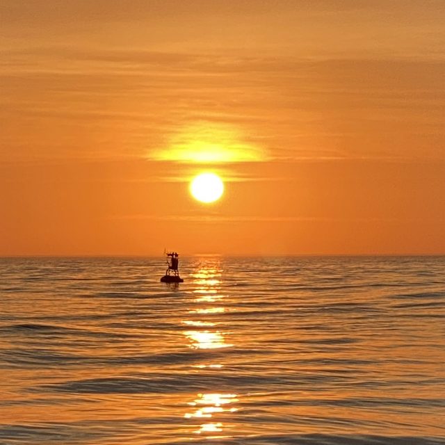
[media-caption path="https://oceanobservatories.org/wp-content/uploads/2024/04/Sunrise-17-April-Ryder-2-scaled.jpg" link="#"]The sunrise was captured on 17 April over the Northern Offshore Surface buoy, highlighting the completion of the installation of the Pioneer Array in its new location in the Mid-Atlantic Bight. Credit: Jim Ryder © WHOI.[/media-caption]A review of the day-to-day operations to install the Pioneer Array in the Mid-Atlantic Bight m can be found here.
Read MoreHoses Galore Hold Moorings Together
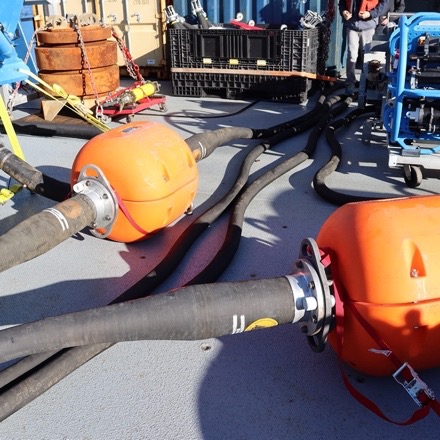
A flexible connection between the buoy and the anchor of the Coastal Surface Moorings of the Pioneer MAB Array is created by multiple hoses with the capacity to stretch while maintaining an electrical connection (Fig 1). The stretch is necessary to account for wind, waves and currents that push and pull the buoy relative to the anchor. The hoses connect mooring components and contain coiled conductors that allow data transfer and carry power generated by wind turbines and solar panels on the buoy.
The Northern Coastal Surface Mooring deployed for the first time in the MAB on April 4, 2024, illustrates the vital role these connection points play in keeping the mooring in place and operating. The mooring was deployed in 100 meters of water. The surface buoy is connected to the near surface instrument frame with a five-meter-long electromechanical chain (EM) chain. The EM Chain is flexible enough to bend to allow deployment (Fig. 2) but does not stretch. This provides support and stability at the top of the mooring. The EM chain also contains conductors to allow transmission of power created by solar, wind, and batteries on the surface mooring to the instruments below.
[media-caption path="https://oceanobservatories.org/wp-content/uploads/2024/04/EMChain.jpg" link="#"]Fig 2. The EM Chain connects the bottom of the surface buoy to the Near Surface Instrument Frame (NSIF) to left. Credit: DT Crist © WHOI.[/media-caption]Power moves through the EM chain to the instruments attached to the Near Surface Instrument Frame (NSIF), and then off to three stretch hoses each 30.48 meters long! The stretch hoses do what their name implies, stretch as needed in response to environmental conditions, yet they are strong enough to keep the mooring in place. The first section of stretch hose is connected to a Hose Interface Buoyancy (HIB) module, an orange flotation device that helps keep the stretch hoses floating and upright. The second section of stretch hose connects to a second HIB. Electrical connectivity is maintained by wired connections from the end of a stretch hose, through the hollow center of the HIB, and then to the next hose.
[media-caption path="https://oceanobservatories.org/wp-content/uploads/2024/04/HIBS.jpg" link="#"]Two Hose Interface Buoyancy (HIBs) sections are connected to each other with electromechanical stretch houses that provide flexibility and strength to the mooring and transmit power down the line. Credit: DT Crist © WHOI.[/media-caption]The third stretch hose section is connected to the Multi-Function Node (MFN), which houses instruments that need power. The MFN also contains the anchor.
[media-caption path="https://oceanobservatories.org/wp-content/uploads/2024/04/MFN.png" link="#"]The Multi-Function Node and Anchor Assembly being deployed off the back deck of the R/V Neil Armstrong. The stretch hose, which connects it to the rest of the mooring, is at the top and to the right. Credit: DT Crist © WHOI.[/media-caption]
[media-caption path="https://oceanobservatories.org/wp-content/uploads/2024/04/Complete-configuration.jpg" link="#"]More than 96 meters of hose keep the Coastal Pioneer Northern Array in place in its new location in the Mid-Atlantic Bight. Credit: DT Crist © WHOI.[/media-caption]
Perspective in Pounds
What’s amazing about the hoses that keep the Pioneer moorings on station and operational is the scale of the equipment that makes up the mooring. Take the top and the bottom of the mooring, for example. The Surface Buoy weighs some 8,500 pounds. The MFN and Anchor Assembly weigh 11,000 pounds. These weights and the scale of the equipment are not only challenging for moving around the deck and getting into the water, but thanks to the hoses these massive components are able to stay in the water, collect data, and report for up to six months. Hats off to hoses galore!
Read More
First Deployment of the Pioneer Array in the MAB
At 0900 Eastern on Monday April 1, 2024, the R/V Neil Armstrong will back out of the dock at Woods Hole, MA to begin the transit to the new location of the U.S. National Science Foundation (NSF) Ocean Observatories Initiative (OOI) Coastal Pioneer in the Mid-Atlantic Bight (MAB). This promises to be a momentous trip for it will be the first deployment of the Pioneer in the MAB, a location decided upon after a series of NSF-sponsored meetings with community users of OOI data. The expedition also will mark the 20th Pioneer deployment undertaken by the Coastal and Global Scale Nodes (CGSN) team at Woods Hole Oceanographic Institution (WHOI).
“The array is design to provide data to help scientists better understand the dynamics of the region, the role of biogeochemical cycling and transport, and the impact of extreme events like hurricanes and freshwater outflows,” said Albert Plueddemann, chief scientist for this first deployment and lead scientist of the CGSN group. “There’s already considerable community interest in obtaining data from the OOI infrastructure and leveraging the array installation for research and testing. Once the array is in place, we anticipate even more interest, and look forward to engaging with researchers in the region.”
The Pioneer MAB is a T-shaped array with moorings, located offshore of Nags Head, North Carolina, at depths of 30-300 meters and nominal spacing of15-25 kilometers. The array will consist of ten platforms at seven different sites – two platforms will be deployed as adjacent pairs at three sites. The platforms include three surface moorings, five profiler moorings, and two shallow-water moorings. The Pioneer MAB will also have mobile assets—four coastal gliders and two autonomous underwater vehicles (AUVs). These mobile assets will traverse the water column along different track lines to give a fuller, more robust picture of water column properties.
[media-caption path="https://oceanobservatories.org/wp-content/uploads/2024/03/MAB-Array-map-3-scaled.jpg" link="#"]Figure 1: Location of moorings of the Coastal Pioneer Array in its new location in the Mid-Atlantic Bight.[/media-caption]After a ~36-hour transit to the site, the team of 15 scientists and engineers will get to work to deploy the new array. Because of the large size of the moorings, the expedition will be conducted in two legs and be completed on April 22nd. In addition to the mooring and mobile asset deployments, the team will be conducting CTD (to measure conductivity, temperature, and depth) casts with water sampling at the deployment sites. In addition, they will be making ship vs meteorological comparisons at the surface mooring sites to ensure the rigor and accuracy of meteorological measurements. They also will be conducting some shipboard underway surveys, as well as a bathymetric survey to gain a complete picture of the new location.
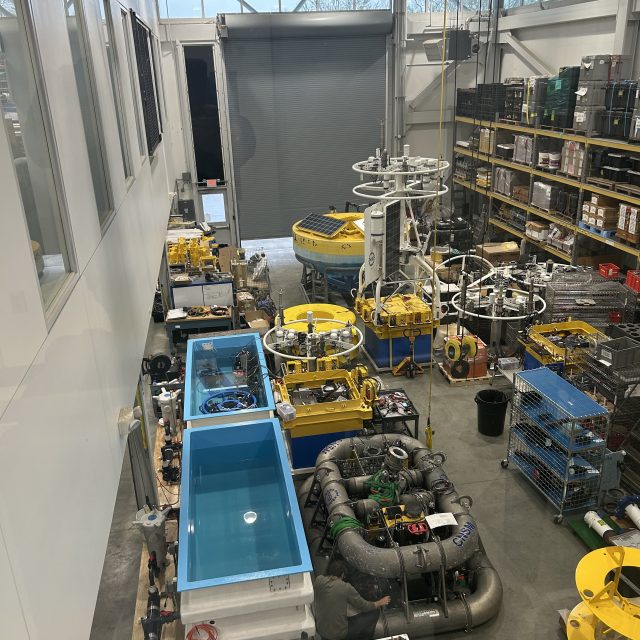
[media-caption path="https://oceanobservatories.org/wp-content/uploads/2024/03/IMG_0550-2-scaled.jpg" link="#"]A lot of equipment is at the ready! Northern and Southern Coastal Surface Moorings, along with seabed multi-function nodes and near-surface instrument frames, as they were being assembled. The team integrates the science instrumentation with the mechanical/power/telemetry/data systems, then tests the system before loading on the vessel. Credit: Derek Buffitt © WHOI.[/media-caption]Continuing the tradition of the Coastal Pioneer Array off the New England Shelf, this first deployment expedition will be a collaborative one. A marine mammal observer from the National Oceanic and Atmospheric Administration will be onboard to count marine mammals in the region. A representative from the Northeast U.S. Shelf Long-Term Ecological Research (NES-LTER) will be onboard to conduct sampling from CTD casts and flow cytometers, which can analyze the characteristics of cells found in water as the ship is underway. This will be a continuation of an ongoing collaboration for the past seven years. And a Department of Energy representative will also be onboard as tests are conducted to determine the viability of placing a wave energy conversion device on the array.
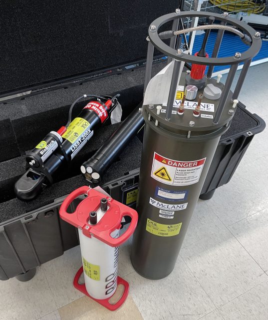
Along with being the first deployment in the Southern Mid-Atlantic Bight, the Pioneer MAB Array will also include new instrumentation on the three Surface Moorings. The new instrumentation includes plankton imaging sensors (the McLane IFCB), instruments that measure particle size distribution (the Sequoia LISST-200X), short-range velocity profile instruments for the upper water column (the Nortek Aquadopp Profiler-S1VP), turbidity sensors (the Sea-BIrd ECO), and new seafloor pressure sensors (the RBR Quartz3QPlus). These were among the measurements recommended during the National Science Foundation OOI Facility Board community workshops in 2021 to select a new location for the Pioneer Array.
[media-caption path="https://oceanobservatories.org/wp-content/uploads/2024/03/IMG_0554-2-scaled.jpg" link="#"]Sheri White and Nikki Arm prepare and bench test the new Imaging Flow CytoBot, also known as a Plankton Imaging System (PLIMS), that will be deployed on the Central Surface Mooring of the new Pioneer MAB array. The PLIMS generates images of the particles in the local aquatic environment. Credit: Derek Buffitt © WHOI.[/media-caption]
Read More
Instrumentation Updates for Planned Pioneer MAB Array
Community Input
The Ocean Observatories Initiative Facilities Board (OOIFB), sponsored by the National Science Foundation (NSF) and in partnership with KnowInnovations, facilitated two community workshops, called Innovations Labs, that resulted in the decision to relocate the Pioneer Array to the southern Mid-Atlantic Bight (MAB). The second Lab included community input on measurements that would be desirable for the relocated array. More than 40 instruments or measurement types were discussed. This was reduced to about a dozen high-priority recommendations based on consensus among the Innovations Lab sub-groups. After considering applicability to the science themes, technical readiness level, operational feasibility, and budget impacts the OOI Program was able to implement the majority of the high-priority recommendations.
Among the goals for the relocation process was to optimize the use of existing inventory, and it was possible to do so while addressing several of the instrumentation recommendations. In some cases, new procurements were required, although it should be noted that one of these procurements was needed to replace an obsolete core sensor. A summary of the instrumentation updates for the proposed Pioneer MAB relocation in these two categories is provided below.
Repurposing of Existing Core Instruments
The OOI deploys a set of core instruments across all the Arrays. Reconfiguration of the Pioneer Array elements, along with some inventory available from the decommissioned southern hemisphere arrays, meant that some instrumentation could be repurposed for the Pioneer MAB Array without requiring new purchases. Five instrumentation changes were made using this approach:
- Near-surface temperature and salinity: A Seabird SBE-37 CTD will be mounted on the “foot” of the five Coastal Profiler Mooring (CPM) buoys.
- Incident radiation: A Sea Bird OCR-507 multispectral radiometer will be mounted on the tower of the three Coastal Surface Mooring (CSM) buoys. This instrument will measure downwelling radiation per unit area.
- Surface wave spectra: A TriAxys Next Wave sensor will be added to the buoy well of all three CSMs. These sensors, which provide both non-directional and directional wave parameters, were previously deployed on only the Central CSM for the Pioneer NES.
- Turbidity: Seabird ECO triplet instruments with a secondary turbidity calibration on the optical backscatter channel will be deployed on the Near Surface Instrument Frame (NSIF) and seafloor Multi-Function Node (MFN) of the three CSMs.
- Nitrate: A glider with a Sea-Bird SUNA nitrate sensor will be deployed on the offshore “flux line”.
New Procurements
Several of the high-priority recommendations from the Innovations Labs that were deemed feasible for implementation required instrumentation that was not part of the OOI core. In this case, a formal procurement process is required (the process for replacing an obsolete sensor is similar). Four measurements required new instrument procurements: Near-surface velocity, phytoplankton imagery, particle size, and seafloor pressure. The procurement process for these instruments was initiated in November 2022.
The procurement process involves multiple steps of specification, information collection, review and approval before actual purchases are made. Among the first set of steps executed for the Pioneer MAB procurements were: consultation with a Focus Group of scientists external to the OOI, development of measurement specifications and revision of requirements as needed. The specifications were then used to create a solicitation of information from vendors through a broadly disseminated Request For Information (RFI). The RFI responses were reviewed by a selection committee composed of both internal and external subject matter experts, who evaluated instrument and vendor capabilities relative to performance specifications, technical feasibility, cost, and other factors. Additional steps included Design Reviews and Selection Reviews where the documentation of the process is presented to the Program Management Office and the NSF. After approval of vendor selection from the Review steps, orders were placed for the new equipment.
The Program is currently pursuing the procurement of four instrument classes, with 15 instances to be deployed at different locations within the Pioneer MAB Array (Table 1). Instrument locations include the buoy, Nearshore Instrument Frame (NSIF) and Multi-Function Node (MFN) on the Coastal Surface Moorings, and the buoy and buoyancy sphere of the Coastal Profiler Moorings.
Table 1: New Instrument Procurements for Pioneer MAB
| Measurement | OOI Code | Make/Model | Location | Instances |
| Near-surface velocity profile | ADCPU | Nortek Aquadopp profiler 1MHz | Coastal Profiler Mooring Sphere | 5 |
| Plankton Imaging | PLIMS | McLane Imaging Flow CytoBot | Coastal Surface Mooring Central site NSIF | 1 |
| Particle Size Analysis | PRTSZ | Sequoia LISST-200X | Coastal Surface Mooring NSIF and MFN | 6 |
| Seafloor Pressure | PRESF | RBR Quartz3Qplus | Coastal Surface Mooring MFN | 3 |
More information on the proposed relocation of the Pioneer Array to the Mid-Atlantic Bight is available here.
Read More
PI-Added Sensors / Equipment Requests for Pioneer Array MAB Accepted After Array is Operational
We are very excited about deploying the Pioneer Array in its new location in the southern Mid-Atlantic Bight (MAB), including new designs and new sensors. The MAB location and design require new permitting, new engineering, and inclusion of new sensors as part of the core Array measurements. We are optimistic that we are on track to deploy the new Array in Spring 2024 as planned.
Because of this aggressive timeline for deployment in the new location, the National Science Foundation (NSF) has directed the OOI Facility to put acceptance and evaluation of Principal Investigator requests for new sensors/equipment on hold until the new Array has been deployed and fully operational for one month. This will allow the OOI to focus on delivery of the core OOI measurements during this critical period, including initial understanding of performance. The NSF also has directed the OOI to return assessments as soon as practicable after the hiatus has been lifted, ideally by Summer 2024.
Specific dates will be posted as they become known. Regular updates on progress at the Pioneer Array MAB will be posted here.
Read More