
Posts Tagged ‘Sheri White’
Another Round of Pioneer MAB At-Sea Tests Completed
A team of OOI Coastal and Global Scale Nodes (CGSN) scientists and engineers returned to Woods Hole, MA aboard the R/V Neil Armstrong on November 4, having successfully completed another round of tests of mooring equipment and site location surveys for the proposed relocation of the Coastal Pioneer Array to the Mid-Atlantic Bight (MAB), off the coast of Cape Hatteras, NC.
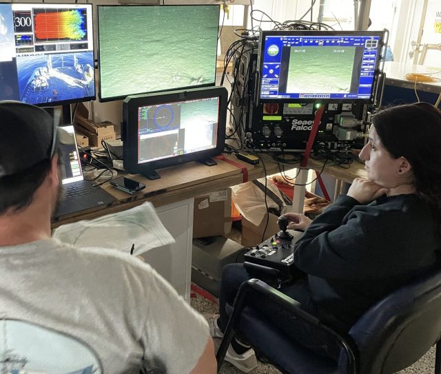
[media-caption path="https://oceanobservatories.org/wp-content/uploads/2023/11/IMG_6640-2048x2048-2.jpg" link="#"]The OOI-CGSN team surveyed the seabed to better understand the environment for the proposed moorings sites. The RV Neil Armstrong operated hull-mounted acoustic equipment to collect bathymetry (depth contours; shown left ), backscatter imagery (seabed characterization), and sub bottom data (seabed profile and geophysical layering). Chris Basque and Irene Duran (shown right) also piloted the ROV over the mooring locations to collect still images, video, and high-resolution sonar of the seabed. Photos: Sheri N. White © WHOI.[/media-caption] [media-caption path="https://oceanobservatories.org/wp-content/uploads/2023/11/IMG_6643-1536x1536-1.jpg" link="#"]Closeup of multi-beam survey.[/media-caption]Having accomplished all of the primary cruise objectives under un-seasonally warm and calm conditions, the weather picked up at the MAB as they were finishing up the last two CTD (Conductivity, Temperature, and Depth) surveys along the proposed location of the main mooring lines.
The team then headed north to conduct a final ROV survey of the Shallow Water test mooring they had put in place the week before in 32 meters of water southwest of Martha’s Vineyard. This ROV inspection was the second conducted at this mooring location. A first inspection was done shortly after the mooring’s deployment, when all components were found to be in place and operational. The second confirmed the earlier findings.
In addition to deployment of the Shallow Water test mooring off Martha’s Vineyard, the CGSN team conducted recovery operations onsite at MAB. They recovered the Coastal Profiler Mooring anchor, deployed in the spring of 2023. The mooring itself had been recovered in August of this year. The team also recovered the Coastal Surface Mooring after ~8 months operating at the proposed Pioneer MAB location. The mooring was deployed in a water depth of 30 m and survived storms with max wave heights of 7.5-10 m and continued to send data to shore!
[media-caption path="https://oceanobservatories.org/wp-content/uploads/2023/11/IMG_6642-1536x1536-1.jpg" link="#"]The Coastal Surface Mooring is safely on deck after ~8 months operating at the proposed Pioneer Mid-Atlantic Bight location. Credit: Sheri N. White © WHOI.[/media-caption]Other activities conducted during the 11-day expedition included a site surveys (utilizing multi-beam, sub-bottom, and ROV) of alternate mooring locations, and cross-shelf and along-shelf CTD surveys to better understand the oceanographic conditions in the Mid-Atlantic Bight.
“Conducting at-sea tests of our infrastructure and detailed environmental surveys of the environment are important to ensure the success of new OOI Array,” said Sheri N. White, Chief Scientist for the recovery cruise. “We were lucky to have excellent weather for our deployment and recovery cruises. But also pleased that our test moorings experienced challenging weather during the deployment. This gives us the confidence that the moorings can operate successfully in the new environment and collect data year-round.” The plan is to deploy the Coastal Pioneer Array in its new location in spring 2024.
More details about and images from the expedition can be found here.
Read MoreWHOI hosts MME Annual Meeting
The Massachusetts Marine Educators Association (MME) 46th Annual Meeting was held at Woods Hole Oceanographic Institution (WHOI) on Saturday April 30th. The event, sponsored by WHOI and Woods Hole Sea Grant, provided an opportunity for educators to get together in person, tour WHOI’s facilities, and learn about how ocean and coastal data can be used in the classroom.
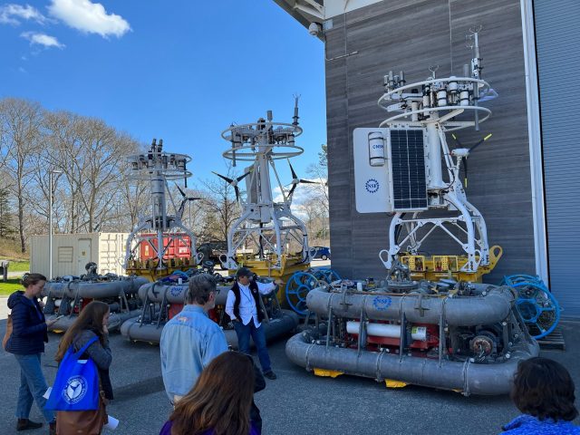
WHOI and Ocean Observatories Initiative (OOI) Engineer Sheri White gave one of the keynote addresses: “The Ocean Observatories Initiative:Collecting Long-Term Coastal and Global Time Series Data.” She followed this with a tour to a group of about 15 people of OOI’s lab and equipment testing and holding area at LOSOS and of some recovered Pioneer Array gear.
[media-caption path="/wp-content/uploads/2022/05/IMG_0498-rotated.jpg" link="#"]WHOI Engineer Sheri White showed participants recovered Pioneer Array gear. Photo: Stace Beaulieu©WHOI.[/media-caption]
WHOI Researcher Stace Beaulieu presented a workshop entitled “Wild Ocean Data: Easily Within Reach.” Her presentation, a tutorial on how to use OOI’s Data Explorer, is available online for those who missed it at https://tinyurl.com/WildOceanData.
[media-caption path="/wp-content/uploads/2022/05/IMG_0495-copy-2.jpg" link="#"]WHOI Researcher Stace Beaulieu showed how to use Data Explorer in the classroom. Photo: Annette Brickley.[/media-caption]
Rounding out the day was a presentation by Education Specialist by Annette Brickley, who presented “Is it Data? or Is it Cake?” She talked about the NES-LTER Data Jam and what students can do with NES-LTER and OOI Data.
[media-caption path="/wp-content/uploads/2022/05/IMG_0997-2-scaled.jpg" link="#"]Education Specialist Annette Brickley presented: Is it Data? Or is it cake? Photo: Stace Beaulieu ©WHOI.[/media-caption]
Read More