
News
Video of OOI Data Users Town Hall
On 24 August, OOI Data Lead Jeff Glatstein, Axiom Data Science Designer Brian Stone, and Axiom Data Science Coder Luke Campbell gave a preview of upcoming additions to Data Explorer that will help users access glider data. The presenters sought input from OOI’s user community to improve the platform to ensure it meets data users’ needs when it goes live in September 2021. You can see the demonstration of the upcoming Data Explorer changes in the video below and hear suggestions from OOI’s data users community.
[embed]https://vimeo.com/592362218[/embed]
Read More
Kathleen Gonzalez: Student Ambassador for VISIONS’21 Expedition

The first time Katie Gonzalez went to sea was as a student participant on the 2017 Ocean Observatories Initiative (OOI) annual operations and maintenance Regional Cabled Array (RCA) VISIONS’17 cruise. From that experience, she knew that whatever she did in the future needed to involve the oceans.
Katie recently graduated as a first-generation college student from the University of Washington (UW) with her bachelor’s degree in biological oceanography. But despite her young age, she has amassed a vast amount of sea-going experience. This year marks her fifth time joining the RCA VISIONS cruises, and the third time she has participated in all legs of the expedition.
Last year, when UW limited the number of people who could go on the cruise due to COVID restrictions, Katie was one of only two student participants aboard. As restrictions eased this year, she was excited to welcome back her peers as their student ambassador, using her extensive knowledge and experience to mentor the first-time students on how to use the equipment and interact with the scientists and crew aboard the ship. “Compared to the other students, I’ve had so much more prior experience, and that’s definitely been helpful,” she says. “I’m excited to have some new responsibilities.”
This year, she is also a key member of the science party, mentoring the 19 undergraduate VISIONS’21 students on the intense logging operations and acquisition of 4K and digital still imagery in the remotely operated vehicle Jason control van.
[media-caption path="https://oceanobservatories.org/wp-content/uploads/2021/08/Eve_Katie_Newport_20180701_153908_L2_startSmall.jpg" link="#"]Katie Gonzalez (left) poses with Eve Hudson (right) on the VISIONS ’18 cruise. Katie is currently acting as student ambassador on the VISIONS ’21 cruise. Credit: University of Washington, V18.[/media-caption]Katie first became interested in oceanography when she was attending high school in Clallam Bay, Washington. During one very memorable science class, Dr. Deb Kelley, an oceanography professor at UW and PI/Director for the RCA, came to show her class how to make environmental sensors, which they deployed in the school’s garden.
This experience inspired Katie to pursue a college degree in oceanography, and she decided to apply to UW to work with Professor Kelley. Since decisions for UW’s Seattle campus had already closed, she decided to attend the UW at Bothell and transferred to the Seattle campus the following year. In the meantime, she still wanted to work with Professor Kelley, so she commuted 45 minutes on public transportation to the main campus to work on OOI RCA projects in Professor Kelley’s lab.
Katie’s extensive experience working with OOI and doing research at sea motivated her to write her senior thesis using RCA data.
“I knew that whatever I was doing for my thesis, I wanted to use data from the RCA,” she recounts. As a biological oceanography student, she was most interested in biological happenings in the ocean to which she felt a personal bond. That’s when she heard about the RCA hydrophone data. The RCA hydrophones are used to listen for seismic events along the Juan de Fuca Ridge and Cascadia Margin, but they are also constantly bombarded with marine mammal calls, including whale vocalizations. “That was the connection I was looking for,” explains Katie. She decided to investigate fin whale calls at two different sites along the RCA by analyzing the timing and frequency of their calls. She chose to look at vocalizations from the Slope Base (~125 km from the Oregon coast) and the Axial Base (~475 km from the Oregon coast) sites because whales tend to congregate in areas of high bathymetric relief.
Fin whales are considered a vulnerable species because they have been heavily impacted by human activity.
“Looking into what the whales are doing, where they’re going, and how they’re interacting with their environment will be helpful in guiding the protection of these species,” says Katie.
Working with Dr. William Wilcock, a UW Oceanography professor and a seismologist who has been studying whale calls in the Northeast Pacific for several years, she fed five years of RCA hydrophone data into an algorithm that helped filter out data that matched the frequencies of fin whale calls. She then visualized the data as a spectrogram, which allowed her to make comparisons for frequency correlations.
“That was the moment when everything—the oceanography, the data science, and my human emotion for biological creatures—came together,” she recalls.
The preliminary results of this research showed that the whales appeared at the Slope Base site closer to the continental shelf two to three months earlier in their calling season, before moving out to the far off shore blue water environment of Axial Base. Both sites had their largest volume of calls in January.
Katie has several hypotheses about the seasonal patterns she observed. “They could be following their prey, or coastal upwelling could be providing them with more food closer to the shelf during those months. As for why both sites have peaks in January, that’s a question for further research.”
Her thesis detailing her research and its conclusions was published in the UW FieldNotes Journal.
Now that she has graduated, Katie hopes to continue with her research on whales. For now, she is happy to carry on working in the Kelley lab and helping out on the RCA VISIONS ’21 cruise. She will be writing two guest blog posts about her experience on the VISIONS ’21 cruise. Live updates for the VISIONS ’21 cruise can be found here.
[media-caption path="https://oceanobservatories.org/wp-content/uploads/2021/08/CTD_Katie_MIkeV-scaled.jpg" link="#"]Katie Gonzalez (right) and Mike Vardaro (left) work with the CTD rosette on the VISIONS ’18 cruise. Katie is a key member of the science party on the VISIONS ’21 cruise. Credit: University of Washington, V18.[/media-caption] Read MoreStudents Participate Virtually in Irminger Sea 8
Twelve students from Paige Teves’ fourth-grade class virtually boarded the R/V Neil Armstrong via Zoom in early August to learn what it’s like to be at sea transporting lots of ocean observing equipment in and out of the water for a month. The connection was made through John Lund, an engineer at Woods Hole Oceanographic Institution and chief scientist for the eighth turn of the OOI’s Global Irminger Sea Array. John’s daughter, Annika, is a student in Ms. Teve’s class in the Summer Adventures in Learning (SAIL) program, a summer education program in Marion, MA for students in pre-kindergarten through 8th grade.
The Irminger Sea Array 8 team took turns holding up the “Zoom phone” to share their experiences with the students and the implications of their work in helping better understand the ocean and its role in the changing climate. The Irminger sea Array 8 team took the opportunity to showcase the different roles and genders involved in the work onboard the ship to demonstrate to the students the many possibilities in STEM careers.
Chief Scientist John Lund initiated the visit by explaining what the project was about (gathering real-time ocean data in one of the most important and difficult to sample regions in the Atlantic Ocean ), where they were (in the Atlantic off the Southeast coast of Greenland) and what they were doing (recovering and deploying ocean observing equipment).
[feature][caption id="attachment_21913" align="aligncenter" width="487"]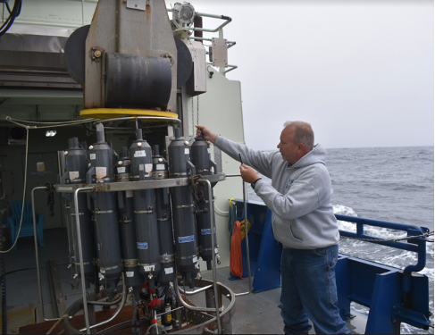 Chief Scientist John Lund showed off the CTD rosette, which is used to measure the temperature, conductivity, and density of seawater. He had the bonus of seeing his daughter via the Zoom call, who was a participant in the SAIL program. Credit: ©WHOI, Andrew Reed.[/caption]
[/feature]
Engineer and Instrumentation Lead Jennifer Batryn explained her role working with the instruments. She took them on a virtual tour of one of the surface moorings, pointing out the different instruments and explaining what the measure.
[feature][caption id="attachment_21914" align="aligncenter" width="610"]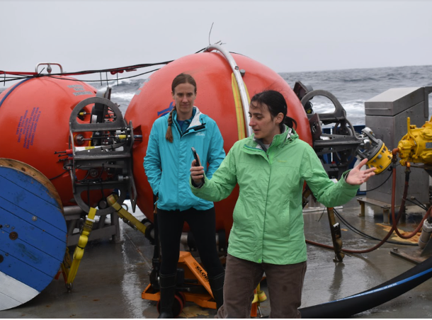 Engineers Jennifer Batryn (in back) and Stephanie Petillo (on phone) took turns talking about the equipment they are responsible for aboard the R/V Neil Armstrong. Credit: ©WHOI, Andrew Reed.[/caption]
[/feature]
Senior Oceanographic Engineer, Software Architect & Manager, Oceanographic Roboticist and Technologist Stephanie Petillo explained her role as software lead and how the data are collected and relayed back to shore for the engineers and scientists, both to operate the array and to study the data.
[feature][caption id="attachment_21912" align="aligncenter" width="566"] Engineer Dan Bogorff showed the 4th grade SAIL program students the floats that comprise part of OOI’s subsurface moorings. Credit: ©WHOI, Andrew Reed.[/caption]
[/feature]
Engineer and Subsurface Mooring Lead Dan Bogorff presented the Subsurface Moorings, explained their different requirements from surface moorings. Like Batryn, he explained to the students the different instrument on these below-the-surface moorings and what kind of data they collect and report back.
The students peppered each of the presenters with great questions, demonstrating their curiosity and engagement.
Teacher Paige Teves summed up the experience, saying: “What an awesome experience we had today! It was so cool for everyone, including myself, to see everything we have learned in our summer session about climate change come together by listening to scientists and engineers share what they do.”
Added Chief Scientist Lund, “We are glad the kids enjoyed the experience and hope some of them will be inspired to pursue the fields of science and engineering.”
The SAIL program is sponsored by the Old Rochester Regional School District and Superintendency Union #55. The school district includes the towns of Marion, Marion, Mattapoisett, and Rochester in Plymouth County, Massachusetts.
Read More
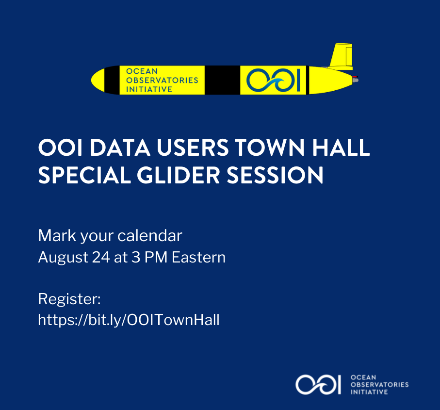
OOI Data Users Town Hall: Special Gliders Session Aug 24
OOI is seeking input from its data users. All are welcome to attend and contribute to an OOI Data Users Town Hall: Special Glider Session. The Town Hall will take place on August 24 AT 3 PM Eastern. Simply click here to register. We look forward to hearing your ideas.
Since Data Explorer’s inaugural launch in October 2020, OOI has been working with users of Data Explorer to learn what features worked for them, which could be improved, and what could be added to optimize users’ experiences. A version update (1.2) to the Data Explorer is now under development for release in early September. Among the new features include enhancements to the display and user interaction with underwater gliders.
During an upcoming Data Users Town Hall, August 24 at 3 pm Eastern, the new beta features will be demonstrated with the goal of soliciting feedback and suggestions from glider experts to ensure the tool meets users’ needs.
Here is a brief summary of the features that will be reviewed:
1) visualizations of glider previews alongside static instrument previews
2) searchable map interface for visualizing and downloading glider and discrete cruise data
3) mapping interface for finding and visualizing glider and discrete sample profiles that are within range of the selected instrument
Please register, mark your calendar, and see you soon.
Read More
OOI Data Center Transferred to OSU
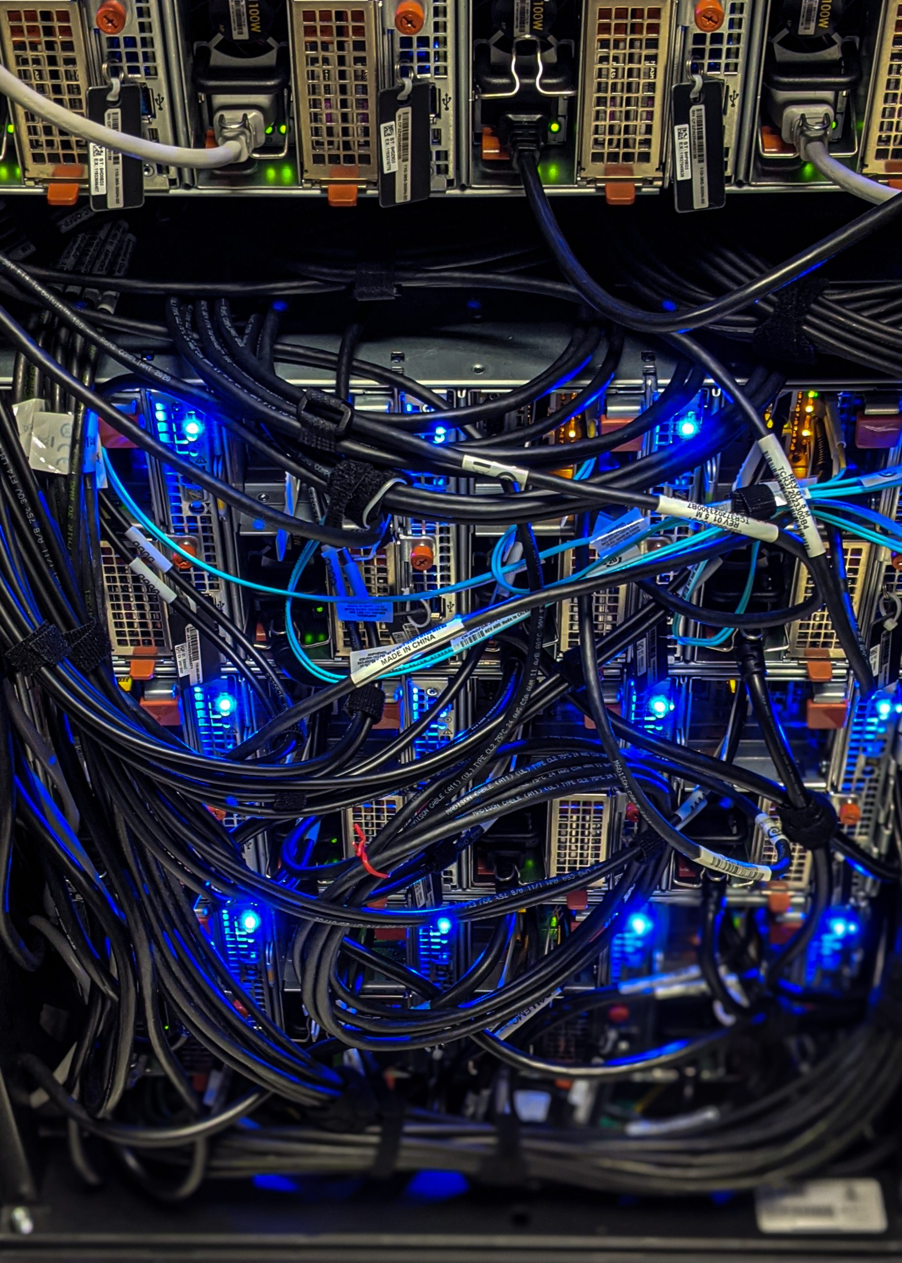
It’s official. As of Friday 30 July 2021, OOI data are now being stored and served on their new Cyberinfrastructure housed at the OOl Data Center at Oregon State University (OSU). The transfer of data from Rutgers, the State University of New Jersey, has been in the works since last October, when OSU was awarded the contract for the center.
“The transfer of 105 billion rows of data was nearly seamless, which attests to the collaboration between the OOI technical and data teams, said Jeffrey Glatstein, OOI Data Delivery Lead and Senior Manager of Cyberinfrastructure. “It literally took a village and we are grateful to the marine implementing organizations at the University of Washington, Woods Hole Oceanographic Institution, and Oregon State University for their part in making this transfer happen while data continue to be collected 24/7.”
OSU Project Manager Craig Risien added, “July 30, 2021 was the culmination of about ten months of working with our Dell EMC partners, the OOI Marine Implementing Organizations, and the OOI Cyberinfrastructure team to deliver a state-of-the-art and highly extensible data center to meet OOI’s present and future data handling needs. We are very pleased with how the data center migration project has proceeded, thus far.”
[feature][caption id="attachment_21888" align="aligncenter" width="519"]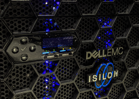 The primary repository of OOI raw data is the Dell EMC Isilon cluster, a scale out network-attached storage platform for storing high-volume, unstructured data. Photo: Craig Risien, OSU.[/caption]
[/feature]
OSU’s Data Center was designed to handle telemetered, recovered, and streaming data for OOI’s five arrays that include more than 900 instruments. Telemetered data are delivered to the Data Center from moorings and gliders using remote access such as satellites. Recovered data are complete datasets that are retrieved and uploaded once an ocean observing platform is recovered from the field. Streaming data are delivered in real time directly from instruments deployed on the cabled array.
“The OSU Data Center includes modern storage solutions, Palo Alto next-generation firewalls that ensure system security, and a hyperconverged ‘virtual machine’ infrastructure that makes the OOI software and system easier to manage and more responsive to internal and external data delivery demands, “ explained OSU Principal Investigator Anthony Koppers. “With this equipment now operational at OSU, we are well positioned to seamlessly serve the more than 1 PB of critically important data collected by the OOI to the wide-ranging communities doing marine research and education with ample space to grow well into the future.”
Read MoreTesting of New Glider Models Underway
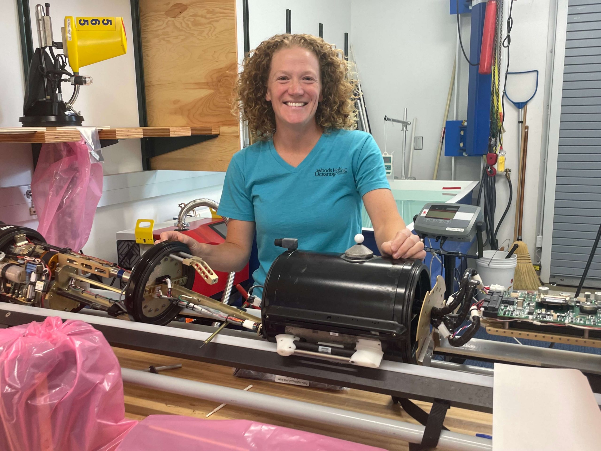
Last fall, the Coastal Endurance team conducted an initial test run of a Slocum G3 glider to determine its capabilities and operational differences to the G2 glider, currently used by the Endurance and Coastal & Global Scale Nodes (CGSN) teams. The test was prompted by glider vendor Teledyne’s announcement that it would no longer support the G2 glider past 2023.
Both the Endurance and CGSN teams have since expanded testing. The Endurance team recently completed a two-month deployment of a G3 glider, with plans to deploy another later this summer. The CGSN team, which operates the Pioneer and two global arrays, is testing three G3 gliders. One is being tested for use as a coastal glider at the Pioneer Array and the other two are being configured for the Irminger Sea and Station Papa global sites.
“Recent testing at the Pioneer Array was really valuable for us,” said Peter Brickley, CGSN Observatory Operations Lead. “We got a chance to see that our missions were workable, we found and made the changes that were needed, and we were also able to get a better estimate of how much energy these things were going to use.”
[media-caption path="https://oceanobservatories.org/wp-content/uploads/2021/07/IMG_3107-2-1-scaled.jpg" link="#"]Diana Wickman of the CGSN team at Woods Hole Oceanographic Institution is responsible for keeping the CGSN gliders operational. Here she has stripped the exterior of the glider to ensure that all internal parts are functional. Once refurbished, the gliders are tested in a water tank before being deployed at sea. Credit: Jade Lin ©WHOI.[/media-caption]The G3 gliders use more power than the G2 gliders, so the logistics of when and where they are deployed will require some adjustments. When powered by primary lithium batteries, for example, the G2 gliders can be deployed for about 90 days. The initial tests of the G3 gliders showed they could last in the water for around 75 days using primary lithium batteries. For trial runs using rechargeable batteries, the time in the water for the G3 gliders was reduced to about 30 days.
OOI is working with the vendor to evaluate operational alternatives to extend the operating window of the G3 gliders.
Improvements may require tweaking
“The rechargeable batteries are a really cool feature, but because they are about half of the energy density of the usual batteries, we’re going to have to adjust sampling schemes and plans for time in the water when we use the rechargeable batteries,” said Stuart Pearce, who works with the Endurance gliders. For now, the Endurance team intends to test the rechargeable batteries in the near shore gliders in the spring and summer when they can reliably get out to sea to recover and deploy the gliders.
G3 gliders also come equipped with larger volume buoyancy pumps than the G2 models in response to users’ feedback. “The gliders rise and fall in the water column by changing their volume and therefore density,” explained Pearce. “The new gliders have 800-1000 cubic centimeters of fluid volume to rise and dive with, compared to the 500 cubic centimeters of volume in the G2 gliders. This means that the G3 gliders can climb and dive in a greater buoyancy range.” One option being explored is whether power consumption can be reduced by adjusting the volume of the reservoir fluid needed to make the glider rise and fall.
The new G3 gliders incorporate some changes that address feedback from OOI and other users who have operated G2 gliders. “If you put anything in the ocean and use it as much as we do, you will find things that unexpectedly fail,” said Peter Brickley, CGSN Observatory Operations Lead. “We’ve been operating gliders since 2013, so we have lots of experience. In the early days, for example, we had a lot of problems with the digifin, the steering rudder that’s on the back of the vehicle. We worked closely with Teledyne to document and study this issue and they ultimately made needed improvements.” Other issues have been similarly addressed over the years.
Integrating the new G3 gliders into its Global Arrays may offer greater reliability as older G2 models are phased out. Diana Wickman, Senior Engineering Assistant II at Woods Hole Oceanographic Institution who keeps the CGSN gliders operational, explained “We need the equipment to work really well, and it needs to work for the entire year. At Pioneer, if we have problems, we can replace vehicles that are struggling with vehicles that we can refurbish in-house, but we simply can’t do that at the global sites.”
For now, the teams will continue with testing to make sure the new gliders will work for OOI’s purpose of long-term ocean monitoring.
OOI shares its glider data with the Integrated Ocean Observing System (IOOS) Glider Data Assembly Center and the OceanGliders project, which is a part of the Global Ocean Observing System (GOOS). Both serve as repositories for researchers interested in using glider data.
Read More
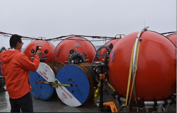
Global Station Papa Team Recovers Two Years of Data
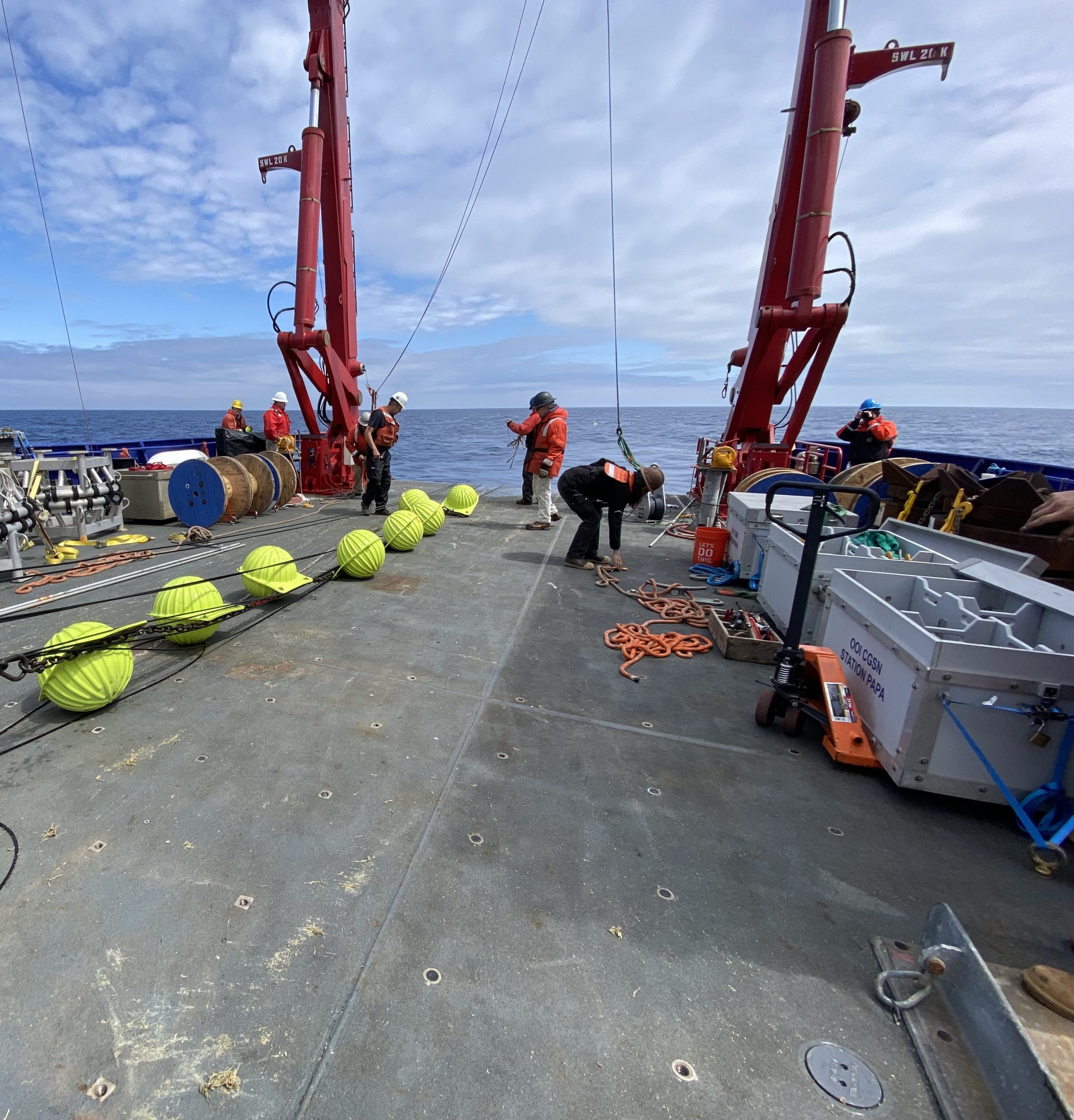
The winds seemed to have blown in favor of the Global Station Papa 8 team last month. Their mission to “turn” (recover old and deploy new) moorings went without incident, and two-years of data were recovered after COVID canceled the 2020 cruise.
On July 18, the seven members of the Station Papa 8 team set out aboard the R/V Sikuliaq from Seward, Alaska following a seven-day COVID isolation period. The weather was beautiful the first three days while in transit to Station Papa, located in the Gulf of Alaska in the Northeast Pacific, and weather remained favorable for work for the rest of the cruise.
Over the 16-day period at sea, the team successfully deployed and recovered two flanking moorings and one hybrid profiler mooring, and deployed and recovered two open ocean gliders. While on station, the team also conducted 11 CTD (conductivity, temperature, and depth) casts that help calibrate the instruments and validate the data they collect.
This eighth turn of the Station Papa Array was particularly important because the annual expedition to turn the array last year was canceled due to constraints imposed by the COVID-19 pandemic. Instrument data are downloaded upon recovery, and following a Quality Assessment/Quality Control (QA/QC) review, nearly two years of ocean observation data may have been recovered. As part of the review, OOI’s Coastal and Global Scale Node team will inspect the instruments for bio-fouling and reagent use to assess whether there was any significant impact to the data.
“We were really pleased to see that the instruments were still collecting and recording data, even after being in the water for almost two years,” said Kris Newhall, chief scientist of the Station Papa 8 expedition. “In spite of limited battery power and challenging conditions, most instruments continued to collect data for the duration of the two-year extended deployment.”
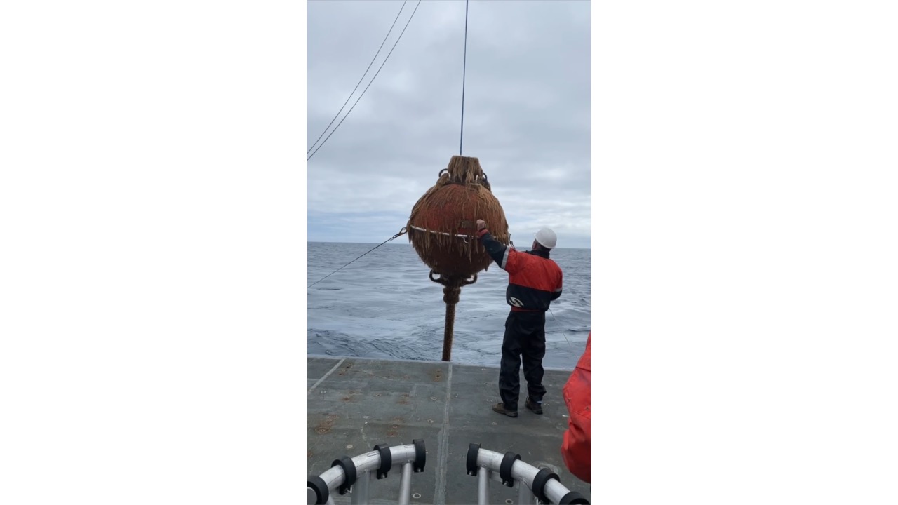
[embed]http://https://vimeo.com/585980063[/embed] [media-caption path="http://https://vimeo.com/585980063" link="#"]Shown above is the recovery of a Global Station Papa Array subsurface mooring by the team aboard the R/V Sikuliaq. The mooring was coated with marine life that had been growing there for the past two years. The team cleaned the mooring as the ship transited to its next station. Video courtesy of Bern McKiernan. [/media-caption]The periodic turning of the moorings present opportunities to incorporate design innovations into the arrays. The new moorings have improved controllers and new positioning beacons with GPS and flashers built into the housing, which will help increase performance and simplify recovery.
The team returned to Seward on August 2, then made their way back to their home port in Woods Hole, MA. The data retrieved from the moorings will help researchers investigate topics related to climate, ocean circulation, biological productivity, and ocean acidification in this important region of the Northeast Pacific.
Read More
CGSN Webinar 15 September
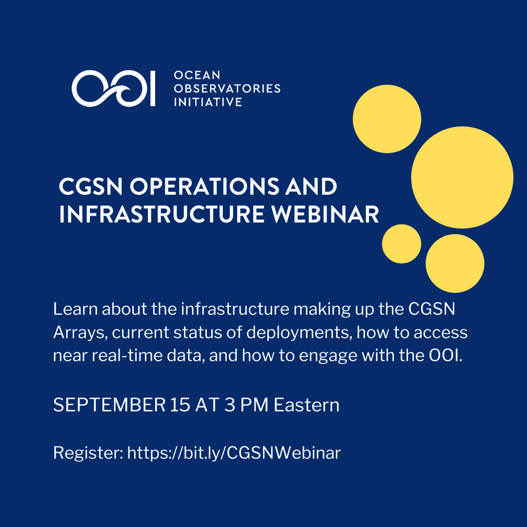
An informational webinar on the OOI Coastal and Global Scale Nodes (CGSN) will be presented on 15 September 2021 from 3:00-4:00 pm EDT. A presentation by the CGSN Team will be followed by a Q&A session.
Topics covered will include infrastructure making up the CGSN Arrays (Coastal Pioneer, Global Irminger Sea, and Global Station Papa), the current status of deployments, how to access near real-time data, and how to engage with the OOI.
Register here so you don’t miss out on the opportunity to meet the OOI CGSN Team and learn how you can work together.
Read More
Summer at Sea: Three Arrays Turned
This summer has been a busy time for OOI’s teams, who are actively engaged in ensuring that OOI’s arrays continue to provide data 24/7. Teams are turning – recovering and deploying – three arrays during July and August. The first expedition occurred earlier in July when a scientific and engineering team spent 16 days in the Northeast Pacific recovering and deploying ocean observing equipment at the Global Station Papa Array. The team recovered three subsurface moorings and deployed three new ones. They also deployed one open ocean glider, recovered one profiling glider, and conducted 11 CTD casts (which measure conductivity, temperature, and depth) to calibrate and validate the instruments on the array. After completing this eighth turn of the Station Papa Array, the team returned to Woods Hole Oceanographic Institution by way of Seward, Alaska on the second of August.
[embed]https://vimeo.com/580883575[/embed]On 30 July, the Regional Cabled Array team embarked on the first of four legs of its 37-day Operations and Maintenance Cruise aboard the R/V Thomas G. Thompson. The ship, operated by the University of Washington, is hosting the remotely operated vehicle (ROV) Jason, operated by Woods Hole Oceanographic Institution (WHOI). During the cruise, Jason will be used to deploy and recover a diverse array of more than 200 instruments from the active Pacific seafloor. The science, engineering, and ROV teams will be joined this year by 19 students sailing as part of the University of Washington’s educational mission (VISIONS’21). A live video feed of the ship’s operations and Jason dives is available for the duration of the cruises.
[media-caption path="https://oceanobservatories.org/wp-content/uploads/2021/07/r1472_elguapo.top_.web_-768x511-1.jpg" link="#"]The Regional Cabled Array team expects to share imagery as spectacular as this during its upcoming cruise. Shown here is the El Guapo hot spring, covered in life venting boiling fluids 4500 feet beneath the oceans surface. Credit: UW/NSF-OOI/CSSF; V11.[/media-caption]On 3 August, a team from WHOI boarded the R/V Armstrong for a weeklong transit to recover and deploy the Global Irminger Sea Array, off the Southeast coast of Greenland. The array is located in one of the most important ocean regions in the northern hemisphere and provides data for scientists to better understand ocean convection and circulation, which have significant climate implications. A science and engineering team will be deploying and recovering a global surface mooring, a global hybrid profiler mooring, two global flanking moorings, and three gliders (two open ocean and one profiling) during the three-week expedition. The team will also carry out shipboard sampling and CTD casts to support the calibration and validation of platform sensors while underway. A novel aspect of this cruise is that near real-time CTD profiles will be made publicly available during the cruise. The profiles will be evaluated by onshore staff, who will provide feedback to the ship, and share online assessment of CTD results.
“This summer’s at-sea activities are the culmination of months of planning, testing, and logistical work that goes on behind the scenes to make these expeditions possible,” said John Trowbridge, OOI’s Principal Investigator and head of the Program Management Office. “A tremendous amount of human effort and ingenuity is required to keep the arrays operational year-round, particularly in some of the ocean’s most challenging environments like the Irminger Sea and on the seafloor at Axial Seamount. The data collected, however, are essential, providing scientists with the tools needed to understand our changing ocean.”
The progress of the expeditions will be reported on these pages and on OOI’s social media channels.
[media-caption path="https://oceanobservatories.org/wp-content/uploads/2021/07/Irminger-Surface-mooring-.jpg" link="#"]A global surface mooring in the Woods Hole Oceanographic Institution stage area is outfitted and ready for deployment in the Irminger Sea Array. Photo: ©Jade Lin, WHOI[/media-caption]
Read More
OOI Facility Board Opening: Apply by Aug 15
The Ocean Observatories Initiative Facility Board (OOIFB) provides independent input and guidance regarding the management and operation of the National Science Foundation-funded Ocean Observatories Initiative (OOI). The OOIFB works to expand scientific and public awareness of the OOI, and ensure that the oceanographic community is kept informed of developments of the OOI.
The OOIFB is soliciting applications to fill one open membership position. The appointment will fill the remainder of an unexpired term and will be effective starting in September 2021 and run through June 2023. The selected individual will be eligible to serve a second term of 3-years. The OOIFB holds at least one in-person meeting per year and one web conference each month.
Scientists with experience using scientific observing systems, such as the OOI, are encouraged to apply. In an effort to maintain the expertise and disciplinary depth on the committee, we are particularly interested in applicants with research experience using data from the OOI Global Arrays. However, all interested applicants will be considered.
The responsibilities of the OOIFB may include, but are not limited to, the following:
- Serving as the prime scientific and technical conduit between the oceanographic community and NSF regarding OOI.
- Examining the accomplishments and work flow of the OOI Operator, in order to provide feedback regarding the OOI Annual Work Plans (AWPs).
- Via workshops, community meetings, and/or other mechanisms, stimulate and engage the user community in order to keep the accomplishments of the OOI at the cutting edge of scientific inquiry and technological innovation.
- Developing and implementing strategies to expand scientific and public awareness of the unique scientific and technological opportunities of the OOI.
Applications should be submitted to Annette DeSilva, at the OOIFB Administrative Support Office, and must include a letter of interest and an academic CV. Applications are due by August 15, 2021. Applications will be reviewed by the OOIFB, who will give due consideration to the qualifications of applicants, as well as the maintenance of gender, career level, discipline, and regional balance on the OOIFB. For more information about OOIFB and its activities, please visit the website or contact Kendra Daly, OOIFB Chair. The OOIFB Charter is available for review here.
Read More