News
Ride Along with Pioneer 17
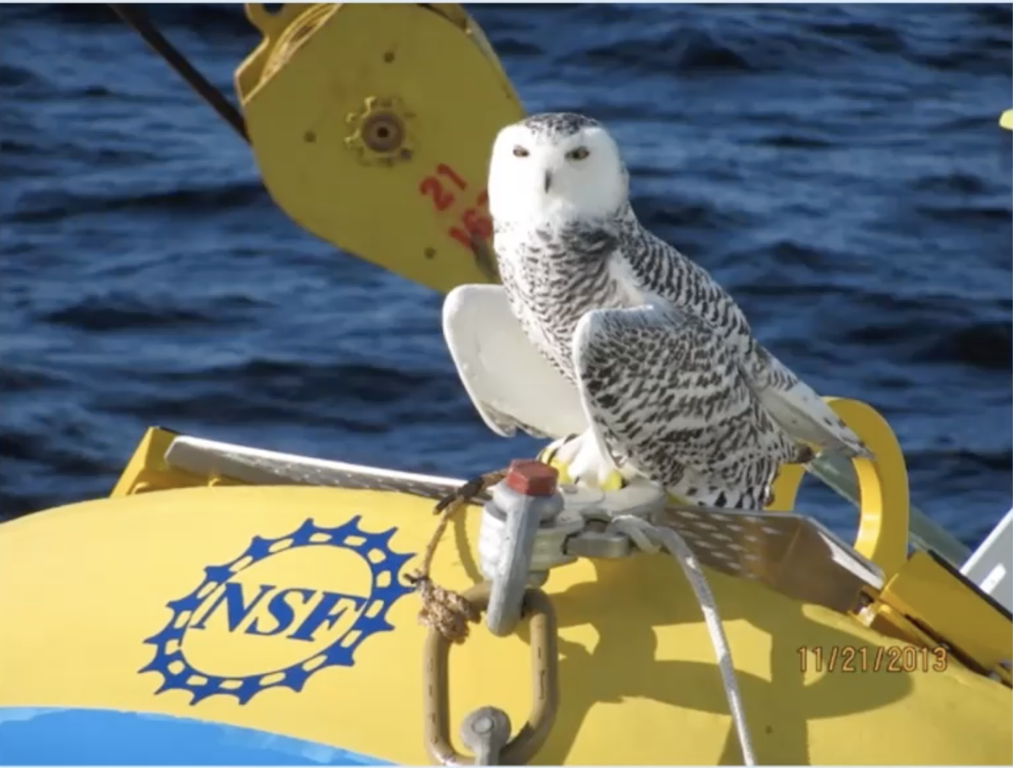
After a three-day weather delay, on Friday 29 October, the 14-member Pioneer Array science party will board the R/V Neil Armstrong in Woods Hole, MA and head toward the array, 75 nautical miles south of Martha’s Vineyard. The team will recover and deploy moorings and instrumentation to keep the array operational, collecting and sending data back to shore.
What’s novel about this mission is not only is it the 17th time the array will have been “turned,” but this time, you can follow along. Bookmark this link for regular updates of progress, conditions, and life at sea. The team promises a good ride along.
Read MoreNew Underwater Camera with Off-the-Shelf Components
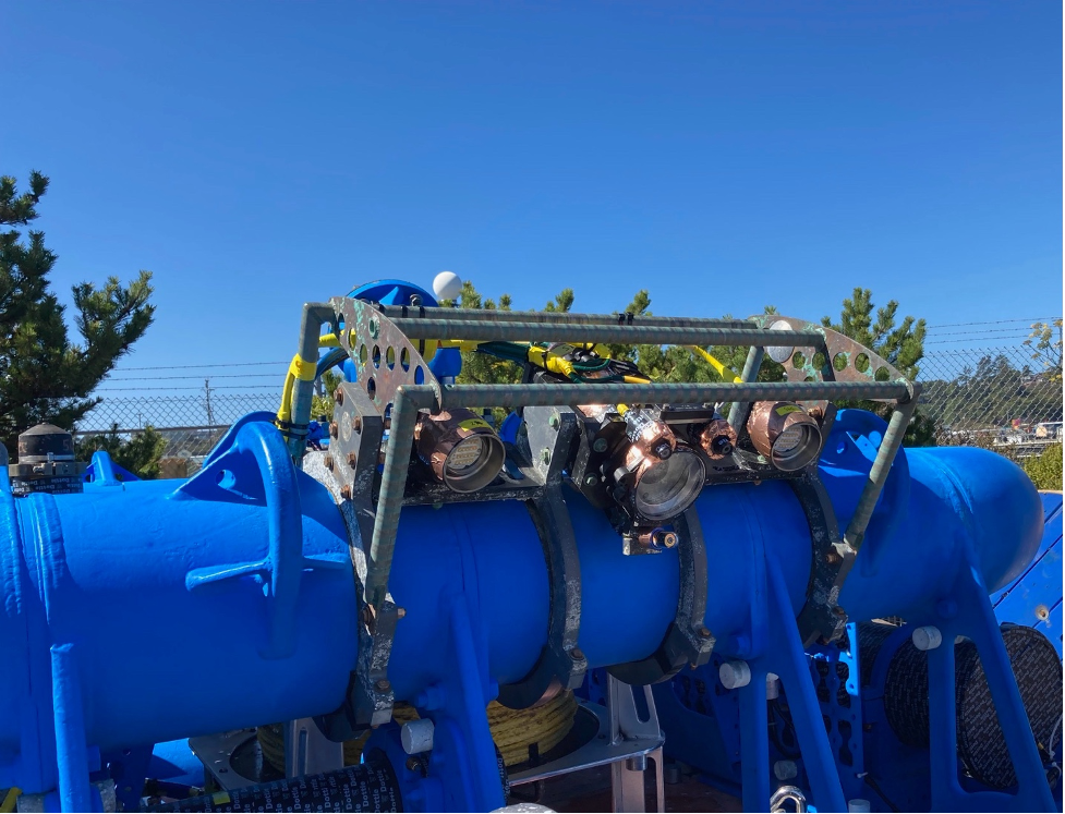
In September 2021, the Coastal Endurance Array began rolling out a much-needed upgrade to their underwater cameras. Endurance Array Innovator Chris Holm engineered a camera using off-the-shelf components to meet the specific needs of capturing environmental conditions and marine life in proximity to the Endurance Array moorings. The prototype was put in place on the inshore mooring (CE01) during the 15th turn of the Coastal Endurance Array.
[media-caption path="https://oceanobservatories.org/wp-content/uploads/2021/10/camera.png" link="#"]The newly configured Endurance Array underwater camera is attached to the inshore mooring, ready for deployment. Photo: Chris Holm, OSU.[/media-caption]The innovation came in multiple steps. Holm first tried to salvage the camera’s hardware and reprogram the camera with new software. He hit a snag, however, in that the motherboard that controlled the camera was no longer supported.
Since it didn’t make sense to rebuild the camera using an out-of-date motherboard, Holm looked into finding a new camera on the market. It had to be suitable for use underwater, with the capability to go into a low-power mode. “What is really needed for low-light conditions underwater is a camera with a large physical sensor, but with fewer megapixels,” explained Holm.
“Since the moorings run on battery power, the cameras need to be able to go into a very low-power sleep state in between taking photos,” said Holm. “If the sleep current is high, the deployment life is low. So, we were trying to find an off-the-shelf solution for a way to go into low power.”
After some searching, Holm obtained a Raspberry Pi High Quality Camera. Although the Raspberry Pi doesn’t come with native power management capabilities, Holm found he could use Sleepy Pi, an add-on-board from Spell Foundry that can power the Raspberry Pi on and off.
For its launch, the camera is programmed to autonomously take a burst of three images every four hours. The system can also take photos when triggered by a Data Concentration Logger (DCL) and can be partially configured remotely. Future iterations will be fully configurable remotely via the DCL.
The final touch to this first iteration was figuring out how to turn the lights and lasers on and off. Holm used a relay board from Waveshare Electronics to power the original systems lights and lasers. The lights adjust their brightness depending on the voltage being sent through a signal line which is controlled by the GPIO pins of the Raspberry Pi.
Altogether, the system is very suitable for the Endurance Array’s needs and is an extremely cost-effective, off-the-shelf solution. The cameras also can be easily swapped out if the Endurance team decides to upgrade the cameras.
Since this newly configured camera was put in place in early September, Holm said, it has been performing flawlessly, with the auto-exposure working well. Since this mooring uses a cell modem to transmit data, the team has been able to see the photos the camera is taking in near real-time. Once the formal approval process for the camera’s integration and use across the OOI is completed, Holm will be building more camera systems for the Endurance Array to deploy on the offshore and shelf moorings during the spring.
Since the cameras and its settings can be upgraded and/or optimized for different use cases, depending on what an investigator is interested in (such as marine snow or benthic organisms), Holm would like to hear from scientists about what they’d like the camera to focus on. He created a survey for data users interested in the underwater cameras.
“It would be very helpful to know what kind of data would be most useful to scientists using the system,” he said.
For those interested in seeing underwater, please complete the survey here.
[media-caption path="https://oceanobservatories.org/wp-content/uploads/2021/10/camera-output.png" link="#"]The Endurance Array team has the capability to adjust the settings of the underwater cameras based on researchers’ interests. In addition, some post-processing tools could be developed to sort images or extract useful information from them. Photo: Chris Holm, OSU.[/media-caption]
Read More
NERACOOS Makes Case for Ocean Observations
In an editorial opinion piece that ran in the Cape Cod Times and The Maritime Executive, Jake Kritzer, Executive Director of OOI’s partner organization Northeastern Regional Association of Coastal Ocean Observing Systems (NERACOOS), clearly and succinctly laid out the case for why ocean observing systems are so important and worthy of federal support. “Ocean infrastructure generates information that underpins our maritime economy, supporting navigation, safety and coastal resilience. We’re talking about the lighthouses of the 21st century.”
OOI data from the Pioneer Array are accessible on NERACOOS’ Mariner’s Dashboard, helping to provide a better picture of both current and long-term conditions on the New England Shelf. Together, this network of ocean observing systems is working to improve forecasting, enhance mariner’s safety, and ultimately helping to advance scientific understanding of ocean processes.
Read MoreKatie Bigham: From VISIONS Student to Co-Chief Scientist
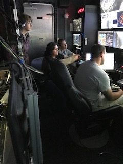
Katie Bigham feels like her journey with the Ocean Observatories Initiative (OOI) has come full circle. She first visited Axial Seamount as a University of Washington (UW) School of Oceanography undergraduate participant on the Regional Cabled Array (RCA) VISIONS 2014 program when the underwater observatory was being installed. This summer, she returned to Axial Seamount on her seventh cruise, this time as a Co-Chief Scientist.
[media-caption path="https://oceanobservatories.org/wp-content/uploads/2021/10/Katie_V15_byLauren_DSC_0069.sm-copy-scaled.jpg" link="#"]Katie Bigham on the R/V Thomas G. Thompson. Credit: L. Kowalski, University of Washington, V15.[/media-caption]Katie was excited to step into the role of Co-Chief Scientist on the fourth leg of the annual RCA operations and maintenance cruise (VISIONS’21). She previously participated in many other roles on the ship and was looking forward to a new challenge sailing as a Chief Scientist aboard a global class research ship.
Her responsibilities as Co-Chief Scientist included much planning and communication during the round-the-clock operations and numerous remotely operated vehicle dives. “It’s really about keeping everybody who’s invested in the voyage up to date, from the RCA team itself, to the Captain and crew, to the VISIONS’21 students, to the RCA team shore-side,” she says. Katie credits the success of leg four to the OOI RCA team aboard the R/V Thomas G. Thompson and strong shore support. “I felt well-supported in my first time as Co-Chief, and that helped me step up to the challenge,” she says.
Katie says the coolest part of being on the cruise was working with recent UW graduate Katie Gonzalez. She met the younger Katie when she went to visit her school for an outreach event in the far western reaches of the Olympic Peninsula and later mentored her in the lab for a year. “To see her very confidently and competently prepping the osmotic fluid samplers and then sharing with the ROV pilots what the goals of the installation dive were, and what was needed for this instruments deployment within and active vent site was really cool,” she says.
Katie Bigham grew up as the granddaughter of a commercial fisherman and spent a lot of time on the water, but she didn’t know that oceanography was something people studied until high school, when she interned with an oceanography graduate student at UW. The lab was very welcoming to her, and she attended the lab’s summer barbecues and dissertation defenses in between her work helping to culture Arctic bacteria.
After that experience, Katie initially wanted to study geology at Arizona State University, but she decided to stay closer to home and attend UW instead. When she remembered how welcoming the oceanography lab was, she decided to take oceanography classes, and that’s when things started coming together. Early in her college career, Katie took Dr. Deb Kelley’s hydrothermal vents class and came away from it wanting to see the underwater hot spring environments in person and work with Dr. Kelley and the OOI team.
“Deb bringing me onboard as a VISIONS student and then mentoring me through that process was what helped me know I wanted to stay in oceanography,” Katie explains. “I was really inspired by her research and her work with students, and I’d really like to continue in academia because of her influence. I wouldn’t be doing the things I’m doing without all her support.”
[media-caption path="https://oceanobservatories.org/wp-content/uploads/2021/10/20210903_100228_01-scaled.jpg" link="#"]VISIONS’21 Leg 4 students and participants. Credit: M. Elend, University of Washington, V21.[/media-caption]Katie is currently pursuing a joint PhD at the Victoria University of Wellington and the National Institutes of Water and Atmospheric Research in New Zealand. She is continuing with deep-sea science, researching the impact of turbidity currents, or underwater landslides, on benthic communities living in submarine canyons. This work builds on some of the work she did for her undergraduate senior thesis mapping megafauna at methane seeps along the RCA. Katie hopes that her research will be helpful for management of marine protected areas in New Zealand and inform about impacts in other marine canyons, such as those on the Cascadia Margin.
Katie returned to Washington from New Zealand during the COVID-19 pandemic. She has been able to continue her writing and data analyses while abroad from an office within the RCA space. Ironically, thanks to the pandemic, she was able to participate in this year’s RCA cruise.
After she obtains her PhD, Katie hopes to continue her research as a postdoc. “I would really like to bring what I’ve learned during my PhD and my experiences with the RCA back together,” she comments. “I’d love to do a postdoc working with RCA data.”
[embed]https://youtu.be/_YOsgNNLOP8[/embed]
Katie Bigham also played an instrumental role in the production of this video that was a project for the VISION’14 class. It was selected as one of the top ten videos in a nationwide contest sponsored by the Florida Center for Ocean Sciences Education Excellence. The video has been viewed by nearly 38,000 student judges in 1,600+ classrooms in 21 countries.
Read More
Rocky Seas Didn’t Deter Endurance 15’s Success
In spite of rocking seas, a generator in need of repair, and a medical delay, the Coastal Endurance Array team successfully completed its mission to turn the array for the 15th time, achieving all of its science objectives.
Weather conditions in the northern Pacific were less-than-ideal for two of the three legs of the two-week expedition. At one point, winds speeds of 25-30 knots, with accompanying waves of up to 10 feet, caused a weather delay in operations and subsequent alterations in cruise plans.
“While it was comfortable to be aboard the R/V Thomas G. Thompson even in such conditions, sea conditions were borderline for entering or exiting Newport and deploying or recovering most platforms, “explained Chief Scientist Jonathan Fram, who led the 10-member science party. “Fortunately, we had good weather during the first leg of the cruise, which gave us some leeway to address weather-related downtime and other delays during latter legs of the cruise. We were able to switch the order of some activities, delay some deployments, and ultimately got most everything in and out of the water as planned during our time at sea.”[media-caption path=”https://oceanobservatories.org/wp-content/uploads/2021/09/Screen-Shot-2021-09-28-at-5.20.52-PM.png” link=”#”]When seas were calm, the team was able to deploy moorings like this one. After deployment, they headed back to port with a deck full of recovered equipment.[/media-caption]
The team successfully deployed and recovered six surface moorings, four gliders, and two profilers. They also recovered two additional profilers and an anchor from 2020. In addition, the team conducted CTD water sampling and also conducted sampling for researchers with instruments on Endurance Array moorings. The team succeeded in collecting fouling communities growing on buoy panels for researcher Linsey Haram of the Smithsonian Institution and organisms on devices attached to two multi-function nodes for Oklahoma State researcher Ashley Burkett.
While in the roaring sea, the team tested potential instrument replacements and new sampling strategies. They also assessed first-time implementation of technical improvements including a new solar panel frame to prevent sea lions from unplugging the panels, an underwater camera constructed with off-the-shelf replacement parts to ensure longevity and resilience, and a stretch hose from a new manufacturer with a slightly different design than previous versions.
“In spite of having to repeatedly change our plans,” adds Fram, “we were pleased to be able to meet all of the cruise objectives. The ocean in the Pacific Northwest is too harsh for scientists to go to sea often in fall and winter, so it is important to refresh this array of autonomous platforms that will keep recording and delivering data during rough times.”
Read MorePioneer Relocation Update 2021-09-29
The Pioneer Array, currently sited on the New England Shelf (NES), was conceived within OOI as a re-locatable, coastal array (OOI Science Plan, 2001; OOI Science Prospectus, 2007). At the Fall 2020 American Geophysical Union meeting, the National Science Foundation announced the start of a process for relocation of the Array. After a variety of community engagement activities and two intensive Innovations Labs, it was determined that the Pioneer Array will be relocated to the southern Middle Atlantic Bight (MAB). Existing infrastructure, with some modifications, will be utilized to create a new Array to address compelling science questions at the new site.
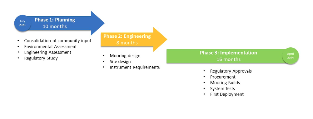
The OOI Program is consolidating the community input and preparing for Pioneer relocation activities. The overall effort is complex, and will span roughly 30 months. In order to provide a window for these efforts within the existing operational budget, there will be a pause in Pioneer field activities. Preliminary plans are for the final recovery of the NES Pioneer Array in the fall of 2022 and the initial deployment of the MAB Array in the spring of 2024. The figure below shows the anticipated timeline, with three main phases. Phase 1 will focus on preparatory activities, including environmental and engineering assessments, and a study of regulatory requirements. During Phase 2, the bulk of the engineering and design effort will be conducted. During Phase 3, environmental compliance and permitting will be completed, along with the preparation of the infrastructure for deployment.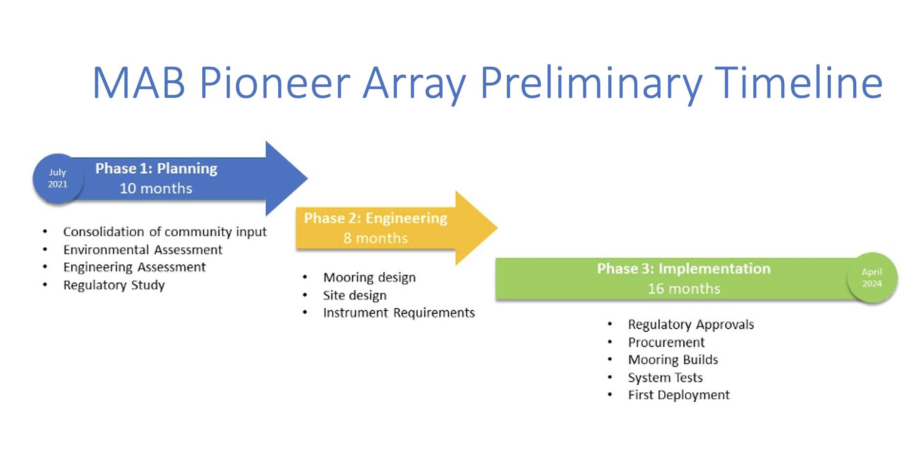
Read More
New Round of Improvements for Data Explorer
The OOI Data Team continues to listen to data users’ feedback to refine and improve Data Explorer. Many of those improvements are reflected in the latest release of Data Explorer, version 1.2, which is now operational. Data Explorer was originally released in September 2020, and this latest version is the second round of improvements made by Axiom Data Science, working with the OOI Data Team.
This version makes more OOI data accessible online and brings new features for gliders and profilers. It is also now possible to search for cruise data in the tabular search interface. Once there, you can select specific cruises, see their data profiles, and have a three-dimensional view of where the samples were taken. Glider data are also now available online and searchable by time and location. Once you’ve identified a glider of interest, it is possible to map or plot the glider’s route and compare data collected with data from other sensors. With another click, you can compare sensor data with profiler information, then change the parameters on the screen to learn more.
All data can be downloaded in csv, GeoJSON, KML, and ShapeFile formats for future use.
Additionally, discrete sample data (chemical analyses of seawater collected during shipboard verification sampling) have been added. Water samples are collected during OOI cruises at multiple depths, and analyzed for oxygen (Winkler), chlorophyll-a fluorescence and pigment distribution, nitrate/nitrite, and potentially a full nutrient suite, total DIC (dissolved inorganic carbon) and total alkalinity, pH, and salinity. These data can be used to compare to in situ instrument data or CTD casts in order to ensure OOI data quality. It is now possible to use Data Explorer 1.2 to convert discrete dissolved oxygen sample data from milliliters to micromoles and create standard_name mapping for discrete sample data.
In response to users’ feedback, many defects found in version 1.1 have been fixed. A summary of all the new features and bug fixes is available in the release notes.
“Data Explorer is a tool that allows users to access, manipulate, and understand OOI data for use in their research and classroom,” said Jeff Glatstein, OOI Data Delivery Lead and Senior Manager of Cyberinfrastructure. “Users’ feedback has been—and will continue to be— extremely useful in refining Data Explorer to ensure it meets users’ need and expectations. We are holding regular open meetings as one way to ensure that we receive timely feedback and work with our users to meet their needs.”
An open OOI Town Hall previewing some of the new and special glider-related features was held on 24 August 2021, where user input was welcomed. A recording of the session is available here.
Read MorePosition Opening: NSF OOI Program Director
Irminger Array Successfully Turned 8th Time
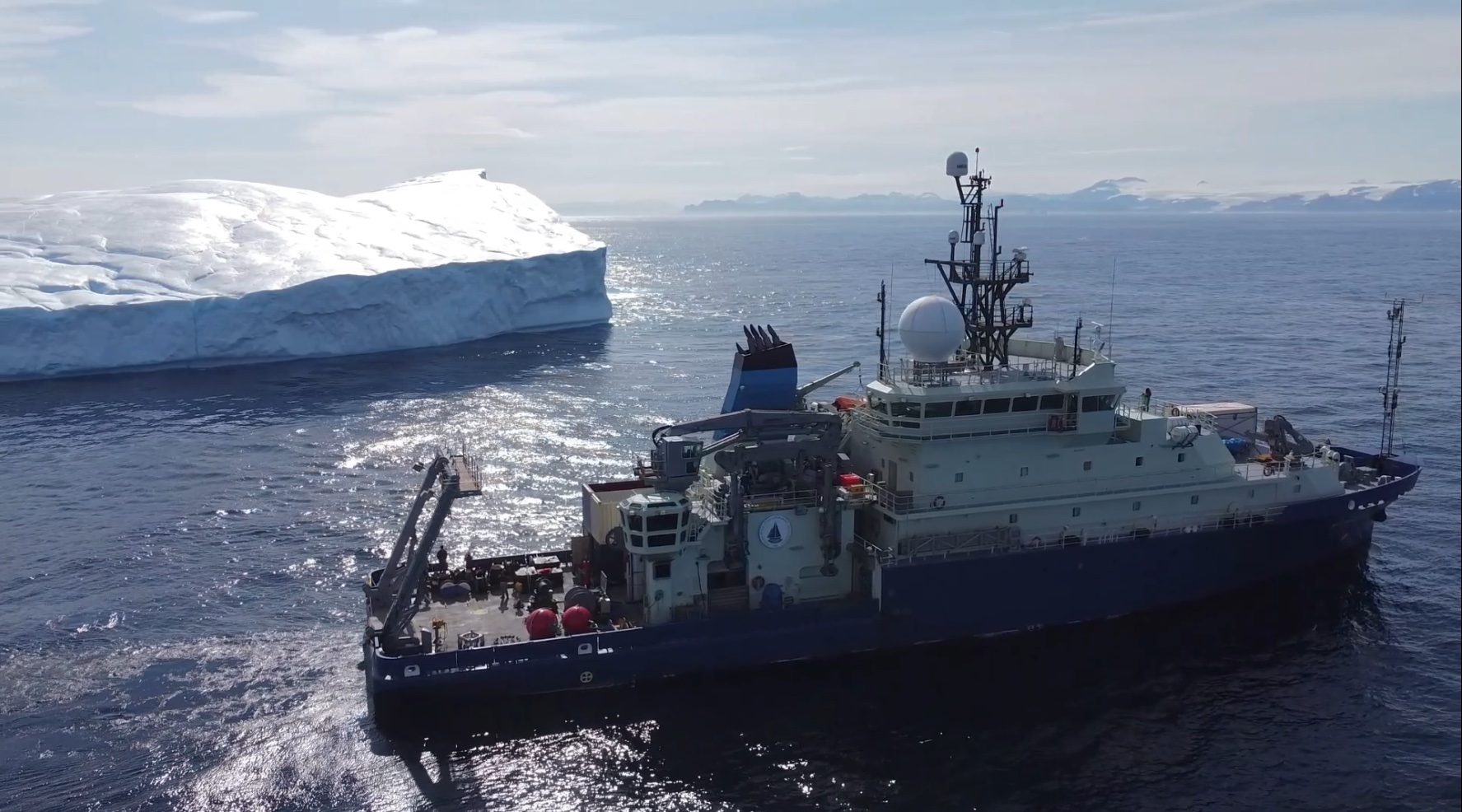
The Irminger 8 Team successfully wrapped up the eighth turn of the Global Irminger Sea Array on 26 August when the R/V Neil Armstrong docked in Reykjavik, Iceland. After a few days of demobilization, the 10 members of the science party were free to head home after showing proof of a negative COVID test 72 hours before boarding a flight back to the U.S.
Chief Scientist John Lund led the science party of 10 in completing all of the expedition’s objectives. Over the course of 26 days at sea, they recovered four moorings and deployed four new moorings in their place. The team also deployed three gliders—two Open Ocean and one Profiling—and recovered a glider that had been in the water since 2020 and whose battery supply was rapidly depleting.
[media-caption path=”https://oceanobservatories.org/wp-content/uploads/2021/08/Armstrong-and-Iceberg-e1629493552453.jpg” link=”#”]The Irminger Sea presents challenges of high winds, strong waves, and icebergs as shown here with the R/V Neil Armstrong in the foreground. Credit: drone video, Croy Carlin SSSG. [/media-caption]One highlight of the trip was engaging in scientific outreach with a class of fourth graders. The team connected with the students while out on the open ocean via Zoom. The oceanographers aboard the ship each had a chance to share what it’s like being on an oceanographic voyage and explain the purpose of the different instruments and sensors on the arrays. Another highlight of the expedition was the OOI team’s ongoing collaboration with OSNAP (Overturning in the Subpolar North Atlantic Program). While OSNAP participants were not onboard the Armstrong as in the past, their shore-based presence was clearly in evidence. Expert hydrographer Leah McRaven worked with the onboard team to adjust CTD (Conductivity, temperature, depth) sampling to ensure that new CTD equipment was calibrated and sampling properly.
The science team also added a novel twist to the regular shipboard sampling that supports field calibration and validation of the platforms and sensors in the arrays. During Irminger 8, the shipboard team worked with OOI’s onshore data team to make collected CTD data available online in near real-time. As an added bonus, McRaven shared her insights about CTD sampling in regular blog posts here.
The Irminger 8 Team took full advantage of being in this critical ocean region, which is sensitive to climate change. During transit from Woods Hole to the array, off the southeast coast of Greenland, the team deployed surface drifters and ARGO floats for the Greenland Freshwater Project, which is studying the impact of freshwater runoff from Greenland’s melting ice sheet on the North Atlantic and Arctic climate. The team also deployed a biogeochemical ARGO float for the Global Ocean Biogeochemistry Project, and took a series of CTD casts on behalf of OSNAP, to add to long term data collection efforts in this critical region. In addition, the team deployed two RAFOS floats for the Madagascar Basin Project to measure deep water circulation and 15 Sofar Spotter buoys to measure wind, wave, and temperature data.
“In the ideal, science is a collaborative process,” said Chief Scientist John Lund. “During transit time to and from the array, we were able to help our scientific partners get their equipment in the water. The data provided will help advance understanding of this critically important region, which is equally difficult to sample. The region has high winds, large, steep waves, strong currents, icebergs, and consequent equipment icing.”
Given the challenges of the ocean environment at these latitudes, the eighth turn of Irminger Array included equipment improvements. The newly deployed surface moorings included wind turbine modifications to help it withstand strong, volatile winds, and it also incorporated other structural modifications to strengthen the mooring, while easing refurbishment. Similarly, design modifications were made to the subsurface moorings to help ensure consistent, long-term data collection.
The team experienced some of these challenges of high winds and strong waves while on the cruise, but the rough conditions were compensated by the gorgeous scenery of the region. Added Lund, “One afternoon, the sun came out as the ship transited further up Prince Christian Sound. Everyone was awed by the beauty of the landscape. We saw glaciers, icebergs and the occasional whale.”
Prior to leaving the Sound, the team secured all the items for the transit to Reykjavik, the demobilization of the ship, and finally the journey home to Woods Hole.
Read More
37-day RCA Cruise Met All Objectives and More
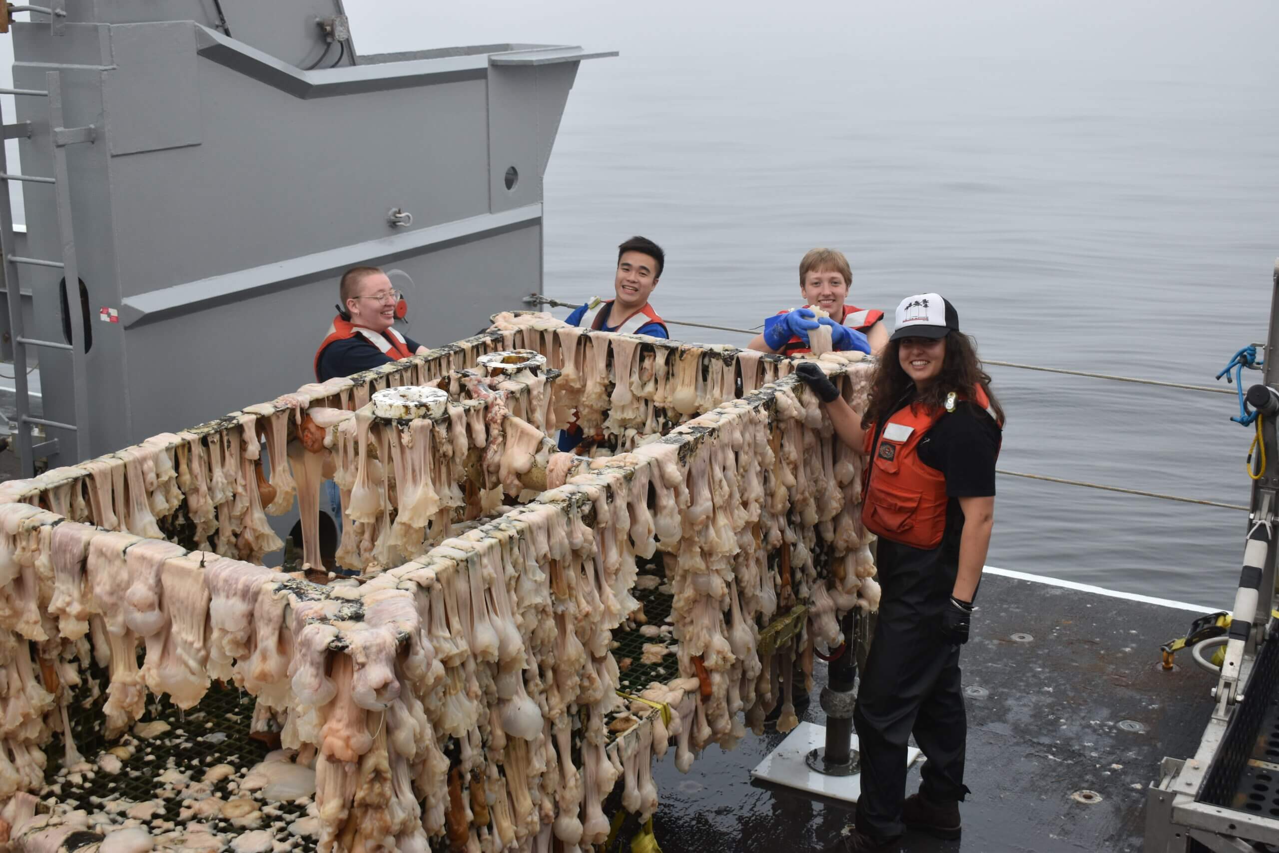
This summers’ Regional Cabled Array (RCA) 37-day expedition was one of the most complex of the seven annual Operations and Maintenance cruises to date. Not only was the expedition impacted by COVID restrictions, but it also included four Legs, a full contingent of engineers, scientists, students, and the Jason team, as well as coordinated ship operations with the R/V Thompson, the IT Integrity cable support ship, and the Ocean Exploration Trust ship the E/V Nautilus. However, thanks to the hard work of the RCA staff, and amazing support from the R/V Thompson (Captain Dave Vander Hoek) and ROV Jason teams, (Expedition Leads Ben Tradd and Mario Fernandez) the expedition was highly successful with the completion of all scheduled tasks…and more.
The expedition was led by Chief Scientists Mike Vardaro (Leg 1) and Orest Kawka (Legs 2-4), and Co-Chief Scientists James Tilley (Legs 1-3), Wendi Ruef (Leg 1 – this was the first time Ruef has sailed as a Co-Chief Scientist), Mike Vardaro (Leg 2), and Katie Bigham (Leg 4). Katie will receive her Ph.D. in 2022 from the University of Wellington, NZ. This cruise provided her a strong early career foundation for becoming a future Chief Scientist. James Tilley was the lead engineer and Larry Nielson led shore support.
COVID safety protocols significantly increased cruise complexities, which included the verification of full COVID vaccination status for all ship and science party members, ensuring that all participants sheltered-in-place, and the arrangement of COVID tests spanning both Washington and Oregon testing sites. The RCA team is highly appreciative of the exceptional support that the UW Marine Operations group provided to ensure our safety, the dynamics of crew changes, and modification of dock-side logistics in response to IT Integrity and E/V Nautilus operations.
[media-caption path=”https://oceanobservatories.org/wp-content/uploads/2021/09/PD01A_20210821_084428_recovery-scaled-1.jpeg” link=”#”]The Slope Base Deep Profiler Mooring comes aboard the R/V Thompson. Credit: M. Elend, University of Washington, V21. [/media-caption]Highlights: During the four Legs, just over 200 RCA Core and PI instruments were recovered/deployed, the Platform Interface Assemblies and Science pods on all three Shallow Profiler Moorings were turned, Deep Profiler vehicles were turned at the Oregon Offshore and Axial Base sites, and the Deep Profiler mooring was turned at Slope Base. Of particular note, the southern cable line was repaired, resulting in the return of full operational status for Primary Nodes PN1C and PN1D, providing communications and data flow once again to/from the Oregon Offshore and Shelf sites.
Over the 37 days of staging, mobilization, and demobilization for the four Legs, twenty 48 ft trailers transported 394,000 pounds of RCA equipment to and from Seattle, WA and Newport, OR. Onboard staffing included twenty-one RCA scientists and engineers, 13 ROV Jason crew, 16 students, 1 postdoc, and an artist, as well as two research scientists. During the 30 at-sea days, including two to aid in the recovery of the Ocean Exploration Trust ROV Hercules and Argus vehicle from the Endeavour Segment of the Juan de Fuca Ridge, the R/V Thompson transited ~1775 miles, 49 Jason dives were completed traversing a total of~ 125,000 meters of the water column, seven CTD casts with water sampling were completed spanning maximum cast depths of 200 m to ~ 2900 m, and two EM302 bubble plume surveys were conducted over methane seep sites at Southern Hydrate Ridge and Pythias Oasis. Finally, a new, highly active methane seep area was discovered east of the novel Pythias Oasis vent site, which has been continuously venting since its discovery in 2014.
PN1B: During Legs 1 and 2, significant and dynamic coordination was required to ensure that the R/V Thompson and C/S Integrity operations (lead by APL Engineer Chuck McGuire) were tightly coupled and that shore cranes and trucks were in place for mobilization and demobilization of both the RCA cruise gear and that associated with the recovery-repair of Primary Node PN1B. Three dives (August 5: J2-1342, and August 10-11: J2- 1342, and J2-1354) were dedicated to disconnection of cables, preparation of PN1B for recovery, and recovery of a ½ frame deployed by the Integrity, which was utilized for installation of the recovery line. The R/V Thompson-ROV Jason operations went well. Although the replacement PN1B installation could not be completed, the cable Segments 2-3 were joined and then successfully installed on August 23 – reinstating power and communications to Primary Nodes PN1C and PN1D. Unfortunately, the Southern Hydrate Ridge site will remain offline until next year, when PN1B can be reinstalled. However, joining of the segments allowed 76% of the instruments to go live again that had been offline since August 2020, as well as the Shallow Profiler and Deep Profiler moorings and BEP at the Oregon Offshore site, and the BEP and other seafloor instruments at the Oregon Shelf site.
VISIONS’21: Once again, live streaming of video and updates on the cruise were provided on the interactiveoceans website as part of the UW- RCA VISIONS’21 engagement efforts and highlights were provided on Instagram and Twitter. The 16 undergraduates that participated on the cruise worked four-hour shifts in the ROV control van, they learned how to process and analyze CTD samples, and they helped with cleaning of recovered RCA equipment (a big hit). Their enthusiasm permeated the team and their hard work contributed significantly to the cruise. We were grateful to have a resident watercolor artist onboard who shared aspects of the cruise and seafloor and biological observations through her eyes. The students shared their experiences through blogs and for many it changed their lives – a few examples of their impressions:
I found this to be a once in a lifetime opportunity and [it] offered me a broader perspective of how much preparation and consideration goes into the planning and execution of the research projects being facilitated through the OOI VISION’s expedition. It opened my eyes to the full circle of science.
This has truly been one of the coolest experiences I’ve had …. after 4 quarters of zoom classes and online labs, I’ve been so happy to finally get a feel for oceanographic research out in the field and to work with the instruments I’ve been learning about for a year and a half.
As a kid, I watched documentaries about the deep sea and imagined myself descending into the depths with the camera, sometimes sitting in a cardboard box “submarine” that I made. Being here and getting to work in the Jason van feels like accomplishing some part of that dream, and I’m very grateful to have had the opportunity to come on this trip. I’ve also come away with a better idea of how data are collected at sea, and in speaking with the scientists onboard I’ve gained a better understanding of how one goes about getting into the field.
Externally Funded Projects: The 2021 program was also another successful field season for turning, and installation, and recovery of instrumentation, and for science programs funded outside of OOI. This work included:
- The turning of NSF-funded CTDs at the ASHES hydrothermal field and at the Eastern Caldera sites, as well as installation of a new CTD at Central Caldera at the summit of Axial Seamount (W. Chadwick, Oregon State University – OCE 1928282 “Phase 2 of Enhancements to the OOI Cabled Array at Axial Seamount”). [1-day]
- The reinstallation of the University of Bremen-Germany-funded cabled overview multibeam sonar for imaging of all methane plumes at Southern Hydrate Ridge (G. Bohrmann and Y. Marcon -University of Bremen – Sonar monitoring of natural release of methane greenhouse gas from the seafloor – A contribution to the understanding of global change), the 4K camera, and turning of a CTD. [1-day]
- Installation of an NSF-funded new Pinnacle ADCP at the Central Caldera site to provide, for the first real-time, monitoring of currents throughout the entire ~1500 m water column (D. Manalang and D. Kelley, University of Washington – OCE 2129943 “RAPID: OOI-Industry Partnership to Install a Cabled 45 kHz ADCP at Axial Seamount Caldera”). This effort is in partnership with Teledyne Marine.
- Recovery of a NSF-funded self-calibrating pressure sensor at the geodetic-focused Central Caldera site (William Wilcock, University of Washington – OCE 1634103 – “A Rotating Tiltmeter for Marine Geodesy: Development and Testing at Axial Seamount on the Ocean Observatories Initiative Cabled Array”).
- A NSF-funded dive to complete site characterization, based on an ~ 1 m resolution bathymetry Sentry map, of the Pythias Oasis ridge. The dive focused on a “gully” that runs parallel to the ridge and s significant depression at the termination of the ridge (D. Kelley, University of Washington – OCE 1658201 “Collaborative Research: Pythia’s Oasis – Access to Deep Subduction Zone Fluids”). Pythias Oasis is venting fluids unlike any yet discovered in the world’s oceans. They are likely sourced at/near the plate boundary. Evidence of additional sites of seepage were discovered. [1-day]
- Three dives funded by the Bureau of Ocean Energy Management (D. Kelley, University of Washington – M21AC00009-00 “Arctic Marine Mineral Exploration – Ramen Laser Spectroscopy Validation”) at the ASHES hydrothermal field in support of the NASA InVADER program. Major and gas-tight vent fluids and several sulfide samples were recovered, and a couple microbial incubation experiments were deployed [1-day].
Recovery of the ROV Hercules and Argus Vehicle: On August 26th, the Ocean Exploration Trust ROVs Hercules and Argus became detached from the tether on the E/V Nautilus working east of the Main Endeavour Field (MEF) on the Endeavour Segment of the Juan de Fuca Ridge (2220 m). After a flurry of phone calls and Zoom meetings, the R/V Thompson, RCA, and OET (Expedition Lead Allison Fundis) teams came together for a community effort to recover the vehicles. The R/V Thompson transited ~ 10 hrs north to the MEF where there were two Jason dives to facilitate the September 2 successful recovery of the vehicles back onboard the E/V Nautilus. The effort required extension of the RCA cruise by two days, and it was a weary team that pulled back into Newport on September 3. Demobilization was complete on September 4th.
Read More