
Posts Tagged ‘Cruise’
Array Enhanced Understanding of Complex Southern Ocean
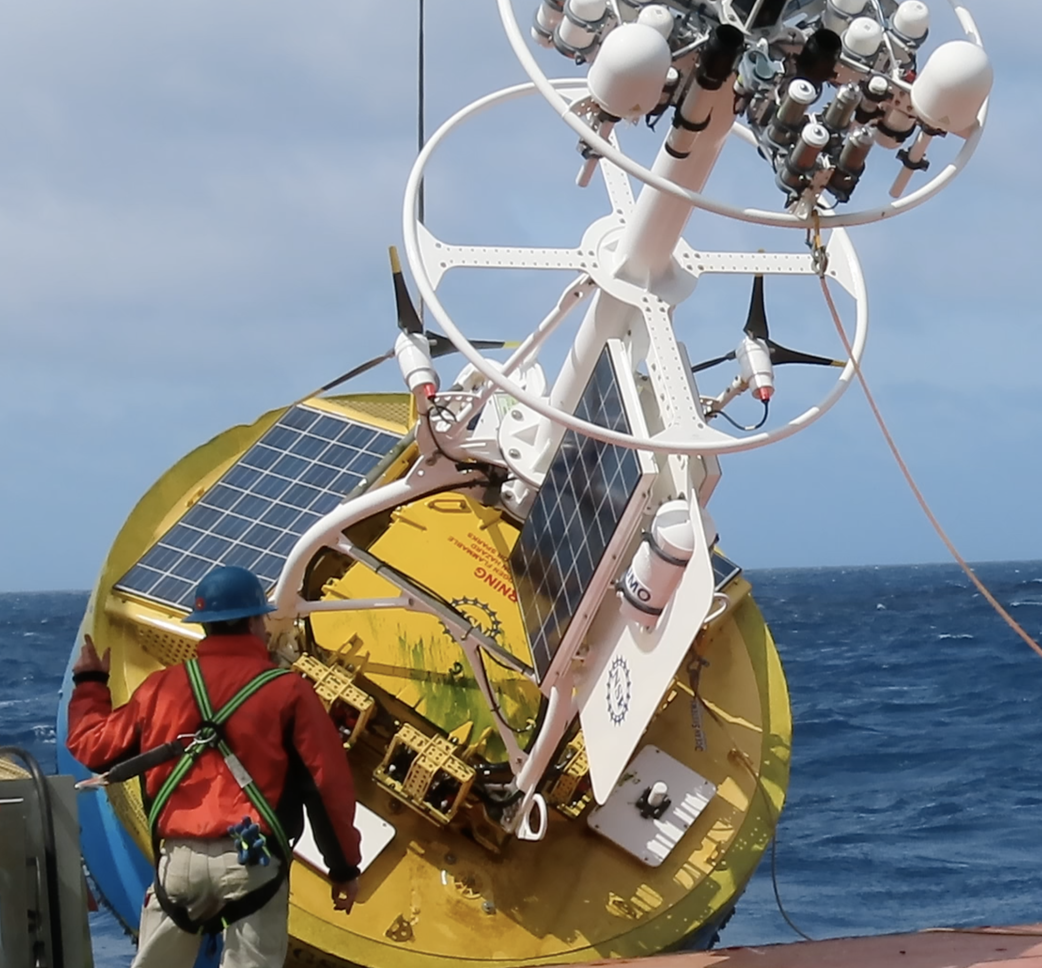
Five years of data have made a significant difference in understanding of the complex processes occurring in the remote and hostile conditions of the Southern Ocean. In its five years of deployment, OOI’s Southern Ocean Array has provided critical data that enhanced weather modeling and forecasting, while providing means to study the mechanisms behind Southern Ocean warming and the storage of carbon at depth.
Four OOI moorings were deployed in February 2015 in a very sparsely sampled area in the Southern Ocean (55 degrees South, 90 degrees W) with the goal of helping modelers, forecasters and scientists understand this dynamic and volatile environment. One mooring was decommissioned in 2017. Two bottom halves remained in place through 2018 and a single surface mooring remained in place through January 2020. Collectively, these deployments provided a continual treasure trove of data to scientists, modelers, and forecasters.
This data stream is particularly important because the Southern Ocean is not only warming faster than other parts of the world ocean, it has also been implicated as the major region for ocean uptake of carbon dioxide.
“Collecting continuous data in this sparsely sampled region has provided a groundtruth point to help refine climate models and weather forecasts, and better understand complex processes occurring in the Southern Ocean,” said Dr. Sheri N. White, lead systems engineer for the Coastal Global Scale Nodes of OOI at Woods Hole Oceanographic Institution and chief scientist on the 2018 and 2020 OOI expeditions that recovered the Southern Array.
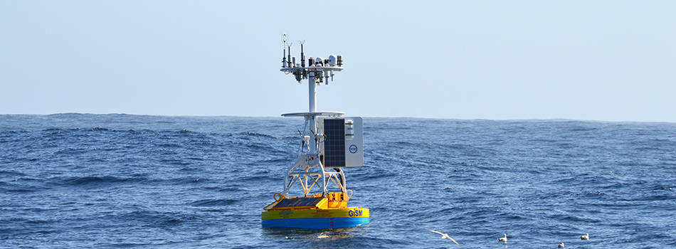
The benefits of deployment were evident. When the moorings were first deployed in 2015, data were not initially integrated into the World Meteorological Organization’s Global Telecommunication System (GTS). In August 2017, when the data were added to the GTS, making them more easily accessible for weather forecasters and modelers, they had an almost immediate impact on forecasting by the European Centre for Medium-Range Weather Forecasts (ECMWF). In August 2017, for example, OOI’s Surface Buoy picked up a low-pressure system moving through the area. Integrating these data into forecast models, researchers filled in some key spatial gaps in their observational coverage, reducing the error in 24-hour forecasts. With improved data, ECMWF was better able to forecast the next huge Southern Ocean storm with a central pressure around 955 mb that had simultaneous major impacts on southern South America, Drake Passage, and the Antarctic Peninsula.
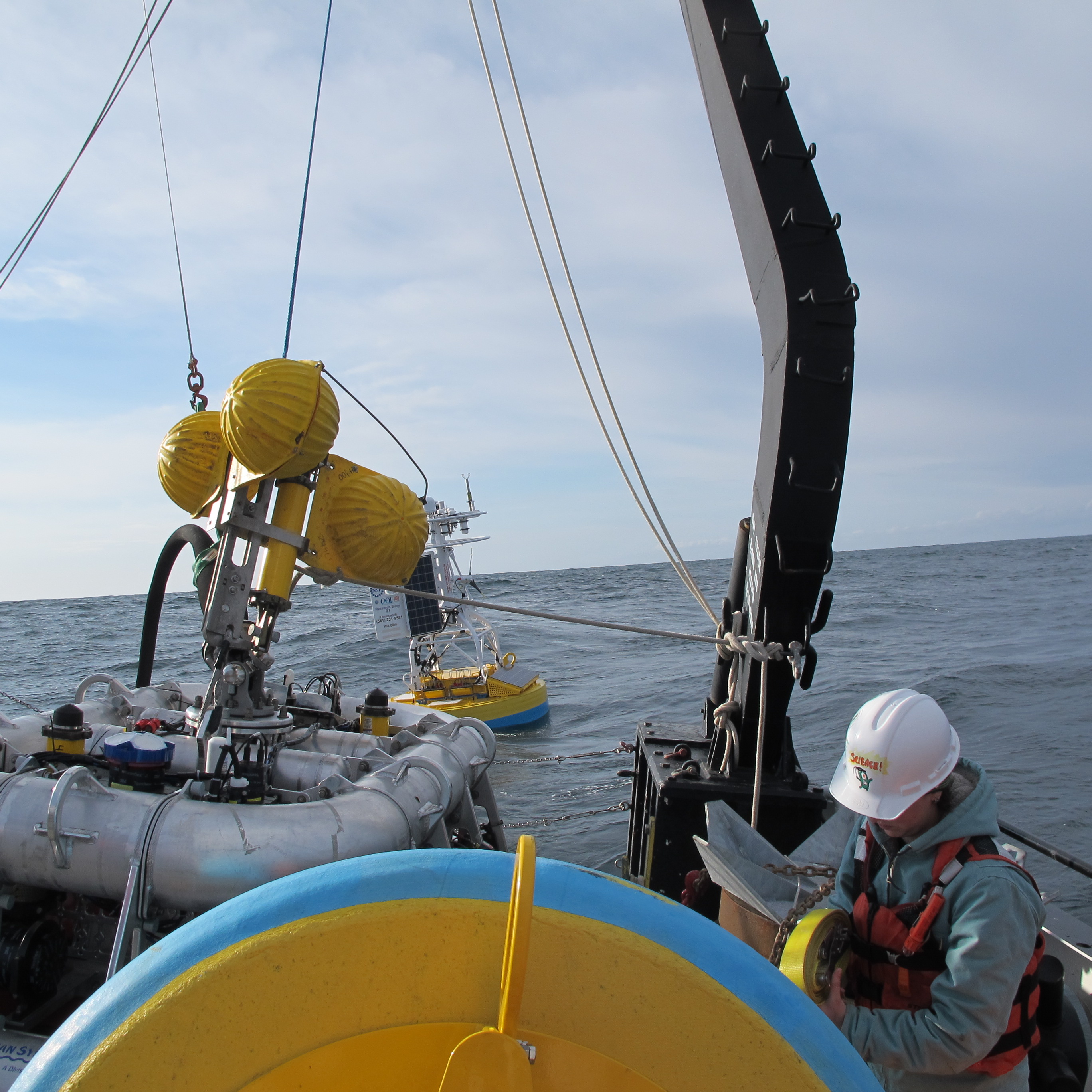
The Southern Ocean Array also provided a platform for interagency and interdisciplinary collaborations. The National Science Foundation and its UK counterpart, the National Environmental Research Council joined forces to support two expeditions in 2018 and 2020. The 2018 expedition recovered the bottom halves of the moorings, while outfitting the surface mooring with equipment to measure silicate and nitrate using “lab-on-a-chip” technology (miniaturized analytical devices that integrate laboratory operations into a single chip on a very small scale.) This work was an investigation undertaken by Dr. Adrian Martin of the UK’s National Oceanography Centre and an investigator for CUSTARD (Carbon Uptake and Seasonal Traits in Antarctic Remineralisation Depth). The sensors and the surface mooring were recovered during the 2020 expedition.
“CUSTARD focuses on how interactions between marine organisms, nutrients in the water and the ocean circulation control the storage of carbon at depth. To do so requires information through the year because of the boom and bust seasonal cycle of phytoplankton,” explained Martin. “The mooring gave us both a variety of important data as well as a platform to deploy some of our own sensors year-round in the challenging environment of the Southern Ocean. The CUSTARD project benefited immensely from our collaboration with OOI. “
The OOI moorings also provided scientists with a means to study the mechanisms behind Southern Ocean warming. In a study led by Sarah Ogle of Scripps Institution of Oceanography, scientists found that just a few extreme storm events drive most of the mixed-layer deepening, suggesting that air-sea heat exchange is a highly episodic process.
“Only the largest storm events each year are able to mix the upper ocean enough to influence the ocean interior,” said Dr. Sarah Gille, also of Scripps and a member of OOI’s Facility Board. “With the removal of OOI, we’ve lost one window into these big events, but from the OOI data, we’ve gained some perspective on what types of measurements need to be collected to understand air-sea exchange in the region. In the future, I hope that we’ll be able to make use of newer autonomous systems to continue the research started in the Southern Ocean with OOI.”
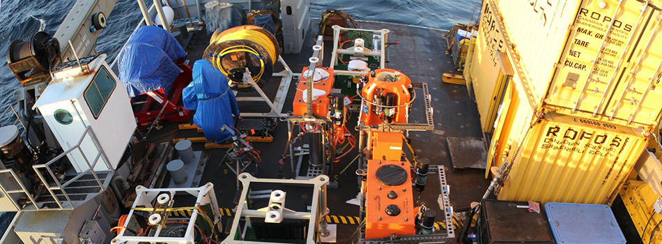
[media-caption type="vimeo" path="https://vimeo.com/398932101" link="#"] Crew members recover the last Southern Array Surface Mooring (9000+ lbs) aboard the RRS Discovery, operated by the Natural Environment Research Council.Video courtesy of Dr. Adrian P. Martin, National Oceanography Centre [/media-caption] Read MoreEndurance Cruise Delayed by COVID-19
The spring 2020 OOI Endurance Operations and Management (O&M) turn cruise has been delayed for at least 30 days due to travel and personnel restrictions imposed to stem the spread of the virus COVID-19.
The 16-day cruise was set to depart on 31 March from Newport, Oregon aboard the R/V Sikuliaq to service the array off the Oregon and Washington coasts. The R/V Sikuliaq is part of the US academic research fleet managed by UNOLS (the University-National Oceanographic Laboratory System). UNOLS imposed a 30-day suspension in fleet operations on 13 March to help ensure the safety of the ship’s crew and science party and to mitigate the risk of virus spread. Rescheduling of activities will commence once the situation stabilizes and UNOLS sees a path forward to re-start research vessel operations safely.
Upcoming O&M cruises for the Pioneer, Irminger, and Papa Arrays also are scheduled aboard UNOLS vessels (R/V Neil Armstrong and R/V Sikuliaq). These cruises fall outside of the UNOLS current 30-day suspension so cruise preparation continues.
We do not anticipate that cruise schedule changes will affect the collection nor dissemination of OOI data, which will continue to be available for users here.
Read More
Metadata Review Improves OOI Data

OOI’s data teams have just completed an extensive, year-long review of critical metadata to ensure the quality and usability of data for OOI data users. The review covered data collected through the end of 2019 and included instrument calibration coefficients, instrument deployment assignments, and deployment dates. Moving forward, all metadata verification will conform to the standards established during the review.
“Our reason for undertaking this review was no more complicated than to make the data better for our data users,” explains Jeffrey Glatstein, Senior Manager of Cyberinfrastructure and OOI Data Delivery Lead. “It is the first time since the inception of the program that we’ve really gone in and looked at the metadata from top to bottom. If there was a calibration that was off, a depth missing, or something misspelled, we found it.
“This intense and deliberative review process brought historic metadata up to current standards to ensure continuity, completeness of records, and consistency in how metadata are reported now and moving forward.”
The data teams used a combination of human review and an automated script development process to identify and correct data issues. The human-in-the-loop (HITL) process ensured that two sets of eyes verified each metadata product, whenever possible, while the scripts performed automated verification and generated reports to pass back into the HITL workflow.
“This initiative is part of ongoing OOI efforts to make its data more accessible, user friendly, and integrated into ongoing science,” adds Glatstein.
Check Previously Downloaded Data
The OOI Data Portal operates on a process-on-demand model, which means that data downloaded prior to the end of 2019 should be checked to see if relevant metadata has been modified.
Users can check to see if changes were made to relevant metadata by clicking here. This link provides a searchable database by array, platform, and instrument to help ensure that previously downloaded data are correct or if they need to be re-downloaded so users are working with the best available data. The OOI data teams are continuing to verify the historical deployment assignments/dates, and the results will be updated accordingly
[feature]A Gargantuan Effort
As part of the transition of OOI to 2.0 in October 2018, the RCA data team initiated a comprehensive audit of all critical metadata to ensure that data products served by the OOI Cyberinfrastructure system meet Quality Assurance/Quality Control standards set by the program and expected from the user community. This daunting task included the examination of over 700 calibration files from 2013 to the present. The results of this audit were used to aid in evaluation of current processes and guide in adapting workflows to improve QA/QC efforts and communication to the users, a vital component to building confidence in the OOI datasets as reliable and valuable resources that can be used in scientific research and education.
Wendi Ruef, Research Scientist, Regional Cabled Array
The CGSN Data Team worked carefully and methodically through thousands of files containing over 30,000 calibration coefficients and other critical metadata. We now have a high level of confidence in past metadata and a strong process for continued review going forward.
Al Plueddemann, Chief Scientist, Coastal Global Scale Nodes
[/feature] Read More
Visions 17 Cruise Underway
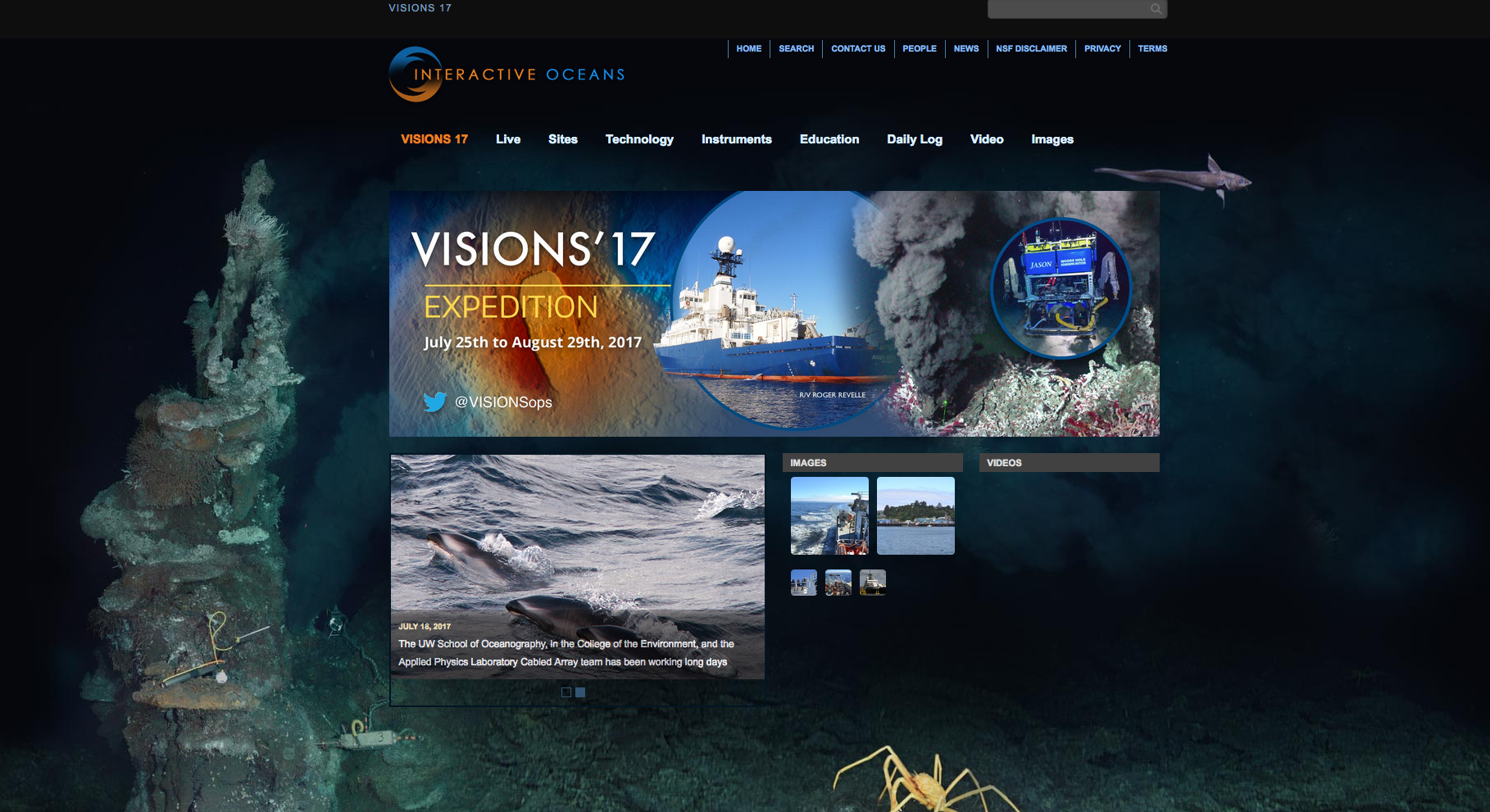
On July 27, the R/V Roger Revelle departed Newport, OR to begin VISIONS’17, a 32-day mission to replace and maintain elements of the Cabled Array off the coasts of Oregon and Washington.
Read MoreOOI Endurance Array team sets sail on fall O&M cruise
On Sunday Sept. 18, the R/V Atlantis set sail off the coast of Oregon and Washington for a 17-day Operations and Maintenance cruise of the OOI Coastal Endurance Array. During this cruise, the OOI team led by Oregon State University (OSU) will recover and redeploy six surface moorings as well as the Washington Offshore Profiler Mooring and several uncabled surface piercing profilers. The team will also recover 1 coastal glider and deploy 5-6 more.
Biannual maintenance cruises are an important element of OOI Coastal Array operation and maintenance as it ensures that infrastructure and instrumentation in the ocean are constantly replaced before they break and are refreshed to minimize the influence of bio-fouling and sensor drift. The coastal ocean is a harsh environment; equipment are constantly blasted by sand and debris and beaten by waves. Additionally, full, high resolution, data sets are able to be downloaded from the recovered instrumentation, increasing the data available from the telemetered near-real time data sent to shore via satellite.
The OSU-team has been hard at work to prepare the OOI equipment for deployment. A time-lapse video (below) shows a mere 10 days of that effort as they integrate mooring elements and prepare to place these equipment out to sea for six-months.
[media type="video" path="https://www.youtube.com/watch?v=PKR8z10zKwM&feature=youtu.be" link="#"][/media] Read MoreVISIONS’16 OOI Cabled Array Maintenance Cruise Begins
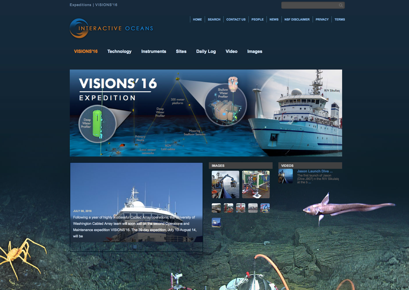
On July 10, the R/V Sikuliaq left dock at the University of Washington to begin VISIONS’16, a 39-day mission to replace and maintain elements of the Cabled Array off the coasts of Oregon and Washington. Led by Chief Scientist Deb Kelley, this is the second Operations and Maintenance cruise for the Cabled Array implementing organization, as part of the National Science Foundation’s (NSF) Ocean Observatories Initiative.
During the cruise, scientists from the University of Washington School of Oceanography within the College of the Environment and engineers from the Applied Physics Laboratory will visit all of the Cabled Array sites where they will recover, install, and test over 100 instruments and nine junction boxes. They will also recover and reinstall the Deep Profiler Moorings at the Endurance Offshore and Slope Base sites. The remotely operated vehicle (ROV) Jason will also assist in the recovery and installation of the underwater infrastructure. This is Jason’s first time supporting the Cabled Array, which required special modifications to be made to the ROV over the past year.
The three legs of the cruise will run from July 10 to August 15, 2016.
You can learn more about the cruise on the VISIONS’16 website, which includes daily cruise logs, as well as image and video galleries. You can also follow along on Twitter (@VISIONSops), where up-to-the-minute updates about activities on board are posted.
Read MoreWelcome Aboard the R/V Neil Armstrong
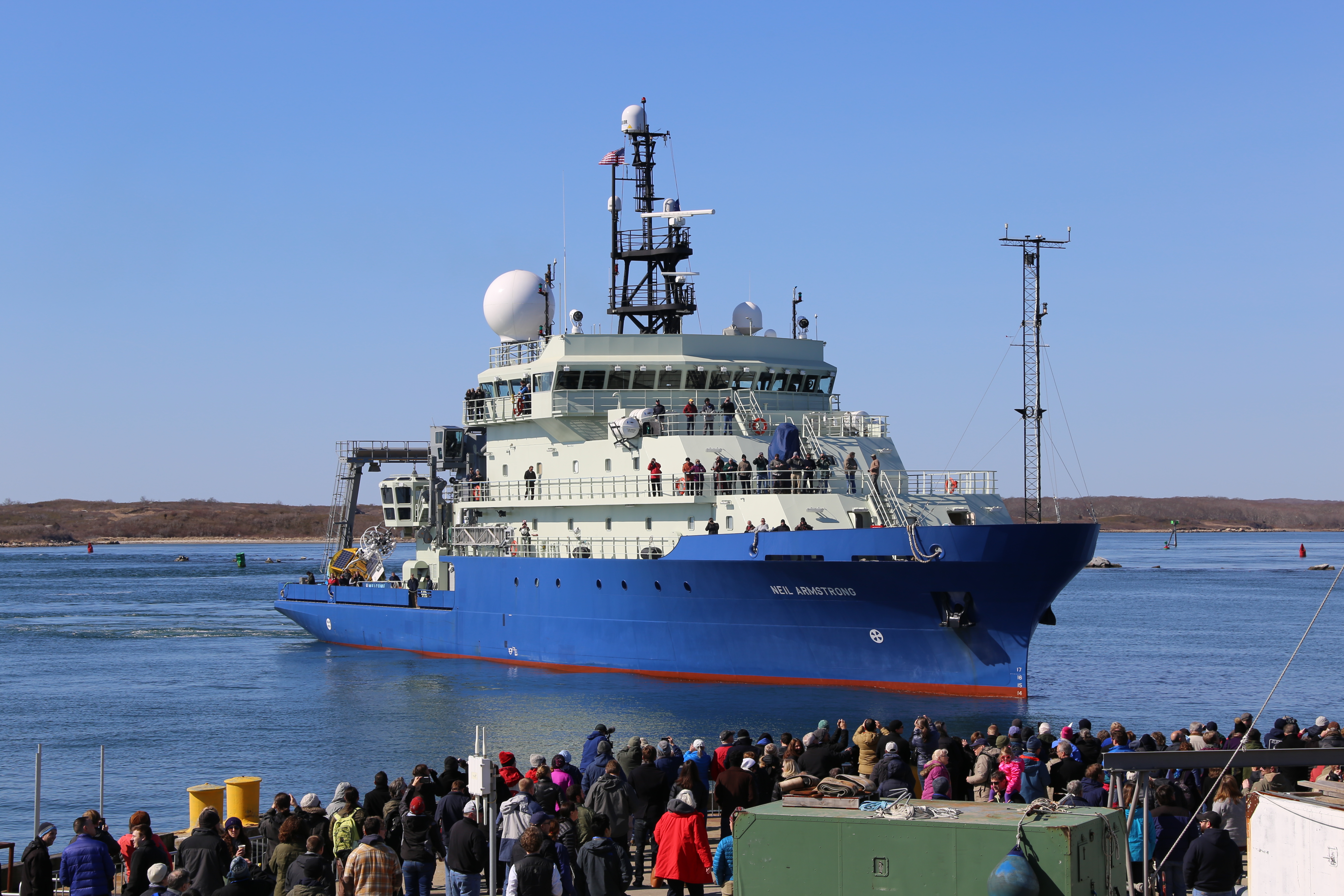
Welcome the newest member of the nation’s research vessel fleet, the R/V Neil Armstrong! Christened after the legendary explorer Neil Armstrong, the new ship will seek to follow his legacy of exploration and scientific discovery. Capable of ranging up to 11,500 nautical miles, the Neil Armstrong is 238 feet long, is equipped with two full-sized labs, and can support up to 44 scientists and crew.
The Ocean Observatories Initiative (OOI) is excited to be amongst the first to use this vessel as the R/V Armstrong recovered two OOI Moorings during its “Science Verification III (SVC III)” Cruise from Virginia to Woods Hole, MA. These moorings were the Coastal Pioneer Array Central Surface Mooring and Upstream Inshore Profiler Mooring located on the continental shelf south of Martha’s Vineyard.
Home-ported at the Woods Hole Oceanographic Institution, the Armstrong will be enlisted for future Pioneer Array maintenance cruises, as well as cruises to the Global Irminger Sea Array southeast of Greenland.
The Coastal Pioneer and Global Irminger Sea Arrays are the OOI’s two arrays in the North Atlantic. The Coastal Pioneer Array is one of two coastal arrays and is located along the continental shelf-break front off the coast of New England. The Pioneer Array’s oceanographic and meteorological observations from the highly productive region along the continental shelf-break off the coast of New England. This array allows scientists and educators to examine several important coastal processes, including shelf break fronts, frontal upwelling, and the role of filaments and eddies in cross-shelf exchange of parameters such as nutrients, heat, and biomass.
The Global Irminger Sea Array is one of four global sites in the OOI focusing on the critical, yet under-sampled, high-latitude regions of the Pacific and Atlantic. It includes a network of moorings that will support sensors for measurement of air-sea fluxes of heat, moisture and momentum; physical, biological and chemical properties throughout the water column.
The OOI, a project funded by the National Science Foundation, is an integrated infrastructure of science-driven platforms and sensor systems that measure physical, chemical, geological, and biological properties and processes from the seafloor to the sea surface. It was designed to provide data to address scientific challenges such as climate and ecosystem health.
Please continue to visit the OOI Website for the latest news on the program, sign up for our Mailing List, or submit comments or question through the HelpDesk.
Read MoreSuccessful Turn of the Irminger Sea Array
The 2015 Irminger Sea Array cruise marked the first “turn” (recovery & reinstallation) of the moorings and gliders as well as a first look at the data collected during the first year.
Read More2015 Cabled Array Cruise, A Success for OOI Infrastructure and Scientific Discovery
The 2015 Cabled Array cruise marked the completion of installation at the Cabled Array, provided a first look at the April 2015 Axial eruption site, and led to the discovery of a new seep site on the continental slope.
On August 7th, the OOI Cabled Array team, along with 21 students and the remotely operated vehicle ROPOS, completed installation of the OOI Cabled Array, as well as its first maintenance cruise. A total of 118 instruments are now streaming data from the Juan de Fuca plate through 540 miles of fiber-optic cable to shore.
The R/V Thompson set sail on July 4th from the University of Washington on a 3-Leg, 35-day cruise with the objective to 1) deploy Deep Profiler Moorings on the continental slope, at the slope base off of Oregon, and at the base of Axial Volcano and 2) recover and reinstall junction boxes, mooring science pods, and instruments at the 6 cabled study sites comprising the Cabled Array. Over the course of the cruise, 13 platforms and 112 instruments were installed and ROPOS completed 55 dives. (more…)
Read MoreStation Papa Array Annual Maintenance and Profiling Glider Deployment
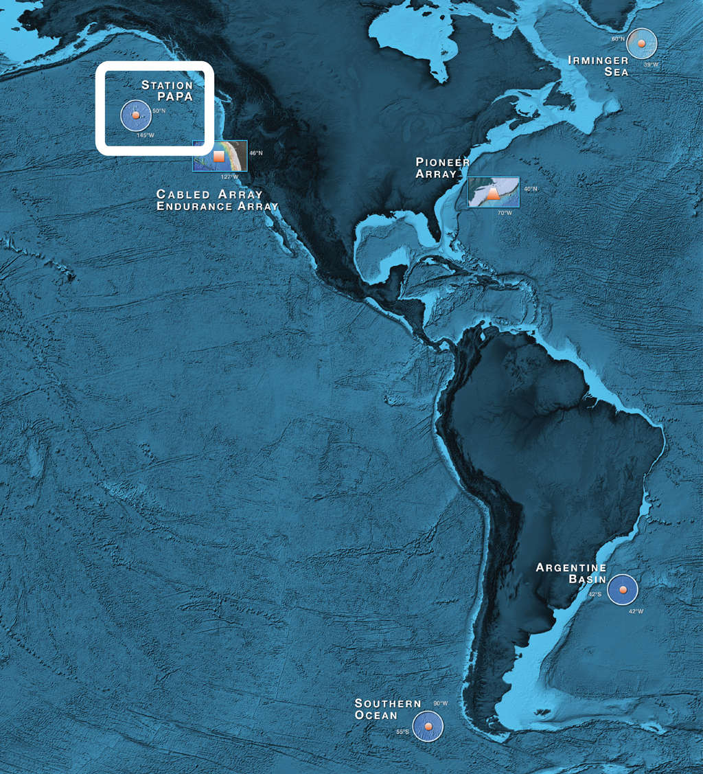
The Ocean Observatories Initiative (OOI) team in June 2015 conducted deployment and scheduled maintenance activities for the global component of the OOI infrastructure located in the Station Papa site, in the Gulf of Alaska.
Read More