
Posts Tagged ‘NSF’
NSF Issues Dear Colleague Letter to Support Ocean Technical Workforce Education
The National Science Foundation (NSF) issued a “Dear Colleague Letter” (DCL) on March 14, 2022 seeking proposals for curriculum development and student engagement to support the expansion of the ocean technical workforce. Through the DCL, NSF hopes to expand the technical capacity of the U.S. workforce in high-technology fields through training programs that educate the next generation of ocean technicians, data scientists, ocean engineers, and ocean scientists.
Proposal topics of high priority include training in ocean instrumentation design, manufacturing and maintenance of marine-related hardware, and ocean data science and data analytics. Submissions are encouraged that target documented gaps in the U.S. technical workforce in marine instrumentation and manufacturing sectors, including those related to renewable energy, such as wave, tide, wind, and solar energy systems.
Full details can be found here. Proposers are encouraged to contact the program officers prior to submitting proposals or requests for supplemental funding. For questions about this DCL, please contact Elizabeth (Lisa) Rom – elrom@nsf.gov in the Division of Ocean Sciences, Jumoke Ladeji-Osias – jladejio@nsf.gov in the Directorate of Engineering, or V. Celeste Carter – vccarter@nsf.gov in the Division of Undergraduate Education.
Read More
Funding Opportunity for OOI Education, Workshops, Training Proposals
To encourage wider use of OOI data by researchers and educators, the Ocean Sciences Division (OCE) of the National Science Foundation is seeking proposals for projects that use OOI data. Funding is available to support workshops, conferences or other training events that introduce researchers and educators to the type of data available through OOI and community tools that have been developed to use that data.
A Dear Colleague Letter (NSF20-047) issued in early 2020 remains in effect.
“We are seeking to support efforts that teach researchers or educators how to use OOI data and tools, that develop additional tools or instructional materials using OOI data or that serve to create communities of practice to use OOI data for multi-investigator, community-driven research, “ said Elizabeth Rom, an OCE Program Director who oversees a number of NSF educational initiatives.
At a recent town hall of the Ocean Observatories Initiative Facility Board at the AGU Fall Meeting, Rom presented a progress report on proposals funded since May 2020. These include:
- Two Ocean Hack weeks held at the University of Washington and Bigelow Laboratory for Ocean Sciences. In 2020, the workshop was virtual, in 2021 the workshop was a hybrid.
- OOI Biogeochemical Data Workshop, which consisted of an online meeting in July 2021 and plans for an in-person meeting for June 2022 at Woods Hole Oceanographic Institution.
- K12 OOI Workshop Series that involves the South Kitsap School District in Washington state and Deb Kelley at the University of Washington. The goals of the workshop series are to develop teacher cohort and lesson plans using OOI data in classrooms. The series launched in early December with virtual and in-person sessions planned throughout 2022.
She also reported on progress in course development, including support of a second cohort of faculty to develop version 2 of the Ocean Data Lab’s online manual, microbial monitoring using OOI RCA remote samplers at Axial Seamount, and development of instructional materials and piloting assessment instruments to explore undergraduate scientific literacy. NSF programs GeoPaths (Pathways into the Earth, Ocean, Polar and Atmospheric and Geospace Sciences) and Research Experiences for Undergraduates (REU) sites also provided opportunities for using OOI data. An initiative to broaden the scope and increase the efficacy of the SERC Discovery System was supported, as were multiple REU student projects in 2020 and 2021.
“While COVID served to discourage in-person meetings and workshops, we were pleased that so many innovative approaches were proposed,” added Rom. “Hopefully in 2022, we will have opportunities to for virtual, hybrid and in-person workshops, and certainly the innovation of this community will shine through.”
Two- and four-year U.S. institutions of higher education and U.S. non-profit non-academic organizations are eligible to submit proposals. Proposals may be submitted at any time, but Principal Investigators are encouraged to submit at least six months prior to the planned event. Submission details are available here. While the DCL refers to Fiscal Year 2020, it continues to be in effect until canceled.
Read MorePosition Opening: NSF OOI Program Director
OOI Community Members Guide Pioneer Relocation
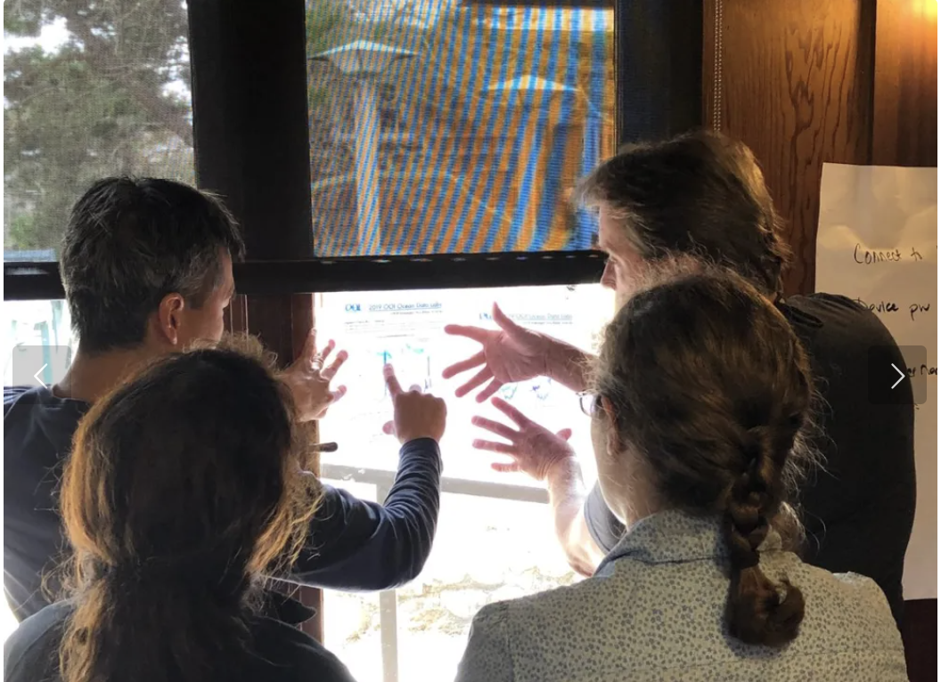
From 21-25 June, 37 members of the Ocean Observatories Initiative (OOI) community are participating in the National Science Foundation-sponsored Phase 2 Innovations Lab to identify the best location within the recently designated geographic region of the Mid-Atlantic Bight (MAB) between Cape Hatteras and Norfolk Canyon for the Pioneer Array relocation.
During the week, participants will work to identify the observatory opportunities that can be offered by the new Pioneer Array location. They will explore how the Pioneer Array sensors and platforms can be optimized to achieve science and education goals at a new site, based on environmental, logistical, and infrastructural considerations. The group will also evaluate challenges presented by deployment of Array infrastructure at a new location, and discuss the potential for partnerships and collaborations at a new site.
The MAB region offers opportunities to collect data on a wide variety of cross-disciplinary science topics including cross-shelf exchange, land-sea interactions associated with large estuarine systems, a highly productive ecosystem with major fisheries, and carbon cycle processes. This geographic region also offers opportunities to improve understanding of hurricane development, tracking and prediction, and offshore wind partnerships. The relocation of the Pioneer Array will take place in 2024.
The Ocean Observatories Initiative Facilities Board (OOIFB), in partnership with KnowInnovations, is facilitating the Phase 2 Innovations Lab. “We selected a diverse mix of Lab participants to achieve a broad range of disciplines and professional expertise, career stage (from early to senior), gender, cultural background, and life experience. By involving such a wide range of people in the conversations this week, it is our hope that the innovative quality, outputs, and outcomes of the Lab will be enriched,” said Kendra Daly, chair of the OOIFB. “And, throughout the year, we will continue to work with the community on the exciting optimization process via scientific meetings, seminars, and other means to ensure we receive broad input.”
Read MoreOOI Welcomes Data Discussions for NSF OED Synthesis Center Solicitation

The National Science Foundation recently issued a solicitation to create a Center for Advancement & Synthesis of Open Environmental Data & Sciences (NSF 21-549). The Center will be fueled by open and freely available environmental data, such as that provided by the Ocean Observatories Initiative (OOI), National Ecological Observatory Network (NEON), the Long-Term Ecological Research Network (LTER) network, and others.
The vision is that large, publicly accessible datasets will catalyze novel scientific questions in environmental biology and speed discovery through collaborations with scientists in other related disciplines. It is also hoped that the Center will help democratize science and diversify the STEM workforce by catalyzing the use of the open data by everyone, from collaborative teams to individual students, researchers, educators, fishers, and policy makers.
OOI is pleased to have been listed as a data source for the Center and looks forward to helping to generate answers to important environmental questions. For those considering submitting a proposal, OOI stands ready to help you learn more about OOI data. If you are interested in having such a discussion, please reach out directly to John Trowbridge.
Read MoreNSF Webinar on Center for Advancement & Synthesis of Open Environmental Data & Sciences Competition
On February 23, 2021 at 3:00 PM EST, NSF will host a one-hour webinar to provide information concerning the competition for a Center for Advancement & Synthesis of Open Environmental Data & Sciences (NSF 21-549). The National Science Foundation’s (NSF) Divisions of Biological Infrastructure (DBI), Environmental Biology (DEB), and the Office for Advanced Cyberinfrastructure (OAC) are hosting the webinar. Following a brief presentation, program directors will be available to answer questions from participants.
Open biological and other environmental data are produced by NSF investments in research and infrastructure such as the National Ecological Observatory Network (NEON), the Ocean Observatories Initiative (OOI), the Long-Term Ecological Research (LTER) network, and the Integrated Digitized Biocollections (iDigBio), as well as by many other public and private initiatives in the U.S. and worldwide. These efforts afford opportunities for collaborative investigations that will advance our predictive understanding of life on Earth; publicly available data are burgeoning. Access to and creative use of these data can democratize science and diversify the STEM workforce as never before by making the same data available to and usable by everyone, from collaborative teams of experts to individual students, researchers, educators and policy makers.
In response, NSF seeks to establish a Center fueled by open and freely available biological and other environmental data to catalyze novel scientific questions in environmental biology through the use of data-intensive approaches, team science and research networks, and training in the accession, management, analysis, visualization, and synthesis of large data sets. The Center will provide vision for speeding discovery through the increased use of large, publicly accessible datasets to address biological research questions through collaborations with scientists in other related disciplines.
Register in advance for this webinar:
https://nsf.zoomgov.com/webinar/register/WN_YvILcBaDRSWB6fCtbR6cAg
Or an H.323/SIP room system:
H.323: 161.199.138.10 (US West) or 161.199.136.10 (US East)
Meeting ID: 161 025 1954
Passcode: 179784
SIP: 1610251954@sip.zoomgov.com
Passcode: 179784
After registering, you will receive a confirmation email containing information about joining the webinar.
Contact: Hannah Perry hanperry@nsf.gov
Read More
Funding Opportunity to Support Dissemination and Use of OOI data
The Ocean Sciences Division of the National Science Foundation (NSF) issued a “Dear Colleague letter” on 18 February to encourage wider use of the OOI data by supporting workshops, conferences or other training events to introduce researchers and educators to available data and community tools.
NSF is encouraging researchers or educators to propose workshops, conferences or other training events to 1) teach other researchers or educators how to use available tools and data; 2) develop additional community tools or instructional material to use the OOI data; or 3) create communities of practice that use the data for multi-investigator, community-driven research purposes. The goal of such activities is to promote development and dissemination of the OOI data tools and research opportunities.
Two- and four-year U.S. institutions of higher education and U.S. non-profit non-academic organizations are eligible to submit relevant proposals.
NSF intends to support about 15-20 awards in FY2020. Proposals may be submitted at any time, but at least six months prior to the planned event. To be considered for FY2020 funding, proposals should be submitted before May 15th. Submission details are available here.
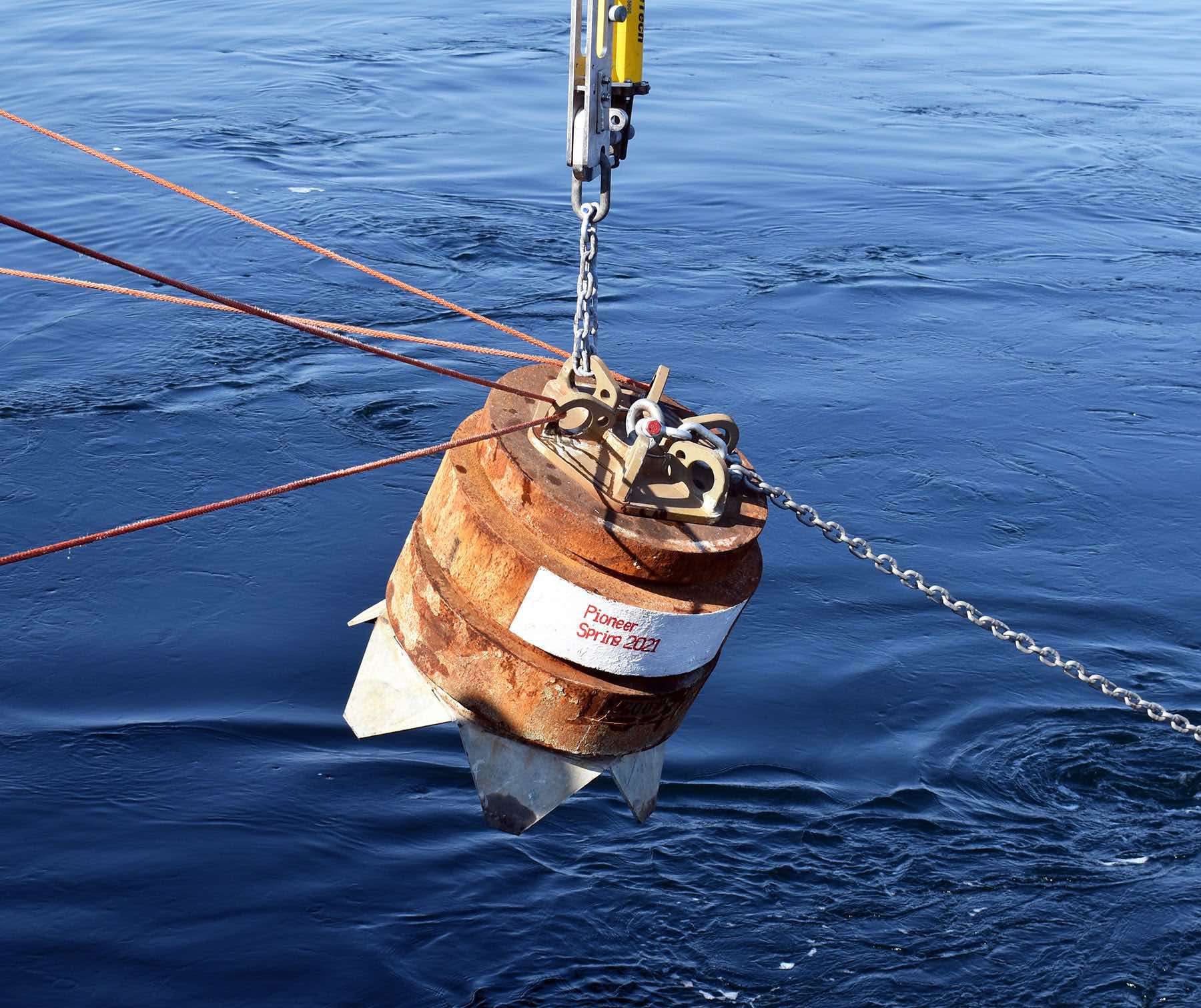
Read MoreOOI achieves milestone with Irminger Sea deployment
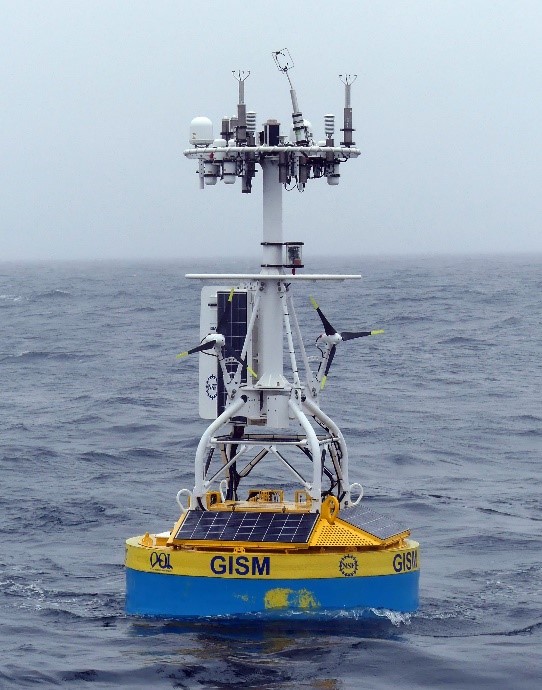
The recently completed OOI mooring service cruise on the R/V Neil Armstrong (2-25 Aug 2019) established a significant milestone – the Irminger Sea Global Surface Mooring was sustained for over a year and returned high quality data. To our knowledge, this is the first surface mooring with instrumentation to compute bulk air-sea fluxes of heat, moisture and momentum that has operated through a full annual cycle in this region.
It is now recognized (e.g. de Jong and de Steur, 2016, Geophys. Res. Lett., 43, 7106–7113, DOI: 10.1002/2016GL069596) that extreme heat loss in the Irminger Sea results in deep water formation, which ultimately influences the strength of the Atlantic Meriodonal Overturning Circulation and has important climate implications. The strong heat loss in the region is largely driven by episodic cold-air outbreaks from the southern tip of Greenland (Josey et al., 2019, Geophys. Res. Lett., 46. DOI: 10.1029/2018GL080956).
[media-caption type="image" path="https://oceanobservatories.org/wp-content/uploads/2019/09/Winds1-300x212.jpg" link="#"]Fig. 2. Satellite scatterometer winds (QuikSCAT) during a cold-air outbreak (right; from Vage et al., 2008))[/media-caption]Cold-air outbreaks are associated with high winds, sub-freezing temperatures, and large, steep waves (Vage et al., 2008, J. Phys. Oceanogr., 38(3), DOI: 10.1175/2007JPO3678.1), which create very difficult conditions for sustained observations at the air-sea interface. The situation is further complicated by the occasional passage of icebergs, which could impact the buoy. The lack of continuous time series data through the winter season capable of identifying episodic events has hindered understanding of air-sea interaction in the Irminger Sea.
The biggest risks to sustained operation of the OOI Irminger Sea mooring were determined to be icing on the buoy tower & freezing of sensitive instrument components. Icing could not be controlled, but potential impacts could be mitigated, for example by shutting down the wind turbines to reduce the likelihood of broken blades. However, a turbine shut-down also meant reduced power generation. Freezing of the precipitation sensor was controllable using a built-in heater, but at the cost of additional power.
[media-caption type="image" path="https://oceanobservatories.org/wp-content/uploads/2019/09/Buoy-300x169.jpg" link="#"]Fig. 3a. Buoy cam pictures showing tower icing.[/media-caption]The CGSN operations team took on the challenge by monitoring weather forecasts for conditions conducive to icing, adding cameras to the buoy tower to detect icing, and implementing a power management strategy during storms. When icing conditions were forecast, the wind turbines were shut down to reduce the likelihood of damage, while some mooring components were simultaneously shut down to save power. Power to high priority instruments (including the bulk meteorology system) and the precipitation sensor heaters was maintained. The strategy was effective, but the difficulty of sustained observations was still evident: The direct-covariance flux package was damaged upon deployment and did not return useful data. The buoy sustained damage to the wind vane, a solar panel and a wind turbine during the winter storms. This compromised power generation capability eventually led to an eight-day data gap in June 2019 due to sustained low wind and overcast skies.
[media-caption type="image" path="https://oceanobservatories.org/wp-content/uploads/2019/09/Winds-2-300x225.png" link="#"]Fig. 4. Time series of METBK meteorological parameters spanning the full deployment period. Left panel: Air (red) and sea surface (blue) temperature, relative humidity and barometric pressure. Right panel: East (red) and north (blue) wind, shortwave (red) and longwave radiation, and precipitation.[/media-caption] [media type="image" path="https://oceanobservatories.org/wp-content/uploads/2019/09/Winds-3-300x225.png" link="#"][/media]Despite the challenges, the buoy bulk meteorology system operated for 420 days of the 428-day deployment (8 June 2018 – 9 Aug 2019) and returned a wealth of scientific data. One-minute records from the bulk meteorology sensors show wind speeds up to 25 m/s and air temperatures as low as -5 C associated with cold -air outbreaks that likely dominate the cumulative wintertime heat loss, as described by Josey et al. (2019). The availability of the first annual cycle of surface meteorology, in conjunction with subsurface data from the OOI Irminger Sea array and the Overturning in the Subpolar North Atlantic Program (OSNAP) array, provide the potential for new insights into the nature of deep mixing, carbon sequestration and deep-water formation in the region.
[media-caption type="image" path="https://oceanobservatories.org/wp-content/uploads/2019/09/team-640x360.jpg" link="#"]Fig. 5. Photo of the Irminger-5 buoy about to be recovered from the R/V/ Armstrong in August 2019. A close look shows damage to the wind turbine and solar panel on the left side.[/media-caption] Read MoreOOI moorings provide sustained observations of the Irminger Sea Deep Western Boundary Current
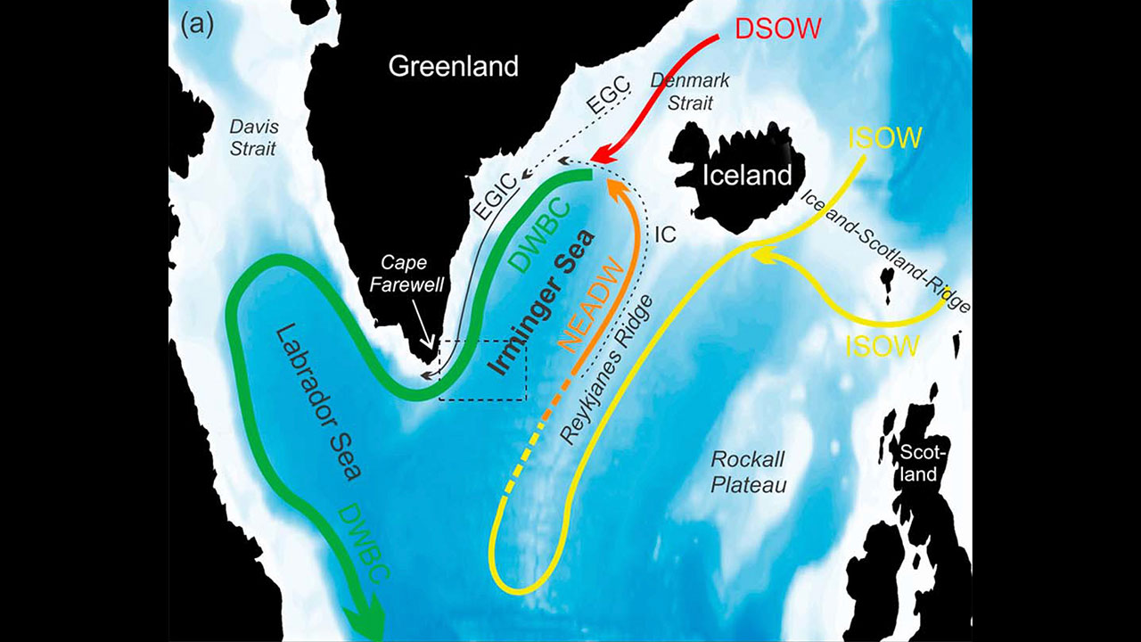
Data from the Ocean Observatories Initiative (OOI) Global Irminger Sea Array contributed to the longest continuous record of total volume transport of water in the Deep Western Boundary Current. This current, in the subpolar North Atlantic, travels southwest along the continental slope off of Greenland and is considered a significant part of the global climate system.
In a recent Journal of Geophysical Research Letters: Oceans paper, Dr. Joanne Hopkins at the National Oceanography Center in Southampton, U.K., and collaborators used data from two U.S. OOI flanking moorings, along with three U.S. Overturning in the Subpolar North Atlantic Program (OSNAP) East Greenland Current array moorings, and five U.K. OSNAP moorings to study the total amount of water moved by the current over a period of two years, as well as its daily and seasonal variability.
The data used for this paper was gathered over 22 months between 2014 and 2016, while all 10 of the moorings were in the water for the same period. Previous research to determine transport estimates at this latitude have been limited by a sparse number of direct and sustained measurements, relying instead on measurements over 9.5 months, 60 days, and “snapshot” or repeated summertime hydrographic sections.
Hopkins et al estimate that the Deep Western Boundary Current transports an average of 10.8 × 10⁶ m3 of water per second with variation in time. In addition, the transport variability shifts from high to low frequencies with distance down slope. While the results did suggest an increase in transport since 2005-2006, they did not conclude that there was a significant long-term trend, given the limitations of previous data sets.
The location of the OOI Global Irminger Sea array was selected as part of an effort by the scientific community to place moorings in areas that have been historically under-sampled and subject to high winds and sea states that make frequent ship-based measurements difficult. The OOI Data Portal provides access to data from the Irminger Sea Array dating back to the initial installation in September 2014.
Read MoreNSF Science in the Deep with ROV Jason
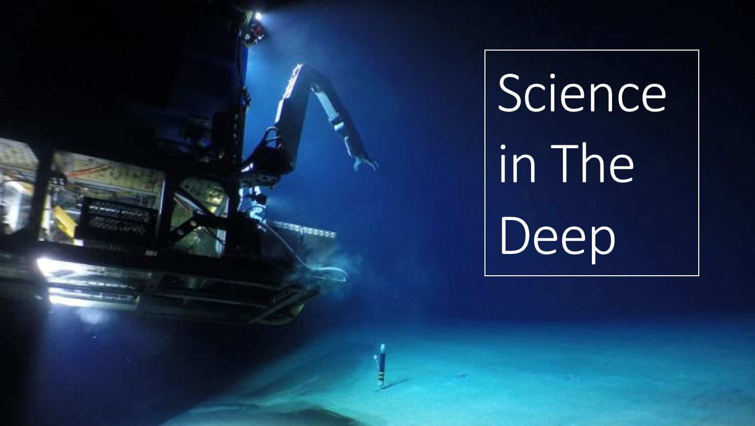
NOTE: Video of this event available here. Fast forward to about 52:00 to get past the distorted audio.
The National Science Foundation will host “Science in the Deep,” a Facebook Live event with researchers aboard R/V Atlantis on Wednesday, June 26, from 1:00-2:00 p.m. Eastern. The Atlantis team will be off the coast of Oregon servicing parts of the Ocean Observatories Initiative Regional Cabled Array using the remotely operated vehicle (ROV) Jason, which is expected to be 800 meters deep at Southern Hydrate Ridge, where methane bubbles from the seafloor and life flourishes.
Join NSF host Deena Headley as she speaks with OOI Research Scientist Michael Vardaro and Research Scientist/Eng2 Katie Bigham, both from the University of Washington, about their work on the recent cruises off the U.S. Northwest Coast, live views from Jason on the seafloor, and life at sea.
Read More