
Posts by Darlene Trew crist
Biofouling Mitigation from Top to Bottom
OOI operates its arrays in challenging environments. At the sea surface, sea lions find the buoys attractive resting spots. At the bottom, instruments must collect data under varying temperatures at intense pressures. And, then throughout the water column’s photic zone is marine growth. Marine life finds OOI’s instrumentation and arrays irresistible, where it attaches and grows like gangbusters.
The folks who keep OOI’s arrays operational explain the conditions this way:
“Putting any kind of instrumentation – electrical or scientific instrumentation – in the water for a year or more at a time is always a challenge, said Dana Manalang, Engineer, OOI Regional Cabled Array (RCA). “It’s a harsh environment due to the high pressures and salt water so getting systems to operate sub-seas is the largest challenge we face.”
“It’s a challenging place to work,” concluded Coastal Endurance Array Project Manager Jonathan Fram, “And, we are very thankful to have the opportunity to make stuff that can survive in just about any marine environment.”
So how do they do it? OOI engineers develop creative ways to tackle the many challenges, particularly in terms of some of the peskier, persistent ones like keeping marine growth, referred hereafter as biofouling, at bay.
Diaper cream as a solution
Coastal and Global Scale Node (CGSN), Coastal Endurance, and RCA team members have implemented novel ways to minimize and in-situ clean marine growth on sensors, gliders, and components of the arrays that spend up to 12 months in the water.
One such novelty is the application of diaper cream. An inexpensive and convenient form of zinc oxide, diaper cream, has been used for decades as a marine anti-foulant, with moderate effectiveness. . “Its application for oceanographic equipment goes back at least to the 1990’s, and is considered non-toxic relative to other concoctions, “ explained Peter Brickley, CGSN Observatory Operations Lead. Other anti-fouling scheme exist, but some are expensive, some add weight, while others take too long to apply and don’t fit into the team’s operational deployment plans.
“The only downside is that diaper cream has be to done onboard right before deployment, or it’s a mess,” he added.
Coastal Endurance Project Manager Jonathan Fram said, “One key issue is that gliders are made of aluminum, so we can’t use copper-based antifouling material on them. Diaper cream is zinc-based, so it won’t corrode gliders’ aluminum.” The Coastal Endurance Team regularly applies diaper cream to its glider fleet, with measurable success. “Gliders with barnacles on them can’t swim straight or efficiently. The diaper cream provides a protective coating to which marine growth cannot readily adhere. It helps keep our gliders moving easily through the water and reporting data.”
[media-caption path="https://oceanobservatories.org/wp-content/uploads/2023/12/Diaper-cream-117.jpg" link="#"]Coastal Endurance team members Raelynn Heinitz and Alex Wick apply diaper cream before launch of a glider off the Oregon coast. The ointment prevents marine growth on gliders that traverse the shallow coastal waters near the Endurance Array’s Washington and Oregon-Newport lines. Marine organisms thrive in the shallow water where sunlight can penetrate, aiding marine growth. Credit: Kathy Hough, NOAA.[/media-caption] [media-caption path="https://oceanobservatories.org/wp-content/uploads/2023/12/without-diaper-cream.jpg" link="#"]Shown above is a recovered glider having spent three months in the upper coastal waters off the Washington coast. It would have been covered with marine life, imperiling its ability to maneuver, but the protective diaper cream kept most of them at bay. Credit: Kathy Hough, NOAA.[/media-caption]After being successfully tested on gliders, the Coastal Endurance Array and RCA teams then tried the protective diaper cream as an option to keeping acoustic transducers on the arrays clean, as suggested by the vendor. An acoustic transducer is an electrical device that vibrates, producing sound waves in water. OOI uses transducers in both echosounders and hydrophones. Here, too, the diaper cream proved to be an inexpensive and effective biofouling mitigation measure.
[media-caption path="https://oceanobservatories.org/wp-content/uploads/2023/12/acoustic-transducer.jpg" link="#"]An acoustic transducer covered with diaper cream to prevent biofouling during its six-months in the water. Credit: Kathy Hough, NOAA.[/media-caption]Addition of UV lights
Putting ultraviolet lights in the water to discourage marine growth is another proven biofouling mitigation measure. Early on, the Coastal Endurance team deployed two oxygen optodes, which measure dissolved oxygen, side-by-side at seven meters depth on the Oregon Shelf Surface Mooring with a UV light pointed at one of them. Data from the two sensors tracked each other for six weeks after which the unprotected sensor fouled. Within weeks, there were daily afternoon spikes of up to twice the oxygen level of the protected sensor, with slightly lower measurements than the unprotected sensor at night due to respiration of the biofilm. Since this test, optodes are regularly deployed with UV lights to aid their operation. (Annotations of OOI moored oxygen data note when a UV light was not operating with it.)
Following the success of the UV-light on dissolved oxygen sensors, the CGSN team tested this antifouling measure on a moored Coastal Pioneer Array spectral irradiance (SPKIR) sensor, which measures the amount of light energy that reaches a surface. The testing was conducted with Sea Bird Scientific, the SPKIR vendor. The vendor confirmed that the UV light did not damage the instrument’s optics nor did it interfere with its light measurements. After this confirmation and positive result, UV lights are now used on all SPKIR sensors on Surface Moorings, Coastal Surface Piercing Profilers, and uncabled digital still cameras moored at less than 70 meters. The teams adjust the on/off cycle of the UV lights so that biofouling is prevented without damaging the sensors, interfering with measurements, or using too much power.
[media-caption path="https://oceanobservatories.org/wp-content/uploads/2023/12/Screenshot-2023-11-27-at-6.02.17-PM.jpeg" link="#"]Sea Bird Scientific’s spectral irradiance sensor needs to be clean to effectively measure light energy in the water column. Shining UV lights on these sensors helps to minimize biofouling and clouding of the sensor.Credit: Sea Bird Scientific.[/media-caption]Lens-Cleaning Brushes
The RCA also has adopted novel ways to deal with biofouling on the Pacific Ocean seafloor. RCA operates and maintains a high-definition (HD) video camera (CAMHD) at the base of an actively venting hydrothermal chimney called “Mushroom” (see below) in the ASHES vent field of Axial Seamount Caldera. Live HD video of this > 4-m high chimney and surrounding seafloor is streamed to shore on an automated schedule for 14 minutes at 3-hour intervals, with longer non-stop monitoring for 24 hours twice a month and 72 hours at the beginning of each month.
[media-caption path="https://oceanobservatories.org/wp-content/uploads/2023/12/Figure-a.jpg" link="#"]RCA’s high-definition video camera installed next to “Mushroom” hydrothermal chimney in the ASHES vent field of Axial Caldera. Credit: UW/NSF-OOI/WHOI; J2-1534, V23.[/media-caption]The scene is fully scanned with programmable pan, tilt, and zoom functions of this instrument, which provides detailed imagery of the high-temperature water spigots, sea spiders, lipets tube worms and other biota covering both the chimney and surrounding lava-covered seafloor.
[media-caption path="https://oceanobservatories.org/wp-content/uploads/2023/12/Figure-b.jpg" link="#"]Close-up of the RCA HD video camera at the base of “Mushroom” hydrothermal chimney. Credit: UW/NSF-OOI/WHOI; J2-1534, V23.[/media-caption]Unfortunately, such live subjects, microorganisms, and other organic/inorganic processes often deposit a film on the camera lens which interferes with visualization. To ensure optimal clarity of HD video between site maintenance visits during annual RCA operation and maintenance expeditions, an automated lens cleaning protocol using a simple brush, installed on the instrument’s frame in the front of the lens has been instituted.
[media-caption path="https://oceanobservatories.org/wp-content/uploads/2023/12/Figure-c-.png" link="#"]Lens-cleaning brush, indicated by red arrow, installed in front of RCA’s HD video camera and used during an automated cleaning protocol. Credit: UW/NSF-OOI/WHOI; J2-1534, V23..[/media-caption]This programmed event occurs three times a month and tilts the camera down and pans it left and right, allowing the brush to gently clean the lens. The video streaming and lens cleaning schedules can be optimized remotely from shore by RCA personnel to provide the highest scientific and educational value from the HD video.
Eco Anti-fouling paint
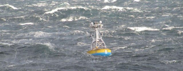
Ever wonder why OOI’s buoys are painted blue? This eco-friendly paint serves the same purpose as diaper cream and UV lights—to minimize marine growth on the buoys and its metal components. The teams use a commercially available water-based and copper-free anti-fouling paint. Once recovered, the CGSN and Coastal Endurance Array components are taken apart and refurbished so they function like new once ready to be redeployed. All metal components and float areas are cleaned and receive a fresh coat of paint in the hope of diminishing their attractiveness to life below the surface.
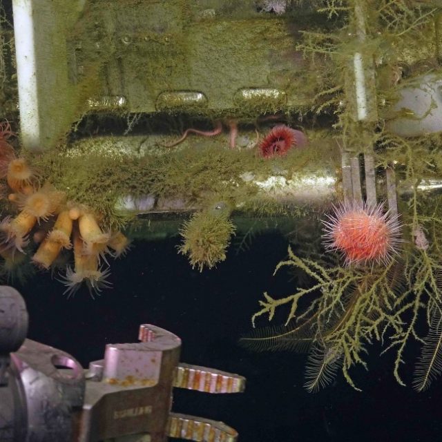
[media-caption path="https://oceanobservatories.org/wp-content/uploads/2023/12/predeployment.png" link="#"]Pre-deployment: The Coastal Pioneer buoys assembled, painted and ready for deployment for six months in the Atlantic Ocean, off the coast of Martha’s Vineyard. Credit: Derek Buffitt © WHOI.[/media-caption] [media-caption path="https://oceanobservatories.org/wp-content/uploads/2023/12/Biofouled-mooring-in-air-2023-03-17-13-33-17-2.jpg" link="#"]After six months in the northeast Pacific, the Coastal Endurance Surface mooring buoy had become a rich habitat for marine life. Credit: Kim Kenney, OSU.[/media-caption] [media-caption path="https://oceanobservatories.org/wp-content/uploads/2023/12/Pink-sea-urchins.jpg" link="#"]Biofouling can be beautiful, as demonstrated here as the ROV Jason prepares to recover the RCA Shallow Profiler during its annual operations and maintenance expedition. Credit: UW/NSF-OOI/WHOI; J2-1516: v23.[/media-caption]
Read More
NASA Astronaut has OOI Roots
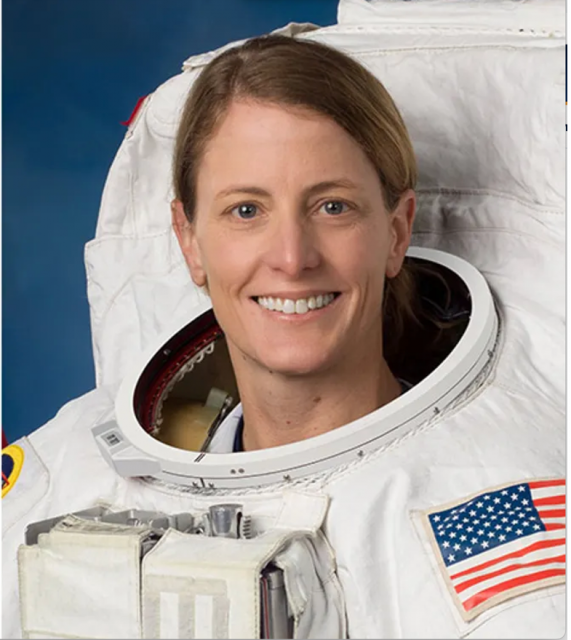
When NASA astronaut Loral O’Hara lifted off on a Russian Soyuz rocket for a six-month stay aboard the International Space Station, Woods Hole Oceanographic Institution (WHOI) Principal Engineer Don Peters and his family were all huddled around their respective NASA TV screens to watch. Peters had hired O’Hara as a WHOI engineer in 2009, where she worked until her acceptance to the NASA Astronaut Class of 2017. During her time at WHOI, O’Hara served as part of the engineering teams on both the Ocean Observatories Initiative (OOI) and the human-occupied vehicle (HOV) Alvin Upgrade.
As an engineering lead for both OOI and Alvin, Peters was hiring a number of engineers in 2009. “Her resume jumped out at me,” he explained, noting that she had gotten her private pilot’s license at age 16, which was all part of her ultimate ambition to be an astronaut. O’Hara joined WHOI after having earned a Bachelor of Science degree in aerospace engineering from the University of Kansas, followed by a Master of Science degree in aeronautics and astronautics from Purdue University.
Throughout her time at WHOI, Peters said she exhibited strong technical skills, a positive attitude, and an ability to work well under pressure. “Loral brought exceptional technical skills to OOI, where she excelled at systems engineering (structuring project efforts based on documented requirements), which was just what OOI needed during its early years, and continues to utilize now in its tenth year of operations,” he added.
O’Hara was involved in the initial development and testing of a new design for high conductor-count mooring stretch hoses, which are key functional elements of the OOI Coastal and Global Scale Nodes (CGSN) coastal surface and profiler moorings. Stretch hoses give the instrument-equipped buoys the ability to be anchored with electrical connection to the seafloor and move with the waves and wind. She spent a majority of her time at WHOI on the Alvin Upgrade project, where she was lead for the specification, design, and fabrication of the main vehicle frame, and served as lead Systems Engineer and assistant Chief Engineer under Peters.
[media-caption path="https://oceanobservatories.org/wp-content/uploads/2023/11/clapping.jpg" link="#"]WHOI staff celebrate Loral O’Hara’s successful liftoff aboard the Soyuz MS-24 spacecraft from the Russia-run Baikonur Cosmodrome in Kazakhstan enroute to the International Space Station. Credit: Jayne Doucette © WHOI.[/media-caption]It was with great delight that, in 2017, Peters learned that her dream of becoming an astronaut was to be realized. It was O’Hara’s third time applying to the space program, and she was selected as one of twelve candidates for the 2017 NASA Astronaut Class, from a field of about 18,000 applicants. He knew she was an awesome team player with good skills and a great personality, who exhibited a steadiness under pressure. “Those qualities resonated with the space program and are visible in Loral’s work in space today,” Peters said, then added, “It’s pretty mind blowing to think of her flying overhead a couple times a day, and it was just such a thrill to see her arriving up there in the Space Station, with such a huge smile on her face.”
When Peters watched O’Hara on her first space walk outside of the International Space Station (ISS) for six hours and 42 minutes on Wednesday November 1, 2023, he wasn’t surprised nor worried. (The spacewalk was the fourth all-female spacewalk outside of the ISS). O’Hara and fellow NASA astronaut Jasmin Moghbeli set out to remove radio frequency group hardware and replace solar array hardware outside the ISS.
Read More
Optimizing Ocean Observing Networks for Detecting the Coastal Climate Signal
Society experiences changes in the global ocean through the ocean’s boundaries. While climate change is certain, its effects in coastal and ocean boundary regions vary considerably geographically. The climate signal is the link between the broader changing climate and the resulting events, which manifests differently in coastal areas than in the open ocean. The U.S. territorial waters encompass 11 Large Marine Ecosystems (LMEs) that range from the cold waters of the Arctic to the tropical waters of the Pacific Islands, and include the Great Lakes that are the world’s largest system of freshwater lakes. As climate change leads to a warmer ocean, LMEs will be exposed to increasing stressors, and coastal communities will be more vulnerable to the effects of climate anomalies. Under these circumstances, it is key to develop a framework that improves the link between larger scale climate variability in the open ocean and its signatures along the coasts.
Objectives
This workshop will bring together operators and users of coastal ocean observing systems to identify the key science issues that need to be resolved to detect and respond to coastal climate change in the coming decades. To achieve this, the workshop will:
- Identify opportunities to accelerate the co-design and optimization of observing systems for detecting the coastal climate signal by integrating knowledge, data, and approaches.
- Foster collaborations between the climate science, operational oceanographic, research, and resource management communities to inform first responder agencies in the management and mitigation of coastal vulnerability to both event-scale and long-term climate changes.
- Bridge gap between global climate research and regional operational oceanography at the coasts.
Outcomes
Deliverables include:
- A workshop report that articulates ways for optimizing global and coastal observing systems to capture the coastal climate signal and address society’s needs for better coastal climate information.
- Identification of coastal climate signals and specific observational metrics needed to track local and regional impacts, including ecosystems and human health.
- Recommendations to be considered by the nascent IOOC Coastal Climate Signal Task Team
Learn more and register here.
Another Round of Pioneer MAB At-Sea Tests Completed
A team of OOI Coastal and Global Scale Nodes (CGSN) scientists and engineers returned to Woods Hole, MA aboard the R/V Neil Armstrong on November 4, having successfully completed another round of tests of mooring equipment and site location surveys for the proposed relocation of the Coastal Pioneer Array to the Mid-Atlantic Bight (MAB), off the coast of Cape Hatteras, NC.
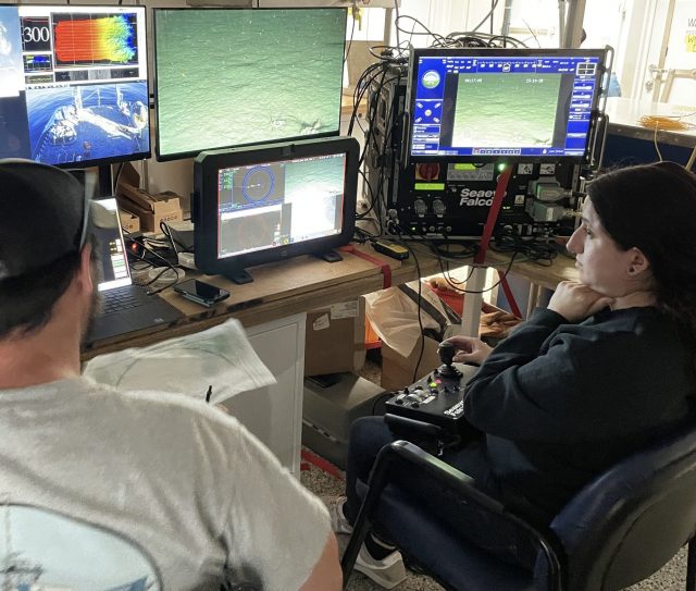
[media-caption path="https://oceanobservatories.org/wp-content/uploads/2023/11/IMG_6640-2048x2048-2.jpg" link="#"]The OOI-CGSN team surveyed the seabed to better understand the environment for the proposed moorings sites. The RV Neil Armstrong operated hull-mounted acoustic equipment to collect bathymetry (depth contours; shown left ), backscatter imagery (seabed characterization), and sub bottom data (seabed profile and geophysical layering). Chris Basque and Irene Duran (shown right) also piloted the ROV over the mooring locations to collect still images, video, and high-resolution sonar of the seabed. Photos: Sheri N. White © WHOI.[/media-caption] [media-caption path="https://oceanobservatories.org/wp-content/uploads/2023/11/IMG_6643-1536x1536-1.jpg" link="#"]Closeup of multi-beam survey.[/media-caption]Having accomplished all of the primary cruise objectives under un-seasonally warm and calm conditions, the weather picked up at the MAB as they were finishing up the last two CTD (Conductivity, Temperature, and Depth) surveys along the proposed location of the main mooring lines.
The team then headed north to conduct a final ROV survey of the Shallow Water test mooring they had put in place the week before in 32 meters of water southwest of Martha’s Vineyard. This ROV inspection was the second conducted at this mooring location. A first inspection was done shortly after the mooring’s deployment, when all components were found to be in place and operational. The second confirmed the earlier findings.
In addition to deployment of the Shallow Water test mooring off Martha’s Vineyard, the CGSN team conducted recovery operations onsite at MAB. They recovered the Coastal Profiler Mooring anchor, deployed in the spring of 2023. The mooring itself had been recovered in August of this year. The team also recovered the Coastal Surface Mooring after ~8 months operating at the proposed Pioneer MAB location. The mooring was deployed in a water depth of 30 m and survived storms with max wave heights of 7.5-10 m and continued to send data to shore!
[media-caption path="https://oceanobservatories.org/wp-content/uploads/2023/11/IMG_6642-1536x1536-1.jpg" link="#"]The Coastal Surface Mooring is safely on deck after ~8 months operating at the proposed Pioneer Mid-Atlantic Bight location. Credit: Sheri N. White © WHOI.[/media-caption]Other activities conducted during the 11-day expedition included a site surveys (utilizing multi-beam, sub-bottom, and ROV) of alternate mooring locations, and cross-shelf and along-shelf CTD surveys to better understand the oceanographic conditions in the Mid-Atlantic Bight.
“Conducting at-sea tests of our infrastructure and detailed environmental surveys of the environment are important to ensure the success of new OOI Array,” said Sheri N. White, Chief Scientist for the recovery cruise. “We were lucky to have excellent weather for our deployment and recovery cruises. But also pleased that our test moorings experienced challenging weather during the deployment. This gives us the confidence that the moorings can operate successfully in the new environment and collect data year-round.” The plan is to deploy the Coastal Pioneer Array in its new location in spring 2024.
More details about and images from the expedition can be found here.
Read MoreNSF Grants OSU Ocean Research Consortium $220 million
The Daily Barometer reported on a recent National Science Foundation $220 million award to a consortium of ocean research institutions — Woods Hole Oceanographic Institution, Oregon State University and the University of Washington — to carry on the operation and maintenance of the NSF-funded Ocean Observatories Initiative. The funding runs through 2028. Read the article here.
Read MoreOOI Featured on IDEA Podcast

Have a listen in here to the IDEA Podcast where OOI’s Lead Principal Investigator Jim Edson, Senior Manager of Cyberinfrastructure Jeffrey Glatstein, and Project Manager of OOI’s Data Center Craig Risien discuss the challenges and opportunities of managing, making available, and securing OOI’s data base of 135 billion rows of stored data that grow by the minute!
The interviewers are Shannon Sheridan, Research Data Librarian at Pacific NW National Laboratory, and Briana Ezray Wham, Data Learning Center Manager and Research Data Librarian at Penn State University.
Read MoreNSF Announces Grants Related to OOI Education; Funding Opportunities Remain

The Ocean Sciences Division (OCE) of the National Science Foundation recently announced two awards related to Ocean Observatories Initiative (OOI) education: a renewal of the OOI Data Labs with Rutgers University and a microcredentialing program at the Marine Technology Society (MTS). The Data Labs project offers opportunities for OOI data users’ participation, and the MTS project will provide a widely available microcredential badging opportunity within a few years.
The OOI Data Labs involves representatives of Rutgers University, Stockton University, Hillsborough Community College, City University of New York Queens College, and the Science Education Resources Center at Carleton College, who will support curriculum development and student engagement using advanced technologies of the OOI. Under previous NSF funding, Ocean Data Labs successfully created and tested a lab manual that includes a collection of laboratory exercises using OOI data, as well as holding hands-on workshops where students and faculty learned how to use OOI data to answer ocean-related science questions.
The MTS award will be used to establish a microcredentialing program to address core competencies required for employment in the blue economy. Microcredentials are short, competency-based recognition that allows a learner to demonstrate mastery in specific areas. By 2025, MTS aims to offer six microcredentials, including a foundational microcredential in Underwater Gliders, Remotely Operated Vehicles (ROVs), Sonar, and Deck Operations. Rutgers University and Northwestern Michigan College will be developing the program along with MTS.
“NSF is pleased to support both these projects that promise expanded use of OOI data in the classroom and skills that will promote competency in some of the advanced technology used by OOI to collect data,” said Elizabeth Rom, Program Director of NSF’s Directorate of Geosciences. “We continue to seek innovative proposals that can serve to integrate OOI data more broadly into the learning and scientific community. We are seeking to support efforts that teach researchers or educators how to use OOI data and tools, that develop additional tools or instructional materials using OOI data or that serve to create communities of practice to use OOI data for multi-investigator, community-driven research.”
Rom provide details of three open funding opportunities:
- NSF 22-059 Dear Colleague Letter that encourages curriculum development proposals with the goal of improving the education of the next generation of ocean technicians, data scientists, ocean engineers, and ocean scientists.
- NSF 23-134 Dear Colleague Letter that encourages workshop proposals to develop connections between academic departments and ocean industries, ocean technicians, data scientists, ocean engineers, and ocean scientists.
- NSF 21-24 Dear Colleague Letter encourages research addressing Critical Aspects of Sustainability (CAS) related to climate change solutions. Proposals addressing cross-cutting topics could focus on technology and workforce development with an emphasis on behavioral and social aspects related to climate mitigation and adaptation. Potential relevant topics in red may include:
o Measurement and sensing innovations;
o Artificial Intelligence and other data analytics, computational and statistical modeling and simulation approaches that directly address climate change solutions;
o Understanding the role of human behavior in achieving mitigation strategies;
o Energy and climate education, capacity building, and broadening participation.
Article was posted on October 26, 2023.
Read MorePBS of North Carolina Blogs about Pioneer’s New Location
In a blog post, the PBS of North Carolina summarizes plans for the relocation of the Coastal Pioneer Array to a site of the coast of Carolina:
[media-caption path="https://oceanobservatories.org/wp-content/uploads/2023/10/PBS-Blog.jpeg" link="#"]Surface moorings of the Pioneer Array loaded with scientific instruments are built to withstand all types of ocean conditions. ©WHOI.[/media-caption]Water covers about 71% of the Earth’s surface, and our oceans hold about 96.5% of it. It’s no surprise then that oceans play a key role in the Earth’s weather, climate and food supply.
So, it’s important to know what’s happening in the ocean. And the ocean off North Carolina’s coast is going to get a closer look starting in 2024. That’s when a set of scientific instruments, called the Coastal Pioneer Array, will be deployed about 35 miles off Nags Head. The system is part of the Ocean Observatories Initiative, or OOI.
“The OOI offers many opportunities for scientists to obtain data to further their research, and it provides insight into conditions in the area for a variety of stakeholders,” said Dr. Albert Plueddemann, project scientist for OOI’s Coastal Global Scale Nodes group at Woods Hole Oceanographic Institution. “We welcome researchers, educators and industry members to reach out to us to explore ways we might work together to maximize the usefulness of the data.”
Read the entire post here.
Read More
Pioneer Mid-Atlantic Bight At-Sea Tests Continue
On Monday October 23, 2023, a team of scientists and engineers from Woods Hole Oceanographic Institution (WHOI) left Woods Hole, MA aboard the R/V Neil Armstrong to conduct a variety of at-sea tests to continue preparations for the anticipated move of the Coastal Pioneer Array to the Mid-Atlantic Bight (MAB), off Cape Hatteras, NC. The science team first traveled to a site off the coast of Martha’s Vineyard to deploy a newly designed shallow water mooring (SWM). This test deployment site was chosen because it offers suitable conditions to test the moorings performance in a shallow water environment, with easy access from Woods Hole, simplifying monitoring and recovery.
The mooring will be deployed for a few months to test the seabed multifunction node, buoyant stretch hose, riser cable, and Prawler profiling vehicle. Engineering data will be collected and assessed prior to the SWM’s deployment at the proposed Pioneer Mid-Atlantic Bight in Spring 2024.
[media-caption path="https://oceanobservatories.org/wp-content/uploads/2023/10/Pioneer-MAB-schematic.png" link="#"]Schematic drawing of the proposed Pioneer MAB moored array to be deployed off the coast of Nags Head, North Carolina. The full array, proposed to be deployed in the spring of 2024, would consist of ten moorings at seven different sites (three sites contain mooring pairs). For the test deployment, one Coastal Surface Mooring was deployed at the Central site and one Coastal Profiler Mooring was deployed at the Northeast site.[/media-caption]From there, the team will head to the Mid-Atlantic Bight to recover a mooring and two anchors that have been in place since spring 2023. Other activities will include a multibeam and sub-bottom site survey and ROV inspection of alternate sites. Water and CTD sampling will be conducted at various depths at the proposed mooring locations. Ancillary science activities will be conducted as time allows. The public comment period on the environmental assessment of the new location is open until October 30, 2023.
“The goal of our test cruises is to evaluate our mooring designs and instrument sampling strategies, and collect environmental data at the new location. This will help to ensure a successful first deployment in the spring of 2004,” said Sheri N. White, Chief Scientist for this expedition and a senior engineer at WHOI. “Understanding the seafloor and water column conditions in the Mid-Atlantic Bight will help us to confirm the optimum locations for the moorings and paths for the gliders and AUVs.”
“This new location in the MAB offers many opportunities for scientists to obtain data to further their research and will provide better insight into conditions in the area for a variety of stakeholders, “said Al Plueddemann, Project Scientist for OOI’s Coastal and Global Scale Nodes group at WHOI, which is responsible for operation of the Pioneer Array. “We welcome researchers, educators, and industry members to reach out to us to explore ways we might work together to maximize the usefulness of the data.”
The new MAB site offers opportunities to collect data on a variety of cross-disciplinary science topics, including cross-shelf exchange and Gulf Stream influences, land-sea interactions associated with large estuarine systems, a highly productive ecosystem with major fisheries, processes driving biogeochemical cycling and transport, and fresh-water outflows during extreme rain events.
The test mooring data will be evaluated during the deployment and after recovery to determine whether any modifications are needed to the mooring designs. The full array will be deployed at the new Mid-Atlantic Bight location in the spring 2024. The At-Sea Test expedition team is expected to return to Woods Hole in early November.
Read More
NSF Funds Creation of Offshore Subduction Zone Observatory as part of OOI’s Regional Cabled Array
With support from the US National Science Foundation, the Ocean Observatories Initiative’s (OOI) Regional Cabled Array (RCA) will be expanded to include an Offshore Subduction Zone Observatory on the Cascadia margin. This new addition to the RCA will produce real-time data to help answer fundamental questions about how subduction zone faults work and can enhance existing systems for earthquake and tsunami warning.
The University of Washington (UW) will lead a team that includes Scripps Institution of Oceanography to implement the “Creating an Offshore Subduction Zone Observatory in Cascadia with the Ocean Observatories Initiative Regional Cabled Array” (COSZO) project to add geohazard sensing instruments, including seismic sensors and calibrated seafloor pressure gauges, to the existing NSF-funded Regional Cabled Array. The UW received one of four Mid-Scale Research Infrastructure-1 (Mid-scale RI-1) awards announced by the US National Science Foundation for Fiscal Year 2023-2024.
“The four awardees NSF has selected — the University of Rochester, Iowa State University, the University of Washington, and the University of Southern California — exemplify the most novel, innovative infrastructure being designed and built in our country to advance the best ideas and train the highly skilled talent in science and engineering for our future,” said NSF Director Sethuraman Panchanathan. “By investing in the most innovative infrastructure, NSF aims to strengthen opportunities for all Americans and advance the frontiers of science and technology.”
Earth’s greatest geological hazards are concentrated in subduction zones. These places where two tectonic plates converge and collide not only produce large-scale earthquakes but suffer from their cascading effects such as devastating tsunamis. The Cascadia subduction zone, spanning the offshore coasts from northern California to British Columbia, hosts earthquakes up to magnitude 9 every few hundred years, the last of which was in 1700. The RCA currently brings power and internet into the ocean offshore of Newport, Oregon.
Today seismic and geodetic sensor networks on land in the Pacific Northwest can quickly alert authorities to geohazards, but the offshore region, where almost all the locked plate boundary and expected earthquake slip would occur, is largely devoid of such instruments.
“There’s a huge amount of interest in subduction zones, from Sumatra to Chile,” said oceanographer William Wilcock, one of several investigators on this project. “Because of the risks and hazards of subduction zones, the National Science Foundation and others have invested in studies to understand a wide variety of subduction zones because they all behave a bit differently and can have devastating impacts.”
“This award will make it possible for scientists to have a front-row seat of the subduction zone with real-time data from 2900 to 80 meters below the ocean’s surface” said Deborah Kelley, Principal Investigator of the Regional Cabled Array. “It builds upon some of the ideas that motivated the OOI. It clearly demonstrates the opportunities for growth through the RCA’s ability to provide power and unprecedented bandwidth to instruments that are monitoring conditions around the clock on the seafloor and throughout the water column. From this will come important new discoveries about how our planet works.”
“We are excited by the addition of COSZO to the Regional Cabled Array,” said Jim Edson, who leads OOI’s Program Office at Woods Hole Oceanographic Institution. “The data made available from COSZO via NSF’s Seismological Facility for the Advancement of Geoscience, will help scientists and engineers understand the hazards from earthquakes and tsunamis, with the potential for improvement of early warning systems, which can ultimately help save human lives. “
A story about the COSZO project can be found here.
——————————————
The Ocean Observatories Initiative is a science-driven ocean observing network that delivers real-time data from more than 900 instruments to address critical science questions regarding the world’s oceans. The National Science Foundation has funded the OOI, under Cooperative Agreement No. 1743430, to encourage scientific investigation. OOI data are freely available online to anyone with an Internet connection.
The U.S. National Science Foundation is an independent federal agency that supports science and engineering in all 50 states and U.S. territories.
Any opinions, findings, and conclusions or recommendations expressed in this material are those of the author(s) and do not necessarily reflect the views of the National Science Foundation.
October 19, 2023
Read More