
Posts by Leslie Smith
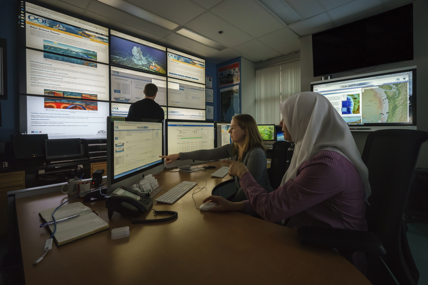
Regional Cabled Array Hack Week: a Collaborative Setting to Explore Big Ocean Data
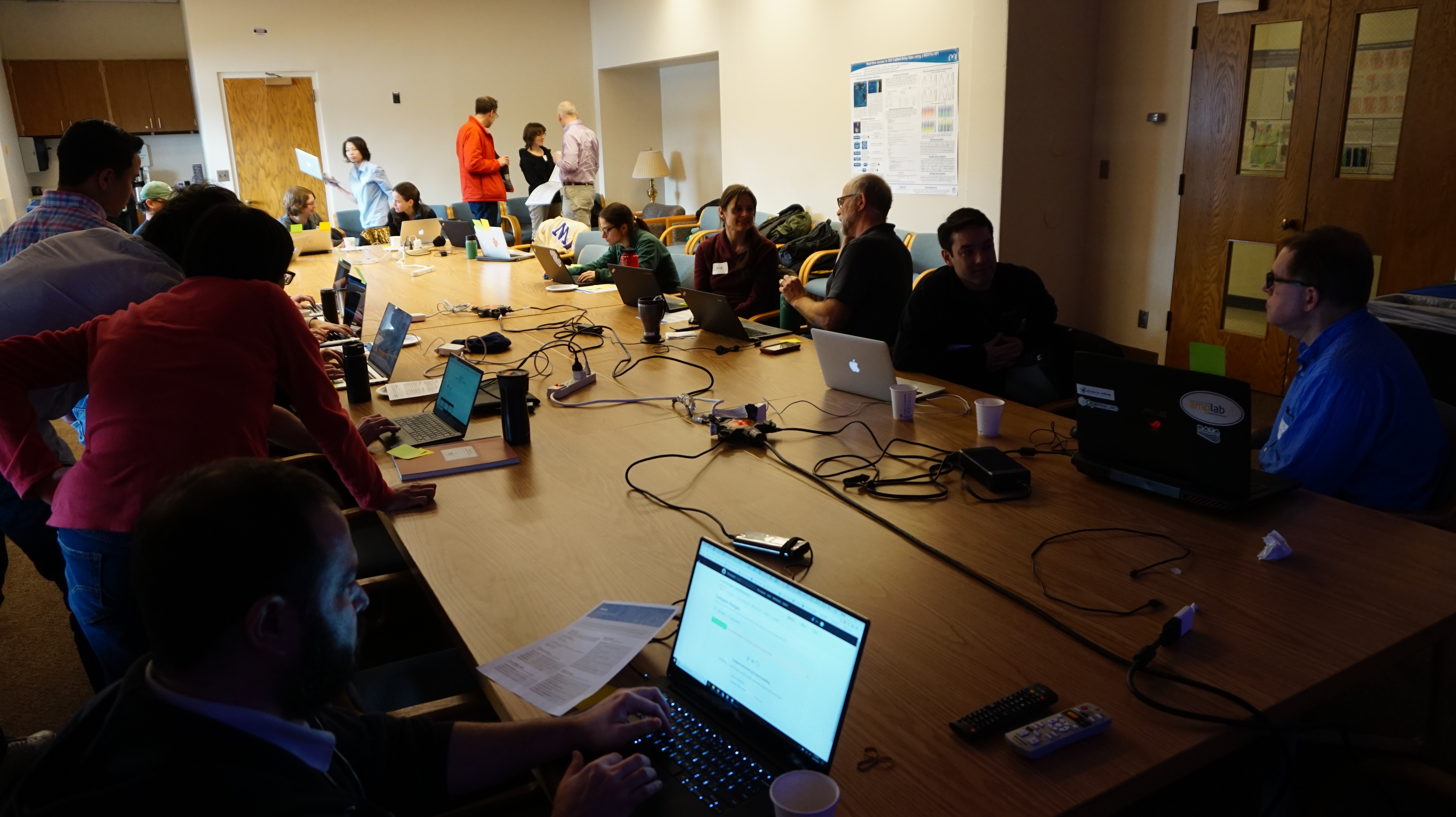
“The size and complexity of ocean data is growing beyond the capacity of what one person and one computer can handle. We need to be thinking of collaborative, cloud-based tools to really explore the capacity of these data.” Friedrich Knuth, Cabled Array Hackweek organizer
Read MoreCollaborations across the North Atlantic – Reflections on the 2017 Irminger Sea Regional Science Workshop
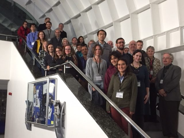
Late last year, more than 30 researchers from countries spanning the Atlantic met in Southampton, UK at the National Oceanography Centre to foster coordination of research efforts focused on the Irminger Sea region. Of central importance to the workshop was to bring in young investigators.
[media type="image" class="external(onlynecessaryiflinkopensdifferentsite)" path="/wp-content/uploads/2018/04/IMG_1270-e1523556889622-300x225.jpg" alt="30 Researchers at the National Oceanography Centre" link="#"][/media]“The Irminger Sea workshop provided me with an incredibly valuable opportunity to meet and develop connections with others working in this region, and to gain a better understanding of the current state of our knowledge and areas of active research in the Irminger Sea and broader subpolar North Atlantic,” reflects Hilary Palevsky, Postdoctoral Scholar at the Woods Hole Oceanographic Institution. “This was especially important for me at this stage in my career to have the opportunity to make these sorts of connections with people whom I had only previously known from reading their published papers.”
The Irminger Sea region, west of Greenland, is a region of high wind and large surface waves, strong atmosphere-ocean exchanges of energy and gases, CO2 sequestration, high biological productivity, an important fishery, and the location of one of the OOI Global Arrays.
“Many of the participants were already using OOI data, and those that weren’t were eager to learn more about the data and improve the time series going forward,” says Mike Vardaro, OOI Data Manager. “I returned with many recommendations to improve data collection, processing, and distribution as well as requests for data, including inquiries about cruise opportunities and how to add to OOI infrastructure or deploy in the OOI area.”
Some of the key recommendations noted were easier bulk download, expansion of ERDDAP, and improved quality control of DO, NUTNR, and PCO2A sensor data.
The overarching objective of the workshop was to coordinate international efforts to observe, study, and better understand the Irminger Sea region.
“The second Irminger Sea workshop saw the fruit being borne of the collaboration between OOI and OSNAP,” says Bob Weller, OOI Global Array PI. “At the first workshop that collaboration resulted in siting the OOI moorings in line with the OSNAP array and adding instrumentation to achieve common sampling. This proved to be very successful. Further, the sampling of the air-sea fluxes and the biology and biogeochemistry at OOI Irminger drew high level of interest and provided the data for a number of papers and joint analyses now underway.”
Check out the O-SNAP blog post written by workshop steering committee member Penny Holliday from the National Oceanography Centre.
Workshop foci were:
- Summaries of present and planned observational, empirical, theoretical, and model-based efforts focused on the physics and biogeochemistry of the Irminger Sea region;
- Presentation of results from recent observational campaigns;
- Identification of key questions and hypotheses related to the physics and biogeochemistry of the region; discussion of sampling strategies to address those questions, including coordination of present, planned and new observational efforts;
- Plans for collaborative analyses and publications;
- Data sharing in support of coordination and collaboration.
Day one of the workshop featured presentations to share results of existing studies and plans for future studies and analysis. A full list of presentations can be found in the workshop report.
On the second day, participants worked in small groups to tackle specific discussion questions with the aim of catalyzing collaborative research, analyses, and publications.
Some questions included:
- Does convection in the Labrador Sea and Irminger Sea have different behavior?
- What are the drivers of extreme convection events?
- What are the controls on productivity, the spring bloom, and ecosystems?
- How do freshwater anomalies (from Arctic) propagate around the subpolar gyre?
- What is the impact of the freshwater on oceanic and atmospheric variability?
Key outcomes of the workshop included:
- Strong support for multi-disciplinary observations made by OOI platforms including the gliders
- Strong support for continued efforts to collect surface meteorology and air-sea fluxes through challenging winter conditions, thus support for OOI to improve surface buoy
- Reliance on OOI Irminger Sea Array continuing allowing Dutch LOCO mooring and German CIS mooring time series to now be collected by OOI going forward.
Join us in the OceanHackWeek 2018 to explore Data Science in Oceanography!
Please join us at the OceanHackWeek 2018, August 20-24, 2018, at the University of Washington, Seattle, in collaboration with the UW eScience Institute. This 5-day hands-on workshop is aimed at exploring, creating and promoting effective computation and analysis workflows for large and complex oceanographic data. The focus will be on data provided by the National Science Foundation’s Ocean Observatories Initiative (OOI). Comparisons to other large-scale ocean observing assets, such as Argo, IOOS, etc. are welcome and encouraged.
Different from conventional conferences and workshops, the OceanHackWeek is constructed based on three core components: tutorials in data science methodologies such as data visualization and cloud computing, peer-learning, and on-site project work in a collaborative environment. We welcome all self-identified oceanographers at all career stages to apply, and hope you will join us in this exciting endeavor!
Travel and lodging grants are available for non-local accepted participants. Participants are expected to attend the entire workshop.
More information is available on: https://oceanhackweek.github.io/
To apply, please fill out the application by May 7, 2018. Accepted applicants will be notified no later than May 21, 2018.
For questions, feel free to email oceanhkw@uw.edu.
[button link="/wp-content/uploads/2018/04/oceanhackweek2018.pdf"]Download Flier[/button] Read More
The Economist – Gliders on the storm

(From The Economist / Technology Quarterly)
From sharks to ice shelves, monsoons to volcanoes, the scope of ocean monitoring is widening.
IN NOVEMBER 2016 a large crack appeared in the Larsen C ice shelf off Antarctica (pictured). By July 2017 a chunk a quarter of the size of Wales, weighing one trillion tonnes, broke off from the main body of the shelf and started drifting away into the Southern Ocean. The shelf is already floating, so even such a large iceberg detaching itself did not affect sea levels. But Larsen C buttresses a much larger mass of ice that sits upon the Antarctic continent. If it breaks up completely, as its two smaller siblings (Larsens A and B) have done over the past 20 years, that ice on shore could flow much more easily into the ocean. If it did so—and scientists believe it would—that ice alone could account for 10cm of sea-level rise, more than half of the total rise seen in the 20th century.
The dynamics of the process, known as calving, that causes a shelf to break up are obscure. That, however, may soon change. Ocean Infinity, a marine-survey firm based in Texas, is due to send two autonomous drones under the Larsen C shelf in 2019, the first subglacial survey of its kind. “It is probably the least accessible and least explored area on the globe,” says Julian Dowdeswell, a glaciologist at the University of Cambridge who will lead the scientific side of the project.
The drones set to explore Larsen C look like 6-metre orange cigars and are made by Kongsberg—the same Norwegian firm that runs the new open-ocean fish farms. Called Hugin, after one of the ravens who flew around the world gathering information for Odin, a Norse god, the drones are designed to cruise precisely planned routes to investigate specific objects people already know about, such as oil pipelines, or to find things that they care about, such as missing planes. With lithium-ion-battery systems about as big as those found in a Tesla saloon the drones can travel at four knots for 60 hours on a charge, which gives them a range of about 400km. Their sensors will measure how the temperature of the water varies. Their sonar—which in this case, unusually, looks upwards—will measure the roughness of the bottom of the ice. Both variables are crucial in assessing how fast the ice shelf is breaking up, says Dr Dowdeswell.
The ability to see bits of the ocean, and things which it contains, that were previously invisible does not just matter to miners and submariners. It matters to scientists, environmentalists and fisheries managers. It helps them understand the changing Earth, predict the weather—including its dangerous extremes—and maintain fish stocks and protect other wildlife. Drones of all shapes and sizes are hoping to provide far more such information than has ever been available before.
That’s why it’s hotter under the water
To this end Amala Mahadevan of Woods Hole Oceanographic Institute (WHOI) in Massachusetts, has been working with the Indian weather agencies to install a string of sensors hanging down off a buoy in the northern end of the Bay of Bengal.
A large bank of similar buoys called the Pioneer Array has been showing oceanographers things they have not seen before in the two years it has been operating off the coast of New England. The array is part of the Ocean Observatories Initiative (OOI) funded by America’s National Science Foundation. It is providing a three-dimensional picture of changes to the Gulf Stream, which is pushing as much as 100km closer to the shore than it used to. “Fishermen are catching Gulf Stream fish 100km in from the continental shelf,” says Glen Gawarkiewicz of WHOI. These data make local weather forecasting better.
Three other lines of buoys and floats have recently been installed across the Atlantic in order to understand the transfer of deep water from the North Atlantic southwards, a flow which is fundamental to the dynamics of all the world’s oceans, and which may falter in a warmer climate.
Another part of the OOI is the Cabled Array off the coast of Oregon. Its sensors, which span one of the smallest of the world’s tectonic plates, the Juan de Fuca plate, are connected by 900km of fibre-optic cable and powered by electricity cables that run out from the shore. The array is designed to gather data which will help understand the connections between the plate’s volcanic activity and the biological and oceanographic processes above it.
A set of sensors off Japan takes a much more practical interest in plate tectonics. The Dense Oceanfloor Network System for Earthquakes and Tsunamis (DONET) consists of over 50 sea-floor observing stations, each housing pressure sensors which show whether the sea floor is rising or falling, as well as seismometers which measure the direct movement caused by an earthquake. When the plates shift and the sea floor trembles, they can send signals racing back to shore at the speed of light in glass, beating the slower progress of the seismic waves through the Earth’s crust, to give people a few valuable extra seconds of warning. Better measuring of climate can save lives over decades; prompt measurement of earthquakes can save them in an instant.
Read MoreNature Climate Change Article Highlights OOI Irminger Sea Data

Increased risk of a shutdown of ocean convection posed by warm North Atlantic summers
Marilena Oltmanns*, Johannes Karstensen and Jürgen Fischer
Abstract: A shutdown of ocean convection in the subpolar North Atlantic, triggered by enhanced melting over Greenland, is regarded as a potential transition point into a fundamentally different climate regime1,2,3. Noting that a key uncertainty for future convection resides in the relative importance of melting in summer and atmospheric forcing in winter, we investigate the extent to which summer conditions constrain convection with a comprehensive dataset, including hydrographic records that are over a decade in length from the convection regions. We find that warm and fresh summers, characterized by increased sea surface temperatures, freshwater concentrations and melting, are accompanied by reduced heat and buoyancy losses in winter, which entail a longer persistence of the freshwater near the surface and contribute to delaying convection. By shortening the time span for the convective freshwater export, the identified seasonal dynamics introduce a potentially critical threshold that is crossed when substantial amounts of freshwater from one summer are carried over into the next and accumulate. Warm and fresh summers in the Irminger Sea are followed by particularly short convection periods. We estimate that in the winter 2010–2011, after the warmest and freshest Irminger Sea summer on our record, ~40% of the surface freshwater was retained.
[button class="block" link="https://www.nature.com/articles/s41558-018-0105-1"]Full Article found can be on Nature Magazine Website[/button] [button class="block" link="/array/global-irminger-sea/"]More details on the OOI Irminger Sea Array design and data products[/button] [feature]Do you have a recent publication using OOI data? Let us know!
Simply send a note to the HelpDesk with the digital object identifier (DOI) of your publication.[/feature]
Read More
Oceanography Magazine OOI Special Issue Now Available
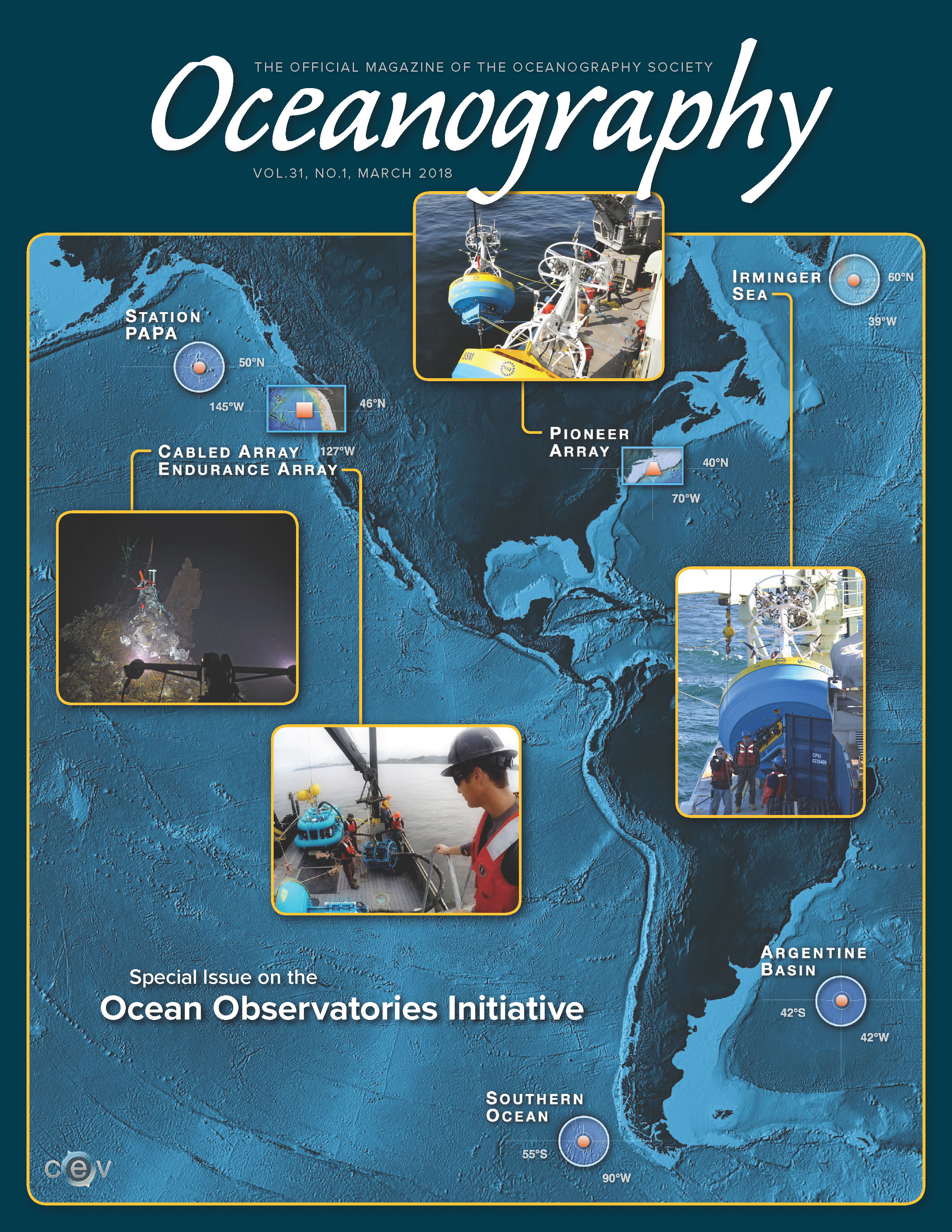
The March 2018 Special Issue of Oceanography Magazine (Volume 31, Issue 1) focusing on the Ocean Observatories Initiative is now available online!
Read More2018 OOI Data Workshops – Apply Now
The OOI is hosting several workshops for early-career scientists (PhD candidates, postdocs and pre-tenure faculty up to 7 years post-PhD) interested in learning more about the OOI and how to use data from the program in their work.
Read MoreOSM ’18 – OOI Related Talks & Posters
Members of the OOI Team and User Community will be sharing their research in posters and presentations throughout the conference. Talks and posters by the OOI Team are listed by date and time.
Read MoreOOI Special Session at OSM 2018
Join OOI scientists and colleagues from other ocean observatories as they discuss the latest in ocean observatory science at the Ocean Sciences Meeting in Portland, Oregon next month.
Read MoreOOIFB Ocean Sciences Meeting Town Hall
There will be an important Town Hall at the upcoming Ocean Sciences meeting in Portland, OR, hosted by the Ocean Observatories Initiative Facility Board (OOIFB) of the National Science Foundation (NSF).
Read More