
Posts Tagged ‘Station Papa Array’
Two OOI Expeditions in Two Oceans
11th Recovery and Deployment of Global Station Papa and Irminger Sea Arrays
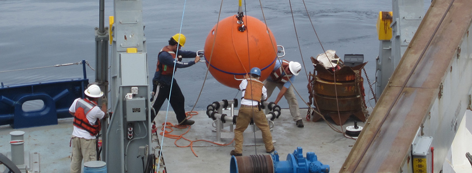
Two OOI Global Scale and Nodes (CGSN) teams are working simultaneously, but in different waters on opposite sides of the United States during June. The first CGSN team left Seward, Alaska aboard the R/V Sikuliaq on May 29 for a 17-day expedition to recover and re-deploy the Global Station Papa Array in the Gulf of Alaska. On June 2, a second CGSN team will depart from Woods Hole, MA to travel to the Irminger Sea Array aboard the R/V Neil Armstrong for a month-long expedition to recover and re-deploy this array.
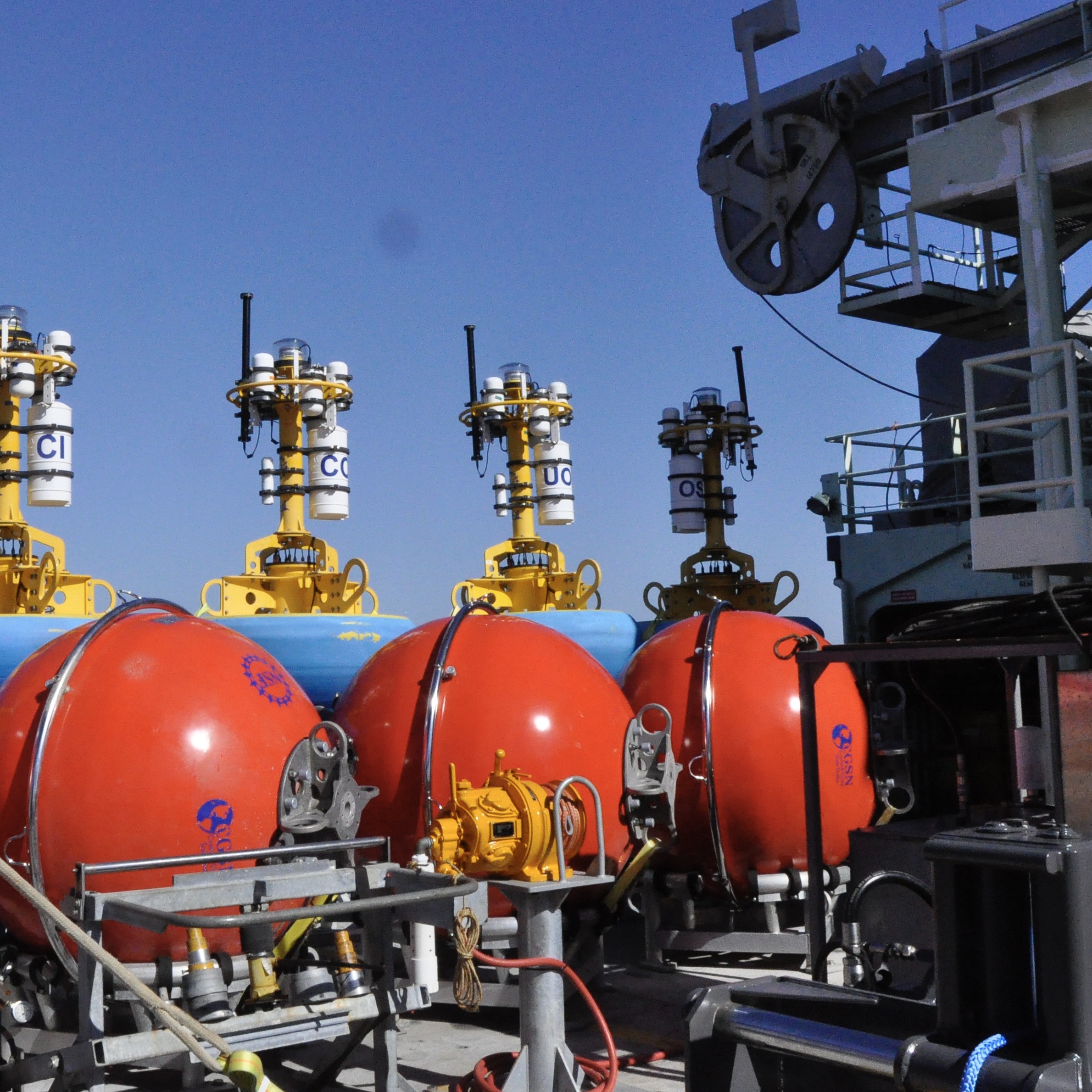
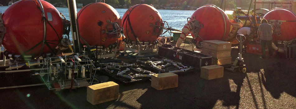
The expeditions share similarities and differences. Both arrays are in remote locations. The Station Papa team has a 2.5-day transit to the array site in the Gulf of Alaska, while the Irminger Sea team has a longer transit of eight days to the array site. Once onsite, the teams will get to work quickly to deploy the replacement moorings to allow for overlapping measurements before recovering the moorings currently in place. This is the 11th time that each array has been turned – that is, existing ocean observing equipment at the sites will be recovered and replacement equipment will be deployed in their place. Such “turns” are needed to address biofouling of sensors, depletion of batteries, and wear and tear on equipment that has been battered by wind, waves, and weather for a year.
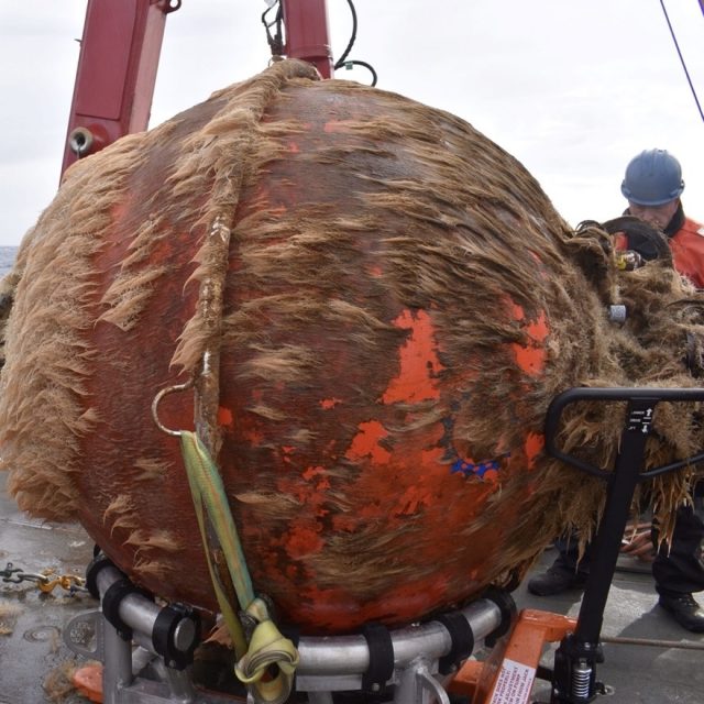
[media-caption path="https://oceanobservatories.org/wp-content/uploads/2024/05/Biofouling.jpg" link="#"]This is what one year in the ocean looks like: a Global Station Papa flanking mooring 64” sphere with 12 months of marine growth. Marine growth can inhibit the operation of the mooring and instruments and is one of the reasons we need to recover and refurbish the OOI infrastructure on a regular basis. Credit: Rebecca Travis © WHOI.[/media-caption]The Global Station Papa Array is located in the Gulf of Alaska, about 620 nautical miles offshore in a critical region of the northeast Pacific with a productive fishery subject to ocean acidification, low eddy variability, and impacted by the Pacific Decadal Oscillation. The Global Irminger Sea Array in the North Atlantic is located in a region with high wind and large surface waves, strong atmosphere-ocean exchanges of energy and gases, carbon dioxide sequestration, high biological productivity, and an important fishery. It is one of the few places on Earth with deep-water formation that feeds the large-scale thermohaline circulation.
“Because of their remote locations, both Station Papa and the Irminger arrays provide critical ocean data that scientists are using to better understand ocean circulation patterns and help identify changes in ocean conditions,” said Sheri N. White, Chief Scientist for the Irminger 11 expedition. “These arrays are hard to get to and to maintain but the data they provide are invaluable.”
Expedition Activities
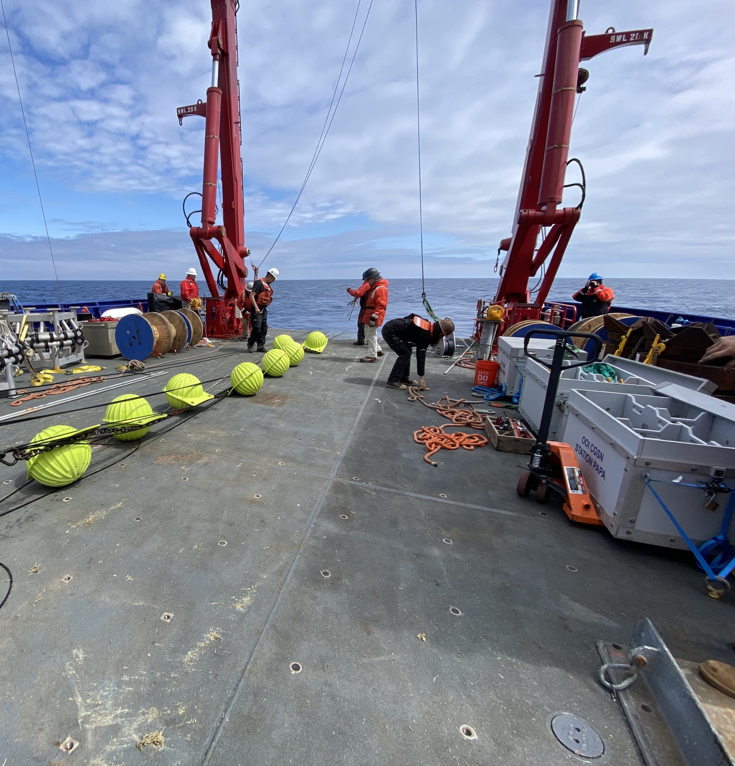
A team of 11 scientists and engineers aboard the R/V Sikuliaq departed from Seward on May 29 for a 17-day expedition. During their time at sea, they will recover and deploy three OOI subsurface moorings and two open ocean gliders. They also will recover and deploy a Waverider mooring for the University of Washington. A POGO Fellowship awardee will be onboard to gain shipboard experience as part of OOI’s collaborative efforts to provide early career scientists opportunities to help increase their knowledge and advance careers. Other onboard activities will include water sampling at the deployment sites and collection of shipboard underway data.
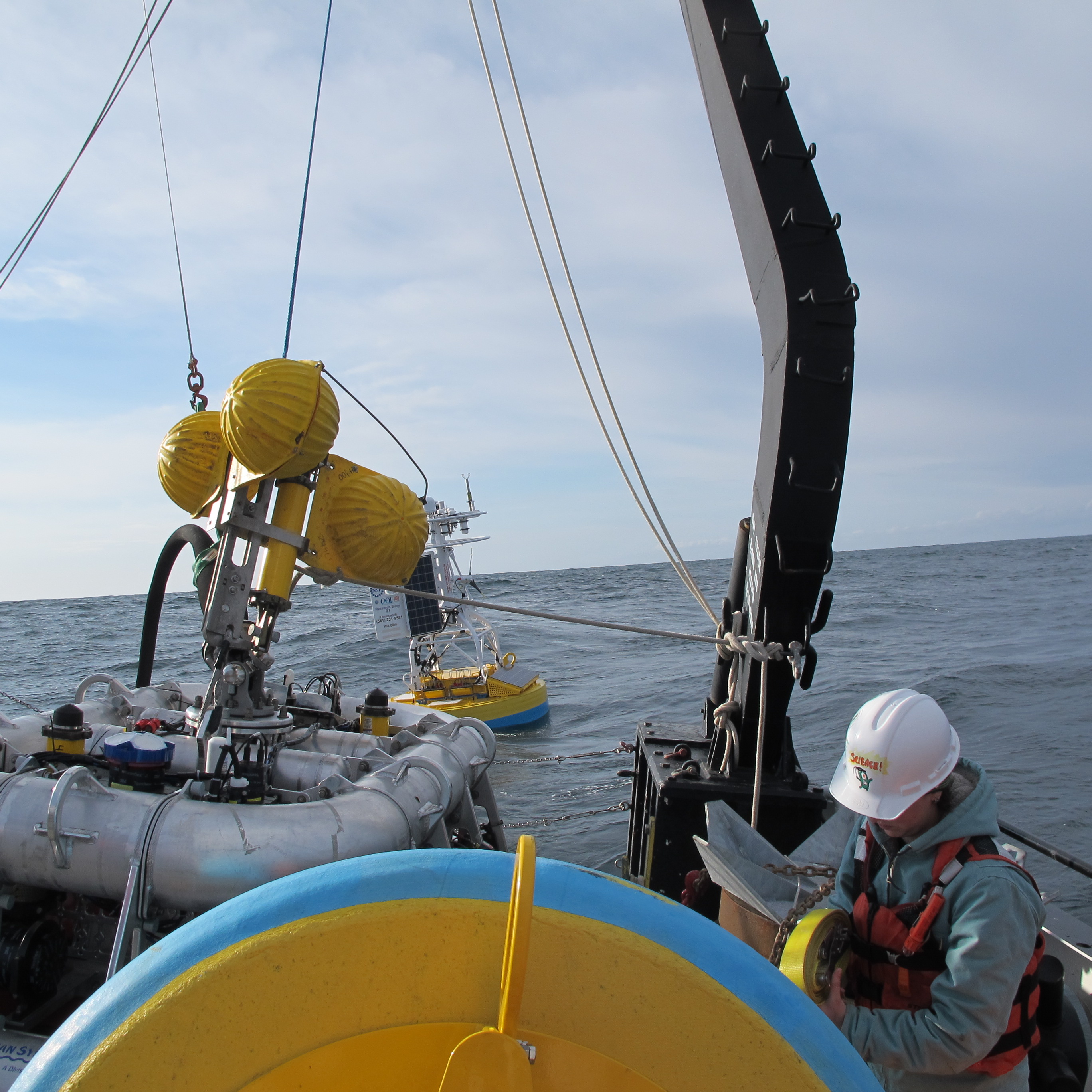
[media-caption path="https://oceanobservatories.org/wp-content/uploads/2024/05/Irminger-gliders.jpeg" link="#"]The OOI CGSN science team will start operations at the Irminger Array by deploying two gliders. This allows the gliders to be monitored by the pilots onshore and ensure all systems are operational while the vessel is still onsite performing mooring operations. These gliders will operate autonomously at Irminger for ~12 months. Credit: John Lund © WHOI.[/media-caption]On the east coast, a second team of 15 scientists and engineers aboard the R/V Neil Armstrong will leave Woods Hole, Massachusetts on June 2 to begin their eight-day transit to the Irminger Sea. Once onsite, the team will recover and deploy four OOI moorings, deploy two gliders, recover a third, and conduct water sampling at the deployment sites. Underway shipboard data will also be collected throughout the voyage. Four additional subsurface moorings will be “turned” for the Overturning in the Subpolar North Atlantic Project (OSNAP). Water and biogeochemical sampling will be conducted in support of both OSNAP and researchers from Boston College. A marine mammal observer from NOAA will be onboard as a continuing collaboration between NOAA and OOI.
Added White, “When planning these expeditions, we do our best to maximize use of ship time by providing berths to researchers who could benefit from direct observation and data collection in these remote locations. During the expedition to Irminger, for example, we will be joined by a graduate student and two undergraduate students from Boston College who will collect biogeochemical data, and experience what it is like to do science at sea.”
A bird’s eye view of a previous Irminger Sea Array expedition:
[embed]https://www.youtube.com/watch?v=LF6Zhmlmd0A[/embed]Daily reports will be filed from both expeditions. Bookmark this site to follow along.
Read More
Global Station Papa Team Recovers Two Years of Data
The winds seemed to have blown in favor of the Global Station Papa 8 team last month. Their mission to “turn” (recover old and deploy new) moorings went without incident, and two-years of data were recovered after COVID canceled the 2020 cruise.
On July 18, the seven members of the Station Papa 8 team set out aboard the R/V Sikuliaq from Seward, Alaska following a seven-day COVID isolation period. The weather was beautiful the first three days while in transit to Station Papa, located in the Gulf of Alaska in the Northeast Pacific, and weather remained favorable for work for the rest of the cruise.
Over the 16-day period at sea, the team successfully deployed and recovered two flanking moorings and one hybrid profiler mooring, and deployed and recovered two open ocean gliders. While on station, the team also conducted 11 CTD (conductivity, temperature, and depth) casts that help calibrate the instruments and validate the data they collect.
This eighth turn of the Station Papa Array was particularly important because the annual expedition to turn the array last year was canceled due to constraints imposed by the COVID-19 pandemic. Instrument data are downloaded upon recovery, and following a Quality Assessment/Quality Control (QA/QC) review, nearly two years of ocean observation data may have been recovered. As part of the review, OOI’s Coastal and Global Scale Node team will inspect the instruments for bio-fouling and reagent use to assess whether there was any significant impact to the data.
“We were really pleased to see that the instruments were still collecting and recording data, even after being in the water for almost two years,” said Kris Newhall, chief scientist of the Station Papa 8 expedition. “In spite of limited battery power and challenging conditions, most instruments continued to collect data for the duration of the two-year extended deployment.”
[embed]http://https://vimeo.com/585980063[/embed] [media-caption path="http://https://vimeo.com/585980063" link="#"]Shown above is the recovery of a Global Station Papa Array subsurface mooring by the team aboard the R/V Sikuliaq. The mooring was coated with marine life that had been growing there for the past two years. The team cleaned the mooring as the ship transited to its next station. Video courtesy of Bern McKiernan. [/media-caption]The periodic turning of the moorings present opportunities to incorporate design innovations into the arrays. The new moorings have improved controllers and new positioning beacons with GPS and flashers built into the housing, which will help increase performance and simplify recovery.
The team returned to Seward on August 2, then made their way back to their home port in Woods Hole, MA. The data retrieved from the moorings will help researchers investigate topics related to climate, ocean circulation, biological productivity, and ocean acidification in this important region of the Northeast Pacific.
Read More
Expanding Reach of OOI Data
 Pioneer Array data is now available on NERACOOS’ new Mariner’s Dashboard. This is but one example of how OOI data are integrated into other data repositories to maximize their benefit and use.[/caption]
OOI shares data with partner repositories and institutions that host similar data but have different user bases. These partnerships expand the data available for forecasting models, help provide insight into current ocean conditions, and serve as important resources for many ranging from fishers and other maritime users to land-based researchers and students.
With the exception of the Station Papa Array, the OOI Coastal and Global Arrays maintain surface buoys. Instruments deployed on these buoys measure meteorological variables such as air temperature, barometric pressure, northward and eastward wind velocities, precipitation, solar radiation, and surface water properties of sea surface temperature and salinity. Other instruments on the moorings collect wave data, such as significant wave height, period, and direction. These data are then consumed by national and regional networks to improve accuracy of weather forecasting models.
The Regional Cabled Array (RCA) consists of fiber-optic cables off the Oregon coast that provide power, bandwidth, and communication to seafloor instrumentation and moorings with instrumented profiling capabilities. A diverse array of geophysical, chemical, and biological sensors, a high-definition camera, and digital still cameras on the seafloor and mooring platforms, provide real-time information on processes operating on and below the seafloor and throughout the water column, including recording of seafloor eruptions, methane plume emissions and climate change. These data are available for community use. Since 2015, the RCA has fed data into Incorporated Research Institutions for Seismology (IRIS), the primary source for data related to earthquakes and other seismic activity. In addition, data including zooplankton sonar data, are being utilized within the Pangeo ecosystem for community visualization and access and pressure data are incorporated into NOAA’s operational tsunami forecasting system.
Helping Improve Models and Forecasting
One of the recipients of OOI data is the National Data Buoy Center (NDBC), part of the National Oceanic and Atmospheric Administration’s (NOAA) National Weather Service. NDBC maintains a data repository and website, offering a range of standardized real-time and near real-time meteorological data. Data such as wind speed and direction, air and surface water temperature, and wave height and direction are made available to the broader oceanographic and meteorological community.
“Many researchers go to NDBC for their data, “said Craig Risien, a research associate with OOI’s Endurance Array and Cyberinfrastructure Teams, who helps researchers gain access to and use OOI data. “NBDC is a huge repository of data and it’s easy to access. So there’s a low barrier for researchers and students who are looking for information about wind speed, water temperature and a slew of other data. OOI contributing to this national repository significantly increases its data reach, allowing OOI data to be used by as many people as possible. “
OOI sea surface temperature data also make their way into the operational Global Real-Time Ocean Forecast System (RTOFS) at the National Centers for Environmental Prediction (NCEP), another part of NOAA’s National Weather Service. RTOFS ingests sea surface temperature and salinity data from all available buoys into the Global Telecommunications System (GTS). OOI glider data also are pushed in near real-time to the US Integrated Ocean Observing System Glider Data Assembly Center (DAC). From there, the data goes to the GTS where it can be used by the operational modeling centers such as NCEP and the European Centre for Medium-Range Weather Forecasts.
The GTS is like a giant vacuum sucking up near real-time observations from all sorts of different platforms deployed all over the world. On a typical day, the GTS ingests more than 7,600 data points from fixed buoys alone. As a result of this vast input, researchers can go to the GTS, pull available data, and assimilate that information into any model to improve its prediction accuracy.
Advancing Forecasting of Submarine Eruptions
As the first U.S. ocean observatory to span a tectonic plate, RCA’s data are an invaluable contributor to IRIS’s collection. Since 2015, the user community has downloaded >20 Terabytes of RCA seismometer data from the IRIS repository. Fourteen different sampling locations include key sites at Axial Seamount on the Juan de Fuca mid-ocean ridge spreading center, near the toe of the Cascadia Margin and Southern Hydrate Ridge. RCA data are catalogued and available on the IRIS site, using the identifier “OO.”
[caption id="attachment_21046" align="alignleft" width="300"] Data from short period seismometers installed at RCA’s Axial Seamount and Southern Hydrate Ridge sites are streamed live to IRIS. Credit: UW/NSF-OOI/Canadian Scientific Submersible Facility, V13.[/caption]
“RCA is a critical community resource for seismic data. Axial Seamount, for example, which erupted in 1998, April 2011, was the site of more than 8,000 earthquakes over a 24-hour period April 24, 2015 marking the start of large eruption,” explained Deb Kelley, PI of the RCA. “Being able to witness and measure seismic activity in real time is providing scientists with invaluable insights into eruption process, which along with co-registered pressure measurements is making forecasting possible of when the next eruption may occur. We are pleased to share data from this volcanically and hydrothermally active seamount so researchers the world over can use it to better understand processes happening at mid ocean ridges and advance forecasting capabilities for the first time of when a submarine eruption may occur.”
Providing Data with Regional Implications
[caption id="attachment_21047" align="alignright" width="203"]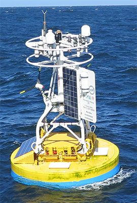 Data from Endurance Array buoy 46100 are fed into WCOFS, where they are accessible to maritime users. Credit: OSU[/caption]
OOI also provides data to regional ocean observing partners. Data from two Endurance Array buoys (46099 and 46100), for example, are fed into a four-dimensional U.S. West Coast Operational Forecast System (WCOFS), which serves the maritime user community. WCOFS generates water level, current, temperature and salinity nowcast and forecast fields four times per day. The Coastal Pioneer Array is within the future Northeastern Coast Operational Forecast System (NECOFS). Once operational, Pioneer’s observations will potentially be used for WCOFS data assimilation scenario experiments.
Coastal Endurance Array data are shared with the Northwest Association of Networked Ocean Observing Systems (NANOOS), which is part of IOOS, and the Global Ocean Acidification Observing Network (GOA-ON). Endurance data are ingested by the NANOOS Visualization System, which provides easy access to observations, forecasts, and data visualizations. Likewise, for GOA-ON, the Endurance Array provides observations useful for measuring ocean acidification.
Data from three of the Pioneer Array buoys also are part of the Mariners’ Dashboard, a new ocean information interface at the Northeastern Regional Association of Coastal Ocean Observing Systems (NERACOOS). Visitors can use the Dashboard to explore the latest conditions and forecasts from the Pioneer Inshore (44075), Central (44076), and Offshore (44077) mooring platforms, in addition to 30+ other observing platforms throughout the Northeast.
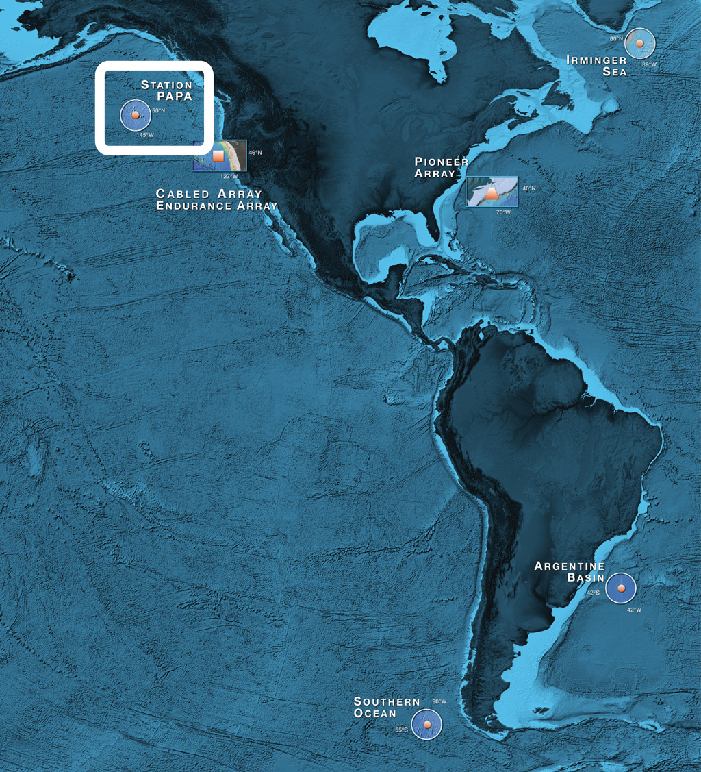
“We are working hard to distribute the OOI data widely through engagement with multiple partners, which together are helping inform science, improve weather and climate forecasts, and increase understanding of the ocean,” added Al Plueddemann, PI of the Coastal and Global Scale Nodes, which include the Pioneer, Station Papa, and Irminger Sea Arrays.
Read More
UNOLS Extends Guidance to Suspend Cruises through 1 July 2020
The University-National Oceanographic Laboratory System (UNOLS), which coordinates oceanographic ships’ schedules, recommended on 17 March 2020 that cruise activities be paused for 30 days due to the COVID-19 pandemic. On 30 March UNOLS extended its guidance to suspend research cruises to July 1 2020. This action is designed to protect the health and safety of the crews and scientific parties.
The planned spring operation and maintenance (O&M) cruise to the Endurance Array in March was affected by the original 30-day guidance. The upcoming O&M cruises for the Pioneer, Irminger, and Papa Arrays aboard R/V Neil Armstrong and R/V Sikuliaq are impacted by this latest guidance.
The OOI is working with UNOLS and ship operators to find potential opportunities to complete the scheduled cruises and conduct needed maintenance on the arrays. In the meantime, there’s been no interruption in OOI data. OOI data continue to be collected and made available for use by the scientific and educational communities.
Read MoreEndurance Cruise Delayed by COVID-19
The spring 2020 OOI Endurance Operations and Management (O&M) turn cruise has been delayed for at least 30 days due to travel and personnel restrictions imposed to stem the spread of the virus COVID-19.
The 16-day cruise was set to depart on 31 March from Newport, Oregon aboard the R/V Sikuliaq to service the array off the Oregon and Washington coasts. The R/V Sikuliaq is part of the US academic research fleet managed by UNOLS (the University-National Oceanographic Laboratory System). UNOLS imposed a 30-day suspension in fleet operations on 13 March to help ensure the safety of the ship’s crew and science party and to mitigate the risk of virus spread. Rescheduling of activities will commence once the situation stabilizes and UNOLS sees a path forward to re-start research vessel operations safely.
Upcoming O&M cruises for the Pioneer, Irminger, and Papa Arrays also are scheduled aboard UNOLS vessels (R/V Neil Armstrong and R/V Sikuliaq). These cruises fall outside of the UNOLS current 30-day suspension so cruise preparation continues.
We do not anticipate that cruise schedule changes will affect the collection nor dissemination of OOI data, which will continue to be available for users here.
Read More
UNOLS hosts Workshop Focused on OOI’s North East Pacific Arrays
The University-National Oceanographic Laboratory System (UNOLS) hosted a recent workshop in Portland, OR focused on the current and future science that can be addressed by the extensive OOI infrastructure operational in the Northeast Pacific.
Read MoreStation Papa Array Annual Maintenance and Profiling Glider Deployment

The Ocean Observatories Initiative (OOI) team in June 2015 conducted deployment and scheduled maintenance activities for the global component of the OOI infrastructure located in the Station Papa site, in the Gulf of Alaska.
Read MoreOOI Deployment and Maintenance at Station Papa
The OOI team in June 2014 conducted deployment and scheduled maintenance activities for the global component of the OOI infrastructure located in the Ocean Station Papa site, in the Gulf of Alaska.
Read MoreOcean Observatories Initiative Deploys First Global Site in Gulf of Alaska
Marking a major milestone, the OOI program in July successfully deployed the first global site of the OOI infrastructure at the Station Papa location in the Gulf of Alaska.
Read MoreOcean Observatories Initiative Deploys First Global Site This Month
This month, OOI will deploy the first global site of the OOI infrastructure at the Station Papa location in the Gulf of Alaska.
Read More