
OOI In The News
OOI Featured in Video of Leading Ocean Research Institutions
[media-caption type="image" class="external" path="https://oceanobservatories.org/wp-content/uploads/2020/10/Wiki-Video.png" alt="Video Wiki" link="#"]The OOI is one of five institutions featured in this five-minute wiki. [/media-caption]
The Ocean Observatories Initiative is featured in a new video wiki Leading Institutions In The Field Of Ocean Research. OOI is joined by Texas A&M’s Harte Research Institute for Gulf of Mexico Studies, the Consortium for Ocean Leadership, Saildrone, and the Future Ocean Labs at the Universida de Vigo. The five-minute video, produced by Ezvid Wiki, summarizes the work of each institution and its contribution to understanding of the changing ocean.
Founded in 2011, Ezvid Wiki was the world’s first video wiki, and is now among the top 3,000 websites in the United States. Its YouTube channel has more than 600,000 subscribers and has had more than 350 million views since its founding.
[threecol_one][button link="https://wiki.ezvid.com/v/5-leading-institutions-in-the-field-of-ocean-research-01a2cd2c" bg_color="#00a9dd" border="#004377" class="bigbutton"]Watch Video[/button]
[/threecol_one]
Read More
ECO Magazine: OSU assumes cyberinfrastructure responsibility for OOI
ECO Magazine posted an article about Oregon State University’s assumption of OOI’s cyberinfrastructure on 7 October 2020.
[threecol_one][button link="https://www.ecomagazine.com/news/ocean-community/osu-assumes-cyberinfrastructure-responsibility-for-ocean-observatories-initiative" bg_color="#00a9dd" border="#004377" class="bigbutton"]Read Full Article[/button]
[/threecol_one] Read More
Invitation to Integrate OOI Data into Teaching
In the March 2020 issue of Oceanography, a group of authors issued an invitation to undergraduate classroom instructors to integrate OOI data into their classrooms.
Abstract
There are many benefits to using real data in undergraduate science education, including building analytical and problem-solving skills and visualizing concepts through real-world examples. The Ocean Observatories Initiative (OOI) provides a unique source of continuous, long-term oceanographic data from multiple locations in the world ocean. Each of these arrays hosts a suite of co-located instruments that measure physical, chemical, geological, and biological properties. Existing educational resources derived from OOI data can be leveraged for undergraduate teaching activities in and beyond the classroom. We provide example applications of the use of OOI resources in lesson plans and in research experiences for undergraduates. There are also abundant opportunities for new resources to be developed by the community. Our goal is to guide educators in determining appropriate OOI data sets and applications for their own needs.
Read the complete article Using Authentic Data from NSF’s Ocean Observatories Initiative in Undergraduate Teaching: An Invitation here.
Read MoreBig Ships and Underwater Robots: Heading Out to Sea with the Ocean Observatories Initiative

Regional Cabled Array Director Deb Kelley, provides some insights as to what the 13 scientists aboard the R/V Thomas G. Thompson will experience during the month of August while in the northeastern Pacific. The interview was reported by the news staff at the University of Washington, 3 August 2020.
It’s summertime, and that means scientists across the University of Washington College of the Environment are in the field collecting data. Researchers in the School of Oceanography are no different and are working off the Oregon coast on their annual expedition to maintain the long-running cabled ocean observatory. Part of the broader National Science Foundation’s Ocean Observatories Initiative (OOI), UW oversees the Regional Cabled Observatory that spans several sites in Pacific Northwest waters, ranging from shallow coastal locales to deeper waters in the open ocean more than 300 miles offshore. Each site hosts internet-connected scientific instruments that measure physical, chemical, geological and biological properties of the marine environment, providing a 24/7, real-time presence in the ocean. The broad goal is to help scientists answer questions about how our planet works, especially in relation to climate and ecosystem changes, and tectonic and volcanic activity in the sea.
For nearly all of August, 13 scientists and engineers from UW will be at sea collecting data and maintaining infrastructure aboard the UW’s R/V Thomas G Thompson. We caught up with Deb Kelley, director of the Regional Cabled Array at the UW, to see what’s in store.
[threecol_one][button link="https://environment.uw.edu/news/2020/08/big-ships-and-underwater-robots-time-to-head-to-sea-again-with-the-ocean-observatories-initiative/" bg_color="#00a9dd" border="#004377" class="bigbutton"]Read Full Article[/button]
[/threecol_one] Read More
During a Pandemic, Is Oceangoing Research Safe?

Dr. Jonathan Fram, project manager for the Endurance Array, is quoted in this Eos article about the potential implications of the cancellation of the spring cruise to recover and redeploy equipment at the Endurance Array:
With research cruises postponed, scientists are trying to get home safe, and others worry about the fate of their instruments left at sea.
Past Plans Scrapped…
Scientists around the world are scrambling to adjust to a rapidly changing environment. Researchers are shuttering their labs, switching to remote observing on telescopes, and learning to present their work virtually.
[button link="https://eos.org/articles/during-a-pandemic-is-oceangoing-research-safe" bg_color="#00a9dd" border="#004377" class="bigbutton"]Read Full Article[/button]
[/threecol_one] Read More
The Economist – Gliders on the storm

(From The Economist / Technology Quarterly)
From sharks to ice shelves, monsoons to volcanoes, the scope of ocean monitoring is widening.
IN NOVEMBER 2016 a large crack appeared in the Larsen C ice shelf off Antarctica (pictured). By July 2017 a chunk a quarter of the size of Wales, weighing one trillion tonnes, broke off from the main body of the shelf and started drifting away into the Southern Ocean. The shelf is already floating, so even such a large iceberg detaching itself did not affect sea levels. But Larsen C buttresses a much larger mass of ice that sits upon the Antarctic continent. If it breaks up completely, as its two smaller siblings (Larsens A and B) have done over the past 20 years, that ice on shore could flow much more easily into the ocean. If it did so—and scientists believe it would—that ice alone could account for 10cm of sea-level rise, more than half of the total rise seen in the 20th century.
The dynamics of the process, known as calving, that causes a shelf to break up are obscure. That, however, may soon change. Ocean Infinity, a marine-survey firm based in Texas, is due to send two autonomous drones under the Larsen C shelf in 2019, the first subglacial survey of its kind. “It is probably the least accessible and least explored area on the globe,” says Julian Dowdeswell, a glaciologist at the University of Cambridge who will lead the scientific side of the project.
The drones set to explore Larsen C look like 6-metre orange cigars and are made by Kongsberg—the same Norwegian firm that runs the new open-ocean fish farms. Called Hugin, after one of the ravens who flew around the world gathering information for Odin, a Norse god, the drones are designed to cruise precisely planned routes to investigate specific objects people already know about, such as oil pipelines, or to find things that they care about, such as missing planes. With lithium-ion-battery systems about as big as those found in a Tesla saloon the drones can travel at four knots for 60 hours on a charge, which gives them a range of about 400km. Their sensors will measure how the temperature of the water varies. Their sonar—which in this case, unusually, looks upwards—will measure the roughness of the bottom of the ice. Both variables are crucial in assessing how fast the ice shelf is breaking up, says Dr Dowdeswell.
The ability to see bits of the ocean, and things which it contains, that were previously invisible does not just matter to miners and submariners. It matters to scientists, environmentalists and fisheries managers. It helps them understand the changing Earth, predict the weather—including its dangerous extremes—and maintain fish stocks and protect other wildlife. Drones of all shapes and sizes are hoping to provide far more such information than has ever been available before.
That’s why it’s hotter under the water
To this end Amala Mahadevan of Woods Hole Oceanographic Institute (WHOI) in Massachusetts, has been working with the Indian weather agencies to install a string of sensors hanging down off a buoy in the northern end of the Bay of Bengal.
A large bank of similar buoys called the Pioneer Array has been showing oceanographers things they have not seen before in the two years it has been operating off the coast of New England. The array is part of the Ocean Observatories Initiative (OOI) funded by America’s National Science Foundation. It is providing a three-dimensional picture of changes to the Gulf Stream, which is pushing as much as 100km closer to the shore than it used to. “Fishermen are catching Gulf Stream fish 100km in from the continental shelf,” says Glen Gawarkiewicz of WHOI. These data make local weather forecasting better.
Three other lines of buoys and floats have recently been installed across the Atlantic in order to understand the transfer of deep water from the North Atlantic southwards, a flow which is fundamental to the dynamics of all the world’s oceans, and which may falter in a warmer climate.
Another part of the OOI is the Cabled Array off the coast of Oregon. Its sensors, which span one of the smallest of the world’s tectonic plates, the Juan de Fuca plate, are connected by 900km of fibre-optic cable and powered by electricity cables that run out from the shore. The array is designed to gather data which will help understand the connections between the plate’s volcanic activity and the biological and oceanographic processes above it.
A set of sensors off Japan takes a much more practical interest in plate tectonics. The Dense Oceanfloor Network System for Earthquakes and Tsunamis (DONET) consists of over 50 sea-floor observing stations, each housing pressure sensors which show whether the sea floor is rising or falling, as well as seismometers which measure the direct movement caused by an earthquake. When the plates shift and the sea floor trembles, they can send signals racing back to shore at the speed of light in glass, beating the slower progress of the seismic waves through the Earth’s crust, to give people a few valuable extra seconds of warning. Better measuring of climate can save lives over decades; prompt measurement of earthquakes can save them in an instant.
Read MoreEos – Incorporating Observatory Data into Oceanography Courses
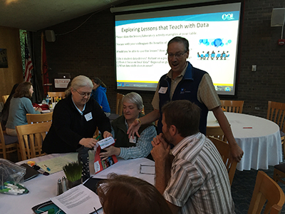
OOI Teaching with Data Workshops; New Brunswick, New Jersey, 19–21 May 2017 (chemistry) and 2–4 June 2017 (geology)
Read MoreGeekWire – Wave Broadband partners with UW to boost ocean observatory’s fiber connections
Wave Broadband is coming out in the open about its partnership with the University of Washington to provide broadband connectivity for the Regional Cabled Array, an undersea observatory that’s part of the federally backed Ocean Observatories Initiative.
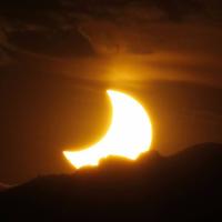
Read MoreLA Times – Poor little zooplankton – they got totally punk’d by Monday’s eclipse

(From Los Angeles Times / Deborah Netburn)
[media-caption type="image" path="/wp-content/uploads/2017/08/la-1503605996-7r2vw3m985-snap-image.jpg" alt="Zooplankton, including this Euphausia pacifica, spend their days in deep water and rise to the surface to feed at night. They made an extra trip on Monday because they were fooled by the eclipse. (NOAA)" link="#"]Zooplankton, including this Euphausia pacifica, spend their days in deep water and rise to the surface to feed at night. They made an extra trip on Monday because they were fooled by the eclipse. (NOAA)[/media-caption]We humans weren’t the only life-forms to be affected by the Great American Eclipse on Monday.
Tiny marine creatures known as zooplankton got all mixed up as the sunlight grew increasingly dim along the path of totality.
One hour before the sky went dark, the gradual change in light caused the confused little critters to begin swimming up the water column to start their nighttime feeding routine.
As soon as totality was over and the light levels began to return to normal, however, they realized their mistake and made their way back to the safety of deeper, darker waters.
“They didn’t make it all the way up because the eclipse is only so long,” said Jonathan Fram, the Oregon State University oceanographer who observed them. “It takes them a while to get to the surface.”
[media-caption type="image" path="/wp-content/uploads/2017/08/la-1503600552-p3w92ijfjn-snap-image.jpg" alt="This plot shows zooplankton (in green) making an extra trip to the ocean surface (in red) during the eclipse. Normally, they come up to feed only at night. (Jonathan Fram / Ocean Observatories Initiative)" link="#"]This plot shows zooplankton (in green) making an extra trip to the ocean surface (in red) during the eclipse. Normally, they come up to feed only at night. (Jonathan Fram / Ocean Observatories Initiative)[/media-caption]To measure the movement of the plankton, Fram used bioacuoustic sonar equipment that is stationed off the Oregon coast.
The sonar equipment is part of a larger suite of instruments deployed by the Ocean Observatories Initiative that allows scientists to measure all kinds of oceanic variables, including water temperature, sunlight and air temperature.
Data collected by these instruments show that, overall, ocean animals do not experience the eclipse the same way we do.
On land, creatures in the path of totality felt the temperature drop several degrees as the moon covered the sun. However, the ocean temperature barely budged — even at totality.
On the other hand, the change in light intensity, which humans generally noticed about 15 to 20 minutes before totality, was more obvious to the deep-dwelling zooplankton earlier in the celestial event, Fram said.
“Light level changes quite a bit at depth,” he said. “If you change the surface light just a little bit, it gets noticeably darker to zooplankton.”
He added that his findings are consistent with similar research done during an eclipse in the early 1970s.
“That’s great,” he said. “That’s what we hoped to see.”
Astronomers and physicists capitalized on the total solar eclipse to gather data on the sun, but findings from the ocean were welcome, too.
“That might be my favorite story of the whole eclipse,” said Dan Seaton, a solar physicist at the University of Colorado who was not involved with the research. “It’s sort of adorable, this whole colony of tiny little creatures being like, ‘Oooh, nighttime!’ and then a few minutes later they’re like, ‘Oops.’
“It’s all part of the magic of eclipses,” he added.
….
[button link="http://www.latimes.com/science/sciencenow/la-sci-sn-eclipse-science-results-20180823-story.html"]Read Full Article[/button] Read MoreLA Times – Will the Great American Eclipse make animals act strangely? Science says yes
(From Los Angeles Times / Deborah Netburn)
It’s not just humans who will be affected by the Great American Eclipse coming on Aug. 21 — expect animals to act strangely too.
Anecdotal evidence and a few scientific studies suggest that as the moon moves briefly between the sun and the Earth, causing a deep twilight to fall across the land, large swaths of the animal kingdom will alter their behavior.
Eclipse chasers say they have seen songbirds go quiet, large farm animals lie down, crickets start to chirp and chickens begin to roost.
[…]
But there is always more to learn, so it should come as no surprise that a few experiments to document animal behavior are in the works for the Great American Eclipse.
Jonathan Fram, an assistant professor at Oregon State University, plans to use a series of bio-acoustic sonars to see whether zooplankton in the path of totality will rise in the water column as the sun is obscured by the moon.
Across the ocean, an enormous number of animals hide in the deep, dark waters during the day, and then swim upward during the cover of night to take advantage of the food generated in the sunlit part of the ocean.
“It’s the biggest migration on the planet, and most of us don’t even know it is happening,” said Kelly Benoit-Bird, a senior scientist at the Monterey Bay Aquarium Research Institute who is not involved with Fram’s study.
Scientists have known for decades that changes in light can affect these animals’ migration patterns. For example, most of these deep-water migrants won’t swim as close to the surface as usual during a full moon. Still, a total eclipse provides an ideal natural experiment that can help researchers learn how important light cues are to different critters, Benoit-Bird said.
Fram, who works on a project known as the Ocean Observatories Initiative, will be able to get data from six bio-acoustic sonars off the Northwest coast — three that are directly in the path of totality and three that are not. This should allow researchers to see how much the sun has to dim to affect changes in the zooplankton’s movements.
….
[button link="http://www.latimes.com/science/sciencenow/la-sci-sn-eclipse-animals-20170809-story.html"]Read Full Article[/button] Read More