
News
Remotely Fixing and Preventing Mooring Issues
Alex Franks’s job is a big one. He is charged with fixing various issues that occur on OOI moorings, while they are hundreds and sometimes even thousands of miles away in the ocean. As an Engineer II at Woods Hole Oceanographic Institution (WHOI), Franks is intimately familiar with the mooring system controller software, which allows him to troubleshoot and fix instrumentation problems on OOI moorings, regardless of their location.
Franks has been working with electronics for over a decade and solving OOI mooring-related challenges since 2015. Many examples exist of his innovative solutions. In 2020, for example, the satellite Internet service that was being used to send data from OOI moorings to WHOI servers was no longer a viable solution. The WHOI team faced the task of either finding a replacement system, or working with the then-current system. One easily implementable solution was to move to transmitting data through OOI’s Iridium radio antennas full time. There were downsides to this solution, however. It would allow no margin of error, would consume more power, and still not be able to send data from all the instruments.
Franks figured out a better solution that would both keep costs manageable and continue to meet timely data transmission goals by modifying the Iridium file transfer portion of the mooring software to accommodate a new data transfer scheme. The new scheme used a feature of the computer program rsync, a fast and versatile file copying tool, called “diff”. Instead of using rsync to communicate with shore servers and determine the “delta” or change between the new instrument data on the mooring and the instrument data files on the WHOI server, he used one of the mooring’s onboard computers as an intermediary server to generate “diff” files against (delineating old from new data). These files were then generated and stored, and sent over the Iridium connection. Using this new configuration, Franks succeeded in sending the entire dataset of all instruments on the mooring, except one that was sent at a reduced sample rate. While transmission times can vary with weather conditions, this newly configured system sends data to the server every 20 minutes every other hour, reducing transmission times from 1440 minutes per/day to about 240 minutes per day.
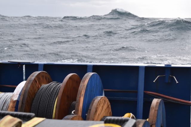
[media-caption path="/wp-content/uploads/2022/04/DSC_0639-copy.jpg" link="#"]Waves in the North Atlantic can get pretty large, which makes it hard to conduct research at sea, especially in winter. The waves and wind in the Irminger Sea also create challenges for ocean observing equipment in the water there year-round. Credit: ©WHOI.[/media-caption]
Franks also found ways to remotely manage mooring issues caused by weather and sea state by modifying software that controls wind turbines. Wind turbines play a critical role on OOI moorings, providing power to recharge the main system batteries. At the Irminger Sea Array, where the sun is absent for months at a time (the moorings also utilize solar panels), these wind turbines are critical. Prior to Franks’ software fix, human input was required to disable the turbines to prevent them from spinning while wave heights were too great. Franks modified the software used to control the spinning of the turbines to read environmental data from the buoy itself and make automated decisions in real-time that previously had to be done manually. The system now changes its configuration based on a variety of sensor inputs, which make for more immediate decisions to ensure the continued safe operations of the turbines. The software modifications not only help mitigate heavy sea damage to the turbines but saves power, as well. The software detects when the air temperature is above freezing and turns off the precipitation sensor heaters, conserving energy when possible. The software also has fail-safes in place for high or low voltage and to determine hydrogen concentration levels inside the electronics. An illustration of this software configuration is provided below.
[media-caption path="/wp-content/uploads/2022/04/Mooring-system-software-upgrade.png" link="#"] This new software configuration detects when the air temperature is above freezing and turns off the precipitation sensor heaters, and has fail-safes in place for high or low voltage and for hydrogen concentration levels inside the electronics .Credit: ©WHOI.[/media-caption]
Franks has also developed software improvements to the power system controller inside the OOI surface moorings. His work ran the gamut from disabling operational bugs in the system to reducing power consumption to fixing software errors to increase reliability. During a year-long deployment in the Irminger Sea, part of the power system controller board failed. Franks installed a software patch remotely that was able to limit the level of charge coming from wind turbines and wrote a fail-safe feature for the system to disconnect all charging sources if the voltage approached dangerous levels.
The challenges are what keeps Franks enthusiastic about his job, “I just love trying to figure out a solution and it’s particularly rewarding to be able to remotely resolve issues with equipment deployed in the open ocean.”
Read More
Efforts to Standardize Data Continue
The OOI Data Teams have recently made great strides in ongoing efforts to standardize data, making it easier for users to understand what OOI data and metadata are available. Efforts have focused on improving labeling, descriptions, and correcting units to ensure consistency. A major improvement underway is matching variable naming conventions with those governed by Climate and Forecast (CF) metadata standards.
The first round of changes is expected to be completed by the end of June 2022. Once these changes are implemented, existing scripts used to download and process OOI data files could be impacted depending on how the code was written. The Data Teams will publish a list of affected streams and recommended code updates prior to the release of these changes, to highlight the improvements and to allow for processing script modifications.
Read MoreIn Spite of Weather, Endurance 16 Delivers
Weather did not deter the Endurance 16 cruise to recover and deploy ocean observing equipment to ensure the continuance of data to shore for the next six months. When heavy weather closed in at the end of the second leg, the science party and crew aboard the R/V Sikuliaq met the challenge, accelerated their schedule, and arrived back in Newport on April 2, several days early.
“In spite of the less-than-ideal weather conditions, we successfully accomplished all activities with the exception of the Oregon Coastal Surface Profiler (CSPP) deployments and the Oregon offshore anchor recovery,” said Ed Dever, Chief Scientist for Endurance 16 and Principal Investigator of the Coastal Endurance Array team at Oregon State University. “When the weather cooperates, we will use a smaller vessel to deploy the remaining CSPP’s. The anchor recovery will be done during Endurance 17.”
He added, “Early spring weather in the Northeast Pacific can be unpredictable and sometimes pretty nasty for shipboard operations. We carefully monitored the weather conditions and adjusted our recovery and deployment schedule accordingly to maximize work that could be accomplished during safe weather conditions.”
[media-caption path="https://oceanobservatories.org/wp-content/uploads/2022/04/Endurance-1.png" link="#"]Working to the weather. Spring in the North Pacific can bring pretty high winds and seas. When the Endurance 16 team had good weather, they pressed on through long days. Here Alex Wick and Kristin Politano get a subsurface float into position on the R/V Sikuliaq during an evening mooring deployment on the OOI Spring Endurance cruise. Credit: Ed Dever, OSU[/media-caption]
In spite of the abbreviated time at sea, in addition to the mooring deployments, the Endurance 16 team also successfully deployed four gliders and recovered another. And, during the second leg of the cruise, a scientific party of five that had joined the expedition succeeded in collecting and recovering sediment trap samples for an ongoing experiment led by Dr. Jennifer Fehrenbacher of Oregon State University.
The sediment traps had been collecting material in place for the past six months and were recovered during the Endurance 16 team’s recovery and deployment work. Once the traps were back onboard, the collecting cups were taken off, emptied, replaced, and the traps redeployed for another six-month period. The researchers packaged the collected materials for analysis at OSU and her collaborators at the University of South Carolina.
The team also analyzed live specimens from night-time plankton tows, which took advantage of the quiet night-time hours when the Endurance team was unable to safely move large, bulky, equipment in the dark.
Added Dever, “Success at sea is about teamwork, and I really appreciate the science party and the captain and crew of the R/V Sikuliaq. Everyone was flexible and willing to work long, arduous hours to get the job done.”
[media-caption path="https://oceanobservatories.org/wp-content/uploads/2022/04/Endurance-in-port.png" link="#"]At the end of an expedition everyone’s eager to get home. Here the R/V Sikuliaq approached NOAA’s pier in Newport, OR, but there was one more chore to do – get that recovered equipment off the deck. The motivated crew and science party cleared the deck within 2 and half hours of docking! Photo: Ed Dever, OSU[/media-caption]
Read More
Ride Along with Pioneer 18
 Here’s an opportunity to travel along with the team of sixteen scientists and engineers as they conduct a bi-annual recovery and deployment of ocean observing equipment at the Coastal Pioneer Array. This is the 18th “turn” of the equipment since the observatory was put in place in 2015. The data collected has advanced understanding of the shelf/slope dynamics and impacts on ecosystems. Bookmark this page to follow along on the expedition, which runs through the end of April.
18th Turn of the Pioneer Array in April
Sixteen science party members will be on board the R/V Neil Armstrong during April for each of two legs comprising the eighteenth turn of the Pioneer Array, where moorings are recovered and new ones deployed. This April cruise will be extremely busy, with 32 overall objectives, as well as other ancillary operations. Pioneer 18 is the first cruise since 2020, when COVID-19 protocols were implemented, to support a larger science party to conduct ancillary activities.
The cruise plan calls for deployment of eight moorings and three gliders and recovery of 10 moorings. Autonomous underwater vehicle (AUV) missions will be conducted in the vicinity of the moored array, providing additional ocean observing measurements. CTD casts and water sampling will be done in conjunction with deployment/recovery operations and ship vs. buoy meteorological comparisons will be made at each Coastal Surface Mooring site.
[media-caption path="/wp-content/uploads/2022/03/DSC0507.jpg" link="#"]During Pioneer 18, ten moorings will be recovered. Once close to the ship, crew members grab the moorings with a hook, and direct them to the stern of the ship to be brought onboard. Credit: Darlene Trew Crist ©WHOI.[/media-caption]
“We are pleased to be approaching full capability for Pioneer 18 after multiple cruises with COVID-related restrictions,” said Al Plueddemann, chief scientist for Pioneer 18 and lead for the Ocean Observatories Initiative Coastal and Global Scale Node of which the Pioneer Array is part. “There is a lot to accomplish over our 21 days at sea, and having the opportunity again to bring collaborating scientists onboard will make full use of the ship and our time at sea.”
On Leg 1, Scientists Mei Sato of Woods Hole Oceanographic Institution (WHOI) will join Pioneer 18 to conduct zooplankton sonar testing, Peter Duley of the National Oceanic and Atmospheric Administration will conduct Marine Mammal Observations, and a student from the University of Rhode Island will oversee a glider deployment. Additionally, unattended underway sampling will be conducted in support of the Northeast U.S. Shelf (NES) Long-Term Ecological Research (LTER) project on Leg 1. On Leg 2, NES-LTER efforts will increase, with four participants (two from WHOI and two from the University of Rhode Island) onboard to conduct activities that include CTD and ring net casts and incubations, as well as continuing unattended underway sampling.
[media-caption path="/wp-content/uploads/2022/03/IMG_6146.jpeg" link="#"]Plans are to deploy three gliders that will collect data in the water column between the Pioneer moorings for the next sixth months. Credit: Darlene Trew Crist ©WHOI.[/media-caption]
Weather conditions and time constraints during the Pioneer 17 cruise precluded complete recovery of the Offshore and Upstream Offshore Profiler Moorings. Additional objectives for Pioneer 18, to be conducted if time and conditions permit, include completing the recovery of these two moorings, as well as several anchor recoveries using a remotely operated vehicle (ROV), glider tests, and surveys in the vicinity of the Pioneer moored array using shipboard systems (CTD, ADCP, EK-80).
“We have a very ambitious agenda for Pioneer-18, but our team is experienced and well-equipped to complete this large list of tasks ,” added Plueddemann. “We just need a good weather window to get the job done.”
Pioneer 18 team members will be sharing their progress during the month of April. Bookmark this page and follow along.
Read More
Uncovering Changing Life in the Water Column
Oregon State University Assistant Professor Jennifer Fehrenbacher needed a ship to carry out her National Science Foundation-funded research investigating the lives of foraminifera (single-celled organisms about the size of a grain of sand and smaller) in the northern Pacific. Her work, in collaboration with Dr. Claudia Benitez-Nelson at the University of South Carolina (UofSC), involves deploying bottom-moored sediment traps and collecting plankton tows while at sea, giving researchers the opportunity to explore foraminifera that live in lighted surface waters, and how these communities have changed over time in response to the surrounding ecosystem.
Fehrenbacher found her ship. She will be joining forces with the Endurance Array Team aboard the R/V Sikuliaq during its bi-yearly expedition to recover and deploy ocean observing equipment at its array in the northeast pacific off the coast of Oregon. Fehrenbacher and her team of four researchers will join the Endurance Array 16 team in early April for the second of its two-leg expedition. This will be a continuation of her research project that began in September 2021.
Last September, Fehrenbacher’s team put in place two tandem sediment traps that are located close to the OOI Slope base node. One was deployed at about 600 meters water depth, the other slightly above the sea floor. The last sediment trap study in this region was conducted around 30 years ago, and the foraminiferal species have likely changed since then, as have ocean conditions.
[media-caption path="/wp-content/uploads/2022/03/IMG_5185-copy.jpg" link="#"]Fehrenbacher’s team will be retrieving two tandem sediment traps that are located close to the OOI Regional Cabled Array slope base node. Credit: Jennifer Fehrenbacher, OSU.[/media-caption]
The sediment traps have been collecting material in place for the past six months and will be recovered along with the Endurance 16 team’s recovery and deployment work. Once the traps are back onboard, the collecting cups will be taken off, emptied, replaced, and the traps redeployed for another six-month period. The researchers will package the collected materials for analysis at OSU and UofSC.
The team also will be examining live specimens from night-time plankton tows, taking advantage of quiet night-time hours to conduct the plankton tows when the Endurance team is unable to work safely moving large, bulky, and unwieldy equipment in and out of the ocean. “This arrangement is a win-win for everyone,” said Endurance Array Chief Scientist Ed Dever. “It maximizes the use of ship time, while helping to provide data to answer some questions about how ocean conditions are changing.”
Fehrenbacher’s team will be conducting a series of discrete new tows from the surface to about 500 meters. “While I don’t anticipate a ton of critters in the really deep water, net tows haven’t been done extensively in these waters at these depths. The last one was 30 years ago by oceanographer Alan Mix and his graduate student Joseph Ortiz, so this new work will give us insight into how life in the water column may have changed over time, “ said Fehrenbacher.
Fehrenbacher’s team will be conducting experiments with live foraminifera in a portable travel lab they will bring onboard. A number of different experiments are planned:
PhD candidate Kelsey Lane will be collecting foraminifera (shortened version “forams”) to study their genetics and their microbial communities, other species living with forams.
Graduate student Grace Meyer will be striving to measure carbon and oxygen isotopes in individual forams. She will be collecting empty shells from both the water column and sediment trap material and compare what is found in both, providing information about water column processes that could alter shells’ composition.
Postdoctoral researcher Brittany Hupp will be collecting both live forams and empty shells to study the chemistry of different types of forams, looking at their isotopes and trace metals content.
Researcher Eric Tappa, a sediment trap expert from the UofSC, will be deploying and recovering the sediment trap equipment. Tappa has been working with sediment trap moorings for decades and have proven critical in providing longer time-series records of processes occurring in overlying waters.
As lead scientist Fehrenbacher will be participating in these onboard experiments. She also will be growing forams under controlled conditions and watching them to learn how temperature modulates their shells or their behaviors during the day-night cycle, and will continue her work with recovered forams once she returns to her home lab. There she will be measuring the trace element concentrations in foram shells so results can help inform the Paleo record. . She explained, “Foram shells are used basically as proxies for environmental conditions. So when we measure trace elements in their shells, this gives us information about the pH, temperature, nutrient content, and even the salinity of the ocean in the past.” The onboard experiments help scientists under how forams incorporate these elements into their shells when they are alive, which they can use in assessing past records.
[media-caption path="/wp-content/uploads/2022/03/IMG_5196-copy.jpg" link="#"]An anchor weighing ~2500 pounds is deployed to keep a sediment trap in place for six months until it is recovered with a treasure trove of marine life and particulates for investigation. Credit: Jennifer Fehrenbacher, OSU.[/media-caption]
Challenges of studying small living things
Studying single-celled organisms is difficult on dry land, but is compounded by a moving ship in rolling seas. Fehrenbacher’s team will be taking onboard multiple microscopes, including an inverted microscope to see their subjects, water circulators to keep them at constant conditions while they are alive, and a pH meter. High-powered microscopes are critical for the work because forams range in size from smaller than a grain of sand—about 100 microns— to up to about a millimeter.
“We look at forams in a petri dish under the microscope,” explained Fehrenbacher. “This is challenging as the ship moves back and forth so does the water in the petri dish so you’re looking back and forth as the ship moves.” The researchers have come up with the solution of holding the petri dish at an angle so the water and foram stay in one place and helps prevent researchers’ sea sickness.
Fehrenbacher predicts that the amount of material collected on the Endurance Array 16 cruise will keep she and her graduate students busy for at least the next two years and beyond. She added, “There’s really just nothing quite like the type of information you can get from sediment trap studies. While going out to sea for two weeks a year and doing plankton tows are helpful, we only get information about what’s in the water column at the exact moment of collection. But sediment traps provide months’ worth of data at really high resolution that we can compare with other OOI data and get a detailed picture of ocean conditions and how those conditions affect marine life.
Read More
NSF Issues Dear Colleague Letter to Support Ocean Technical Workforce Education
The National Science Foundation (NSF) issued a “Dear Colleague Letter” (DCL) on March 14, 2022 seeking proposals for curriculum development and student engagement to support the expansion of the ocean technical workforce. Through the DCL, NSF hopes to expand the technical capacity of the U.S. workforce in high-technology fields through training programs that educate the next generation of ocean technicians, data scientists, ocean engineers, and ocean scientists.
Proposal topics of high priority include training in ocean instrumentation design, manufacturing and maintenance of marine-related hardware, and ocean data science and data analytics. Submissions are encouraged that target documented gaps in the U.S. technical workforce in marine instrumentation and manufacturing sectors, including those related to renewable energy, such as wave, tide, wind, and solar energy systems.
Full details can be found here. Proposers are encouraged to contact the program officers prior to submitting proposals or requests for supplemental funding. For questions about this DCL, please contact Elizabeth (Lisa) Rom – elrom@nsf.gov in the Division of Ocean Sciences, Jumoke Ladeji-Osias – jladejio@nsf.gov in the Directorate of Engineering, or V. Celeste Carter – vccarter@nsf.gov in the Division of Undergraduate Education.
Read More
Sixteenth Turn of the Coastal Endurance Array
A team of ten scientists and engineers will depart aboard the R/V Sikuliaq in late March for a two-week expedition to recover and redeploy ocean observing equipment at the Coastal Endurance Array. Located in the northeast Pacific off the coasts of Oregon and Washington, the Coastal Endurance Array consists of two cross-shelf moored array lines, designed to observe cross-shelf and along-shelf variability in the region.
The team will recover and deploy seven moorings. Four of the moorings are located on the Washington Shelf, with the remaining three on the Oregon Shelf. The team also will be recovering a surface piercing profiler at the Washington Shelf site and deploying four surface piercing profilers on the Washington and Oregon lines. Another goal of the team is to deploy and recover gliders so that five are in the water and continue to sample and report back data over the next three months. The gliders collect data across the shelf in shallow water down to 200 meters and also collect data offshore down to depths of 1000 meters.
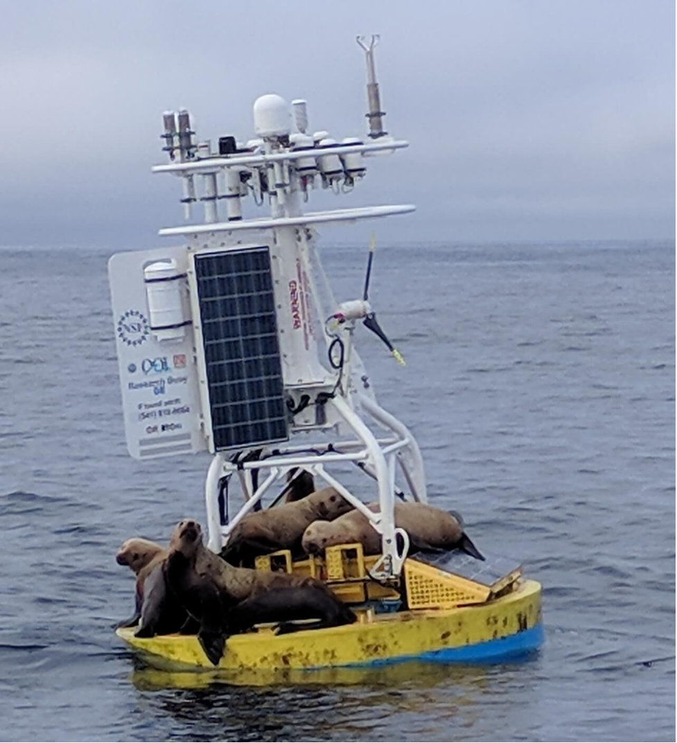
[media-caption path="/wp-content/uploads/2022/03/sea-lions.png" link="#"]The Endurance Array team has to contend with occasional visits of sea lions, which can weigh up to 1000 pounds, and who like to explore the components of the array. This expedition will be testing a re-enforce solar platform to see if can better bear the weight of these hefty and curious visitors. Credit: Endurance Array team.[/media-caption]
When not recovering and deployment equipment, members of the onboard team will be taking CTD (connectivity, temperature, and depth) casts to verify and calibrate instrumentation. Because of the quantity of the equipment to be recovered and deployed, the cruise will take place in two separate legs.
Measurements collected by this array capture the variability of ocean properties across a broad range of temporal and spatial scales. Scientists are using these data to examine ocean health issues such as hypoxia, ocean acidification, and harmful algal blooms, and changing ocean conditions such as intermittent marine heat waves.
“Every time we head out to turn the Endurance Array, the OSU team works together with folks at WHOI to improve the resilience of the gear we put out there and to improve the quality of the data collected,” said Ed Dever, Principal Investigator for the Coastal Endurance Array, serving as Chief Scientist for the Endurance 16 expedition. “It’s a tough environment. The equipment spends six months at sea, getting jostled by high waves and strong winds and serving as habitat for marine life big and small. Yet over the last eight years, we’ve continuously made improvements to the instruments and infrastructure to improve data return. It’s a real testament to the creativity and skills of the whole team. They never stop thinking about ways to make things even better.”
During the second leg of the cruise, a scientific party of five will join the expedition to collect sediment samples for an ongoing experiment led by Dr. Jennifer Fehrenbacher from Oregon State University. This specific scientific inquiry is an example of how the OOI was designed to add instrumentation and adapt sampling approaches to meet the needs of the scientific community it serves.
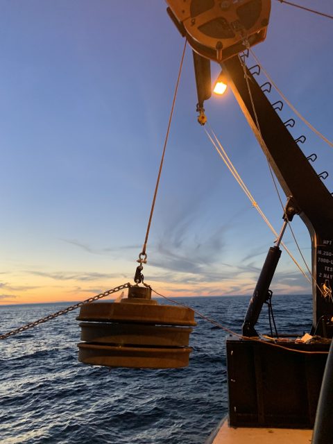
[media-caption path="/wp-content/uploads/2022/03/Sediment-trap.jpeg" link="#"]Dr. Jennifer Fehrenbacher’s team will be deployin this McLane Mark VII 13 cup Sediment Trap, which is used to collect a time-series of material falling through the water column. The stack of three railroad wheels (on right) are the anchor. Credit: University of South Carolina.[/media-caption]
To help answer other specific science questions, the Endurance 16 team also will be conducting sampling for researchers with instruments on the Endurance Array moorings. The team will test deployment of fish acoustic monitors on the near shore instrument frames (see picture below) of both inshore moorings and the Washington Shelf surface mooring for Taylor Chappel a researcher at Oregon State University. The team will also collect settling organisms on devices attached to multi-function nodes on the Oregon Offshore and Surface moorings for Oklahoma State researcher Ashley Burkett.
[media-caption path="/wp-content/uploads/2022/03/Endurance-mfn.png" link="#"]This Near-Surface Instrument Frame (NSIF) is an instrumented cage that is suspended below surface moorings. (7m for Coastal moorings, 12m for Global moorings). The NSIF contains subsurface oceanographic instruments attached to multiple data concentrator logger computers. During Endurance 16, fish acoustic monitors will be added to the standard equipment. Credit: Ed Dever, OSU.[/media-caption]
During this expedition, the team also will be deploying new equipment and other improvements. For example, a new anemometer, which sits at the top of the mooring to measure the wind speed will be deployed for the first time. A new camera made with off-the-shelf components will be put into field during for its first six-month deployment. And, the team will be testing the rigor of its newly reinforced solar panels, which often have to withstand the weight of the occasional visit by sea lions.
The team has followed all COVID protocols and are ready to go. They will be blogging and sharing photographs of their two-week expedition. Bookmark this page and follow along as they share their stories.
Read MoreUW Students Catalog Visual Treasures from the Undersea World
Watch a squid change color or a spider crab move out of the way of the arm of a Remotely Operated Vehicle (ROV), or have a closeup view as a deep sea skate gracefully swims over the seafloor at Axial Seamount. These are but some of the magical moments captured and cataloged by University of Washington (UW) students who have participated in the UW at-sea experiential learning program associated with the Ocean Observatories Initiative Regional Cabled Array’s (RCA) VISIONS cruises.
[media-caption path="/wp-content/uploads/2022/03/Sponge.png" link="#"]The Poralia rufescens was seen at Slope Base. It was found floating in the water column at 2867 meters. Another one was spotted swimming among the dust kicked up by ROPOS at about 2900 meters. Photo Credit: NSF-OOI/UW/CSSF; Dive 1757; V14.[/media-caption]Since 2014, a team of students has been sorting, cataloging, and making publicly available high-definition video and images captured by underwater cameras on ROVs during RCA expeditions. While the primary work of the ROVs is to recover and deploy ocean observing equipment powered by RCA’s high-power and bandwidth submarine cables that stream data live to the Internet, a side benefit is reams of footage and still images of marine life on and near the seafloor and throughout the water column collected during the ROV dives. As part of their shipboard experience during VISIONS expeditions, students stand daily watches in the ROV control labs, working alongside scientists, engineers, and the ship and ROV teams. The students help catalog and timestamp the video footage streaming live from the ROV back to the ship.
The idea for a publicly available online biology catalog was the brainchild of seven VISIONS’14 students on the cruise that year. They were prompted to develop a community resource by perpetually trying to answer the question in the control room: “What do you think that animal is?”
“The initial idea was to create a repository specific to the cabled array and specific to the sites that we visit each year to help answer that question for students and people on shore,” explained Katie Bigham, who evolved from VISIONS student to co-chief scientist for VISIONS’21 and contributed significantly to the catalog during its inception. “We first started the catalog with images and video from Axial Seamount and it grew from there. And Lottie Gonzalez, who has been on every VISIONS cruise since 2017, was instrumental in the catalog’s expansion from Axial to coastal sites.”
[media-caption path="/wp-content/uploads/2022/03/Cockatoo-Squid.png" link="#"]A cockatoo squid (Galiteuthis phyllura) encountered at 585 meters depth during a site survey between the 2-legged mooring EOM leg anchor and the low-voltage node LV01C at Endurance Oregon Offshore. The squid was red when we first encountered it, and then it turned clear as we took video. Photo Credit: NSF-OOI/UW/CSSF, Dive R1752, V14.[/media-caption]
Lottie Gonzalez was hooked on the catalog from here first time at sea. “I wasn’t really sure where to get information on relevant biology that I was seeing in the ROV control room. I was initially directed by Deb Kelley (RCA’s Principal Investigator and Lead of the VISIONS program) to take a look at the biology catalog. As soon as I saw it, it became my first project.” Gonzalez continually added to and updated the catalog during her summer shipboard experiences with the VISIONS program. Gonzalez has also used the catalog as the foundation for training programs and other educational resources she has developed to help guide other VISIONS students and is continuously looking for ways to streamline and improve it.
With input from VISIONS students and professors, the catalog now contains images and videos of eight taxonomic groups and 61 species, along with descriptions of animals’ feeding habits, behaviors, and environmental ranges. Student curators have always welcomed input from experts to help improve content and validate species identification.
The biology catalog was originally designed as a growing archive for students and researchers, but has quickly evolved into an educational and visually spectacular resource for everyone interested in seeing and learning about deep-sea organisms that live in some of the most extreme environments on Earth.
“Part of our job as oceanographers is to share what we know about the vast and unseen ocean below the surface because it is so important to life on the planet,” said Dr. Deborah Kelley, Principal Investigator of the RCA and a UW oceanography professor. “This student-created catalog is serving to inform and excite people about life in the deep ocean, and is a resource for not only scientists, but members of the media, documentarians, educators, and students all over the globe.”
All thanks to the efforts of a few students looking for answers to “What do you think this animal is?”
More images and videos can be seen at the Biology Catalog.
[media-caption path="/wp-content/uploads/2022/03/Dumbo.png" link="#"]A small “dumbo” octopus sits atop a lobate flow at the summit of Axial Volcano – water depth ~ 1500 m (nearly 5000 feet beneath the surface). VISIONS ’13. Photo credit: OOI-NSF/UW/CSSF.[/media-caption]
Read More
Distributed Acoustic Sensing Lays Groundwork for Earthquake, Tsunami Warnings, and More
Researchers using the OOI Regional Cabled Array are at the forefront of testing Distributed Acoustic Sensing (DAS) along the seafloor through funding from the National Science Foundation. Ocean-bottom DAS using submarine fiber optic cables promises to advance what we know about marine geology, offshore earthquakes, ocean currents, ocean waves, sediment transport, marine mammals, and a host of other activities that now can be measured by this revolutionary technique.
Taking advantage of a rare temporary shutdown of RCA’s submarine fiber optic cables during a shore station maintenance period, University of Washington Researcher William Wilcock and California Institute of Technology (Caltech) Graduate Student in Geophysics Ethan Williams were part of a team of scientists who installed DAS interrogators on RCA’s “dark cables” to test and collect data for a community experiment. The experiment was designed to determine the potential of submarine DAS to observe seismic, oceanographic, acoustic and geodetic processes. Each interrogator transmitted laser pulses down the fiber optic cable from RCA’s shore station and across the offshore Cascadia Margin and recorded the echoes that came back. This backscatter remains constant until some movement on the bottom or in the water column perturbs the fibers in the cable, changing the pattern of backscattered light. By rapidly probing the cable hundreds of times per second, DAS allows researchers to monitor what’s happening in the cable environment.
“Using DAS, the fiber optic cable acts, in effect, like a line of seismometers that can measure the stretching and contracting of the ground, “explained Wilcock. “It’s an amazing technology, similar to going out in the field and putting a seismic instrument every 10 meters for a stretch of 100 kilometers. So it’s just astounding in terms of what it can potentially measure,” said Wilcock.
The DAS system also has the capability of measuring other oceanographic signals. “It turns out that ocean bottom acoustic sensing on these fiber optic cables is as sensitive to the water layer above as it is to the solid Earth below. This sensitivity provides all sorts of really interesting signals that you would normally observe using an ocean bottom pressure sensor. DAS is opening up the door for lots of interesting research opportunities,” said Williams, who has been working with DAS systems for years under the supervision of Zhongwen Zhan at Caltech, one of the world’s foremost experts in the field.
Among the many potential ways DAS data might be used include advancing earthquake and tsunami early warning systems, and understanding wave and current action, sediment transport, and ocean-generated seismic noise, as well as providing biological information. In Wilcock’s case, he’s excited about using DAS to gain access to fin whale calls that were picked up by this DAS experiment.
The National Science Foundation funded this experiment in the hopes of developing protocols that can support the use of DAS for science and hazards mitigation in the Northeast Pacific while meeting national security requirements. The U.S. Navy conducted a preliminary review of the data and subsequently released the data for public use. The data are being stored on RCA servers at the University of Washington. Researchers will have ftp access to the data at this link. But because the full data set is 26 terabytes, researchers can also email ooicable@uw.edu to arrange to provide disks that will be returned with data they are interested in.
Four days of continuous measurements in this dynamic offshore environment also offer a potential treasure trove of data. Graduate student Williams is turning his attention to exploring these datasets and calibrating them against conventional measurements to better understand what some of the potential applications may be. “I’m very excited about the potential DAS brings to understanding what’s happening on the seafloor. Having, in essence, so many seismometers on the ocean floor means that we can apply all sorts of array-based processing so we’re not only averaging in time, we’re combining information in space. And this allows a lot of really innovative things that we weren’t able to do before.”
“But the real value of these datasets comes from being an open dataset. It will be a great facilitator for learning with the potential to expand general knowledge about how to use DAS in the marine geology and marine geophysics world, which is great,” Williams added.
Both Wilcock and Williams were excited about the potential for DAS to open up understanding of the processes involved in this deep-sea world. They both mentioned a dream of having DAS sensors integrated into future SMART cable technology to expand DAS use on land and in the sea.
Read More