
Posts Tagged ‘2020’
Regional Cabled Array 2019 Expedition Sets Records
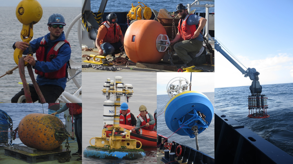
This summer’s Regional Cabled Array (RCA) 44-day expedition (May 30-July 12, 2019) onboard the R/V Atlantis was highly successful with the completion of all tasks scheduled for this annual maintenance and operations cruise. One hundred forty-nine out of 151 RCA Core and PI instruments are operational, all three instrumented Deep Profiler vehicles and instrumented Science Pods on the Shallow Profiler Moorings are conducting daily traverses through the water column, and 113 RCA instruments were installed. It was wonderful to once again see the beautiful life inhabiting the hydrothermal vents at Axial Seamount, amazing aggregations of cod curious about our work at the Oregon Offshore site, and to witness the profound changes that have taken place again at the methane seeps at Southern Hydrate Ridge.
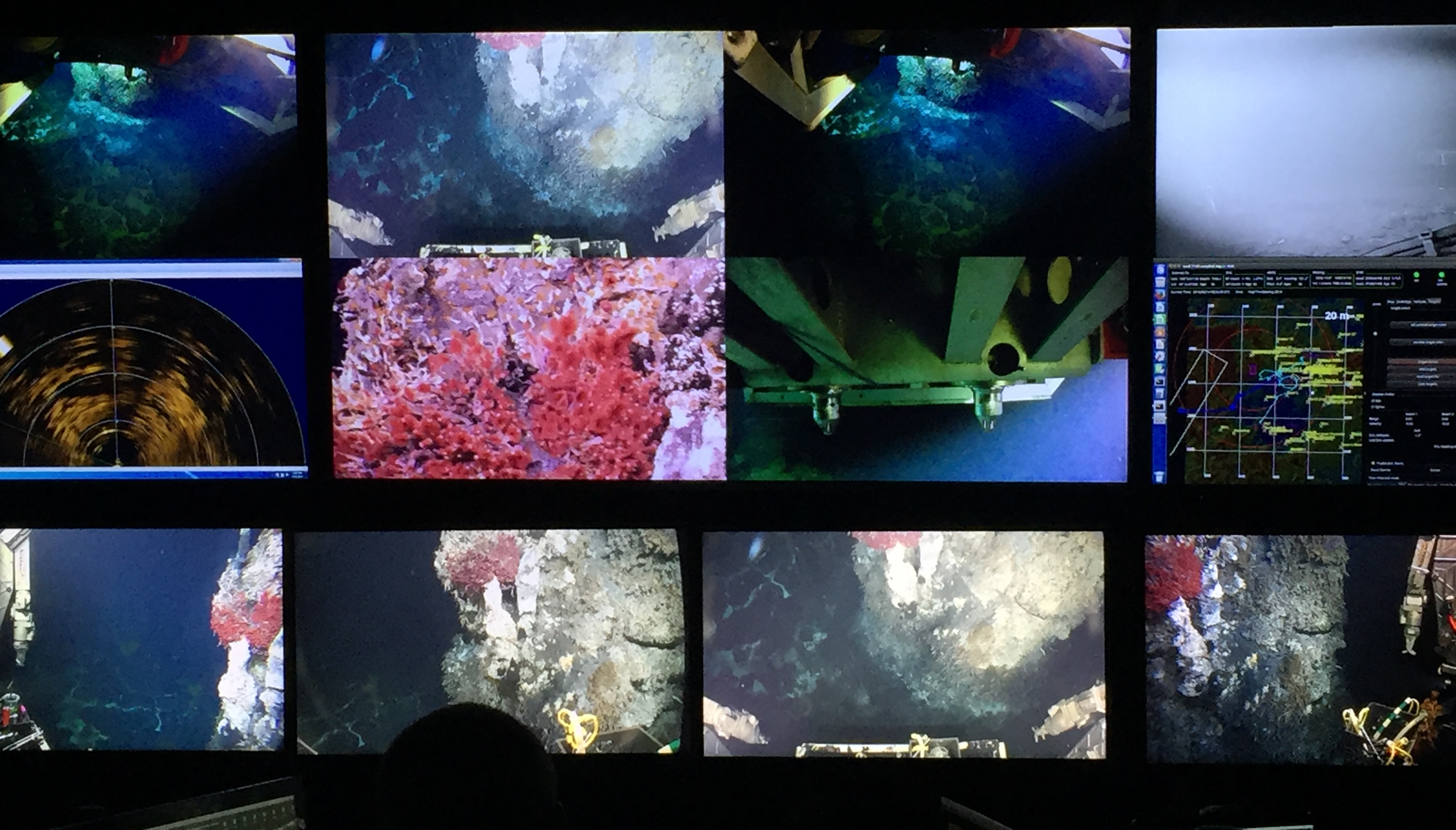
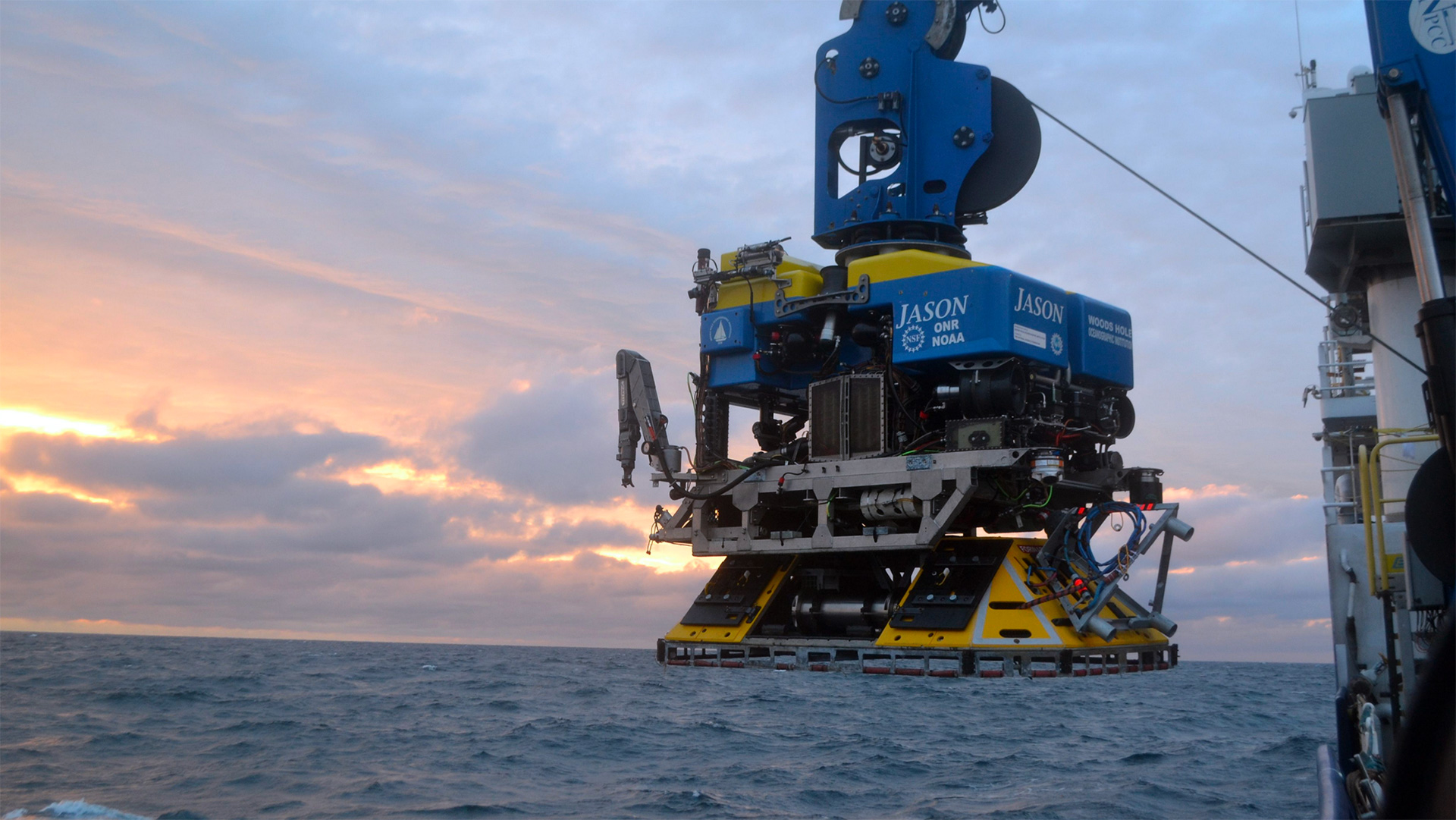
During the 53 days of staging and demobing for the cruise over the four legs 166 tons of RCA equipment were transported to/from Seattle, WA and Newport, OR. Onboard staffing included 52 personnel with 13 students, six non-OOI PI’s-technicians from four institutions and one member from industry. In addition, Susan Casey, a New York Times bestselling author (i.e. The WAVE, the Devils Teeth, and Voices of the Ocean) participated on Leg 4. As part of the NSF Oceans Month, a 1-hour “Science in the Deep” Facebook live interactive broadcast was conducted, including live streaming of imagery from Jason working at Southern Hydrate Ridge and a period for questions and answers. There were 58 Jason Dives, with a record setting 20 dives in five days including deep dives to 2600 m and 2900 m water depths. The vehicle worked extremely well with turn-arounds commonly less than one hour.
Another big success for this summer occurred during nine days of at-sea operations dedicated to turning and installation of cabled and uncabled instrumentation and field work provided to externally-funded researchers. This work included the:
- Installation of an NSF-funded new high resolution, self-calibrating pressures sensor at Central Caldera, Axial Seamount (W. Wilcock, University of Washington).
- The recovery, repair and reinstallation of the NSF-funded COVIS multibeam sonar for hydrothermal plume imaging at the ASHES hydrothermal field, as well as installation of a thermistor array (K. Bemis, Rutgers University); Bemis also conducted a several hour thermal and video survey of the field.
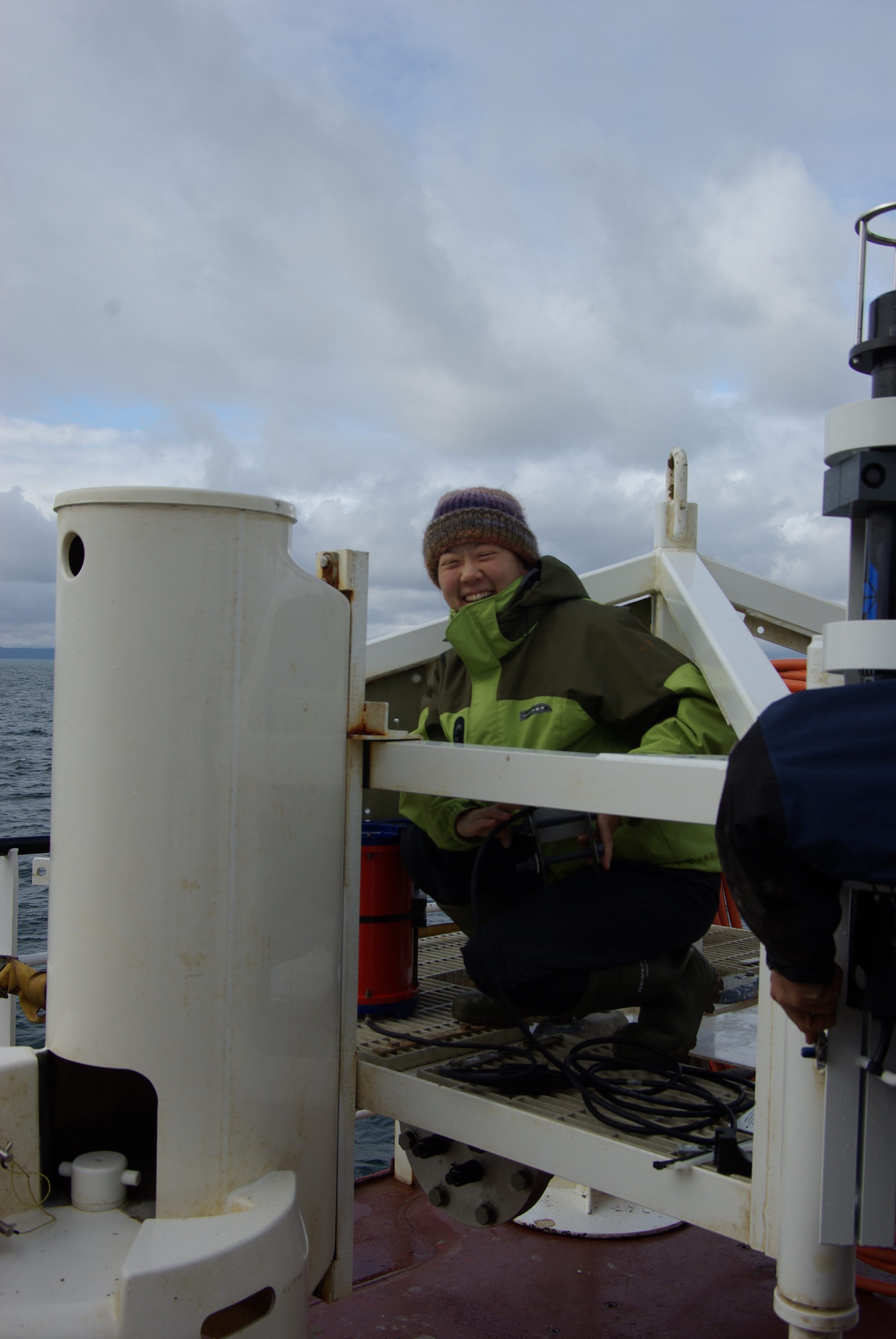
- The turning of an NSF-funded CTD at the ASHES hydrothermal field, Axial Seamount (W. Chadwick, Oregon State University). Note Chadwick received a new NSF award to expand the CTD network to monitor the release of subsurface brines associated with eruptions at Axial as observed during the 2015 eruption (see Xu et al., 2018).
- The recovery of an ONR-funded uncabled Benthic Observatory Platform (BOP) from the Oregon Offshore site and installation of another BOP at a seep site at Southern Hydrate Ridge (C. Reimers-Oregon State University and P. Girguis-Harvard University) and associated sediment sampling; and
- The recovery, repair, and reinstallation of a University of Bremen-Germany-funded cabled overview multibeam sonar for imaging of all methane plumes at Southern Hydrate Ridge (G. Bohrmann and Y. Marcon -University of Bremen) – the range of this sonar is now extended from 200 m to 700 m. A new 4K video-still camera was also installed near Einsteins’ Grotto.
The RCA engineering and science team is enjoying being on land after conducting round the clock operations to insure that the facility work was completed on schedule. Folks are enjoying the Seattle sun and the Cascades and Olympic mountains during the summer blue-skied days. Soon however, our thoughts, will be turning to refurbishment and planning for next years cruise. The team is looking forward to working with the VISIONS19 students on their projects this upcoming academic year; we are excited to see the stories they tell with new eyes focusing on the oceans, the RCA, and OOI.
Read MoreOOI moorings provide sustained observations of the Irminger Sea Deep Western Boundary Current
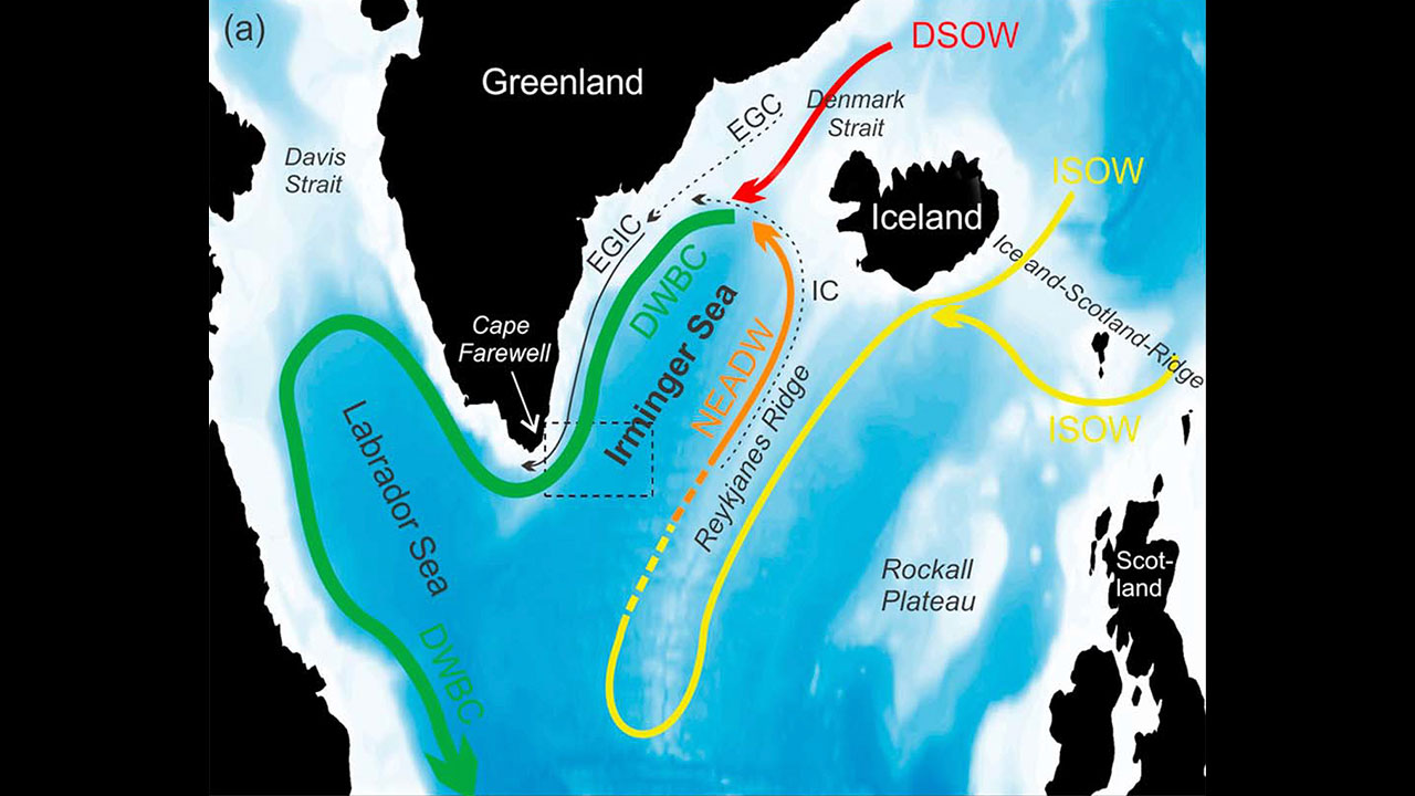
Data from the Ocean Observatories Initiative (OOI) Global Irminger Sea Array contributed to the longest continuous record of total volume transport of water in the Deep Western Boundary Current. This current, in the subpolar North Atlantic, travels southwest along the continental slope off of Greenland and is considered a significant part of the global climate system.
In a recent Journal of Geophysical Research Letters: Oceans paper, Dr. Joanne Hopkins at the National Oceanography Center in Southampton, U.K., and collaborators used data from two U.S. OOI flanking moorings, along with three U.S. Overturning in the Subpolar North Atlantic Program (OSNAP) East Greenland Current array moorings, and five U.K. OSNAP moorings to study the total amount of water moved by the current over a period of two years, as well as its daily and seasonal variability.
The data used for this paper was gathered over 22 months between 2014 and 2016, while all 10 of the moorings were in the water for the same period. Previous research to determine transport estimates at this latitude have been limited by a sparse number of direct and sustained measurements, relying instead on measurements over 9.5 months, 60 days, and “snapshot” or repeated summertime hydrographic sections.
Hopkins et al estimate that the Deep Western Boundary Current transports an average of 10.8 × 10⁶ m3 of water per second with variation in time. In addition, the transport variability shifts from high to low frequencies with distance down slope. While the results did suggest an increase in transport since 2005-2006, they did not conclude that there was a significant long-term trend, given the limitations of previous data sets.
The location of the OOI Global Irminger Sea array was selected as part of an effort by the scientific community to place moorings in areas that have been historically under-sampled and subject to high winds and sea states that make frequent ship-based measurements difficult. The OOI Data Portal provides access to data from the Irminger Sea Array dating back to the initial installation in September 2014.
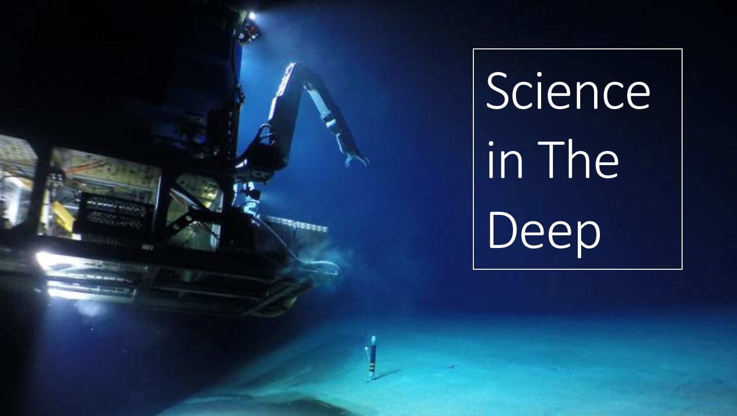
Read MoreNSF Science in the Deep with ROV Jason
NOTE: Video of this event available here. Fast forward to about 52:00 to get past the distorted audio.
The National Science Foundation will host “Science in the Deep,” a Facebook Live event with researchers aboard R/V Atlantis on Wednesday, June 26, from 1:00-2:00 p.m. Eastern. The Atlantis team will be off the coast of Oregon servicing parts of the Ocean Observatories Initiative Regional Cabled Array using the remotely operated vehicle (ROV) Jason, which is expected to be 800 meters deep at Southern Hydrate Ridge, where methane bubbles from the seafloor and life flourishes.
Join NSF host Deena Headley as she speaks with OOI Research Scientist Michael Vardaro and Research Scientist/Eng2 Katie Bigham, both from the University of Washington, about their work on the recent cruises off the U.S. Northwest Coast, live views from Jason on the seafloor, and life at sea.
Read MoreStreaming Live From the Deep: The 2019 OOI Regional Cabled Array expedition
This summer’s exciting sea-going expedition in the Northeast Pacific to maintain the National Science Foundation’s Ocean Observatories Initiative Regional Cabled Observatory is underway, and you can join us at InteractiveOceans.
Over the next several weeks, the University of Washington Cabled Array team will be adding novel sensors that allow a global audience to watch live the daily deformation and seismic activity at the largest underwater volcano off our coast, Axial Seamount. Axial erupted in 2015 and is poised to do so again. In addition, we will be adding new instruments, including a 4K video camera aimed at a highly dynamic methane seep site off Newport, Oregon, called Southern Hydrate Ridge, where streams of bubbles issue from the seafloor daily.
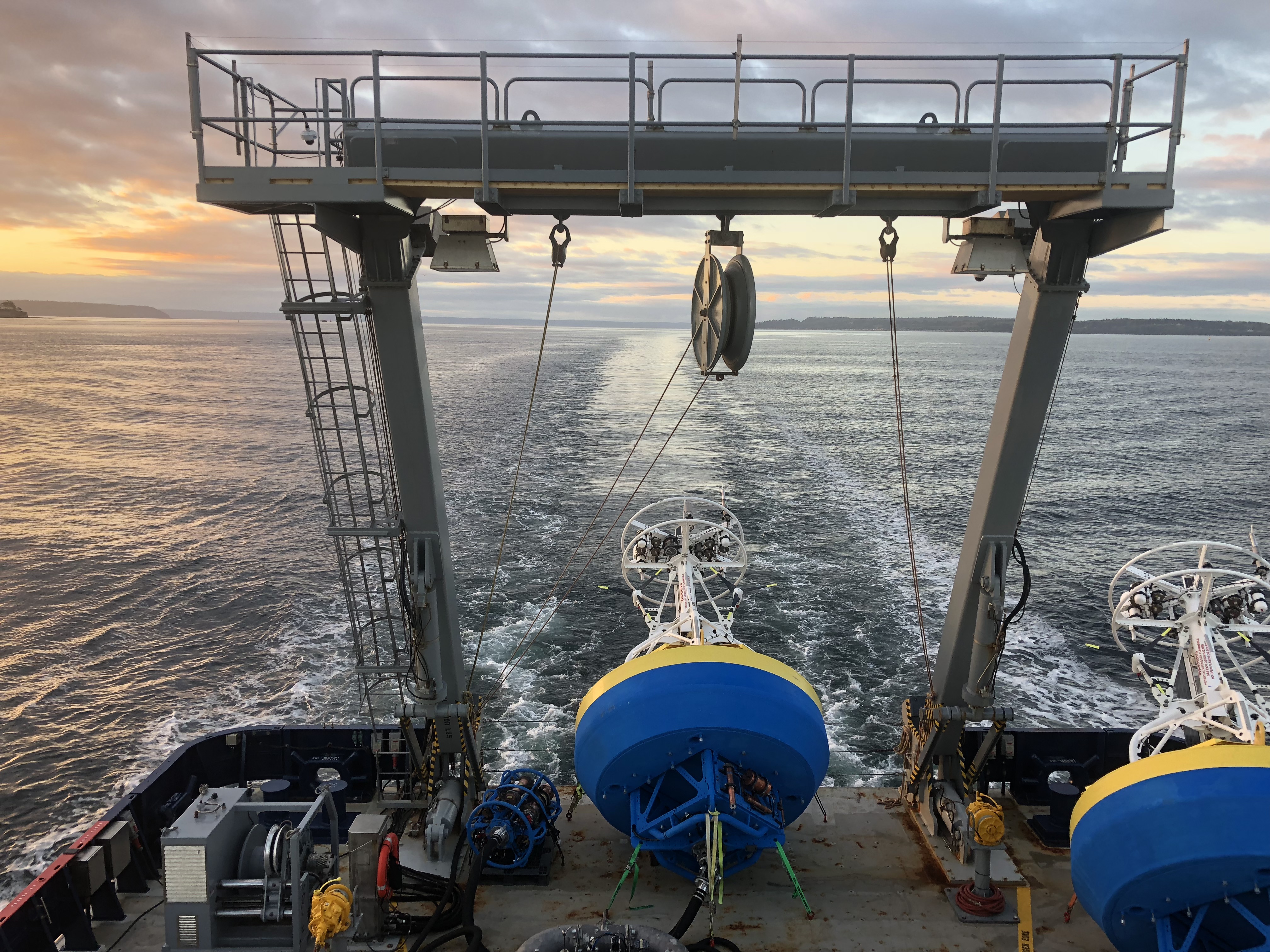
[media-caption type="image" path="https://oceanobservatories.org/wp-content/uploads/2019/06/AtlantisBackdeck_1_small-1080.jpg" link="#"]R/V Atlantis steams back to shore after Leg 1 of the 2019 Regional Cabled Array cruise, following the successful installation of the Shallow Profiler Mooring at Axial Base. Photo by J. Tilley, University of Washington[/media-caption]The cruise, which departed June 2 and continues until July 12, is using the remotely operated vehicle (ROV) Jason onboard the R/V Atlantis operated by Woods Hole Oceanographic Institution. Nineteen U.S. and international undergraduate students are working side-by-side scientists, engineers, ROV team, and ship’s crew on the expedition as part of the UW experiential at-sea VISIONS program.
This expedition is highly complex with a diverse array of more than100 instruments, junction boxes, and instrumented pods on the Shallow Profiler Moorings that will be recovered, installed, and tested. R/V Atlantis will be “packed to the gills” on each of the four legs that make up this expedition, carrying everything from state-of-the-art mooring components to sharpies.
Starting around June 12 or 13, you will be able to watch our underwater operations live through streaming video as ROV Jason works more than 300 miles offshore and 5,000 feet below the surface down at the summit of Axial Seamount, which hosts 350°C (660°F) deep-sea hot springs that support some of the most bizarre creatures on Earth. We will also be 250 miles off Newport in depths ranging from 250 feet to 10,000 feet in some of the most biologically productive waters in the world and at sedimented sites on the Cascadia margin where methane-rich plumes jet from the seafloor. There, methane seeps support dense bacterial mats and large clams that thrive in the absence of sunlight on gases pouring from the seafloor.
A 4K camera funded by the University of Bremen will provide real-time views of the methane plumes and seafloor life to document this incredibly dynamic environment marked by large explosion pits and collapse basins. This is the second year of this international collaboration that expands the capability of the Regional Cabled Array and provides new imagery of these dynamic systems for all to see.
An enhanced, high-bandwidth satellite connection from R/V Atlantis will allow you to experience our deep-sea operations through daily live video streams. It will also allow onboard engineers and scientists to see data for the first time as new instruments are connected to the seafloor submarine fiber optic cables that bring the global Internet into the oceans. So tune in and see what we see when we see it.
Read MoreOpportunity to provide feedback on OOI Data Delivery Systems
We need your help evaluating Ocean Observatories Initiative (OOI) data delivery systems and to assess the extent to which they meet the needs of the user community. The information we gather through this survey will be used to improve the current OOI data delivery systems and perhaps develop other systems that better meet the needs of users. We want to know what you think of the OOI data delivery systems and how they could be improved for users.
The survey should only take about 15 minutes to complete. Your participation is voluntary and your responses are anonymous. Click here for the OOI Data survey
Please complete the survey by April 26th. This survey is being conducted by the NSF’s OOI Facility Board’s Data Dissemination and Cyber Infrastructure (DDCI) Committee. If you have any questions, please contact Tim Crone.
Thank you very much for your time and feedback.
Regards,
Tim Crone, DDCI Committee Chair & Larry Atkinson, OOIFB Chair
Endurance Array Fall 2018 cruise data available through OOI Data Portal
Endurance Array Fall 2018 cruise data available through OOI Data Portal
[media-caption type="image" path="https://oceanobservatories.org/wp-content/uploads/2019/01/IMG_1853.jpg" link="#"]The shelf and offshore Washington buoys on the back deck of the R/V Sally Ride. Photo Credit: Zoë Philby[/media-caption]The Fall 2018 Endurance Array cruise on the R/V Sally Ride departed Seattle, Washington on September 16 and completed in Newport, Oregon on September 30. All uncabled moorings were recovered and newly refurbished moorings deployed in their place. Telemetered science data from this deployment are being ingested and are available through OOI’s Data Portal. Data from instruments deployed in spring 2018 and recovered in Fall 2018 are also available through OOI’s Data Portal. As bottle data are analyzed, they are being posted to alfresco.oceanobservatories.org. The full cruise report is available at this URL.
Read MoreA Community Welcome from The OOI 2.0 Team
A Community Welcome from The OOI 2.0 Team
The Ocean Observatories Initiative team is excited about implementation of OOI 2.0 and advancing this community facility over the next five years. Phase two of OOI began October 1, 2018 following the award by the National Science Foundation of a cooperative agreement to Woods Hole Oceanographic Institution (WHOI) to host the Program Management Office. Operations and maintenance of observatory components remains as before with WHOI operating the Global sites and the Pioneer Array, the University of Washington (UW) operating the Regional Cabled Array, Oregon State University (OSU) operating the Endurance Array, and Rutgers, the State University of New Jersey operating the cyberinfrastructure that ingests and delivers data. One important change in OOI 2.0 is that the data assessment responsibilities, formerly at Rutgers, are now distributed among the marine operating institutions to provide better integration with the science and engineering teams, as OOI 2.0 puts renewed emphasis on data QA/QC and data access.
[media-caption type="image" path="https://oceanobservatories.org/wp-content/uploads/2019/01/PioneerSurfaceMooring-300x184.jpg" link="#"]Figure 1. The Multi-Function Node of a Pioneer Surface Mooring prepared for launch on the fantail of the R/V Armstrong. Pioneer Array moorings are recovered and replaced with refurbished components twice per year. (Photo credit: OOI CGSN)[/media-caption]The Global Array infrastructure deployments at the Irminger and Papa sites are ongoing – entering their 5th and 6th year of operation, respectively. OOI operations at the Irminger Sea Array are conducted in coordination with the NSF Overturning in the Subpolar North Atlantic Program (OSNAP), while OOI subsurface moorings and gliders at Papa are deployed in coordination with a surface mooring from NOAA’s Pacific Marine Environmental Laboratory. Deployments with reduced scope, consisting of a surface mooring only, are being conducted at the Southern Ocean Array in collaboration with the National Oceanography Centre (NOC), Southampton, UK. Operations at the Argentine Basin Array have been suspended. The Pioneer Array (Figure 1), serviced twice per year, is preparing for its 12th mooring service cruise. Several community PI projects have leveraged the Pioneer Array infrastructure, including the New England Shelf Long-Term Ecological Research (LTER) program. Observations from Pioneer, in conjunction with remote sensing and historical data, have highlighted new shelf-slope exchange mechanisms within a rapidly changing physical system with significant impacts on ecosystems.
[media-caption type="image" path="https://oceanobservatories.org/wp-content/uploads/2019/01/EnduranceArray-300x169.png" link="#"]Figure 2. The September 2018 Endurance Array cruise occurred during the transition to OOI 2.0. We recovered equipment deployed in March 2018, deployed newly refurbished equipment and continued delivering data to the OOI Data Portal. (Photo credit: OOI OSU)[/media-caption]The Endurance Array (Figure 2) includes moorings, profilers and gliders off Oregon and Washington. The infrastructure off Oregon is tied into the Regional Cabled Array at the shelf and offshore locations. The full scope of the Endurance Array was first deployed in April 2015, and we are preparing for our eleventh Endurance Array cruise in April-May 2019. Significant technical improvements have been made across the array based on system performance. Among the many improvements, we have updated sensors (Satlantic ISUS sensors replaced with SUNA) and improved bio-fouling mitigation (UV biofouling protection added to dissolved oxygen optodes). Notable successes on the Endurance Array include observations of seasonal hypoxia events at multiple locations using fixed time series, profilers, and gliders. There are also moored multi-spectral optical attenuation and absorption time series from fixed depths and from profilers. While the OOI data portal is the source of all Endurance Array data, to better serve the regional user community, some Endurance Array data is passed through other widely used access points. Near real-time Endurance buoy meteorological and surface data can be accessed through NDBC. Recent near real-time Endurance Array data can also be accessed through the regional IOOS site, nanoos.org. OOI glider data is also passed on to the IOOS Glider DAC.
[media-caption type="image" path="https://oceanobservatories.org/wp-content/uploads/2019/01/RegionalCabledArray-300x200.jpg" link="#"]Figure 3. The R/V Revelle fully loaded with the Regional Cabled Array infrastructure for installation during Leg 1 of the 2018 expedition. (Photo credit: OOI UW) [/media-caption]The Regional Cabled Array (Figure 3) is now in its 5th year of operation. As part of the OOI 2.0 transition, the UW partnered with Pacific Northwest Gigapop to operate the terrestrial west coast infrastructure, which included moving the Cabled Array and CI servers to Seattle from Portland, Oregon. In addition, the UW is now responsible for the port agent drivers and data parsers for Cabled Array Core and PI instruments. The CI Machine to Machine interface is now being routinely used by the community to access Cabled Array data, and compared to samples for verification. The OOI Cabled Array Core infrastructure is enhanced by the addition of 13 “PI” instruments with funding from the NSF, the Office of Navy Research and Germany. Newly installed PI instruments include two cabled multibeam sonars that are imaging all methane plumes issuing from the seeps at Southern Hydrate Ridge as well as a CTD-O2 sensor, two new geophysical sensors, the cabled COVIS multibeam sonar, as well as three uncabled thermistor arrays. The Shallow Profiler moorings continue to be work horses for the Cabled Array, having completed >30,000 profiles since 2015. During this next ~ six months, the Cabled Array team is working hard on platform and instrument refurbishment, and integration as testing in preparation for our 2019 cruise, which begins late May onboard the R/V Atlantis.
The OOI cyberinfrastructure (CI) is a robust CI system architecture with established processes based on community best practices that allows 24/7 connectivity and ensures sustained, reliable worldwide ocean observing data any time, any place, on any computer or mobile device. Since the operations and maintenance phase of the project started in January 2016, the OOI CI system infrastructure has provided and continues providing extremely high uptime and quality of service, has served over 150 million user requests, delivered over 100TB of data to user from over 100 distinct countries across the globe. This CI architecture is being used as model by other NSF facilities.
Read MoreOceanographers from around the world explore deep ocean observing questions in the NE Pacific
Last month, the OOI hosted a workshop in Seattle, WA focusing on exploring research questions in deep ocean observing in the NE Pacific using nearby OOI arrays (Cabled Array, Endurance Array, Station Papa) and other regional observatories.
Read MoreOceanHackweek 2018 explores the intersection of data science and oceanography
Stemming from the successful Cabled Array Hackweek in February 2018, the OceanHackweek last month set out to broaden their scope of data exploration to include all OOI assets as well as other large scale ocean observatories, such as Argo and the Integrated Ocean Observing System (IOOS).
Read MoreEarly Career Highlight – Mei Sato – Using sound to unravel how animals change their behavior in complex environments
“Having all of those sensors available at the same time as bioacoustics data is a huge opportunity for me and other scientists,” says Sato. “It is not just biology or physics, it is the coupling that is so critical. I think the OOI will provide a big opportunity for us to answer questions in this gap.”
Read More