
Posts Tagged ‘Irminger Sea Array’
OOI achieves milestone with Irminger Sea deployment
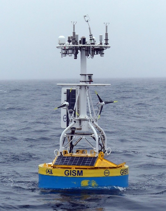
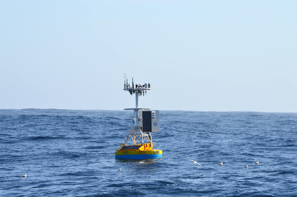
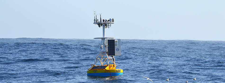
The recently completed OOI mooring service cruise on the R/V Neil Armstrong (2-25 Aug 2019) established a significant milestone – the Irminger Sea Global Surface Mooring was sustained for over a year and returned high quality data. To our knowledge, this is the first surface mooring with instrumentation to compute bulk air-sea fluxes of heat, moisture and momentum that has operated through a full annual cycle in this region.
It is now recognized (e.g. de Jong and de Steur, 2016, Geophys. Res. Lett., 43, 7106–7113, DOI: 10.1002/2016GL069596) that extreme heat loss in the Irminger Sea results in deep water formation, which ultimately influences the strength of the Atlantic Meriodonal Overturning Circulation and has important climate implications. The strong heat loss in the region is largely driven by episodic cold-air outbreaks from the southern tip of Greenland (Josey et al., 2019, Geophys. Res. Lett., 46. DOI: 10.1029/2018GL080956).
[media-caption type="image" path="https://oceanobservatories.org/wp-content/uploads/2019/09/Winds1-300x212.jpg" link="#"]Fig. 2. Satellite scatterometer winds (QuikSCAT) during a cold-air outbreak (right; from Vage et al., 2008))[/media-caption]Cold-air outbreaks are associated with high winds, sub-freezing temperatures, and large, steep waves (Vage et al., 2008, J. Phys. Oceanogr., 38(3), DOI: 10.1175/2007JPO3678.1), which create very difficult conditions for sustained observations at the air-sea interface. The situation is further complicated by the occasional passage of icebergs, which could impact the buoy. The lack of continuous time series data through the winter season capable of identifying episodic events has hindered understanding of air-sea interaction in the Irminger Sea.
The biggest risks to sustained operation of the OOI Irminger Sea mooring were determined to be icing on the buoy tower & freezing of sensitive instrument components. Icing could not be controlled, but potential impacts could be mitigated, for example by shutting down the wind turbines to reduce the likelihood of broken blades. However, a turbine shut-down also meant reduced power generation. Freezing of the precipitation sensor was controllable using a built-in heater, but at the cost of additional power.
[media-caption type="image" path="https://oceanobservatories.org/wp-content/uploads/2019/09/Buoy-300x169.jpg" link="#"]Fig. 3a. Buoy cam pictures showing tower icing.[/media-caption]The CGSN operations team took on the challenge by monitoring weather forecasts for conditions conducive to icing, adding cameras to the buoy tower to detect icing, and implementing a power management strategy during storms. When icing conditions were forecast, the wind turbines were shut down to reduce the likelihood of damage, while some mooring components were simultaneously shut down to save power. Power to high priority instruments (including the bulk meteorology system) and the precipitation sensor heaters was maintained. The strategy was effective, but the difficulty of sustained observations was still evident: The direct-covariance flux package was damaged upon deployment and did not return useful data. The buoy sustained damage to the wind vane, a solar panel and a wind turbine during the winter storms. This compromised power generation capability eventually led to an eight-day data gap in June 2019 due to sustained low wind and overcast skies.
[media-caption type="image" path="https://oceanobservatories.org/wp-content/uploads/2019/09/Winds-2-300x225.png" link="#"]Fig. 4. Time series of METBK meteorological parameters spanning the full deployment period. Left panel: Air (red) and sea surface (blue) temperature, relative humidity and barometric pressure. Right panel: East (red) and north (blue) wind, shortwave (red) and longwave radiation, and precipitation.[/media-caption] [media type="image" path="https://oceanobservatories.org/wp-content/uploads/2019/09/Winds-3-300x225.png" link="#"][/media]Despite the challenges, the buoy bulk meteorology system operated for 420 days of the 428-day deployment (8 June 2018 – 9 Aug 2019) and returned a wealth of scientific data. One-minute records from the bulk meteorology sensors show wind speeds up to 25 m/s and air temperatures as low as -5 C associated with cold -air outbreaks that likely dominate the cumulative wintertime heat loss, as described by Josey et al. (2019). The availability of the first annual cycle of surface meteorology, in conjunction with subsurface data from the OOI Irminger Sea array and the Overturning in the Subpolar North Atlantic Program (OSNAP) array, provide the potential for new insights into the nature of deep mixing, carbon sequestration and deep-water formation in the region.
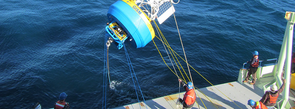
[media-caption type="image" path="https://oceanobservatories.org/wp-content/uploads/2019/09/team-640x360.jpg" link="#"]Fig. 5. Photo of the Irminger-5 buoy about to be recovered from the R/V/ Armstrong in August 2019. A close look shows damage to the wind turbine and solar panel on the left side.[/media-caption] Read MoreOOI moorings provide sustained observations of the Irminger Sea Deep Western Boundary Current
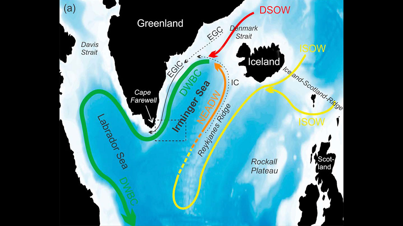
Data from the Ocean Observatories Initiative (OOI) Global Irminger Sea Array contributed to the longest continuous record of total volume transport of water in the Deep Western Boundary Current. This current, in the subpolar North Atlantic, travels southwest along the continental slope off of Greenland and is considered a significant part of the global climate system.
In a recent Journal of Geophysical Research Letters: Oceans paper, Dr. Joanne Hopkins at the National Oceanography Center in Southampton, U.K., and collaborators used data from two U.S. OOI flanking moorings, along with three U.S. Overturning in the Subpolar North Atlantic Program (OSNAP) East Greenland Current array moorings, and five U.K. OSNAP moorings to study the total amount of water moved by the current over a period of two years, as well as its daily and seasonal variability.
The data used for this paper was gathered over 22 months between 2014 and 2016, while all 10 of the moorings were in the water for the same period. Previous research to determine transport estimates at this latitude have been limited by a sparse number of direct and sustained measurements, relying instead on measurements over 9.5 months, 60 days, and “snapshot” or repeated summertime hydrographic sections.
Hopkins et al estimate that the Deep Western Boundary Current transports an average of 10.8 × 10⁶ m3 of water per second with variation in time. In addition, the transport variability shifts from high to low frequencies with distance down slope. While the results did suggest an increase in transport since 2005-2006, they did not conclude that there was a significant long-term trend, given the limitations of previous data sets.
The location of the OOI Global Irminger Sea array was selected as part of an effort by the scientific community to place moorings in areas that have been historically under-sampled and subject to high winds and sea states that make frequent ship-based measurements difficult. The OOI Data Portal provides access to data from the Irminger Sea Array dating back to the initial installation in September 2014.
Read MoreEarly Career Highlight – Hilary Palevsky and the Irminger Sea Biological Pump
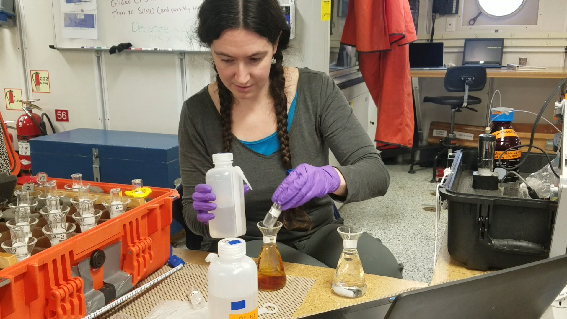
“I wanted to study the ocean’s role in climate and how it takes carbon out of the atmosphere,” says Palevsky. “My goal was to look at the balance between biological, physical, and chemical processes and how they allow the ocean to take up carbon.”
Read MoreCollaborations across the North Atlantic – Reflections on the 2017 Irminger Sea Regional Science Workshop
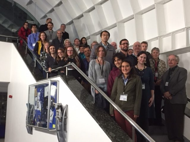
Late last year, more than 30 researchers from countries spanning the Atlantic met in Southampton, UK at the National Oceanography Centre to foster coordination of research efforts focused on the Irminger Sea region. Of central importance to the workshop was to bring in young investigators.
[media type="image" class="external(onlynecessaryiflinkopensdifferentsite)" path="/wp-content/uploads/2018/04/IMG_1270-e1523556889622-300x225.jpg" alt="30 Researchers at the National Oceanography Centre" link="#"][/media]“The Irminger Sea workshop provided me with an incredibly valuable opportunity to meet and develop connections with others working in this region, and to gain a better understanding of the current state of our knowledge and areas of active research in the Irminger Sea and broader subpolar North Atlantic,” reflects Hilary Palevsky, Postdoctoral Scholar at the Woods Hole Oceanographic Institution. “This was especially important for me at this stage in my career to have the opportunity to make these sorts of connections with people whom I had only previously known from reading their published papers.”
The Irminger Sea region, west of Greenland, is a region of high wind and large surface waves, strong atmosphere-ocean exchanges of energy and gases, CO2 sequestration, high biological productivity, an important fishery, and the location of one of the OOI Global Arrays.
“Many of the participants were already using OOI data, and those that weren’t were eager to learn more about the data and improve the time series going forward,” says Mike Vardaro, OOI Data Manager. “I returned with many recommendations to improve data collection, processing, and distribution as well as requests for data, including inquiries about cruise opportunities and how to add to OOI infrastructure or deploy in the OOI area.”
Some of the key recommendations noted were easier bulk download, expansion of ERDDAP, and improved quality control of DO, NUTNR, and PCO2A sensor data.
The overarching objective of the workshop was to coordinate international efforts to observe, study, and better understand the Irminger Sea region.
“The second Irminger Sea workshop saw the fruit being borne of the collaboration between OOI and OSNAP,” says Bob Weller, OOI Global Array PI. “At the first workshop that collaboration resulted in siting the OOI moorings in line with the OSNAP array and adding instrumentation to achieve common sampling. This proved to be very successful. Further, the sampling of the air-sea fluxes and the biology and biogeochemistry at OOI Irminger drew high level of interest and provided the data for a number of papers and joint analyses now underway.”
Check out the O-SNAP blog post written by workshop steering committee member Penny Holliday from the National Oceanography Centre.
Workshop foci were:
- Summaries of present and planned observational, empirical, theoretical, and model-based efforts focused on the physics and biogeochemistry of the Irminger Sea region;
- Presentation of results from recent observational campaigns;
- Identification of key questions and hypotheses related to the physics and biogeochemistry of the region; discussion of sampling strategies to address those questions, including coordination of present, planned and new observational efforts;
- Plans for collaborative analyses and publications;
- Data sharing in support of coordination and collaboration.
Day one of the workshop featured presentations to share results of existing studies and plans for future studies and analysis. A full list of presentations can be found in the workshop report.
On the second day, participants worked in small groups to tackle specific discussion questions with the aim of catalyzing collaborative research, analyses, and publications.
Some questions included:
- Does convection in the Labrador Sea and Irminger Sea have different behavior?
- What are the drivers of extreme convection events?
- What are the controls on productivity, the spring bloom, and ecosystems?
- How do freshwater anomalies (from Arctic) propagate around the subpolar gyre?
- What is the impact of the freshwater on oceanic and atmospheric variability?
Key outcomes of the workshop included:
- Strong support for multi-disciplinary observations made by OOI platforms including the gliders
- Strong support for continued efforts to collect surface meteorology and air-sea fluxes through challenging winter conditions, thus support for OOI to improve surface buoy
- Reliance on OOI Irminger Sea Array continuing allowing Dutch LOCO mooring and German CIS mooring time series to now be collected by OOI going forward.
Nature Climate Change Article Highlights OOI Irminger Sea Data

Increased risk of a shutdown of ocean convection posed by warm North Atlantic summers
Marilena Oltmanns*, Johannes Karstensen and Jürgen Fischer
Abstract: A shutdown of ocean convection in the subpolar North Atlantic, triggered by enhanced melting over Greenland, is regarded as a potential transition point into a fundamentally different climate regime1,2,3. Noting that a key uncertainty for future convection resides in the relative importance of melting in summer and atmospheric forcing in winter, we investigate the extent to which summer conditions constrain convection with a comprehensive dataset, including hydrographic records that are over a decade in length from the convection regions. We find that warm and fresh summers, characterized by increased sea surface temperatures, freshwater concentrations and melting, are accompanied by reduced heat and buoyancy losses in winter, which entail a longer persistence of the freshwater near the surface and contribute to delaying convection. By shortening the time span for the convective freshwater export, the identified seasonal dynamics introduce a potentially critical threshold that is crossed when substantial amounts of freshwater from one summer are carried over into the next and accumulate. Warm and fresh summers in the Irminger Sea are followed by particularly short convection periods. We estimate that in the winter 2010–2011, after the warmest and freshest Irminger Sea summer on our record, ~40% of the surface freshwater was retained.
[button class="block" link="https://www.nature.com/articles/s41558-018-0105-1"]Full Article found can be on Nature Magazine Website[/button] [button class="block" link="/array/global-irminger-sea/"]More details on the OOI Irminger Sea Array design and data products[/button] [feature]Do you have a recent publication using OOI data? Let us know!
Simply send a note to the HelpDesk with the digital object identifier (DOI) of your publication.[/feature]
Read More
UPDATE: Irminger Sea Surface Mooring Flyover Conducted
On 12 October, 2017, the Surface Buoy on the OOI Global Irminger Sea Array Surface Mooring stopped all communications. There remains no indication as to what may have caused the outage.
On 26 October an aerial survey and broad area search was conducted at the Irminger Sea Surface Buoy site and surrounding areas. The surface mooring was not sighted.
The next OOI Maintenance Cruise to the area is scheduled for June 2018. At which time a new Surface Mooring will be deployed.
Read MoreSuccessful Turn of the Irminger Sea Array
The 2015 Irminger Sea Array cruise marked the first “turn” (recovery & reinstallation) of the moorings and gliders as well as a first look at the data collected during the first year.
Read MoreOcean Observatories Initiative (OOI) Deploys Second Global Infrastructure Component
In September, the OOI team deployed their second high latitude, global site in the Irminger Sea, Southeast of Greenland.
Read More