
Posts by Amber Coogan
AMOC Heat Transport from Reanalyses
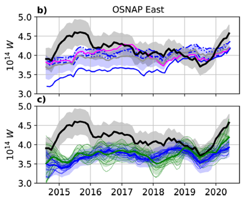
(Adapted from Winkelbauer et al., 2026)
Oceanic heat transport is important for understanding the Atlantic Meridional Overturning Circulation (AMOC), and ocean reanalysis models provide a means of evaluating transport variability and trends. A recent paper by Winkelbauer et al. (2026) evaluated the extent to which reanalyses reproduce transports estimated from observations. Their results show that the reanalyses capture the overall character of heat transport in the subpolar North Atlantic, but have limitations in particular times and regions.
The authors used observations from the Overturning in the Subpolar North Atlantic Program (OSNAP) data set compiled by Fu et. al. (2023), which includes both OSNAP-West (Labrador Shelf to West Greenland) and OSNAP-East (East Greenland to Scotland). The OSNAP-East array incorporates the OOI Irminger Sea Flanking moorings. The observation-based transport estimates were compared to those from several reanalysis models. A composite (mean) product was produced from four models with ¼ degree resolution that are based on the Copernicus Marine Service Global Reanalysis Ensemble Product (GREP). A higher resolution product, the Global Ocean Reanalysis System (GLORYS12V1) was also used in the comparison. All of the reanalyses are based on Nucleus for European Modeling for the Ocean (NEMO). It is notable that none of the reanalyses assimilate ocean velocity observations. This means that ocean transports differences will depend largely on velocity differences between observations and models.
Comparisons during the OSNAP observation period (2015-2020) include temperature, velocity and transport. Temperatures are relatively well reproduced by the reanalysis models, albeit with some systematic biases – cold biases in the basin interiors and warm biases on the shelves. The broad structure of ocean currents can be seen in the models, but there are discrepancies in both strength and location of the Labrador Current, West Greenland Current and East Greenland Current. However, it is also noted that limited observations in a few key regions compromise comparisons there. For transport, the reanalyses capture overall variability, and most are well correlated with observations over the ~6 year period (Fig. 3). However, none of the reanalyses capture the 2015 transport peak observed by OSNAP.
The authors dig deeper into the 2015 transport discrepancy and find that it is associated with a region of the OSNAP line near the Iceland and Rockall-Hatton Basins where glider transects supplemented the moored array in the upper ocean. They speculate that changes in the observational coverage due to gliders contribute to the 2015 transport peak that is not captured by the models.
Overall, this comparison study is a relatively strong endorsement of the reanalysis models, which “generally reproduce the broad structure of the AMOC and its associate heat transport”, although not without bias (5-10% in the mean and 60-80% for some times and locations). In addition, some key boundary currents are not well represented in the models. Interestingly, the case study for 2015 shows that the OSNAP moored array also has limitations, and can be improved by the use of gliders to resolve upper-ocean structure between mooring stations.
[caption id="attachment_37794" align="alignnone" width="496"] Figure 1. Time series of heat transport from OSNAP observations (black) compared to reanalysis models. Upper panel compares five different reanalysis products (colors) and the mean of the ¼ degree products (gray). Lower panel compares OSNAP to indirect heat flux estimates. From Winkelbauer et al., 2026.[/caption]
___________________
References:
Fu, Y. and 25 co-authors, 2023. Meridional Overturning Circulation Observed by the Overturning in the Subpolar North Atlantic Program (OSNAP) Array from August 2014 to June 2020, Georgia Institute of Technology [data set], https://doi.org/10.35090/gatech/70342.
Winkelbauer, S. I Winterer, M. Mayer, Y. Fu and L. Haimberger, 2024. Subpolar Atlantic meridional heat transports from OSNAP and ocean reanalyses – a comparison, Ocean Sci, 22, 629-651, https://doi.org/10.5194/os-22-629-2026.
Read MoreEffects of Dissolved Oxygen and Hypoxia on Catch Rates of Nearshore Groundfishes in a Recreational Hook and Line Fishery
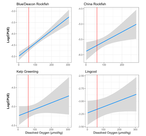
Rasmuson et al. (2026) investigate the impact of hypoxic events on a nearshore, multispecies recreational groundfish fishery along the Oregon coast. Using dissolved oxygen (DO) data from the National Science Foundation’s Ocean Observatories Initiative (OOI) Oregon Inshore Mooring (2018–2022, excluding 2020) and trip-level recreational fishery catch data from the Oregon Department of Fish and Wildlife, they modeled catch-per-unit-effort (CPUE) and species encounter rates as functions of DO and regulatory bag limits. Of the 709 days analyzed, 36.8% were characterized as hypoxic (DO < 61 μmol/kg). Of the 4 years, 2021 had the most severe hypoxia and 2019 had the least. Across all trips, CPUE and average number of species encountered generally declined during hypoxic periods, indicating reduced fishing success. However, species-specific responses varied: some, such as blue/deacon and China rockfish (see Fig. 2), showed increased CPUE with higher DO levels, while others like cabezon and quillback rockfish were more frequently caught during hypoxic events. These patterns suggest that hypoxia alters species’ availability and/or catchability, possibly due to shifts in fish behavior, vertical distribution, or tolerance to low DO. Notably, species with increased CPUE under hypoxia are already considered vulnerable or limiting for the Oregon recreational fishery, raising concerns about increased pressure on sensitive stocks. As hypoxic events become more frequent with climate change, incorporating DO metrics into stock assessments and fisheries management would improve population models for exploited species. Their findings highlight the need for fine-scale, species-specific approaches to recreational fisheries management in the context of changing ocean conditions and suggest that recreational fishers may face constraints in adapting to deoxygenation, especially in strongly place-based or single-species fisheries.
[caption id="attachment_37790" align="alignnone" width="615"] Figure (1) Log (CPUE) for four different species versus DO. Species depicted are those with best-fit Gaussian models that included DO. Gray areas are 95% confidence intervals. Data to the left of the red vertical bar indicate hypoxic conditions and to the right indicate normoxic conditions.[/caption]
___________________
Reference:
Rasmuson, L. K., A. D. Whitman, B. T. Cervantes, and J. P. Fram. 2026. “ Effects of Dissolved Oxygen and Hypoxia on Catch Rates of Nearshore Groundfishes in a Recreational Hook and Line Fishery.” Fisheries Oceanography 1–13. https://doi.org/10.1111/fog.70046.
Read MoreHelp Us Solve a Mystery of the Deep
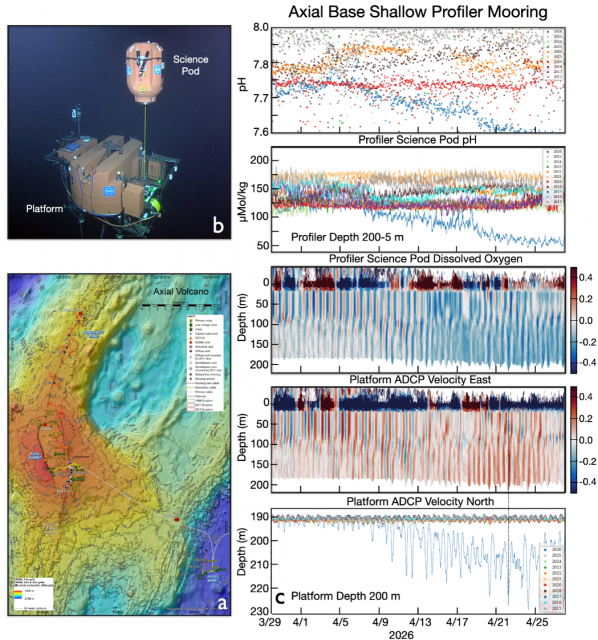
We would like the community’s help in deciphering an unusual “blow down” event impacting environmental conditions near the flank of Axial Seamount (summit depth ~1500 m), located 300 miles offshore Oregon (Figure 1a). A blow down and its impacts were recorded by numerous instruments streaming data back to shore in real time from the Axial Base Shallow Profiler Mooring. The mooring is one of three two-legged moorings on the RCA that include a mechanical anchored leg and a second anchored leg consisting of an Electrical-Optical-Mechanical (EOM) cable supplying power and two-way communications (anchors at ~ 2600 m). Both legs attach to an ~ 3.7 m across central float at ~ 200 m water depth providing 900 Kg buoyancy that pulls on the legs (Figure 1b). The float contains a static platform hosting 8 instruments and a winched science pod with 10 instruments, that conducts a daily science mission of 9 profiles spanning 200 m to ~ 5 m beneath the surface, depending on overlying seastate (see McRae, 2016). For seven of the profiles, the pod ascends at 5 cm/sec and descends at 10 cm/sec. In total, Two profiles are stepped and include 5-minute stops on descent.
The event started April 8, 2026, lasting until April 12, 2026. It was marked by a staggered increase in pressure (depth) closely related to tides, with a mean current of ~ 30 cm sec toward the NE, which blew the platform down almost 40 meters on April 24th (Figure 1c). The water mass included lower dissolved oxygen concentrations and a decrease in pH. Could this reflect an internal wave with tidal forcing? (M. Muglia, pers comm). Over the 12 years of nearly constant monitoring at Axial Base, this is the first time we have witnessed such an event. Several blowdowns have been documented at the Oregon Slope Base and Offshore Shallow Profiler Moorings, but never with the “sawtooth” changes in pressure.
[caption id="attachment_37786" align="alignnone" width="1049"]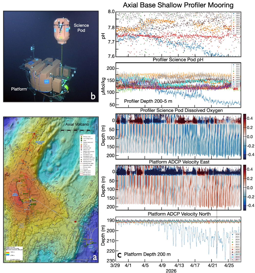 Figure 1. a) Location of the Regional Cabled Array Shallow Profiler Mooring near the base of Axial Seamount (water depth 2600 m), located ~ 300 miles off Oregon. (b) Cabled 2-legged Shallow Profiler Mooring hosting a 12 foot-across platform at 200 m water depth with 1) an array of cabled static instruments (e.g. ADCP, CTD-O2, pH, fluorometer, camera etc); and 2) a winched instrumented profiling “science pod” hosting similar instruments (including CO2, nitrate, PAR etc), which profiles up and down through the water column 9 times a day. c) Platform pressure (depth) and ADCP(m/s) measurements, and winched profiler values for dissolved oxygen concentration and pH.[/caption]
___________________
Reference:
McRae, E., “Continuous real time scanning of the upper ocean water column. Oceans ,” OCEANS 2016 MTS/IEEE Monterey, Monterey, CA Monterey, USA, 2016, pp. 1-6, doi: 10.1109/OCEANS.2016.7761359.
Read MoreOpen Call for Applications for the OOIFB Data Systems Committee
The Data Systems Committee (DSC) of the Ocean Observatories Initiative Facility Board (OOIFB) was established to help ensure timely and reliable access to high-quality U.S. National Science Foundation (NSF) Ocean Observatories Initiative (OOI) data. The Committee evaluates and recommends improvements to the data services, policies, and practices of the NSF OOI Facility that will lead to more efficient and effective scientific use of NSF OOI data.
The DSC is now soliciting applications to fill TWO open positions. One of these 3-year appointments will begin as of October 1, 2026, the other as of November 1, 2026. Selected individuals will be eligible to serve a second 3-year term, if fitting.
The DSC holds one web conference each month and at least one in-person meeting per year. Some objectives of the DSC include:
- Keeping abreast of the current state of the NSF OOI cyberinfrastructure and data services with the goal of helping to promote maximum scientific use of NSF OOI data. These efforts will be informed by the FAIR Guiding Principles for scientific data management and stewardship, such that data are: a) Findable, b) Accessible, c) Interoperable, and d) Reusable.
- Encouraging the use of best practices, standards, and naming conventions established by the oceanographic community.
- Engaging with the user community to gauge user needs in regard to NSF OOI data systems, and to facilitate the promotion of a positive user experience.
- Staying current on potential new modes of data service and access, data analysis methodologies, and related technologies that facilitate the use of NSF OOI data.
- Engaging with members of the NSF OOI Program regarding the priorities and plans of the NSF OOI cyberinfrastructure groups.
- Making recommendations for data products, usage metrics, and improving the user experience on the OOI Data Explorer, JupyterHub environment, as well as other data service systems employed by the NSF OOI.
Scientists affiliated with U.S. institutions, with interests and/or experience using scientific observing systems such as the NSF OOI, as well as those with experience in successfully delivering data from large-scale, multi-sensor observing systems to scientific users are encouraged to apply. All applications will be considered. Interested applicants should submit a letter of interest and accompanying CV to Holly Morin, at the OOIFB Administrative Support Office (holly@ooifb.org), no later than September 10, 2026. The statement of interest should highlight the applicant’s experience with NSF OOI data and/or with other similar data services and products. Applicants might also include a vision for how these experiences might evolve in the future. For more information about the DSC and its activities, please visit the OOIFB website (http://ooifb.org), or contact Jim Potemra, DSC Chair (jimp@hawaii.edu).
Read MoreOOI Team Helps Capture Historic Shipwrecks in 3D
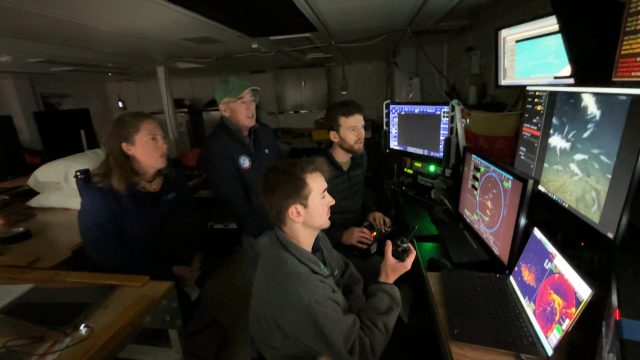
Almost any oceanographic expedition includes a group who disappear soon after departure to become “night stalkers.” These are the people who reverse their circadian rhythm, miss regular meals, and divorce themselves from the daytime pulse of activity to staff the night shift. They often develop a unique culture full of shorthand that only they fully understand.
On the Heroic Age Expedition to map and explore the wrecks of ships connected to Ernest Shackleton and Robert FalconScott, that role fell primarily to a three-person team from the U.S. National Science Foundation (NSF) Ocean Observatories Initiative (OOI). They were operating an OOI-provided, NSF-funded Falcon remotely operated vehicle (ROV) outfitted with a Voyis photogrammetric stereo camera system, as well as an ultra-high definition video camera, forward-looking sonar, and acoustic tracking beacons. The stereo camera allowed the OOI team to meet one of the major objectives of the expedition: fully documenting the shipwrecks and surrounding seafloor in three dimensions.
The Falcon ROV is typically used to inspect, maintain, and recover OOI seafloor observatory infrastructure, making this expedition a unique opportunity to demonstrate how OOI’s advanced capabilities can also support underwater archeological exploration and other scientific discoveries beyond routine observatory operations.
For much of the expedition, which was organized by Woods Hole Oceanographic Institution (WHOI) and the Royal Canadian Geographical Society (RCGS), while most of the science party slept, the OOI team of Andy Robinson, James Kuo, and Sam Dahlberg went to work. Their shift began after the human-occupied submersible Alvin had been safely stowed for the night. From a control station in the Hydro Lab aboard the Office of Naval Research’s R/V Atlantis packed with monitors, they guided the compact ROV through painstaking survey patterns, often just a few feet from the wrecks and the life that flourished on and around them.
“The lack of prior knowledge of the wrecks, especially Quest, where we only had a single sidescan sonar image, was a challenge,” said Robinson, chief pilot of the ROV. “We had to always be mindful of our exits. It was very different from our usual missions inspecting and recovering seafloor instrumentation.”
The targets that the Royal Canadian Geographical Society picked were two iconic vessels from the Heroic Age of Antarctic exploration. The first was Quest, the ship used by Shackleton on his final expedition and the vessel on which he died in 1922. The second was Terra Nova, which carried Robert Falcon Scott to Antarctica on his ill-fated South Pole expedition.
During each dive, the Voyis system captured hundreds of thousands of overlapping stereo photographs. Those images will be stitched together using a photogrammetric processing technique known as simultaneous localization and mapping (SLAM) to produce highly detailed digital reconstructions of the wrecks and surrounding seafloor. Every deck beam, broken spar, and scattered artifact will become part of a virtual model that researchers will be able examine long after the expedition.
“The imagery and data we collected from the wrecks in such a relatively short period is staggering,” said shipwreck expert and co-chief scientist of the expedition David Mearns. “A major question for me in the planning was whether we’d be able to get total coverage of both wrecks, documenting every surface of their exteriors and exposed interiors, knowing that the key to understanding a badly damaged shipwreck would be to have a single coherent, photogrammetrically accurate image as a final product. That question has been answered without reservation, and I can’t wait for the day the RCGS reveals what we have uncovered.”
The contribution of the OOI team extended well beyond operating the vehicle. They served as deckhands, deploying and recovering the ROV and the other half of the two-body vehicle system—a towcam provided by the NSF-funded WHOI Multidisciplinary Instrumentation in Support of Oceanography (MISO) Facility. They also acted as navigators, vehicle mechanics, camera technicians, and, along with imaging specialist Zoe Daheron, data managers and quality-control experts, continuously reviewing imagery and adjusting survey plans to ensure complete coverage.
By the time the ship returned to port, the night stalkers had accomplished something remarkable. Through the combined capabilities of the vehicle and camera systems, Quest and Terra Nova have been documented, transforming two historic wrecks from distant archaeological sites into immersive digital records that scientists, historians, and the public will be able to explore.
[caption id="attachment_37736" align="alignnone" width="2560"]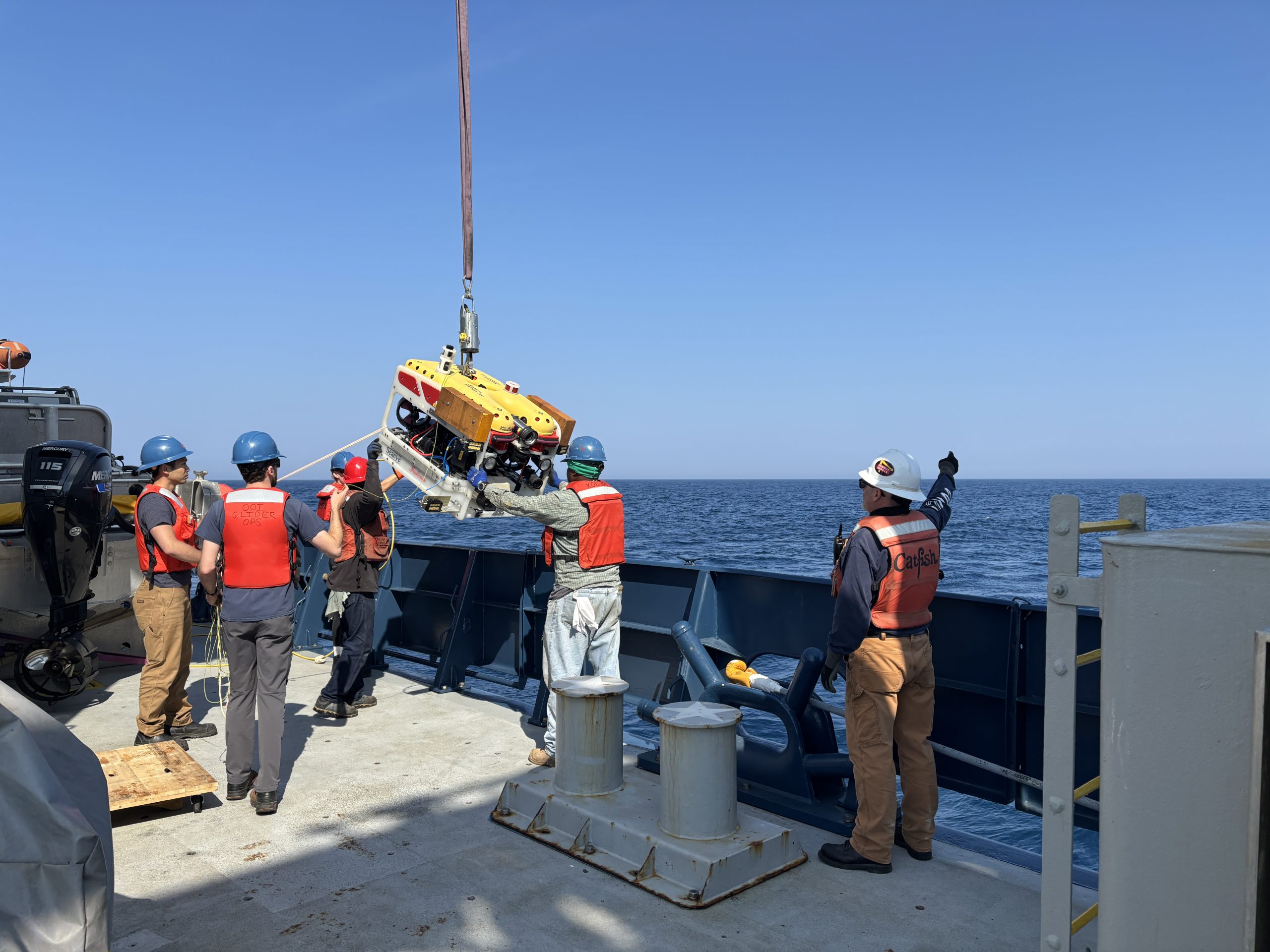 The OOI team and R/V Atlantis crew deploy the OOI Falcon ROV. Credit: Ken Kostel, © Woods Hole Oceanographic Institution.[/caption]
[caption id="attachment_37737" align="alignnone" width="1920"]
The OOI team and R/V Atlantis crew deploy the OOI Falcon ROV. Credit: Ken Kostel, © Woods Hole Oceanographic Institution.[/caption]
[caption id="attachment_37737" align="alignnone" width="1920"]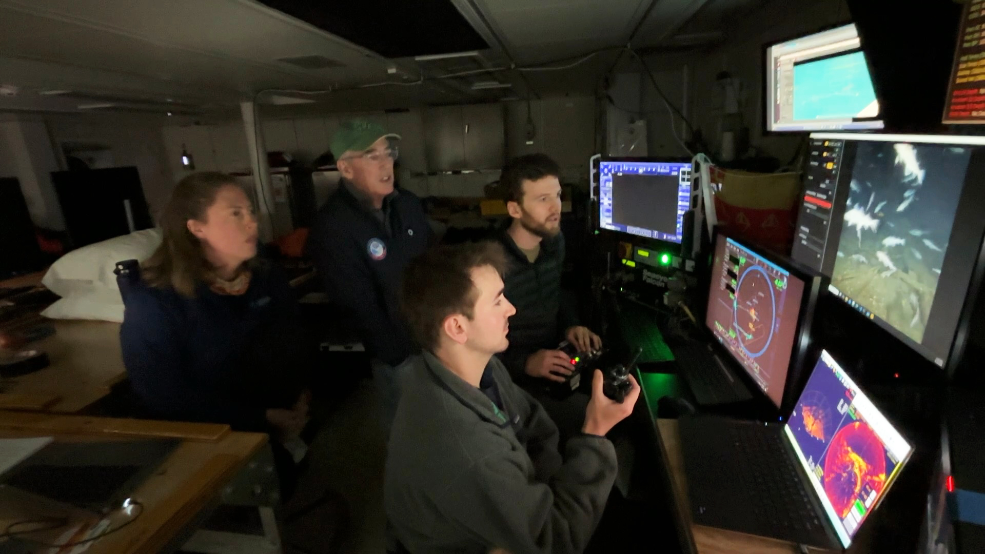 Sam Dahlberg (foreground) provides navigational support and situational awareness while Andy Robinson pilots the ROV and WHOI biologist Kirstin Meyer-Kaiser and co-chief scientist David Mearns watch the survey of Quest. Credit: Ken Kostel, © Woods Hole Oceanographic Institution.[/caption]
[caption id="attachment_37738" align="alignnone" width="2560"]
Sam Dahlberg (foreground) provides navigational support and situational awareness while Andy Robinson pilots the ROV and WHOI biologist Kirstin Meyer-Kaiser and co-chief scientist David Mearns watch the survey of Quest. Credit: Ken Kostel, © Woods Hole Oceanographic Institution.[/caption]
[caption id="attachment_37738" align="alignnone" width="2560"]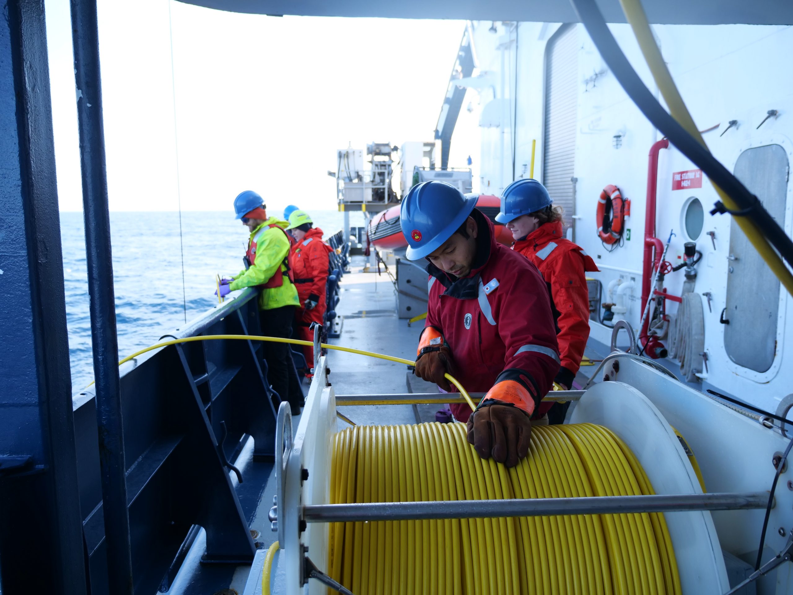 James Kuo (foreground) and Andy Robinson help recover the ROV after an overnight dive on the wreck of Terra Nova. Credit: Ken Kostel, © Woods Hole Oceanographic Institution.[/caption]
Read More
James Kuo (foreground) and Andy Robinson help recover the ROV after an overnight dive on the wreck of Terra Nova. Credit: Ken Kostel, © Woods Hole Oceanographic Institution.[/caption]
Read More NSF Advances Endurance Array Redeployment
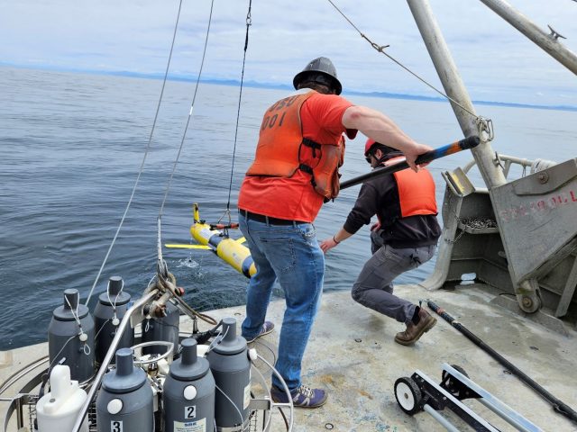
The U.S. National Science Foundation (NSF) has begun the phased redeployment of its Ocean Observatories Initiative (NSF OOI) Endurance Array, restoring critical ocean observations following planned maintenance and servicing.
The redeployment of gliders this summer will restore seasonal observations, enabling scientists to monitor seasonal hypoxia over the central Oregon and Washington shelves. The gliders will also capture changing ocean conditions as El Niño is expected to develop later this year, bringing warmer waters and a deeper thermocline to the region. NSF OOI glider data are available in near real time through the OOI Data Explorer and the national Glider Data Assembly Center (GDAC).
Looking ahead, several moorings are scheduled for redeployment aboard the R/V Sally Ride in early October, including the Oregon and Washington Shelf surface moorings and the Washington Offshore Profiler Mooring. Redeploying these moorings ahead of the developing El Niño will restore continuous observations of winds, waves, and water column conditions throughout the fall and winter. Data from the redeployed moorings will be available on the OOI Data Explorer and the Northwest Association of Networked Ocean Observing Systems NANOOS; meteorological data will also be available through the NOAA National Data Buoy Center (NDBC).
Planning is also underway for redeployments in the spring of 2027 that will fully restore mooring and glider operations across the Endurance Array.
In parallel with redeployment efforts, the Endurance Array team continues to support the broader ocean observing community through scientific leadership. Project Scientist Ed Dever is chairing a session “Ocean Observing Systems at a Crossroads: Accomplishments, Innovations, & Vision” at the Eastern Pacific Ocean Conference.
Dever is also co-convening the Fall 2026 AGU session “Long-Term Ocean Observatories as Drivers of Sensor & Data Science Innovation” with Mike Vardaro and Wendi Ruef of the University of Washington Regional Cabled Array.
[caption id="attachment_37731" align="alignnone" width="1430"]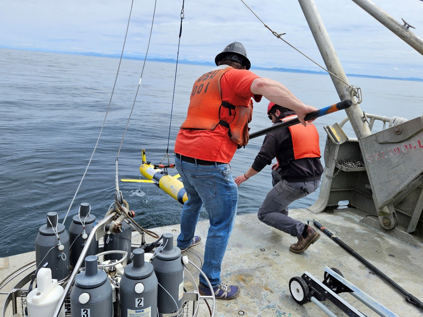 NSF OOI Endurance Array staff recover glider 384 to adjust its ballast before sending it on its mission over the Oregon Shelf. Photo credit: Scarlett Arbuckle (Oregon State University).[/caption]
Read More
NSF OOI Endurance Array staff recover glider 384 to adjust its ballast before sending it on its mission over the Oregon Shelf. Photo credit: Scarlett Arbuckle (Oregon State University).[/caption]
Read More NSF Solicitation Supports AI-Ready Scientific Datasets

The NSF’s new solicitation aims to enhance the scientific value of existing datasets for AI-driven research, particularly leveraging the Ocean Observatories Initiative’s extensive ocean data for innovative interdisciplinary analyses. Researchers can submit proposals until November 4, 2026.
Read MoreNew Research Powered by OOI Data: July 2026
Spatial Variability in Year-to-Year, Near-Bottom Hypoxia Over the United States Pacific Northwest Continental Shelf
Authors: J. A. Barth and S. W. Coleman
Each summer, strong coastal winds drive nutrient-rich deep water onto the Pacific Northwest continental shelf through a process known as coastal upwelling. While these nutrients support one of the region’s most productive marine ecosystems, the upwelled water is also naturally low in oxygen. As organic matter decomposes, oxygen levels can drop even further on the shelf, creating hypoxic conditions that can threaten marine life.
In a recent study, researchers J. A. Barth and S. W. Coleman examined the extent and variability of near-bottom hypoxia along the U.S. Pacific Northwest continental shelf from 2021 through 2024. By combining observations from multiple ocean observing platforms, including the U.S. NSF Ocean Observatories Initiative (OOI), the authors mapped seasonal, near-bottom (within 15 m of the bottom) low-oxygen conditions and investigated the environmental processes driving them.
The study found that near-bottom hypoxia affected between 28% and 52% of the continental shelf each summer, with the largest extent occurring in 2021 when upwelling-favorable winds were particularly strong. Although the severity varied from year to year, the spatial distribution of hypoxia remained remarkably consistent, highlighting the strong influence of regional oceanographic processes.
Researchers also found evidence that stronger seasonal upwelling winds contribute to more widespread hypoxia. Because climate models project increases in coastal upwelling-favorable winds , these findings suggest that low-oxygen events could become more frequent or extensive in the future.
How OOI Data Contributed
Observations from OOI’s Coastal Endurance Array and Regional Cabled Array provided continuous dissolved oxygen measurements that complemented ship-based surveys and other regional observing systems. Long-term, high-frequency observations like these allow scientists to monitor changing ocean conditions, identify emerging trends, and place individual events within a broader environmental context.
Why It Matters
Low-oxygen waters can stress or displace commercially and ecologically important marine species, affecting fisheries, ecosystems, and coastal communities. This study demonstrates how sustained observations from OOI help scientists understand the processes driving hypoxia and improve our ability to monitor and anticipate changes in coastal ocean health as the climate continues to change.
Citation
Barth, J. A., & Coleman, S. W. Spatial Variability in Year-to-Year, Near-Bottom Hypoxia Over the United States Pacific Northwest Continental Shelf.
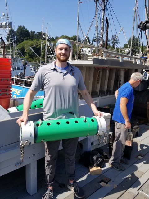
[caption id="attachment_37707" align="alignnone" width="1920"]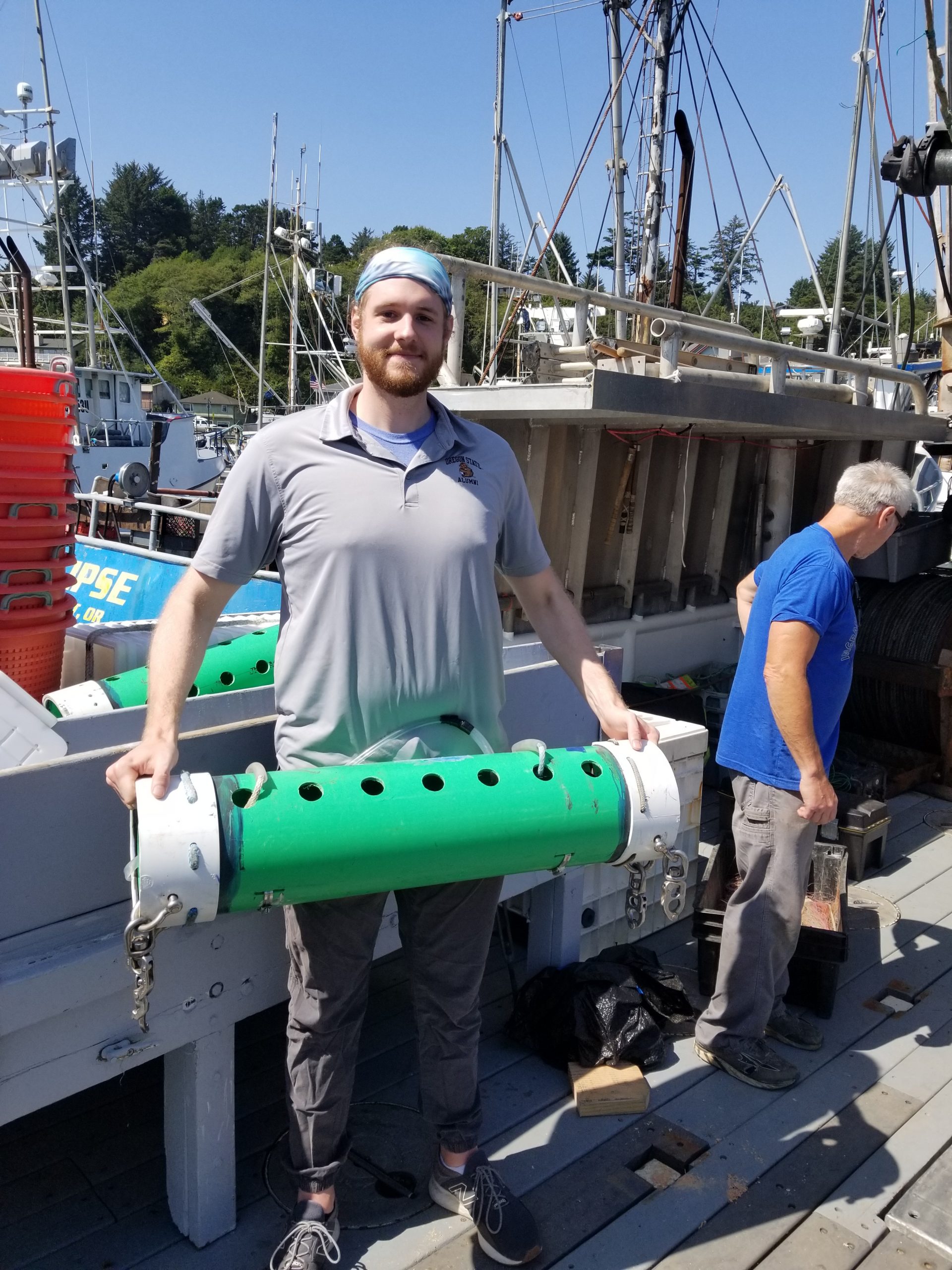 Sean Coleman holds a trawl-mounted CTD instrument used to measure dissolved oxygen during NOAA’s annual groundfish surveys. These observations were among the datasets used in the study. Photo credit: J. A. Barth.[/caption]
[caption id="attachment_37708" align="alignnone" width="1692"]
Sean Coleman holds a trawl-mounted CTD instrument used to measure dissolved oxygen during NOAA’s annual groundfish surveys. These observations were among the datasets used in the study. Photo credit: J. A. Barth.[/caption]
[caption id="attachment_37708" align="alignnone" width="1692"]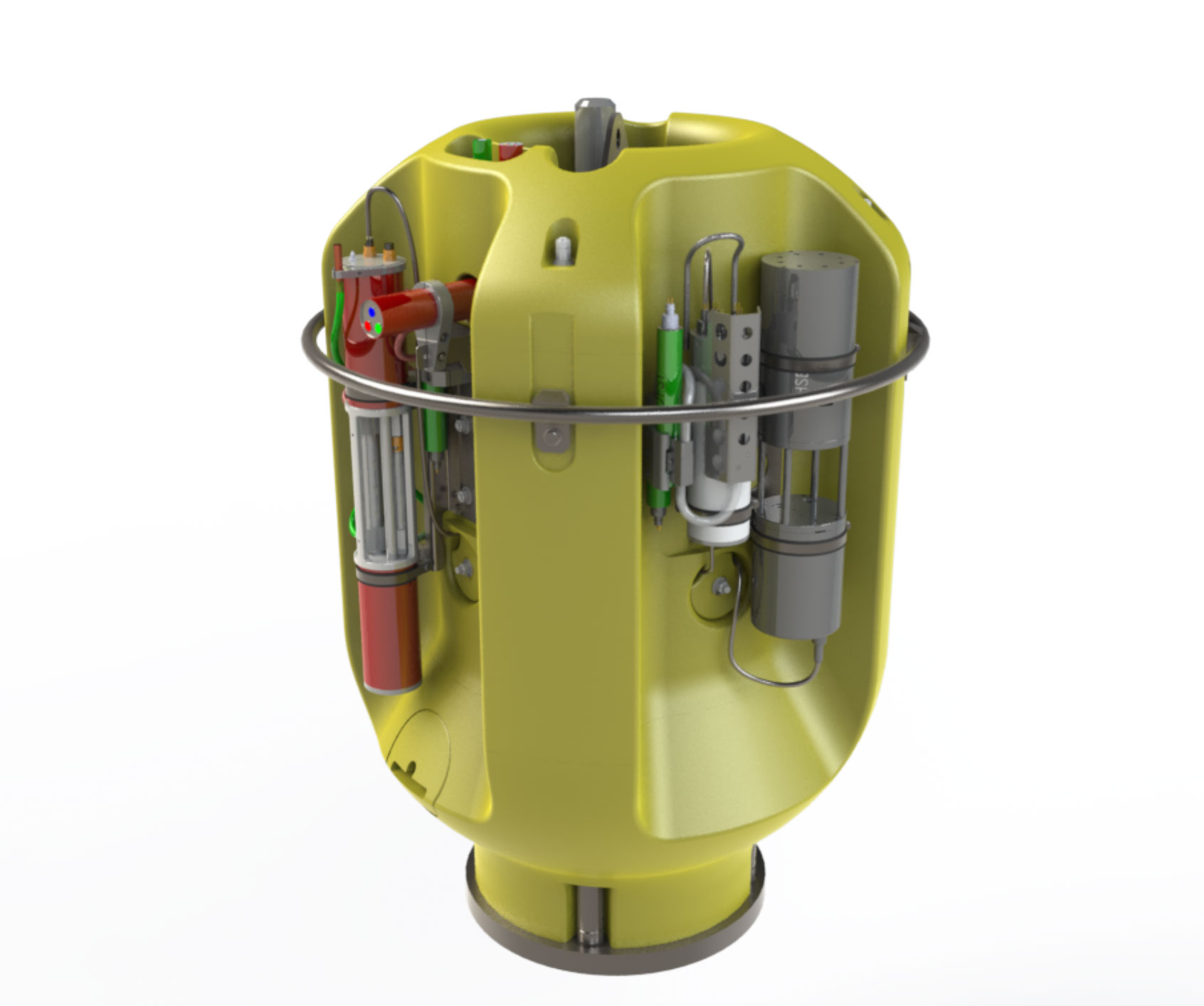 The OOI Regional Cabled Array Shallow Profiler, whose observations contributed to the findings presented in the study. Illustration: Patrick Waite, University of Washington.[/caption]
Read More
The OOI Regional Cabled Array Shallow Profiler, whose observations contributed to the findings presented in the study. Illustration: Patrick Waite, University of Washington.[/caption]
Read More New to OOI? Start Here.
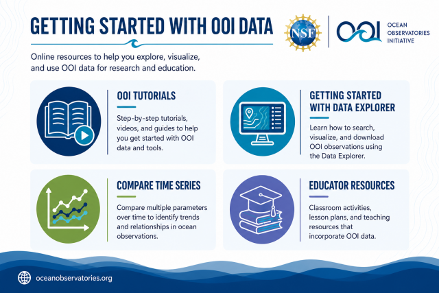
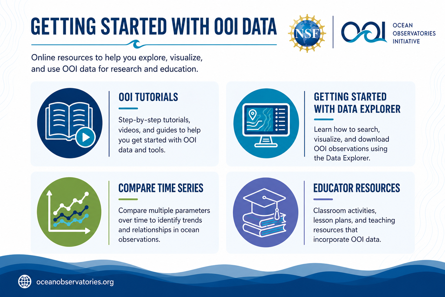
Whether you’re just getting started with OOI data or looking to incorporate it into your research or teaching, OOI offers a variety of online resources to help you get up to speed. Explore step-by-step tutorials, learn the basics of the Data Explorer, discover how to compare time series data, and browse educational resources designed for instructors and students. These free tools make it easier to find, visualize, and use OOI data for scientific research and classroom learning.
Resources include:
- OOI Tutorials:
- Getting Started with Data Explorer
- Compare Time Series Data with Data Explorer
- Educator Resources
OOI Participates in Air–Sea Interaction Symposium at URI
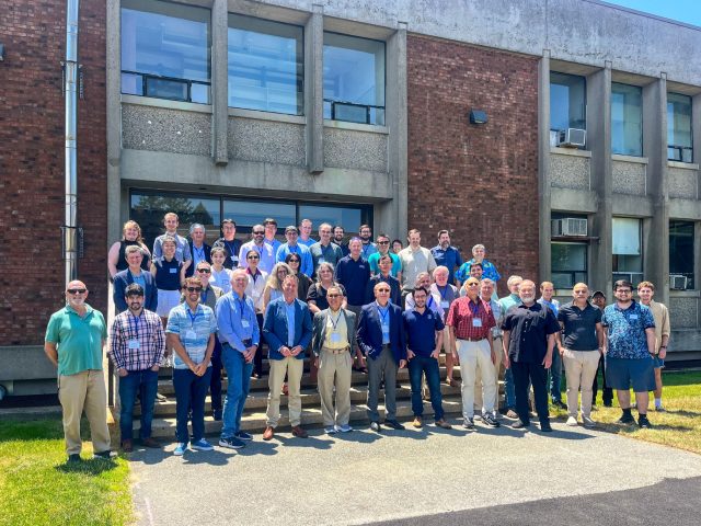
Jim Edson, Lead Principal Investigator of the OOI, recently participated in the Air–Sea Interaction Symposium hosted by the University of Rhode Island Graduate School of Oceanography. The event honored the significant contributions of renowned researchers Alex Ginis and Tetsu Hara to the fields of air–sea interaction and marine meteorology.
During the symposium, Edson presented OOI research and observational capabilities, highlighting the observatory’s role in advancing understanding of ocean-atmosphere processes. The gathering brought together scientists, students, and leaders from across the marine meteorology field to share new findings, discuss emerging challenges, and strengthen collaborations.
[caption id="attachment_37657" align="alignnone" width="2016"]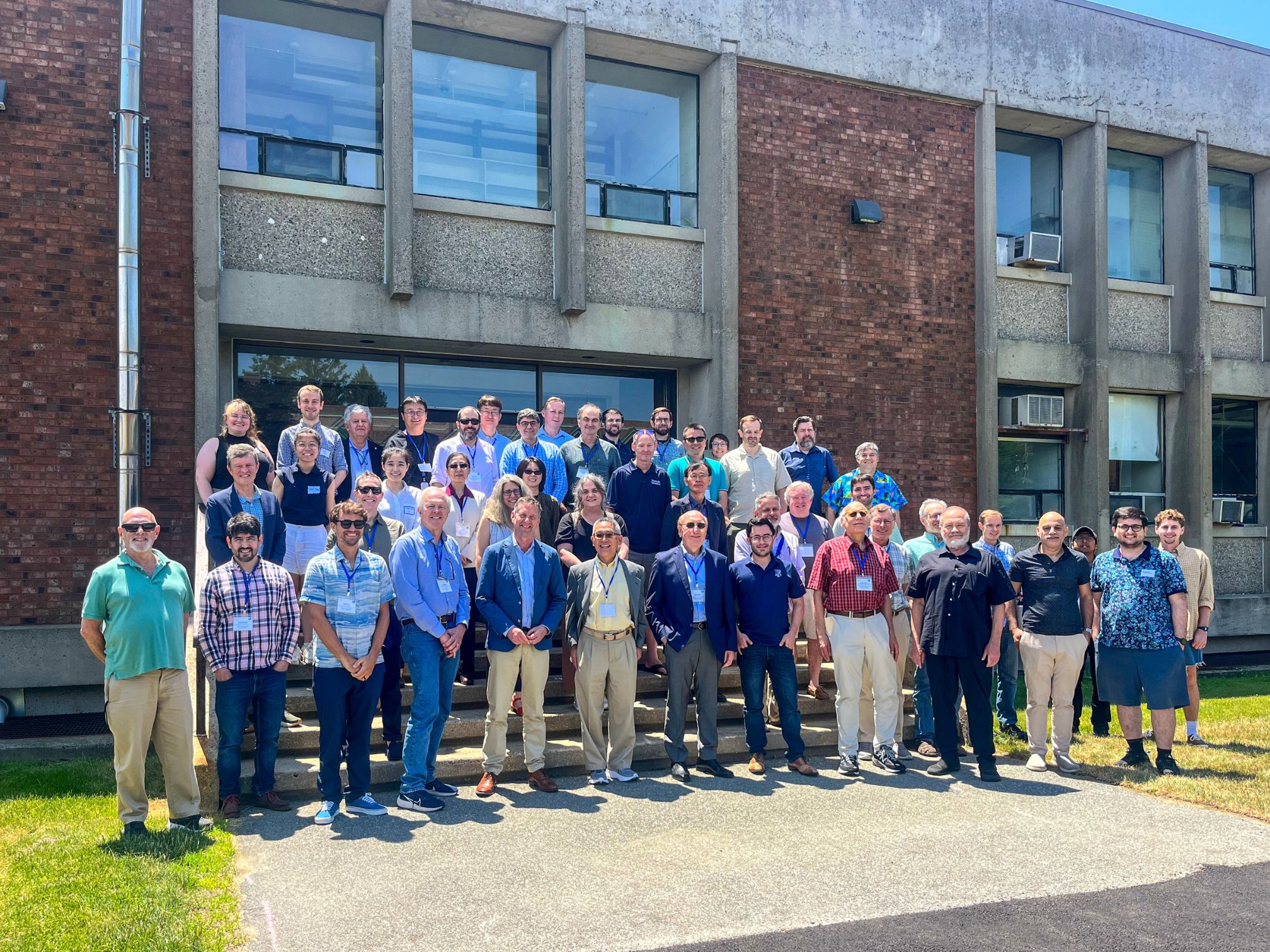 Credit: URI/GSO[/caption]
[caption id="attachment_37658" align="alignnone" width="986"]
Credit: URI/GSO[/caption]
[caption id="attachment_37658" align="alignnone" width="986"]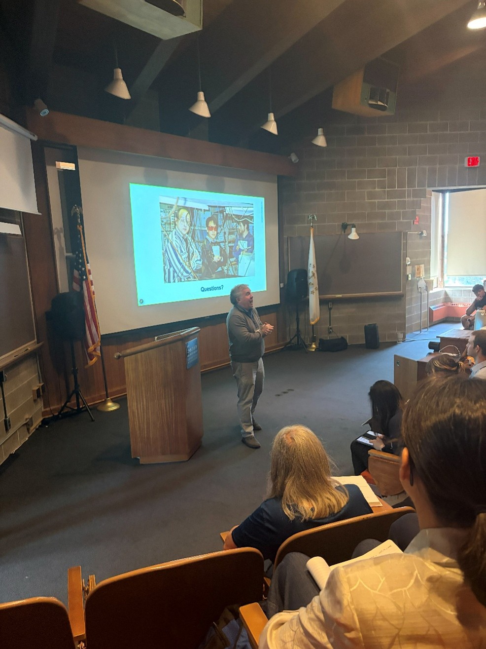 Credit: URI/GSO[/caption]
[caption id="attachment_37659" align="alignnone" width="1095"]
Credit: URI/GSO[/caption]
[caption id="attachment_37659" align="alignnone" width="1095"]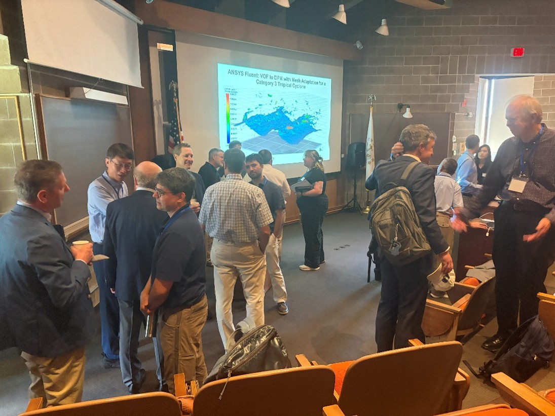 Credit: URI/GSO[/caption]
Read More
Credit: URI/GSO[/caption]
Read More